photo free
Home Images Vectors Videos

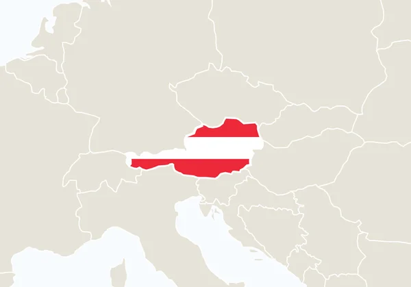
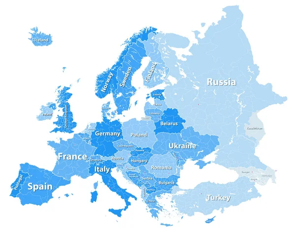
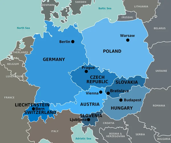
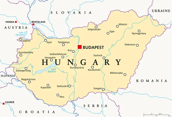
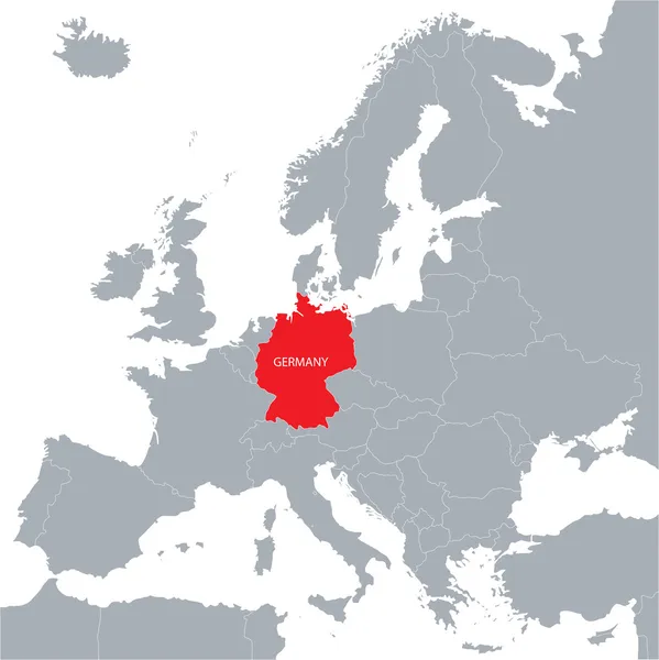
Stock image Central Europe Map

stock image Detailed Earth. Central Europe

Detailed Earth. Central Europe

Image, 9.49MB, 5000 × 5000 jpg
stock vector Europe with highlighted Austria map.

Europe With Highlighted Austria Map.

Vector, 0.41MB, 5000 × 3500 eps
stock vector Europe

Europe

Vector, 7.45MB, 7551 × 7530 eps
stock vector Europe vector high detailed political map with regions borders

Europe Vector High Detailed Political Map With Regions Borders

Vector, 14.21MB, 7292 × 5880 eps
stock vector Europe silhouette

Europe Silhouette

Vector, 0.49MB, 3952 × 3544 eps
stock vector Europe and European Union map with indication of Romania

Europe And European Union Map With Indication Of Romania

Vector, 4.14MB, 3522 × 4500 eps
stock vector High detailed map of Europe main rivers

High Detailed Map Of Europe Main Rivers

Vector, 13.19MB, 7292 × 5306 eps
stock vector Europe high detailed political map. All elements detachable and labeled. Vector

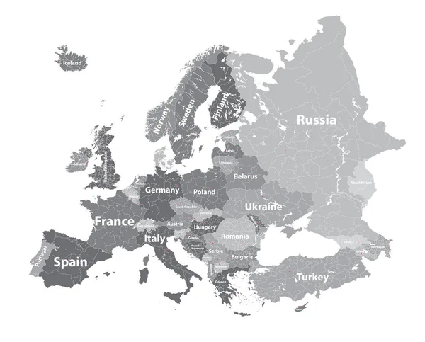
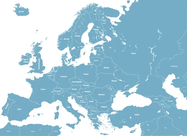
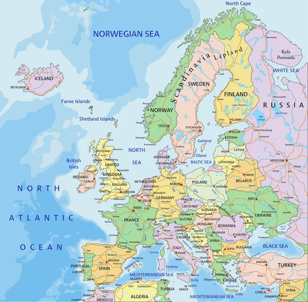
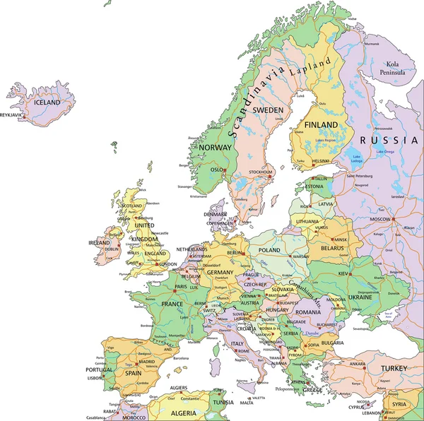
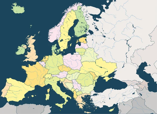
Europe High Detailed Political Map. All Elements Detachable And Labeled. Vector

Vector, 11.55MB, 7293 × 5303 eps
stock vector Europe vector high detailed political map with regions borders

Europe Vector High Detailed Political Map With Regions Borders

Vector, 14.2MB, 7290 × 5832 eps
stock vector Black and white map of Germany

Black And White Map Of Germany

Vector, 4.35MB, 5026 × 5748 eps
stock image Central Europe

Central Europe

Image, 4.26MB, 8946 × 7471 jpg
stock vector Europe political map

Europe Political Map

Vector, 7.26MB, 4909 × 4817 eps
stock image Central Europe Map Czech Republic Targeted in Red

Central Europe Map Czech Republic Targeted In Red

Image, 2.05MB, 4200 × 3200 jpg
stock image Poland Map Abstract 3D Europe Continent

Poland Map Abstract 3D Europe Continent

Image, 2.38MB, 4086 × 3200 jpg
stock image Central Europe

Central Europe

Image, 2.72MB, 8946 × 7471 jpg
stock vector Central Europe Political Map

Central Europe Political Map

Vector, 2.74MB, 6000 × 7170 eps
stock vector Hungary Political Map

Hungary Political Map

Vector, 1.2MB, 8740 × 6000 eps
stock image Blank map of Central Europe with country borders in soft grunge and vintage style, like old paper with watercolor painting.

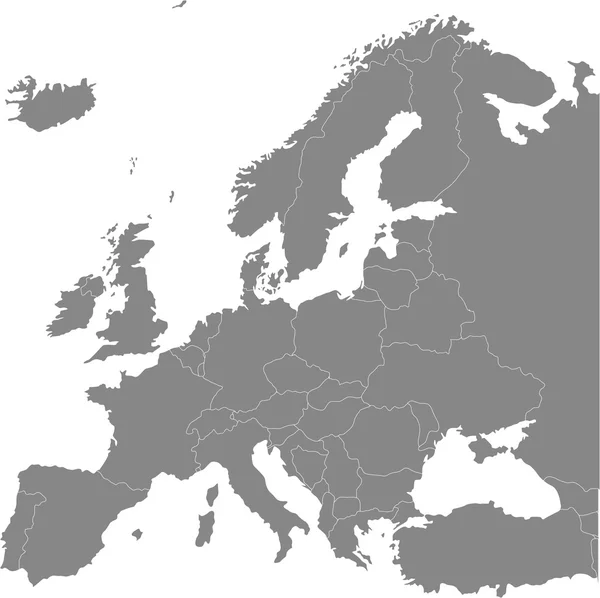
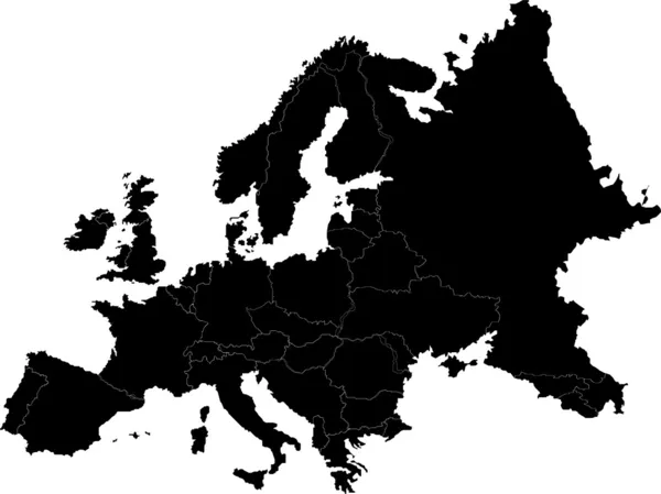
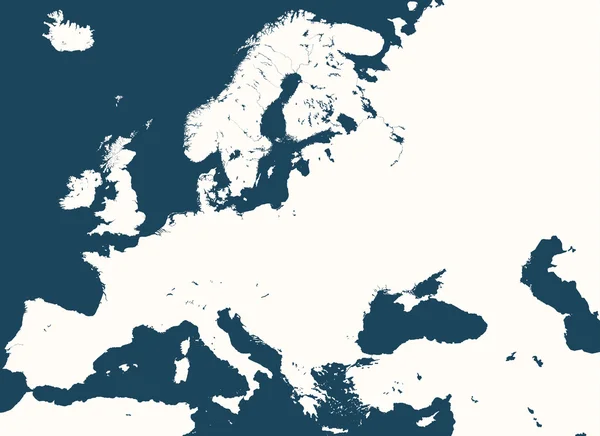
Blank Map Of Central Europe With Country Borders In Soft Grunge And Vintage Style, Like Old Paper With Watercolor Painting.

Image, 18.28MB, 6000 × 6000 jpg
stock image Map of Central Europe with flags of all countries in soft grunge and vintage style, like old paper with watercolor painting.

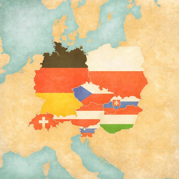
Map Of Central Europe With Flags Of All Countries In Soft Grunge And Vintage Style, Like Old Paper With Watercolor Painting.

Image, 17.17MB, 6000 × 6000 jpg
stock vector Poland Ribbon Waving Flag Isolated on White. Vector Illustration.

Poland Ribbon Waving Flag Isolated On White. Vector Illustration.

Vector, 3.35MB, 5867 × 5867 eps
stock vector Europe and European Union map with indication of Denmark

Europe And European Union Map With Indication Of Denmark

Vector, 4.12MB, 3523 × 4500 eps
stock vector Europe vector map

Europe Vector Map

Vector, 1.14MB, 4580 × 3434 eps
stock image CEI countries from space on planet Earth at night with bright city lights. Detailed plastic planet surface with real mountains. 3D illustration. Elements of this image furnished by NASA.

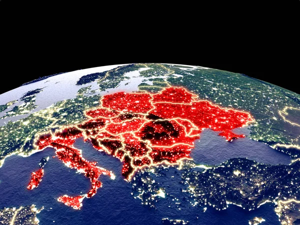
CEI Countries From Space On Planet Earth At Night With Bright City Lights. Detailed Plastic Planet Surface With Real Mountains. 3D Illustration. Elements Of This Image Furnished By NASA.

Image, 15.38MB, 5000 × 3750 jpg
stock vector Baltic states Estonia, Latvia and Lithuania pink highlighted in the political map of Europe. Vector illustration

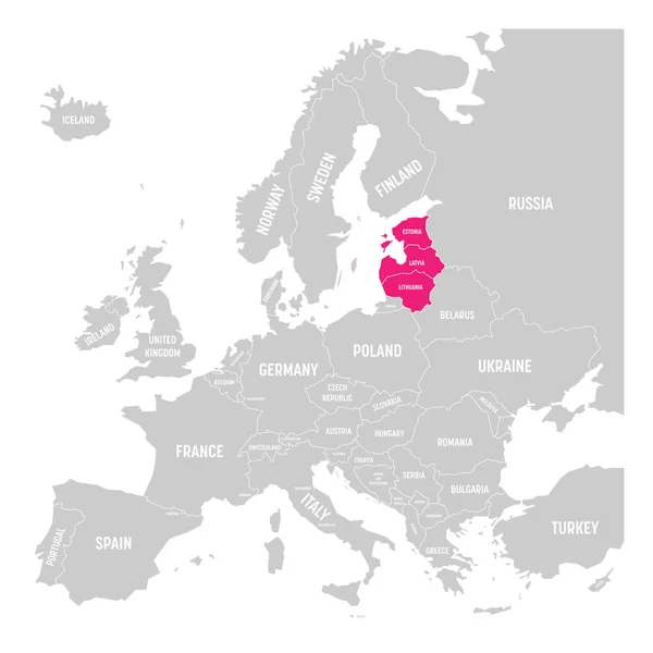
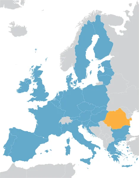
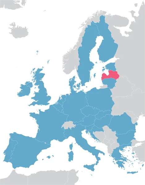
Baltic States Estonia, Latvia And Lithuania Pink Highlighted In The Political Map Of Europe. Vector Illustration

Vector, 0.53MB, 6000 × 6000 eps
stock vector Europe political map

Europe Political Map

Vector, 7.47MB, 4737 × 4711 eps
stock vector Europe and European Union map with indication of Malta

Europe And European Union Map With Indication Of Malta

Vector, 4.15MB, 3522 × 4500 eps
stock vector Europe vector high detailed political map with regions borders

Europe Vector High Detailed Political Map With Regions Borders

Vector, 11.61MB, 7292 × 6038 eps
stock vector blue Europe vector map with indication of United Kingdom

Blue Europe Vector Map With Indication Of United Kingdom

Vector, 4.14MB, 3522 × 4500 eps
stock vector blue Europe vector map

Blue Europe Vector Map

Vector, 4.13MB, 3522 × 4500 eps
stock vector Europe and European Union map with indication of Finland

Europe And European Union Map With Indication Of Finland

Vector, 4.14MB, 3522 × 4500 eps
stock vector blue Europe vector map with indication of Switzerland

Blue Europe Vector Map With Indication Of Switzerland

Vector, 4.14MB, 3522 × 4500 eps
stock vector Map of European Union with the indication of Switzerland

Map Of European Union With The Indication Of Switzerland

Vector, 2.86MB, 3996 × 4000 eps
stock vector Europe and European Union map with indication of Slovenia

Europe And European Union Map With Indication Of Slovenia

Vector, 4.14MB, 3522 × 4500 eps
stock vector grey Europe vector map with indication of Croatia

Grey Europe Vector Map With Indication Of Croatia

Vector, 4.13MB, 3522 × 4500 eps
stock vector blue European Union map

Blue European Union Map

Vector, 4.38MB, 3522 × 4500 eps
stock vector Europe and European Union map with indication of Lithuania

Europe And European Union Map With Indication Of Lithuania

Vector, 4.14MB, 3522 × 4500 eps
stock vector Europe and European Union map with indication of Luxembourg

Europe And European Union Map With Indication Of Luxembourg

Vector, 4.14MB, 3522 × 4500 eps
stock vector Europe high detailed vector political map with main european rivers

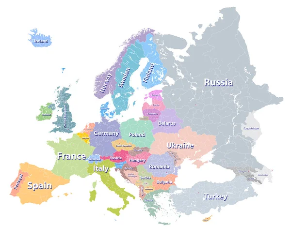
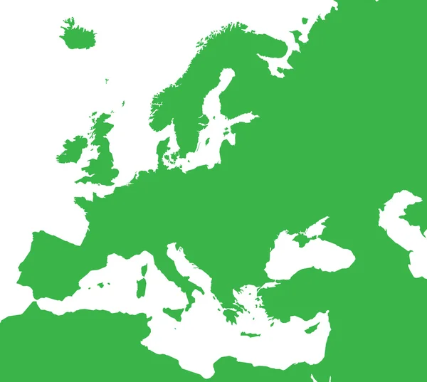
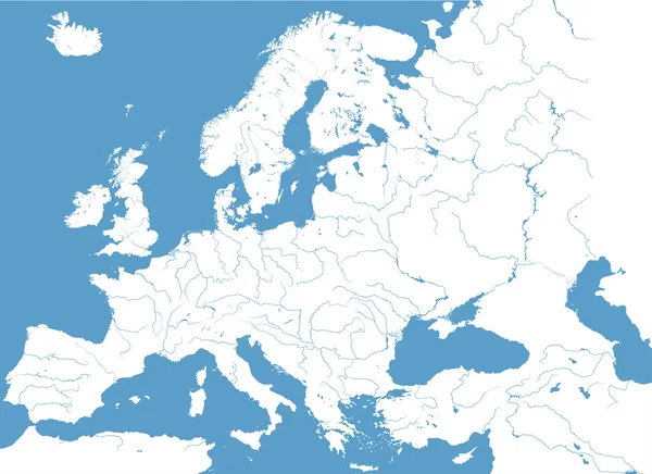
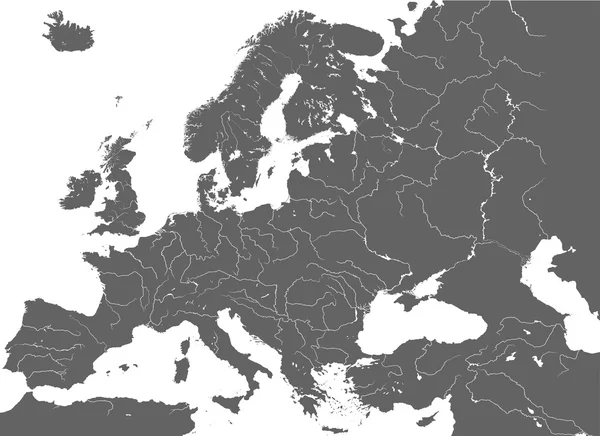
Europe High Detailed Vector Political Map With Main European Rivers

Vector, 13.29MB, 7292 × 5301 eps
stock vector Europe colorful map

Europe Colorful Map

Vector, 4.64MB, 3522 × 4500 eps
stock vector Europe and European Union map with indication of Bulgaria

Europe And European Union Map With Indication Of Bulgaria

Vector, 4.14MB, 3522 × 4500 eps
stock image Ireland Abstract 3d Map Northern Europe Country

Ireland Abstract 3d Map Northern Europe Country

Image, 1.6MB, 4200 × 3200 jpg
stock vector Europe and European Union map with indication of Latvia

Europe And European Union Map With Indication Of Latvia

Vector, 4.14MB, 3522 × 4500 eps
stock vector Europe high detailed political map with main rivers.

Europe High Detailed Political Map With Main Rivers.

Vector, 14.57MB, 7295 × 5304 eps
stock vector colorful map of Europe

Colorful Map Of Europe

Vector, 3.94MB, 3522 × 4500 eps
stock vector high detailed silhouette of Europe map

High Detailed Silhouette Of Europe Map

Vector, 10.15MB, 7292 × 5301 eps
stock vector blue Europe vector map with indication of Poland

Blue Europe Vector Map With Indication Of Poland

Vector, 4.14MB, 3522 × 4500 eps
stock vector Map of European Union with the indication of Germany

Map Of European Union With The Indication Of Germany

Vector, 1.78MB, 3996 × 4000 eps
stock vector colorful map of European Union

Colorful Map Of European Union

Vector, 6.42MB, 4000 × 4000 eps
stock vector high detailed vector map of Europe main rivers

High Detailed Vector Map Of Europe Main Rivers

Vector, 13.51MB, 7292 × 5306 eps
stock vector Map of Europe with highlighted 28 EU member states

Map Of Europe With Highlighted 28 EU Member States

Vector, 0.06MB, 6000 × 6000 eps
Page 1 >> Next