photo free
Home Images Vectors Videos

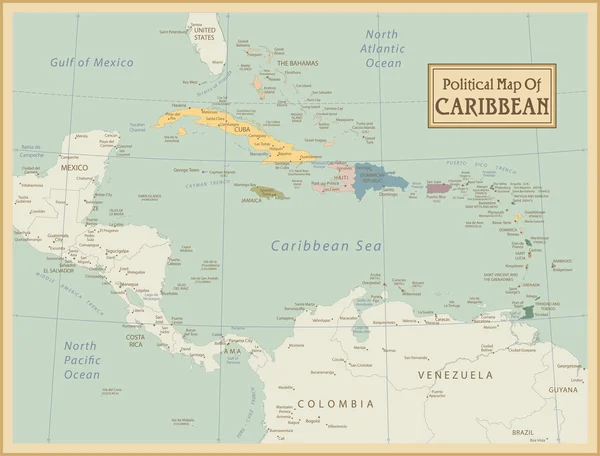
Stock image Dominica Political Map

stock vector Dominica Political Map

Dominica Political Map

Vector, 0.81MB, 6000 × 8690 eps
stock vector America

America

Vector, 22.35MB, 6056 × 3909 eps
stock vector Windward Islands political map. Islands of the Lesser Antilles, south of the Leeward Islands in the Caribbean Sea. From Dominica, Martinique, Saint Lucia, Saint Vincent and the Grenadines, to Grenada.

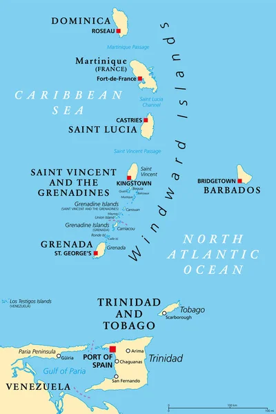
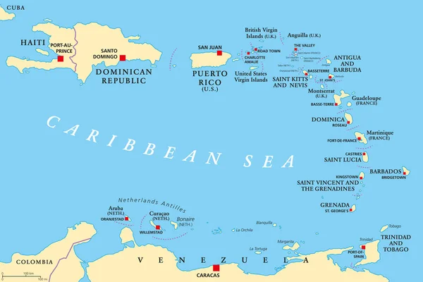
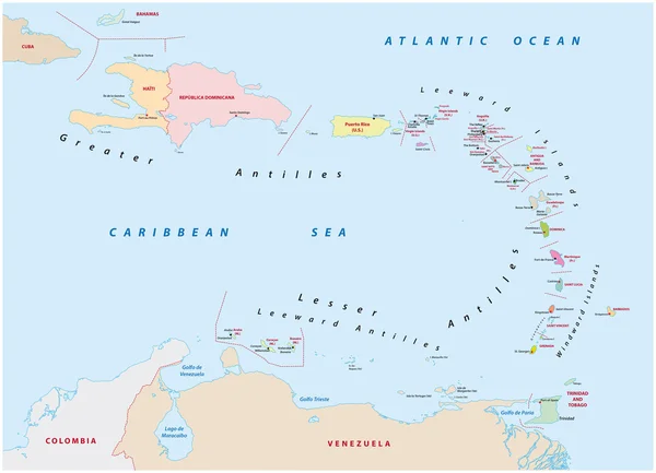
Windward Islands Political Map. Islands Of The Lesser Antilles, South Of The Leeward Islands In The Caribbean Sea. From Dominica, Martinique, Saint Lucia, Saint Vincent And The Grenadines, To Grenada.

Vector, 2.87MB, 6000 × 9000 eps
stock vector Leeward Islands, political map. Part of the Lesser Antilles, north of Windward Islands in the Caribbean. Virgin Islands, Anguilla, St Kitts and Nevis, Antigua and Barbuda, Montserrat, and Guadeloupe.

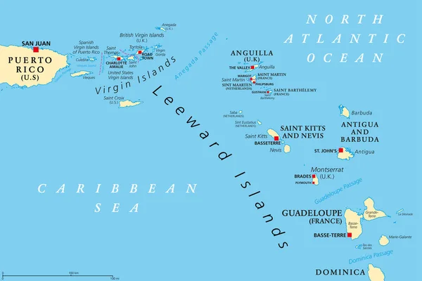
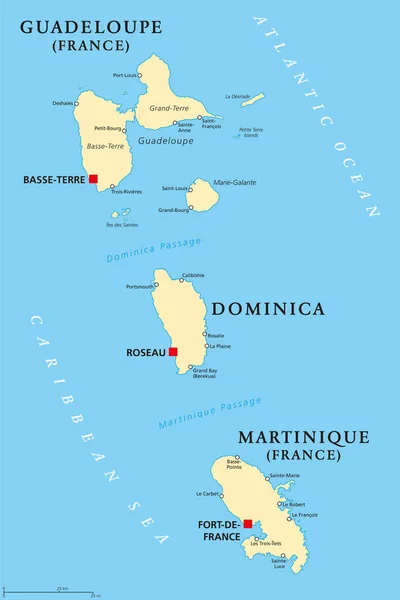
Leeward Islands, Political Map. Part Of The Lesser Antilles, North Of Windward Islands In The Caribbean. Virgin Islands, Anguilla, St Kitts And Nevis, Antigua And Barbuda, Montserrat, And Guadeloupe.

Vector, 3.54MB, 9000 × 6000 eps
stock vector Lesser Antilles political map

Lesser Antilles Political Map

Vector, 2.52MB, 9666 × 6455 eps
stock vector Caribbean - highly detailed map.

Caribbean - Highly Detailed Map.

Vector, 10.27MB, 5001 × 3750 eps
stock vector Lesser Antilles political map

Lesser Antilles Political Map

Vector, 2.95MB, 8985 × 6000 eps
stock vector Guadeloupe, Dominica and Martinique political map

Guadeloupe, Dominica And Martinique Political Map

Vector, 2.6MB, 6521 × 9777 eps
stock vector Lesser Antilles of the Caribbean, multicolored political map. Group of islands between Greater Antilles and South America. Divided into the Leeward Islands, Windward Islands, and the Leeward Antilles.

Lesser Antilles Of The Caribbean, Multicolored Political Map. Group Of Islands Between Greater Antilles And South America. Divided Into The Leeward Islands, Windward Islands, And The Leeward Antilles.

Vector, 3.35MB, 8985 × 6000 eps
stock vector Map on flag button of Commonwealth of Dominica

Map On Flag Button Of Commonwealth Of Dominica

Vector, 1.38MB, 5555 × 5555 eps
stock vector Stylized map of Dominica. Isometric 3D

Stylized Map Of Dominica. Isometric 3D

Vector, 2.04MB, 4800 × 4000 eps
stock vector Dominica vector map with infographic elements, pointer marks. Editable template with regions, cities and capital Roseau.

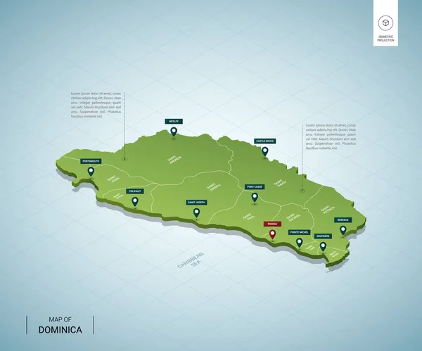
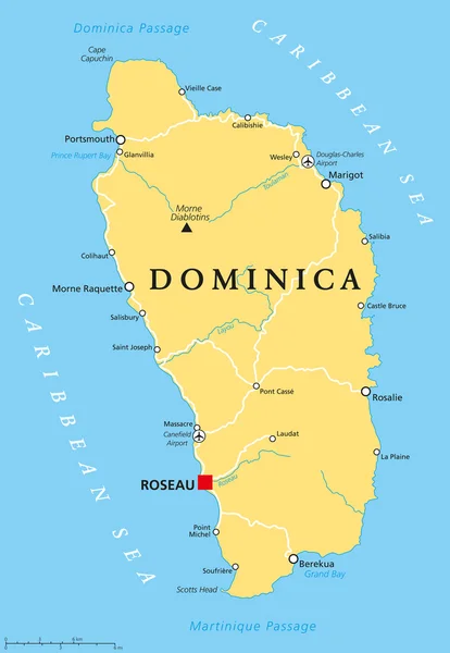
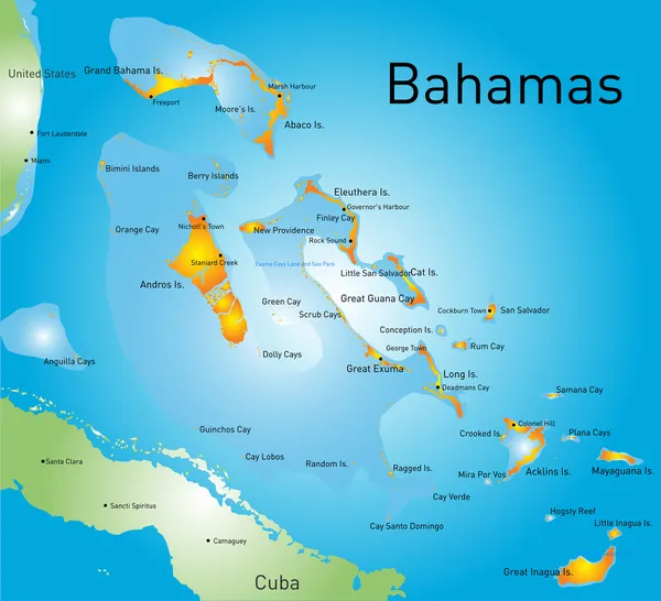
Dominica Vector Map With Infographic Elements, Pointer Marks. Editable Template With Regions, Cities And Capital Roseau.

Vector, 2.13MB, 4000 × 4000 eps
stock vector The world with flag of Dominica

The World With Flag Of Dominica

Vector, 1.05MB, 5431 × 3613 eps
stock vector Association of Caribbean States map

Association Of Caribbean States Map

Vector, 3MB, 5370 × 4295 eps
stock vector Map of Central America and Caribbean. Simlified schematic vector map in shades of green

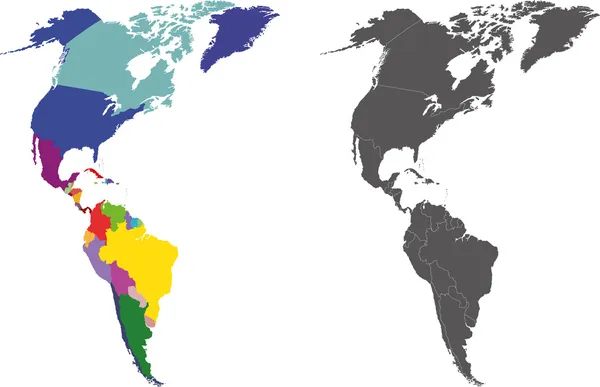
Map Of Central America And Caribbean. Simlified Schematic Vector Map In Shades Of Green

Vector, 0.68MB, 6000 × 4000 eps
stock vector Grand Bahama

Grand Bahama

Vector, 1.8MB, 7666 × 4217 eps
stock vector Caribbean -highly detailed map.

Caribbean -highly Detailed Map.

Vector, 10.74MB, 5001 × 3803 eps
stock vector Caribbean -highly detailed map.

Caribbean -highly Detailed Map.

Vector, 10.74MB, 5001 × 3803 eps
stock vector map of the states of the lesser Antilles

Map Of The States Of The Lesser Antilles

Vector, 1.33MB, 6772 × 4893 eps
stock image Caribbean on 3D model of Earth with country borders and water in oceans. 3D illustration isolated on white background.

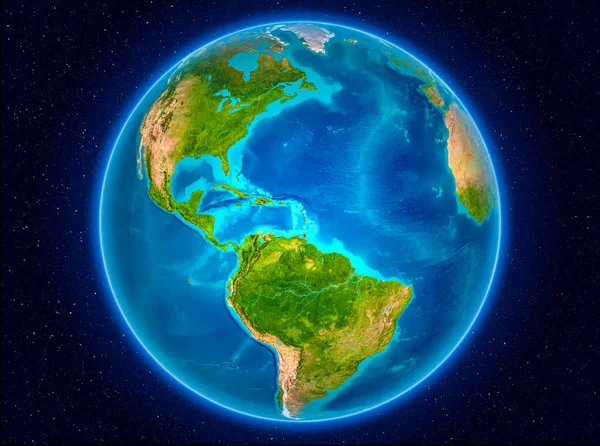
Caribbean On 3D Model Of Earth With Country Borders And Water In Oceans. 3D Illustration Isolated On White Background.

Image, 13.73MB, 5000 × 3750 jpg
stock vector lesser antilles map, vector illustration

Lesser Antilles Map, Vector Illustration

Vector, 0MB, 6456 × 4652 zip
stock vector Political map of Carribean. Blue highlighted states and dependent territories. Simple flat vector illustration

Political Map Of Carribean. Blue Highlighted States And Dependent Territories. Simple Flat Vector Illustration

Vector, 1.2MB, 6000 × 4500 eps
stock vector Map of North and South America. Flags of the Americas

Map Of North And South America. Flags Of The Americas

Vector, 13.53MB, 7677 × 5985 eps
stock vector Dominica map

Dominica Map

Vector, 8.08MB, 7000 × 7000 eps
stock vector Political map of Carribean. Pink highlighted states and dependent territories. Simple flat vector illustration

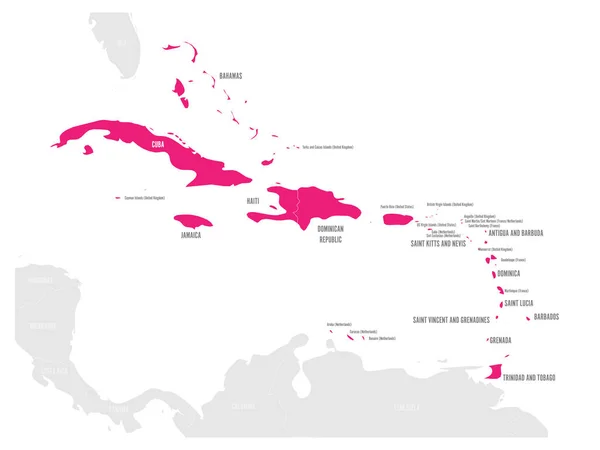
Political Map Of Carribean. Pink Highlighted States And Dependent Territories. Simple Flat Vector Illustration

Vector, 1.2MB, 6000 × 4500 eps
stock image Caribbean on planet Earth in space

Caribbean On Planet Earth In Space

Image, 12.19MB, 5000 × 3722 jpg
stock image Caribbean on blue globe on reflective surface. 3D illustration.

Caribbean On Blue Globe On Reflective Surface. 3D Illustration.

Image, 4.62MB, 3750 × 5000 jpg
stock vector Blue-gray detailed map of Dominica administrative divisions and location on the globe. Vector illustration

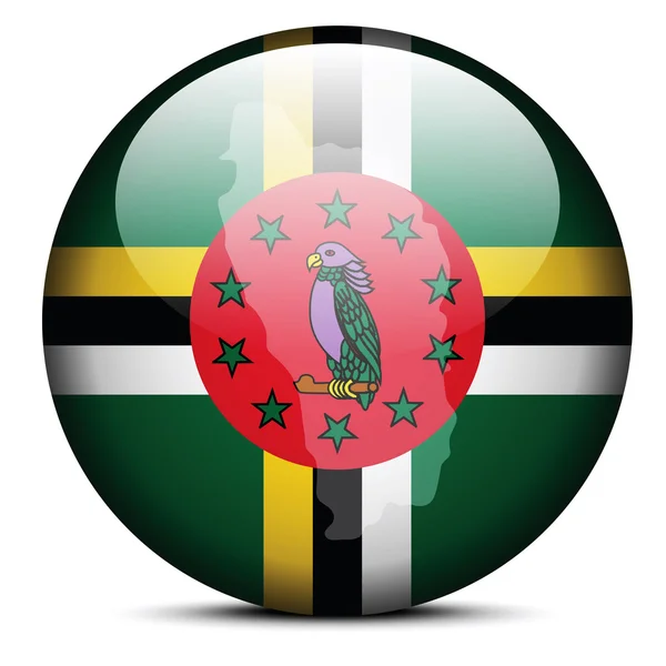
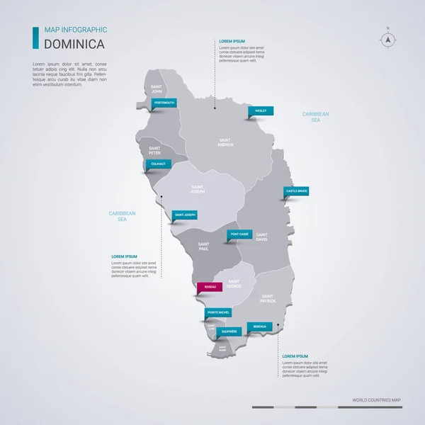
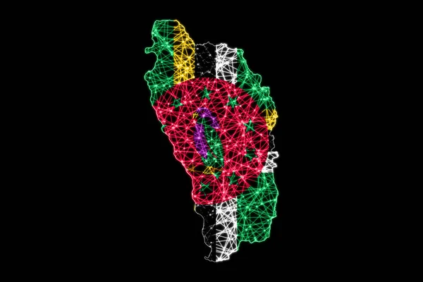
Blue-gray Detailed Map Of Dominica Administrative Divisions And Location On The Globe. Vector Illustration

Vector, 18.65MB, 5250 × 6404 eps
stock vector Political map of Carribean. Gray lands on white background. Simple flat vector illustration

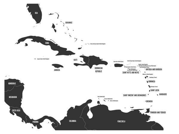
Political Map Of Carribean. Gray Lands On White Background. Simple Flat Vector Illustration

Vector, 1.2MB, 6000 × 4500 eps
stock vector Bahamas

Bahamas

Vector, 2.27MB, 6861 × 6242 eps
stock vector Dominica map with flag inside and ribbon

Dominica Map With Flag Inside And Ribbon

Vector, 0.91MB, 4167 × 4167 eps
stock image Desk flags, United States America and Cuba, isolated on white background. 3d image

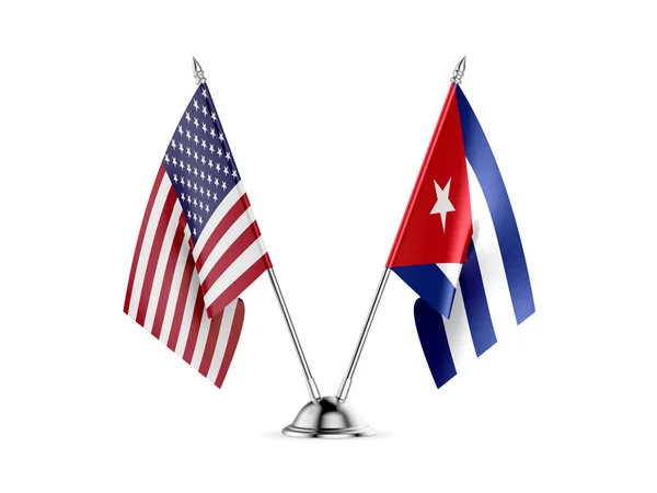
Desk Flags, United States America And Cuba, Isolated On White Background. 3d Image

Image, 2.46MB, 5744 × 4308 jpg
stock image Caribbean on Earth

Caribbean On Earth

Image, 10.97MB, 5000 × 3722 jpg
stock vector Political map of Carribean. Orange highlighted states and dependent territories. Simple flat vector illustration

Political Map Of Carribean. Orange Highlighted States And Dependent Territories. Simple Flat Vector Illustration

Vector, 1.2MB, 6000 × 4500 eps
stock image Round flag icon of dominica

Round Flag Icon Of Dominica

Image, 2.81MB, 5000 × 3750 jpg
stock image Caribbean on translucent globe in hands in space. 3D illustration.

Caribbean On Translucent Globe In Hands In Space. 3D Illustration.

Image, 8.35MB, 5000 × 5485 jpg
stock image Map of Dominica, Polygonal mesh line map, flag map

Map Of Dominica, Polygonal Mesh Line Map, Flag Map

Image, 5.97MB, 7500 × 5000 jpg
stock vector Political map of Carribean. Green highlighted sovereign states and orange dependent territories. Simple flat vector illustration

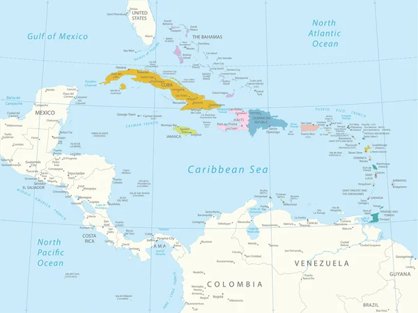
Political Map Of Carribean. Green Highlighted Sovereign States And Orange Dependent Territories. Simple Flat Vector Illustration

Vector, 1.2MB, 6000 × 4500 eps
stock vector Locator map showing the location of the country Dominica in North America. The country is highlighted with a red polygon. No labels at all. Made with Natural Earth.

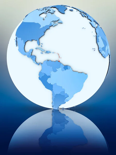
Locator Map Showing The Location Of The Country Dominica In North America. The Country Is Highlighted With A Red Polygon. No Labels At All. Made With Natural Earth.

Vector, 1.36MB, 4223 × 4474 eps
stock vector Dominica silhouette map isolated on white background

Dominica Silhouette Map Isolated On White Background

Vector, 8.08MB, 3000 × 5000 eps
Page 1 >> Next