
Stock image Grinten

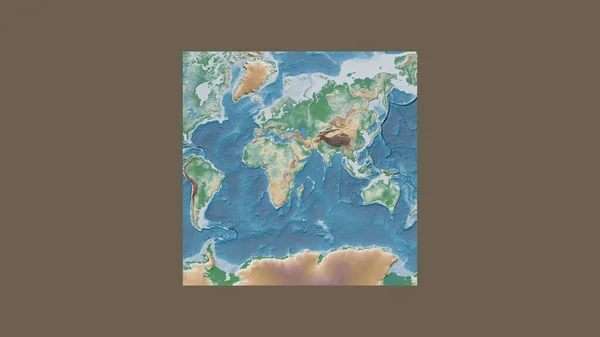
World Map In The Van Der Grinten Projection Centered On 11 East Longitude. Bilevel Topographic Map - Raw Composite Of Raster With Graticule. 3D Illustration
Image, 2.1MB, 4000 × 2000 jpg

Neighborhoods Of The Caribbean Tectonic Plate On The Grayscale Map In The Van Der Grinten I Projection (oblique Transformation). Raw Composite - No Outlines
Image, 2.65MB, 2880 × 1620 jpg
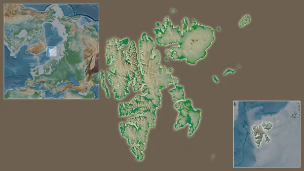
Close-up Of Svalbard And Its Location In The Region And In The Center Of A Large-scale World Map. Color Physical Map
Image, 2.07MB, 2880 × 1620 jpg
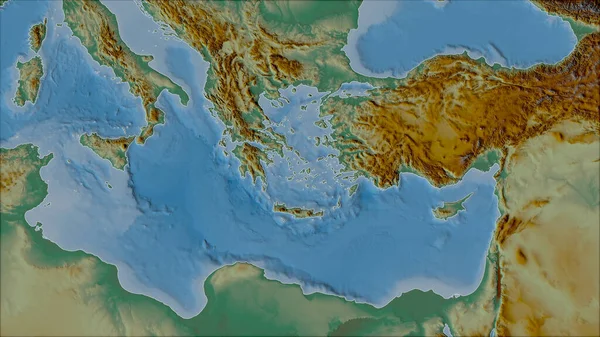
Neighborhoods Of The Aegean Sea Tectonic Plate On The Relief Map In The Van Der Grinten I Projection (oblique Transformation). Raw Composite - No Outlines
Image, 5.12MB, 2880 × 1620 jpg
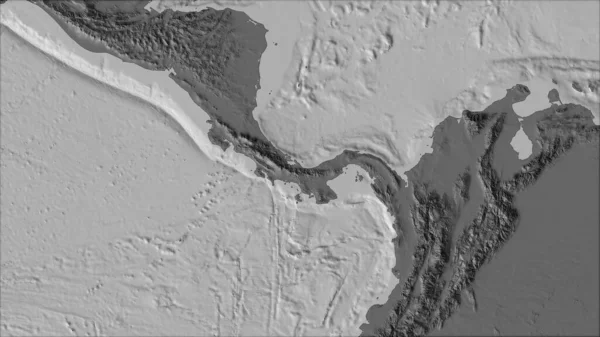
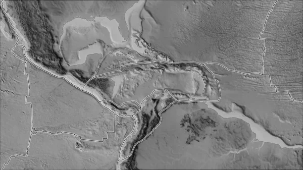
Neighborhoods Of The Panama Tectonic Plate On The Bilevel Elevation Map In The Van Der Grinten I Projection (oblique Transformation). Raw Composite - No Outlines
Image, 2.12MB, 2880 × 1620 jpg
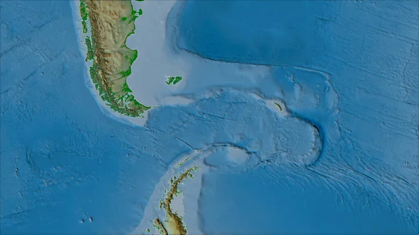
Neighborhoods Of The Scotia Tectonic Plate On The Physical Map In The Van Der Grinten I Projection (oblique Transformation). Raw Composite - No Outlines
Image, 3.92MB, 2880 × 1620 jpg

Close-up Of Norway And Its Location In The Region And In The Center Of A Large-scale World Map. Color Physical Map
Image, 1.83MB, 2880 × 1620 jpg
Tectonic Plates Borders On The Grayscale Map Of Areas Adjacent To The Caribbean Plate Area. Van Der Grinten I Projection (oblique Transformation)
Image, 2.7MB, 2880 × 1620 jpg

Outlined Pacific Tectonic Plate And Borders Of Adjacent Plates On The Physical Map In The Van Der Grinten I Projection (oblique Transformation)
Image, 7.06MB, 2880 × 1620 jpg
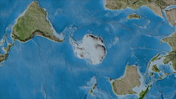
Neighborhoods Of The Antarctica Tectonic Plate On The Satellite B Map In The Van Der Grinten I Projection (oblique Transformation). Raw Composite - No Outlines
Image, 6.47MB, 2880 × 1620 jpg

Neighborhoods Of The Altiplano Tectonic Plate On The Grayscale Map In The Van Der Grinten I Projection (oblique Transformation). Raw Composite - No Outlines
Image, 2.34MB, 2880 × 1620 jpg
Neighborhoods Of The Molucca Sea Tectonic Plate On The Grayscale Map In The Van Der Grinten I Projection (oblique Transformation). Raw Composite - No Outlines
Image, 2.24MB, 2880 × 1620 jpg

Neighborhoods Of The North Bismarck Tectonic Plate On The Relief Map In The Van Der Grinten I Projection (oblique Transformation). Raw Composite - No Outlines
Image, 3.79MB, 2880 × 1620 jpg
Expanded And Enlarged Area Of Caribbean Netherlands Sint Eustatius Extracted From The Large-scale Map Of The World With Leading Lines Connecting The Corners Of The Frames. Satellite Imagery
Image, 1.67MB, 2880 × 1620 jpg
Square Frame Of The Large-scale Map Of The World In An Oblique Van Der Grinten Projection Centered On The Territory Of Somalia. Color Physical Map
Image, 1.42MB, 2880 × 1620 jpg

Neighborhoods Of The Anatolian Tectonic Plate On The Topographic Map In The Van Der Grinten I Projection (oblique Transformation). Raw Composite - No Outlines
Image, 5.95MB, 2880 × 1620 jpg
Neighborhoods Of The Scotia Tectonic Plate On The Grayscale Map In The Van Der Grinten I Projection (oblique Transformation). Raw Composite - No Outlines
Image, 2.06MB, 2880 × 1620 jpg

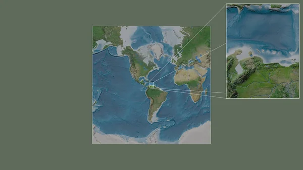
Close-up Of Colombia And Its Location In The Region And In The Center Of A Large-scale World Map. Color Physical Map
Image, 2.15MB, 2880 × 1620 jpg

Close-up Of Guernsey And Its Location In The Region And In The Center Of A Large-scale World Map. Satellite Imagery
Image, 1.92MB, 2880 × 1620 jpg

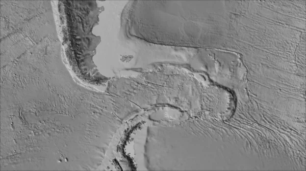
White Mask Of Lands Within Areas Adjacent To The Altiplano Tectonic Plate. Black Background. Van Der Grinten I Projection (oblique Transformation). Compositing Tool
Image, 0.09MB, 2880 × 1620 jpg

Neighborhoods Of The Juan De Fuca Tectonic Plate On The Physical Map In The Van Der Grinten I Projection (oblique Transformation). Raw Composite - No Outlines
Image, 4.81MB, 2880 × 1620 jpg
Expanded And Enlarged Area Of Caribbean Netherlands Bonaire Extracted From The Large-scale Map Of The World With Leading Lines Connecting The Corners Of The Frames. Satellite Imagery
Image, 1.83MB, 2880 × 1620 jpg
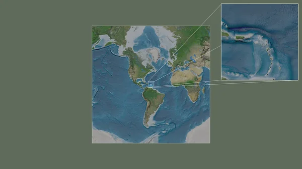
Close-up Of Saint Barthelemy And Its Location In The Region And In The Center Of A Large-scale World Map. Satellite Imagery
Image, 1.7MB, 2880 × 1620 jpg
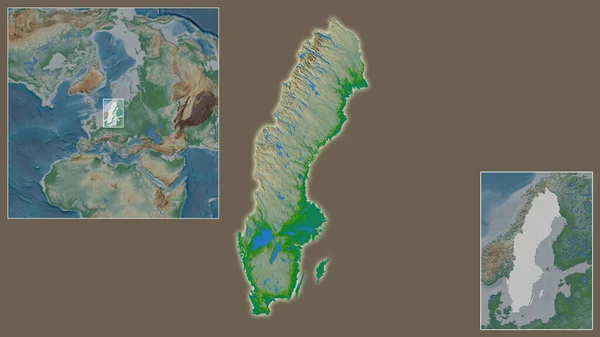
Close-up Of Sweden And Its Location In The Region And In The Center Of A Large-scale World Map. Color Physical Map
Image, 1.97MB, 2880 × 1620 jpg

World Map Van Der Grinten Projection Loopable Rotating Map Of The World Attractive Footage
Image, 0.37MB, 4096 × 2304 jpg
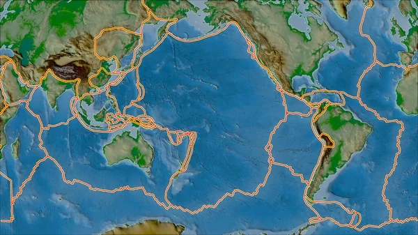
Tectonic Plates Borders On The Physical Map Of Areas Adjacent To The Pacific Plate Area. Van Der Grinten I Projection (oblique Transformation)
Image, 7.14MB, 2880 × 1620 jpg
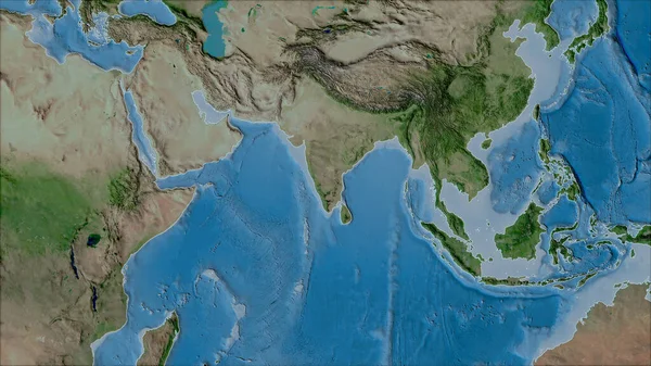
Neighborhoods Of The Indian Tectonic Plate On The Satellite A Map In The Van Der Grinten I Projection (oblique Transformation). Raw Composite - No Outlines
Image, 6.18MB, 2880 × 1620 jpg

Neighborhoods Of The Solomon Sea Tectonic Plate On The Grayscale Map In The Van Der Grinten I Projection (oblique Transformation). Raw Composite - No Outlines
Image, 1.96MB, 2880 × 1620 jpg
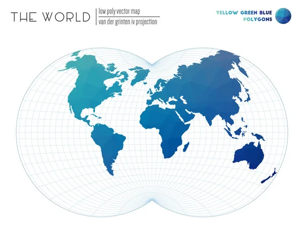
Abstract World Map Van Der Grinten IV Projection Of The World Yellow Green Blue Colored Polygons
Vector, 1.17MB, 6261 × 4818 eps

Map Of The World Van Der Grinten Projection Globe With Latitude And Longitude Net World Map On
Vector, 1.53MB, 5480 × 5480 eps

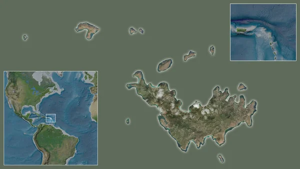
Close-up Of Cayman Islands Grand Cayman And Its Location In The Region And In The Center Of A Large-scale World Map. Satellite Imagery
Image, 1.96MB, 2880 × 1620 jpg
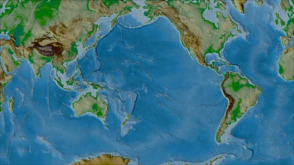
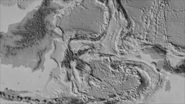
Neighborhoods Of The Pacific Tectonic Plate On The Physical Map In The Van Der Grinten I Projection (oblique Transformation). Raw Composite - No Outlines
Image, 6.81MB, 2880 × 1620 jpg
Page 1 >> Next