photo free
Home Images Vectors Videos

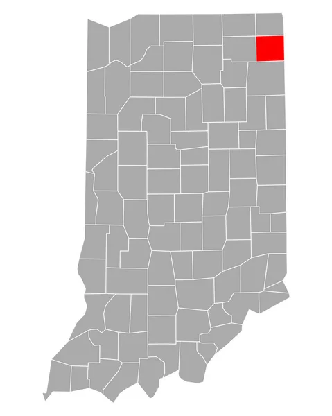
Stock image Indiana Region

stock vector Indiana map Blank vector map of the Us State with counties Borders of Indiana for your

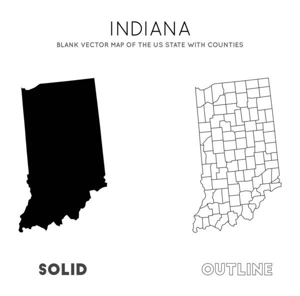
Indiana Map Blank Vector Map Of The Us State With Counties Borders Of Indiana For Your

Vector, 0.31MB, 5523 × 5459 eps
stock vector Accurate map of Indiana

Accurate Map Of Indiana

Vector, 0.66MB, 4000 × 5000 eps
stock vector Accurate map of Indiana

Accurate Map Of Indiana

Vector, 0.7MB, 4000 × 5000 eps
stock vector Accurate map of Indiana

Accurate Map Of Indiana

Vector, 0.66MB, 4000 × 5000 eps
stock image State of Indiana map

State Of Indiana Map

Image, 0.84MB, 4300 × 2800 jpg
stock vector Industrial Mosaic Map of Indiana State with Colored Wheels

Industrial Mosaic Map Of Indiana State With Colored Wheels

Vector, 0.7MB, 4548 × 3518 eps
stock vector Map of the State of Indiana and American flag. Map pointer with American flag.

Map Of The State Of Indiana And American Flag. Map Pointer With American Flag.

Vector, 1.32MB, 4005 × 4005 eps
stock vector Set of vector polygonal Indiana maps.

Set Of Vector Polygonal Indiana Maps.

Vector, 0.49MB, 8333 × 8333 eps
stock vector Indiana map

Indiana Map

Vector, 8.29MB, 7002 × 7002 eps
stock vector Detailed vintage map of United States of America with names of 5

Detailed Vintage Map Of United States Of America With Names Of 5

Vector, 25.88MB, 7296 × 4104 eps
stock vector Icons States map. America states map icons on a white background

Icons States Map. America States Map Icons On A White Background

Vector, 1.51MB, 5000 × 5000 eps
stock vector Map of DeKalb in Indiana

Map Of DeKalb In Indiana

Vector, 0.24MB, 4000 × 5000 eps
stock vector Indiana state outline administrative and political vector map in color

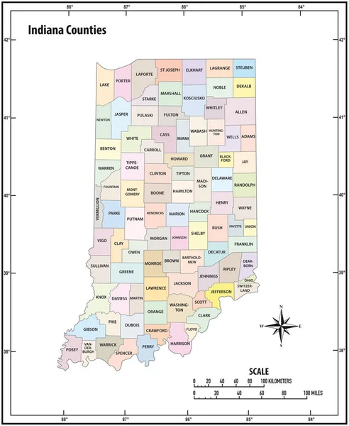
Indiana State Outline Administrative And Political Vector Map In Color

Vector, 1.13MB, 3100 × 3780 eps
stock vector United States census bureau regions and divisions vector map. Flag of United States of America

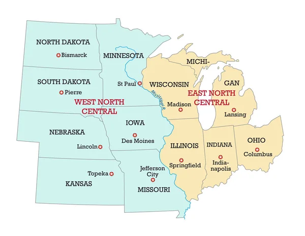
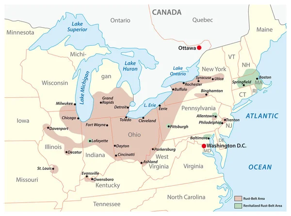
United States Census Bureau Regions And Divisions Vector Map. Flag Of United States Of America

Vector, 6.79MB, 7292 × 3543 eps
stock vector map of the U.S. state of Indiana

Map Of The U.S. State Of Indiana

Vector, 0.56MB, 5000 × 5000 eps
stock vector Detailed map of US regions and time zones, Colorful infographics of the United States of America, vector illustration

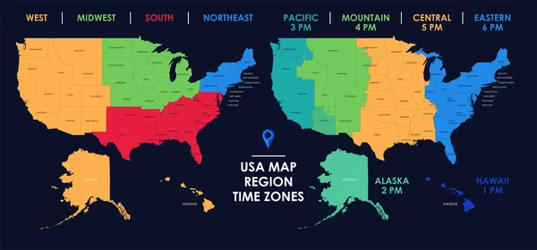
Detailed Map Of US Regions And Time Zones, Colorful Infographics Of The United States Of America, Vector Illustration

Vector, 11.39MB, 11205 × 5237 eps
stock vector Fountain County, Indiana (U.S. county, United States of America, USA, U.S., US) map vector illustration, scribble sketch Fountain map

Fountain County, Indiana (U.S. County, United States Of America, USA, U.S., US) Map Vector Illustration, Scribble Sketch Fountain Map

Vector, 0.72MB, 7087 × 4726 eps
stock image Map of Indiana - USA

Map Of Indiana - USA

Image, 9.21MB, 8000 × 9000 jpg
stock vector map of the U.S. state  Indiana

Map Of The U.S. State Indiana

Vector, 1.85MB, 5000 × 5000 eps
stock vector Two versions of the map of US State Indiana, with the flag of Indiana and highlighted in dark grey. Vector map.

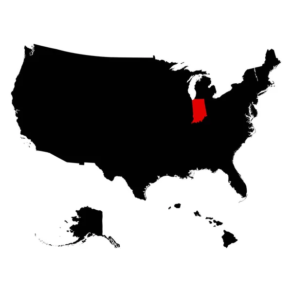
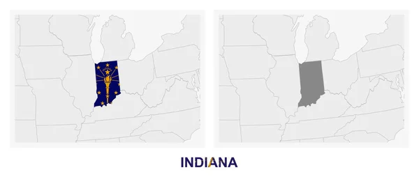
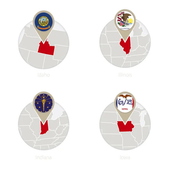
Two Versions Of The Map Of US State Indiana, With The Flag Of Indiana And Highlighted In Dark Grey. Vector Map.

Vector, 0.66MB, 8000 × 3388 eps
stock vector Ohio state detailed editable map

Ohio State Detailed Editable Map

Vector, 0.97MB, 5000 × 5552 eps
stock vector Indiana State in the United States map

Indiana State In The United States Map

Vector, 1.86MB, 5000 × 5000 eps
stock vector Kentucky state detailed editable map

Kentucky State Detailed Editable Map

Vector, 0.91MB, 8000 × 3898 eps
stock vector Indiana vector map silhouette isolated on white background. High detailed silhouette illustration. State of United states of America.

Indiana Vector Map Silhouette Isolated On White Background. High Detailed Silhouette Illustration. State Of United States Of America.

Vector, 0.24MB, 3000 × 5000 eps
stock vector Map of the Midwest United States of America

Map Of The Midwest United States Of America

Vector, 0.7MB, 3988 × 3100 eps
stock vector Black United States Of America map. US background template. Map of America with separated countries and interstate borders. All states and regions are named in the layer panel.

Black United States Of America Map. US Background Template. Map Of America With Separated Countries And Interstate Borders. All States And Regions Are Named In The Layer Panel.

Vector, 1.41MB, 5000 × 3200 eps
stock vector Ohio, Pennsylvania, Hawaii, Alaska, Indiana USA state outline ar

Ohio, Pennsylvania, Hawaii, Alaska, Indiana USA State Outline Ar

Vector, 14.62MB, 5000 × 5000 eps
stock vector Map of States of the United States where Indiana is pulled out

Map Of States Of The United States Where Indiana Is Pulled Out

Vector, 2.06MB, 5666 × 3849 eps
stock vector Vector set 4 of 10 Highly detailed silhouettes of US state maps, divided into counties with names and territory nicknames

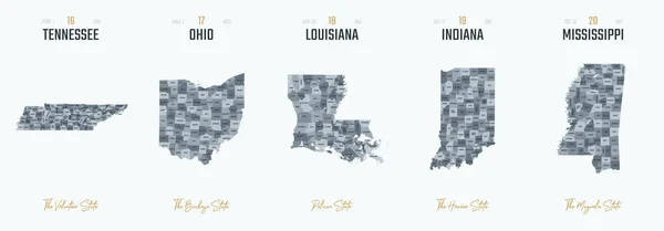
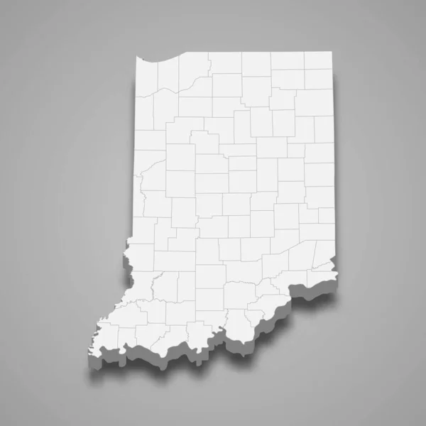
Vector Set 4 Of 10 Highly Detailed Silhouettes Of US State Maps, Divided Into Counties With Names And Territory Nicknames

Vector, 6.15MB, 9585 × 3348 eps
stock vector Indianapolis, Indiana. Downtown vector map.

Indianapolis, Indiana. Downtown Vector Map.

Vector, 2.95MB, 8000 × 8000 eps
stock vector Simple black vector map of the Federal State of Indiana, USA

Simple Black Vector Map Of The Federal State Of Indiana, USA

Vector, 0.41MB, 4001 × 6200 eps
stock vector Outline United States Of America map. US background template. Map of America with separated countries and interstate borders. All states and regions are named in the layer panel.

Outline United States Of America Map. US Background Template. Map Of America With Separated Countries And Interstate Borders. All States And Regions Are Named In The Layer Panel.

Vector, 1.14MB, 5000 × 3500 eps
stock vector 3d map of Indiana is a state of United States

3d Map Of Indiana Is A State Of United States

Vector, 3.52MB, 4000 × 4000 eps
stock vector Indiana, IN, political map, with the capital Indianapolis, and most important cities, rivers and lakes. State in the Midwestern region of the United States of America, nicknamed The Hoosier State.

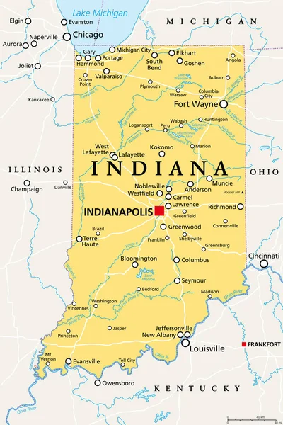
Indiana, IN, Political Map, With The Capital Indianapolis, And Most Important Cities, Rivers And Lakes. State In The Midwestern Region Of The United States Of America, Nicknamed The Hoosier State.

Vector, 3.4MB, 6000 × 9000 eps
stock vector Map of the region Rust Belt in the United States of America

Map Of The Region Rust Belt In The United States Of America

Vector, 0.9MB, 4185 × 3100 eps
stock vector U.S. state of Indiana

U.S. State Of Indiana

Vector, 0.61MB, 5000 × 5000 eps
stock vector Set of heart shaped flag of The United States of America with in

Set Of Heart Shaped Flag Of The United States Of America With In

Vector, 8.44MB, 6250 × 4167 eps
stock vector US States Idaho, Illinois, Indiana, Iowa map and flag in circle.

US States Idaho, Illinois, Indiana, Iowa Map And Flag In Circle.

Vector, 13.08MB, 5000 × 5000 eps
stock image Geographical Map of United States with States with Counties with Regions with Shadows

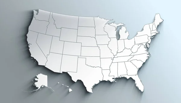
Geographical Map Of United States With States With Counties With Regions With Shadows

Image, 0.95MB, 3500 × 2000 jpg
stock vector Highly detailed vector silhouettes of US state maps, Division United States into counties, political and geographic subdivisions of a states, East North Central - Illinois, Indiana, Ohio - set 4 of 17

Highly Detailed Vector Silhouettes Of US State Maps, Division United States Into Counties, Political And Geographic Subdivisions Of A States, East North Central - Illinois, Indiana, Ohio - Set 4 Of 17

Vector, 6.95MB, 9608 × 4501 eps
stock vector Development Mosaic Indiana State Map and Made in Scratched Watermark

Development Mosaic Indiana State Map And Made In Scratched Watermark

Vector, 4.92MB, 5593 × 3000 eps
stock image State flag ball/stamp of UNITED STATES 2/3

State Flag Ball/stamp Of UNITED STATES 2/3

Image, 0.95MB, 2048 × 2560 jpg
stock vector Set 2 of 5 Highly detailed vector silhouettes of USA state maps

Set 2 Of 5 Highly Detailed Vector Silhouettes Of USA State Maps

Vector, 6.07MB, 8858 × 3738 eps
stock vector Indiana nostalgic rustic vintage state vector sign

Indiana Nostalgic Rustic Vintage State Vector Sign

Vector, 8.04MB, 5013 × 7959 eps
stock vector United States of America Map USA Indiana State with Cutting Paper and Graffiti Style

United States Of America Map USA Indiana State With Cutting Paper And Graffiti Style

Vector, 2.68MB, 4167 × 4167 eps
stock vector Flag of Evansville, Indiana, USA. Vector Format

Flag Of Evansville, Indiana, USA. Vector Format

Vector, 5.86MB, 8250 × 5500 eps
stock vector Vehicle license car number plates isolated icons

Vehicle License Car Number Plates Isolated Icons

Vector, 1.04MB, 6585 × 3853 eps
stock image Indiana IN Letters Abbreviation

Indiana IN Letters Abbreviation

Image, 2.69MB, 4000 × 4000 jpg
stock image Indiana IN Skyline City Metropolitan Area Nightlife 3d Illustration

Indiana IN Skyline City Metropolitan Area Nightlife 3d Illustration

Image, 1.82MB, 5000 × 4000 jpg
stock vector Indiana State Map Polygonal Mesh and Grunge Bicolor Stamp

Indiana State Map Polygonal Mesh And Grunge Bicolor Stamp

Vector, 2.03MB, 5375 × 3000 eps
Page 1 >> Next