photo free
Home Images Vectors Videos

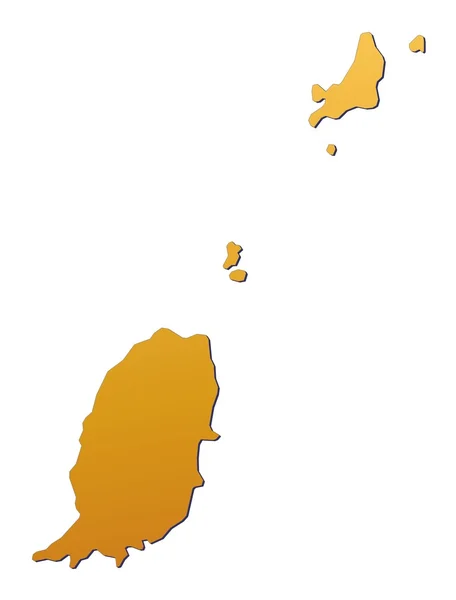
Stock image Map Grenada page 2

stock vector Central America - map - illustration.

Central America - Map - Illustration.

Vector, 3.9MB, 7400 × 5548 eps
stock vector South America Global World in Space

South America Global World In Space

Vector, 1.45MB, 5343 × 5760 eps
stock vector Globe set with borders of countries

Globe Set With Borders Of Countries

Vector, 3.78MB, 2800 × 2800 eps
stock vector Caribbean map

Caribbean Map

Vector, 5.28MB, 7000 × 7000 eps
stock vector Black location map of the Honduran Yoro department inside gray map of Honduras

Black Location Map Of The Honduran Yoro Department Inside Gray Map Of Honduras

Vector, 0.6MB, 6004 × 3533 eps
stock vector Caribbean -highly detailed map.

Caribbean -highly Detailed Map.

Vector, 10.74MB, 5001 × 3803 eps
stock vector Caribbean -highly detailed map.

Caribbean -highly Detailed Map.

Vector, 10.74MB, 5001 × 3803 eps
stock vector Black location map of the Honduran Ocotepeque department inside gray map of Honduras

Black Location Map Of The Honduran Ocotepeque Department Inside Gray Map Of Honduras

Vector, 0.6MB, 6004 × 3533 eps
stock vector Black location map of the Honduran Corts department inside gray map of Honduras

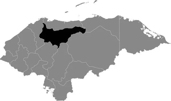
Black Location Map Of The Honduran Corts Department Inside Gray Map Of Honduras

Vector, 0.6MB, 6004 × 3533 eps
stock vector Central America map and navigation icons - Illustration.

Central America Map And Navigation Icons - Illustration.

Vector, 1.29MB, 7400 × 5970 eps
stock vector Colorful Caribbean map with countries and capital cities

Colorful Caribbean Map With Countries And Capital Cities

Vector, 0MB, 5000 × 3442 zip
stock vector Black location map of the Honduran Choluteca department inside gray map of Honduras

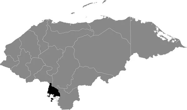
Black Location Map Of The Honduran Choluteca Department Inside Gray Map Of Honduras

Vector, 0.6MB, 6004 × 3533 eps
stock vector map of the states of the lesser Antilles

Map Of The States Of The Lesser Antilles

Vector, 1.33MB, 6772 × 4893 eps
stock vector Caribbean map

Caribbean Map

Vector, 3MB, 6000 × 4150 eps
stock vector Black location map of the Honduran Lempira department inside gray map of Honduras

Black Location Map Of The Honduran Lempira Department Inside Gray Map Of Honduras

Vector, 0.6MB, 6004 × 3533 eps
stock vector Black location map of the Honduran Intibuc department inside gray map of Honduras

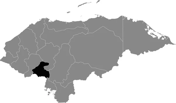
Black Location Map Of The Honduran Intibuc Department Inside Gray Map Of Honduras

Vector, 0.6MB, 6004 × 3533 eps
stock vector Black location map of the Honduran Francisco Morazn department inside gray map of Honduras

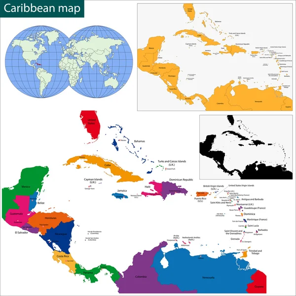
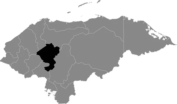
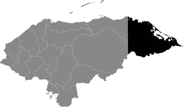
Black Location Map Of The Honduran Francisco Morazn Department Inside Gray Map Of Honduras

Vector, 0.6MB, 6004 × 3533 eps
stock vector Black location map of the Honduran El Paraso department inside gray map of Honduras

Black Location Map Of The Honduran El Paraso Department Inside Gray Map Of Honduras

Vector, 0.6MB, 6004 × 3533 eps
stock vector North and South America Global World

North And South America Global World

Vector, 1.95MB, 5340 × 5757 eps
stock vector AMERICA Countries - Part Three

AMERICA Countries - Part Three

Vector, 3.06MB, 5512 × 5512 eps
stock vector Black location map of the Honduran La Paz department inside gray map of Honduras

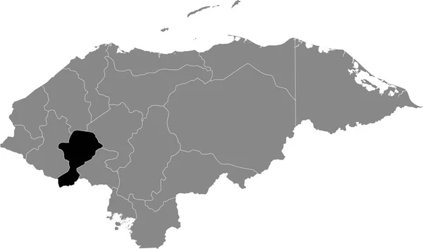
Black Location Map Of The Honduran La Paz Department Inside Gray Map Of Honduras

Vector, 0.6MB, 6004 × 3533 eps
stock image Caribbean on 3D model of Earth with country borders and water in oceans. 3D illustration isolated on white background.

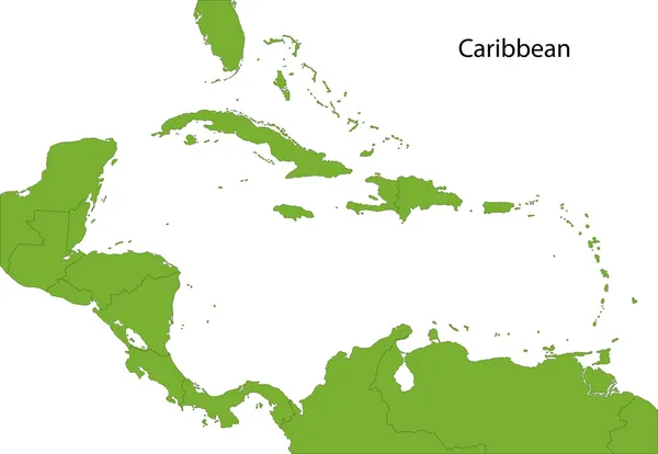
Caribbean On 3D Model Of Earth With Country Borders And Water In Oceans. 3D Illustration Isolated On White Background.

Image, 13.73MB, 5000 × 3750 jpg
stock vector Black location map of the Honduran Comayagua department inside gray map of Honduras

Black Location Map Of The Honduran Comayagua Department Inside Gray Map Of Honduras

Vector, 0.6MB, 6004 × 3533 eps
stock vector South America Global World

South America Global World

Vector, 5.46MB, 5410 × 5687 eps
stock vector Caribbean map

Caribbean Map

Vector, 3.56MB, 6000 × 4131 eps
stock vector Political map of Carribean. Blue highlighted states and dependent territories. Simple flat vector illustration

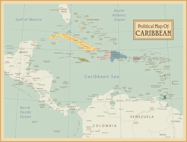
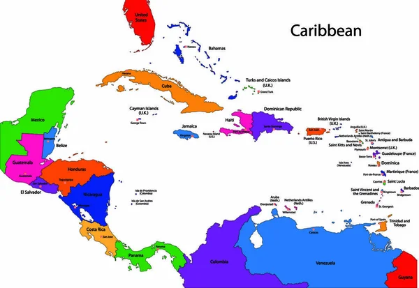
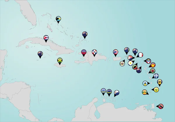
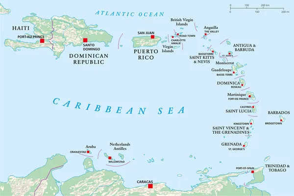
Political Map Of Carribean. Blue Highlighted States And Dependent Territories. Simple Flat Vector Illustration

Vector, 1.2MB, 6000 × 4500 eps
stock vector Travel to Grenada, top view airplane with map and flag of Grenada.

Travel To Grenada, Top View Airplane With Map And Flag Of Grenada.

Vector, 4.3MB, 6500 × 4500 eps
stock image Grenada map

Grenada Map

Image, 0.58MB, 2819 × 3706 jpg
stock vector Black location map of the Honduran Gracias a Dios department inside gray map of Honduras

Black Location Map Of The Honduran Gracias A Dios Department Inside Gray Map Of Honduras

Vector, 0.6MB, 6004 × 3533 eps
stock vector Pinned countries flags on map of Caribbean

Pinned Countries Flags On Map Of Caribbean

Vector, 0.5MB, 5000 × 3477 ai
stock vector Lake Grenada Reservoir (United States of America, North America, us, usa, Mississippi) map vector illustration, scribble sketch Grenada Dam map

Lake Grenada Reservoir (United States Of America, North America, Us, Usa, Mississippi) Map Vector Illustration, Scribble Sketch Grenada Dam Map

Vector, 1.49MB, 7087 × 4726 eps
stock vector 22 North America Country Maps

22 North America Country Maps

Vector, 2.08MB, 5201 × 5356 eps
stock vector Black location map of the Honduran Santa Brbara department inside gray map of Honduras

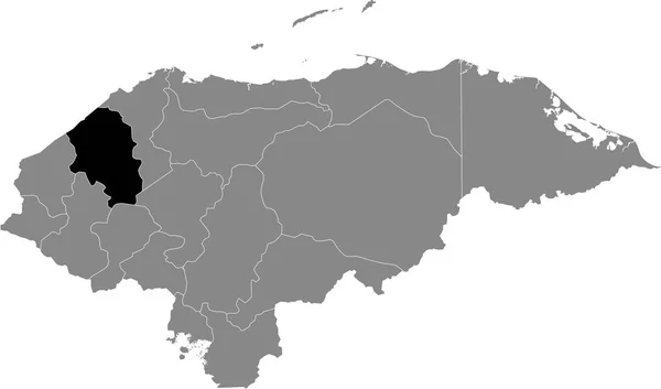
Black Location Map Of The Honduran Santa Brbara Department Inside Gray Map Of Honduras

Vector, 0.6MB, 6004 × 3533 eps
stock vector vector illustration of North America map (include Northern America, Central America and Caribbean regions) with country names and flags of countries.

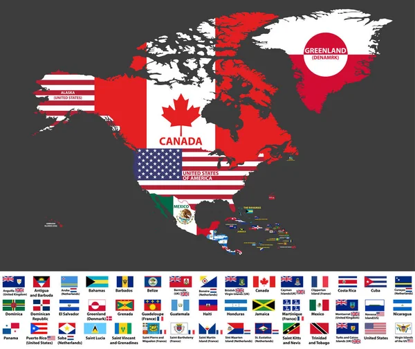
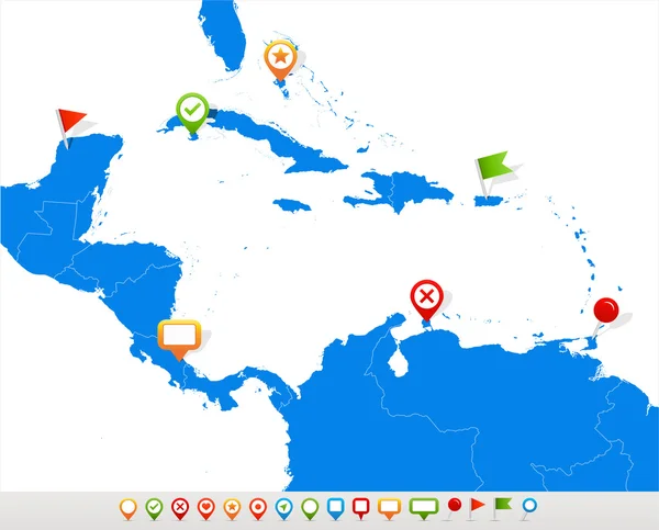
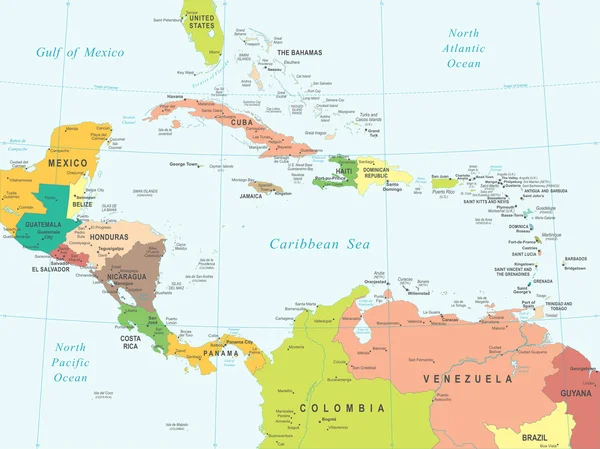
Vector Illustration Of North America Map (include Northern America, Central America And Caribbean Regions) With Country Names And Flags Of Countries.

Vector, 13.27MB, 8334 × 7009 eps
stock vector Black location map of the Honduran Atlntida department inside gray map of Honduras

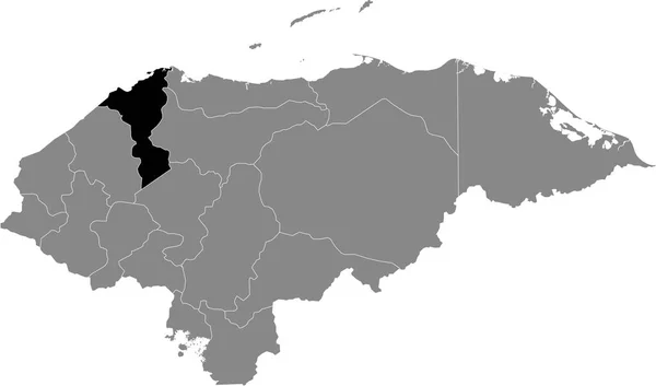
Black Location Map Of The Honduran Atlntida Department Inside Gray Map Of Honduras

Vector, 0.6MB, 6004 × 3533 eps
stock vector High detailed national flags of North and Central American countries, clipped in round shape glossy metal buttons, vector, part 1

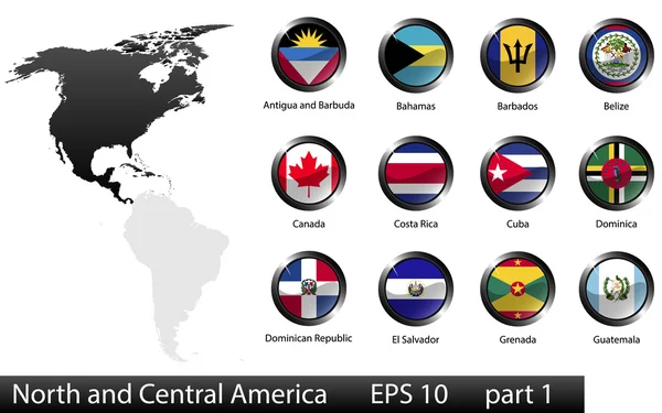
High Detailed National Flags Of North And Central American Countries, Clipped In Round Shape Glossy Metal Buttons, Vector, Part 1

Vector, 9.16MB, 5760 × 3600 eps
stock vector AMERICA Countries - Part Four

AMERICA Countries - Part Four

Vector, 2.54MB, 5512 × 5512 eps
stock vector Caribbean Islands Political Map

Caribbean Islands Political Map

Vector, 4.52MB, 9288 × 7191 eps
stock vector Black location map of the Honduran Valle department inside gray map of Honduras

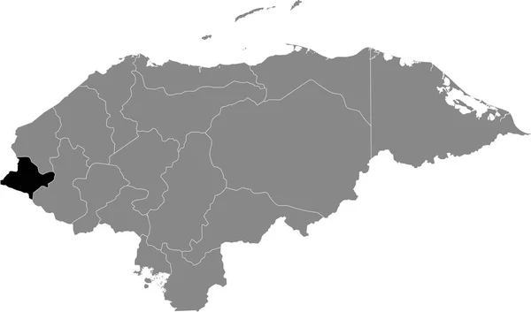
Black Location Map Of The Honduran Valle Department Inside Gray Map Of Honduras

Vector, 0.6MB, 6004 × 3533 eps
stock vector Black location map of the Honduran Olancho department inside gray map of Honduras

Black Location Map Of The Honduran Olancho Department Inside Gray Map Of Honduras

Vector, 0.6MB, 6004 × 3533 eps
stock vector South America Global World

South America Global World

Vector, 1.01MB, 5340 × 5757 eps
stock vector Black location map of the Honduran Islas de la Baha department inside gray map of Honduras

Black Location Map Of The Honduran Islas De La Baha Department Inside Gray Map Of Honduras

Vector, 0.6MB, 6004 × 3533 eps
stock vector Grenada - vector map

Grenada - Vector Map

Vector, 0.31MB, 2965 × 3625 eps
stock image Earth Model from Space: North America View

Earth Model From Space: North America View

Image, 15.04MB, 8000 × 6000 jpg
stock image Earth Model from Space: North America View

Earth Model From Space: North America View

Image, 12.99MB, 6000 × 6000 jpg
stock vector Central America - map - illustration.

Central America - Map - Illustration.

Vector, 5.47MB, 7400 × 5549 eps
stock image Caribbean on digital planet Earth with international network representing communication, travel and connections. 3D illustration. Elements of this image furnished by NASA.

Caribbean On Digital Planet Earth With International Network Representing Communication, Travel And Connections. 3D Illustration. Elements Of This Image Furnished By NASA.

Image, 15.57MB, 5000 × 3750 jpg
stock vector Lesser Antilles, Haiti, Dominican Republic

Lesser Antilles, Haiti, Dominican Republic

Vector, 1.92MB, 10000 × 6682 eps
stock vector Central America - map and navigation labels - illustration.

Central America - Map And Navigation Labels - Illustration.

Vector, 5.23MB, 7400 × 6236 eps
stock vector Political map of Carribean. Pink highlighted states and dependent territories. Simple flat vector illustration

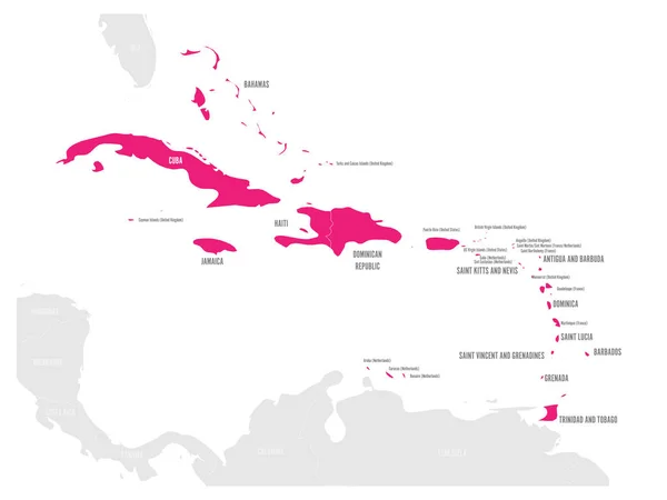
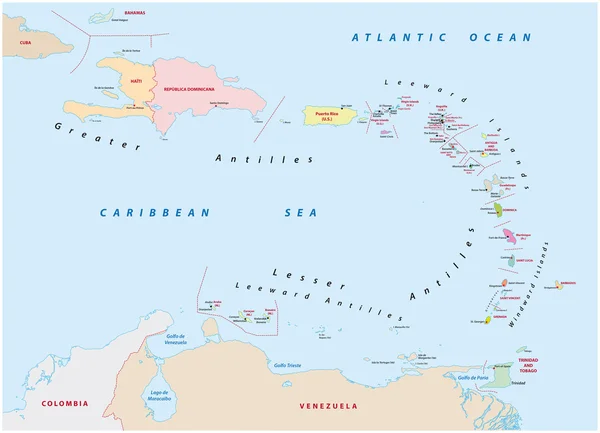
Political Map Of Carribean. Pink Highlighted States And Dependent Territories. Simple Flat Vector Illustration

Vector, 1.2MB, 6000 × 4500 eps
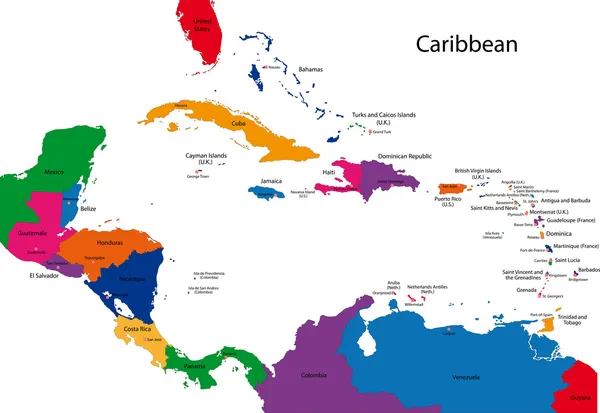
Previous << Page 2 >> Next