photo free
Home Images Vectors Videos

Stock image Map Grenada

stock image St. George's, the capital city of the Grenada on a geographical map

St. George's, The Capital City Of The Grenada On A Geographical Map

Image, 8.48MB, 5184 × 3456 jpg
stock vector Grenada country simplified map.Thin triple pencil sketch outline isolated on white background. Simple vector icon

Grenada Country Simplified Map.Thin Triple Pencil Sketch Outline Isolated On White Background. Simple Vector Icon

Vector, 0.25MB, 8000 × 8000 eps
stock vector Grenada islands highly detailed physical map

Grenada Islands Highly Detailed Physical Map

Vector, 1.26MB, 6872 × 7500 eps
stock vector Official current vector coat of arms of unitary two-party parliamentary constitutional monarchy of Grenada

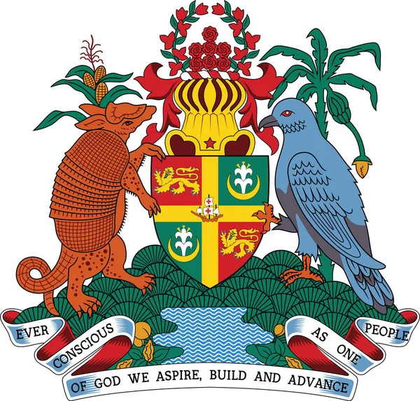
Official Current Vector Coat Of Arms Of Unitary Two-party Parliamentary Constitutional Monarchy Of Grenada

Vector, 1.43MB, 5008 × 4792 eps
stock vector Map of Grenada with flag

Map Of Grenada With Flag

Vector, 5.14MB, 5984 × 5984 eps
stock vector Map on flag button of Grenada

Map On Flag Button Of Grenada

Vector, 1.21MB, 5570 × 5570 eps
stock vector Grenada Travel Logo

Grenada Travel Logo

Vector, 0.72MB, 3333 × 3333 eps
stock vector Grenada Political Map

Grenada Political Map

Vector, 0.95MB, 6000 × 7429 eps
stock vector Caribbean - highly detailed map.

Caribbean - Highly Detailed Map.

Vector, 10.27MB, 5001 × 3750 eps
stock image Grenada Flag wooden sign

Grenada Flag Wooden Sign

Image, 3.61MB, 4100 × 2662 jpg
stock vector Caribbean geography map

Caribbean Geography Map

Vector, 0.84MB, 5004 × 3552 ai
stock vector Caribbean Map with Flags and Location

Caribbean Map With Flags And Location

Vector, 8.34MB, 6350 × 4245 eps
stock vector Central America - map - illustration.

Central America - Map - Illustration.

Vector, 4.36MB, 7400 × 5548 eps
stock vector Central America - map and navigation icons - illustration.

Central America - Map And Navigation Icons - Illustration.

Vector, 4.63MB, 7400 × 5923 eps
stock vector Map of Grenada Island, Grenada, contains geography outlines for land mass, water, major roads and minor roads.

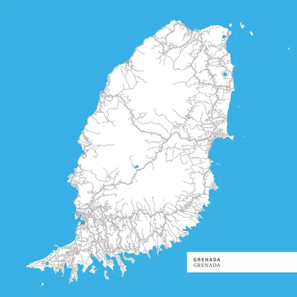
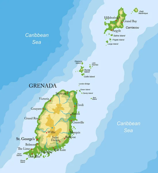
Map Of Grenada Island, Grenada, Contains Geography Outlines For Land Mass, Water, Major Roads And Minor Roads.

Vector, 4.42MB, 8000 × 8000 eps
stock vector Vector maps set.  High detailed 23 maps of North American

Vector Maps Set. High Detailed 23 Maps Of North American

Vector, 13.98MB, 6000 × 3600 eps
stock vector Association of Caribbean States map

Association Of Caribbean States Map

Vector, 3MB, 5370 × 4295 eps
stock vector Grenada vector map with infographic elements, pointer marks. Editable template with regions, cities and capital St. George's.

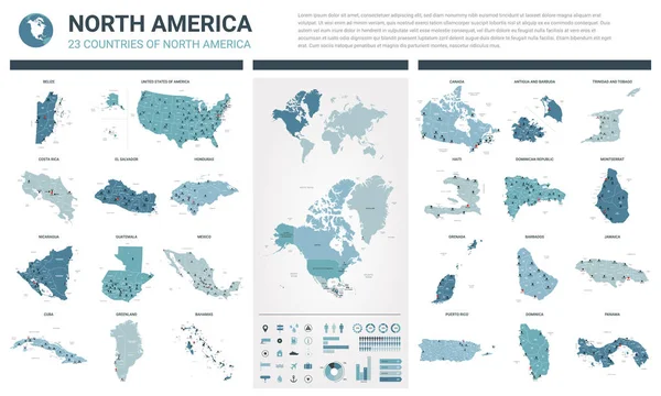
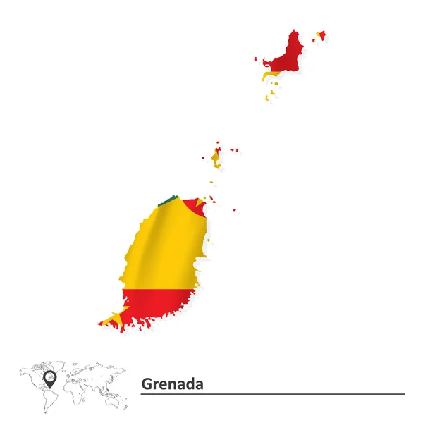
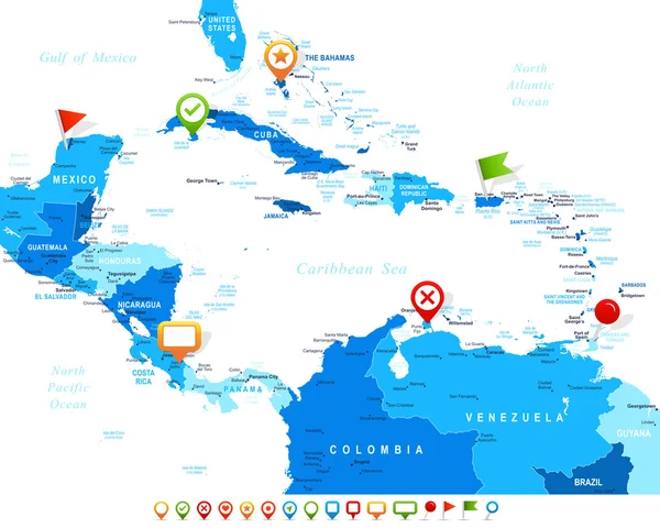
Grenada Vector Map With Infographic Elements, Pointer Marks. Editable Template With Regions, Cities And Capital St. George's.

Vector, 1.95MB, 4000 × 4000 eps
stock vector America

America

Vector, 22.35MB, 6056 × 3909 eps
stock vector Latin, Caribbean, North and South American country regions' maps

Latin, Caribbean, North And South American Country Regions' Maps

Vector, 12.29MB, 7286 × 7255 eps
stock image map Grenada. Isolated Illustration. Black on White background.

Map Grenada. Isolated Illustration. Black On White Background.

Image, 1.04MB, 5000 × 5000 jpg
stock vector America Pointer Flag Icons with american Map set2

America Pointer Flag Icons With American Map Set2

Vector, 10.31MB, 5000 × 5000 eps
stock vector Grenada infographics, statistical data, sights. Antillean Armadi

Grenada Infographics, Statistical Data, Sights. Antillean Armadi

Vector, 1.21MB, 4500 × 4500 eps
stock vector Map of Central America and Caribbean. Simlified schematic vector map in shades of green

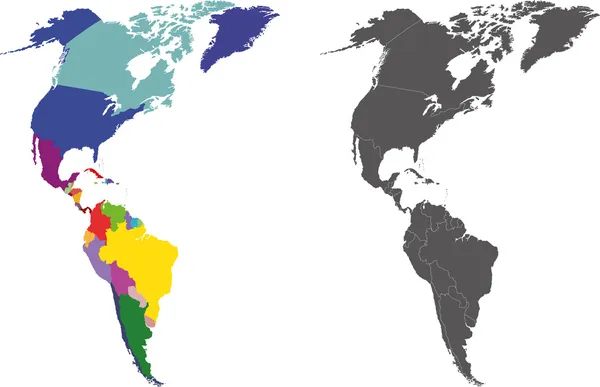
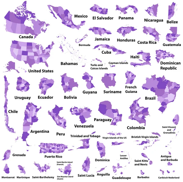
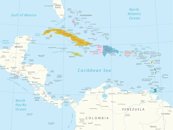
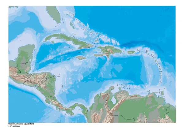
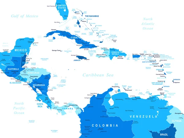
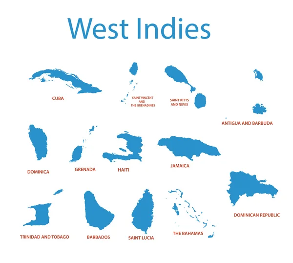
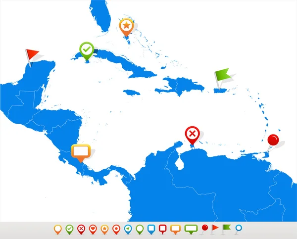
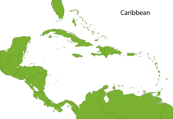
Map Of Central America And Caribbean. Simlified Schematic Vector Map In Shades Of Green

Vector, 0.68MB, 6000 × 4000 eps
stock vector West Indies - vector maps of countries

West Indies - Vector Maps Of Countries

Vector, 0.53MB, 4665 × 4188 eps
stock vector Central America - map - illustration.

Central America - Map - Illustration.

Vector, 3.9MB, 7400 × 5548 eps
stock vector South America Global World in Space

South America Global World In Space

Vector, 1.45MB, 5343 × 5760 eps
stock vector Globe set with borders of countries

Globe Set With Borders Of Countries

Vector, 3.78MB, 2800 × 2800 eps
stock vector Caribbean map

Caribbean Map

Vector, 5.28MB, 7000 × 7000 eps
stock image Grenada on the map of South America in soft grunge and vintage style, like old paper with watercolor painting.

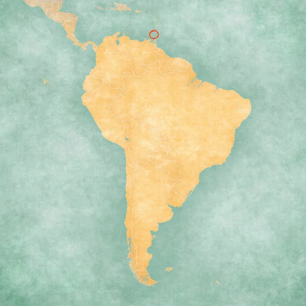
Grenada On The Map Of South America In Soft Grunge And Vintage Style, Like Old Paper With Watercolor Painting.

Image, 14.97MB, 6000 × 6000 jpg
stock vector Black location map of the Honduran Yoro department inside gray map of Honduras

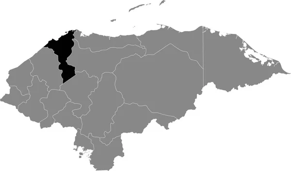
Black Location Map Of The Honduran Yoro Department Inside Gray Map Of Honduras

Vector, 0.6MB, 6004 × 3533 eps
stock vector Caribbean -highly detailed map.

Caribbean -highly Detailed Map.

Vector, 10.74MB, 5001 × 3803 eps
stock vector Caribbean -highly detailed map.

Caribbean -highly Detailed Map.

Vector, 10.74MB, 5001 × 3803 eps
stock vector Black location map of the Honduran Ocotepeque department inside gray map of Honduras

Black Location Map Of The Honduran Ocotepeque Department Inside Gray Map Of Honduras

Vector, 0.6MB, 6004 × 3533 eps
stock vector Black location map of the Honduran Corts department inside gray map of Honduras

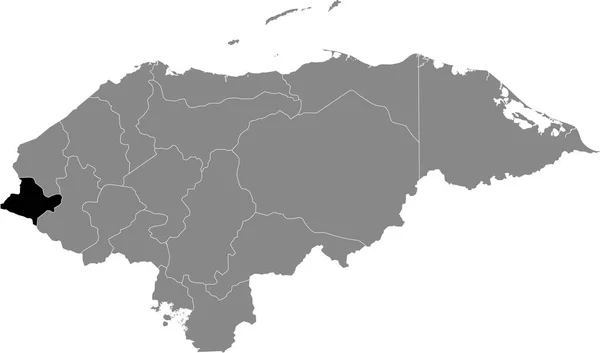
Black Location Map Of The Honduran Corts Department Inside Gray Map Of Honduras

Vector, 0.6MB, 6004 × 3533 eps
stock vector Central America map and navigation icons - Illustration.

Central America Map And Navigation Icons - Illustration.

Vector, 1.29MB, 7400 × 5970 eps
stock vector Colorful Caribbean map with countries and capital cities

Colorful Caribbean Map With Countries And Capital Cities

Vector, 0MB, 5000 × 3442 zip
stock vector Black location map of the Honduran Choluteca department inside gray map of Honduras

Black Location Map Of The Honduran Choluteca Department Inside Gray Map Of Honduras

Vector, 0.6MB, 6004 × 3533 eps
stock vector map of the states of the lesser Antilles

Map Of The States Of The Lesser Antilles

Vector, 1.33MB, 6772 × 4893 eps
stock vector Caribbean map

Caribbean Map

Vector, 3MB, 6000 × 4150 eps
stock vector Black location map of the Honduran Lempira department inside gray map of Honduras

Black Location Map Of The Honduran Lempira Department Inside Gray Map Of Honduras

Vector, 0.6MB, 6004 × 3533 eps
stock vector Black location map of the Honduran Intibuc department inside gray map of Honduras

Black Location Map Of The Honduran Intibuc Department Inside Gray Map Of Honduras

Vector, 0.6MB, 6004 × 3533 eps
stock vector Black location map of the Honduran Francisco Morazn department inside gray map of Honduras

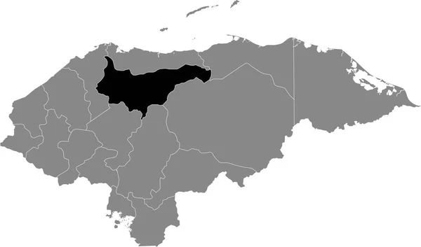
Black Location Map Of The Honduran Francisco Morazn Department Inside Gray Map Of Honduras

Vector, 0.6MB, 6004 × 3533 eps
stock vector Black location map of the Honduran El Paraso department inside gray map of Honduras

Black Location Map Of The Honduran El Paraso Department Inside Gray Map Of Honduras

Vector, 0.6MB, 6004 × 3533 eps
stock vector North and South America Global World

North And South America Global World

Vector, 1.95MB, 5340 × 5757 eps
stock vector AMERICA Countries - Part Three

AMERICA Countries - Part Three

Vector, 3.06MB, 5512 × 5512 eps
stock vector Black location map of the Honduran La Paz department inside gray map of Honduras

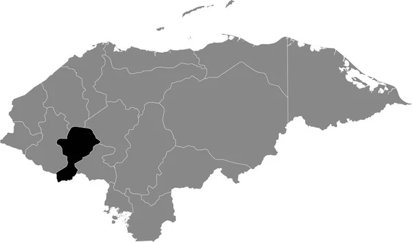
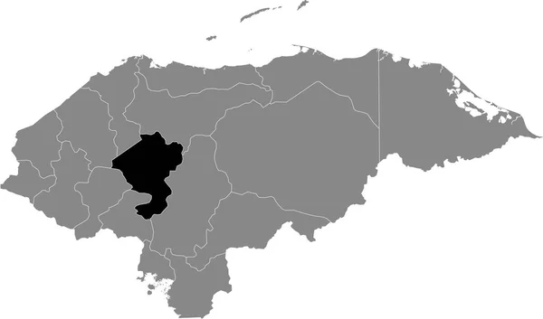
Black Location Map Of The Honduran La Paz Department Inside Gray Map Of Honduras

Vector, 0.6MB, 6004 × 3533 eps
stock image Caribbean on 3D model of Earth with country borders and water in oceans. 3D illustration isolated on white background.

Caribbean On 3D Model Of Earth With Country Borders And Water In Oceans. 3D Illustration Isolated On White Background.

Image, 13.73MB, 5000 × 3750 jpg
stock vector Black location map of the Honduran Comayagua department inside gray map of Honduras

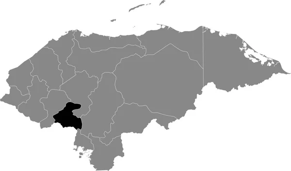
Black Location Map Of The Honduran Comayagua Department Inside Gray Map Of Honduras

Vector, 0.6MB, 6004 × 3533 eps
stock vector South America Global World

South America Global World

Vector, 5.46MB, 5410 × 5687 eps
Page 1 >> Next