photo free
Home Images Vectors Videos

Stock image Map Mozambique

stock vector Mozambique - solid black outline border map of country area. Simple flat vector illustration

Mozambique - Solid Black Outline Border Map Of Country Area. Simple Flat Vector Illustration

Vector, 0.34MB, 6000 × 6000 eps
stock vector Mozambique country simplified map.Thin triple pencil sketch outline isolated on white background. Simple vector icon

Mozambique Country Simplified Map.Thin Triple Pencil Sketch Outline Isolated On White Background. Simple Vector Icon

Vector, 0.25MB, 8000 × 8000 eps
stock vector Mozambique country simplified map. Orange silhouette with thick black sharp contour outline isolated on white background. Simple vector icon

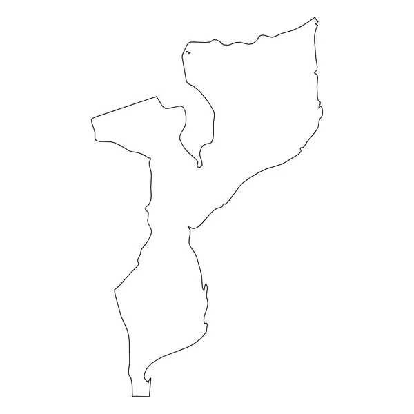
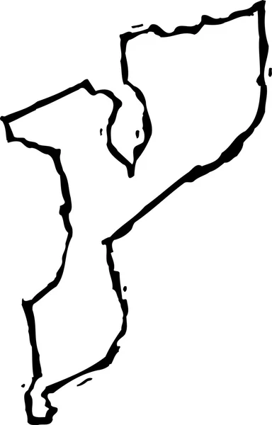
Mozambique Country Simplified Map. Orange Silhouette With Thick Black Sharp Contour Outline Isolated On White Background. Simple Vector Icon

Vector, 0.23MB, 8000 × 8000 eps
stock vector Mozambique flat landmarks vector illustration. Mozambique line city with famous travel sights, skyline, design.

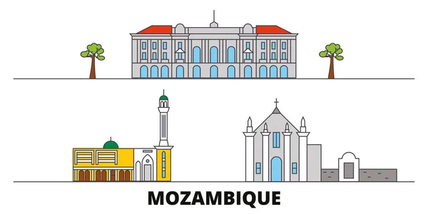
Mozambique Flat Landmarks Vector Illustration. Mozambique Line City With Famous Travel Sights, Skyline, Design.

Vector, 3.1MB, 6000 × 3000 eps
stock vector Maputo, Mozambique map. Detailed map of Maputo city administrative area. Cityscape panorama. Royalty free vector illustration. Road map with highways, rivers.

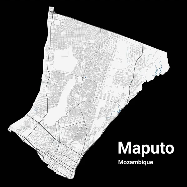
Maputo, Mozambique Map. Detailed Map Of Maputo City Administrative Area. Cityscape Panorama. Royalty Free Vector Illustration. Road Map With Highways, Rivers.

Vector, 20.94MB, 4001 × 4001 eps
stock image Mozambique wooden sign

Mozambique Wooden Sign

Image, 3.97MB, 4100 × 2662 jpg
stock vector Mozambique national day badge Independence from Portugal in 1975 Celebrated on June 25

Mozambique National Day Badge Independence From Portugal In 1975 Celebrated On June 25

Vector, 0.33MB, 5494 × 5494 eps
stock image Mozambique map on Mozambique flag drawing ,grunge and retro flag

Mozambique Map On Mozambique Flag Drawing ,grunge And Retro Flag

Image, 4.49MB, 4512 × 5000 jpg
stock image Detailed Earth. Africa and Madagascar

Detailed Earth. Africa And Madagascar

Image, 11.72MB, 5000 × 5000 jpg
stock vector Mozambique network map.

Mozambique Network Map.

Vector, 5.88MB, 8333 × 8333 eps
stock vector Maputo Mozambique City Map in Retro Style. Outline Map. Vector Illustration.

Maputo Mozambique City Map In Retro Style. Outline Map. Vector Illustration.

Vector, 1.76MB, 8150 × 4702 eps
stock vector Map markers with flags - Africa. Original colors.

Map Markers With Flags - Africa. Original Colors.

Vector, 3.53MB, 4000 × 4429 eps
stock vector Africa map and country contours - Illustration.

Africa Map And Country Contours - Illustration.

Vector, 6.32MB, 5400 × 4411 eps
stock vector Map of Africa

Map Of Africa

Vector, 5.24MB, 5968 × 3013 eps
stock vector Map of Africa.

Map Of Africa.

Vector, 3.78MB, 2775 × 2915 eps
stock vector Pinned countries flags on map of Africa

Pinned Countries Flags On Map Of Africa

Vector, 0.25MB, 5000 × 4839 ai
stock image Mozambique territory on world map

Mozambique Territory On World Map

Image, 9.6MB, 5227 × 2876 jpg
stock vector Map of Africa

Map Of Africa

Vector, 4.07MB, 6216 × 3031 eps
stock vector Mozambique communication network map. Vector low poly image of a global map with lights in the form of cities.

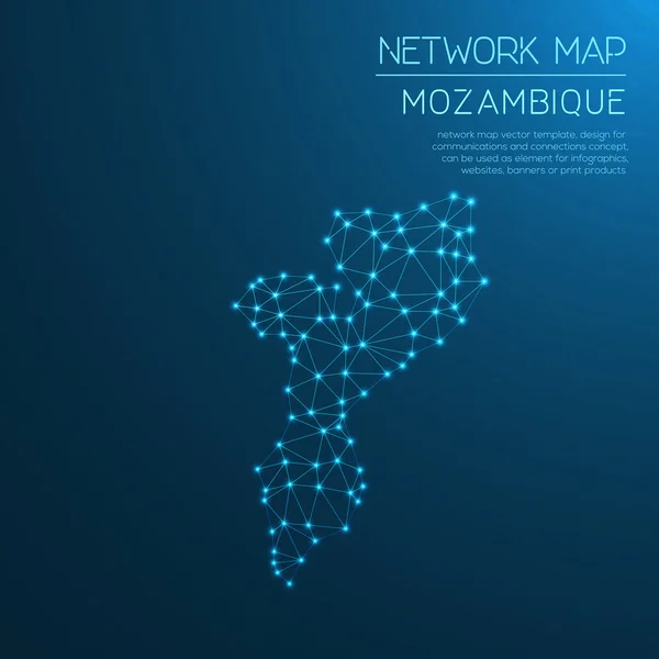
Mozambique Communication Network Map. Vector Low Poly Image Of A Global Map With Lights In The Form Of Cities.

Vector, 0.54MB, 8192 × 5595 eps
stock vector Map of Africa.

Map Of Africa.

Vector, 7.35MB, 3806 × 2786 eps
stock vector Vector Classic Africa Map

Vector Classic Africa Map

Vector, 10.85MB, 6998 × 6988 eps
stock vector Africa, Arabia and India Global World in Space

Africa, Arabia And India Global World In Space

Vector, 2.64MB, 5343 × 5760 eps
stock vector Enlarge Mozambique with a magnifying glass on a folded map of the world.

Enlarge Mozambique With A Magnifying Glass On A Folded Map Of The World.

Vector, 3.92MB, 6000 × 4000 eps
stock vector Africa physical continent map

Africa Physical Continent Map

Vector, 4.9MB, 3877 × 3877 ai
stock vector Africa - map - illustration.

Africa - Map - Illustration.

Vector, 4.66MB, 5400 × 6561 eps
stock vector Vector maps set.  High detailed 46 maps of African countries wit

Vector Maps Set. High Detailed 46 Maps Of African Countries Wit

Vector, 12.15MB, 6000 × 3600 eps
stock vector Mozambique vector map with infographic elements, pointer marks

Mozambique Vector Map With Infographic Elements, Pointer Marks

Vector, 2.37MB, 4000 × 4000 eps
stock vector Africa - map and navigation icons - illustration.

Africa - Map And Navigation Icons - Illustration.

Vector, 4.93MB, 5400 × 6919 eps
stock vector Union of the Comoros location on Africa map

Union Of The Comoros Location On Africa Map

Vector, 5.27MB, 6201 × 7001 eps
stock vector Flags of African countries like pins

Flags Of African Countries Like Pins

Vector, 0.85MB, 5000 × 4251 eps
stock vector Africa map and navigation icons - Illustration.

Africa Map And Navigation Icons - Illustration.

Vector, 2.55MB, 5400 × 7040 eps
stock vector Woodcut Illustration of Map of Mozambique

Woodcut Illustration Of Map Of Mozambique

Vector, 0.29MB, 4792 × 7482 eps
stock vector Africa map

Africa Map

Vector, 6.63MB, 2938 × 2938 eps
stock image Globe map of South Africa, geographical map, physics. Cartography, atlas. Map with reliefs and mountains. Republic of South Africa. Satellite view. 3d render. Element of this images are furnished by Nasa

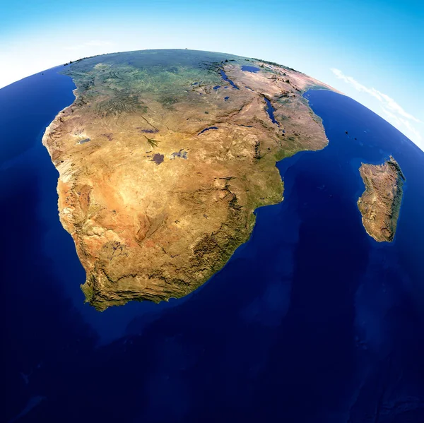
Globe Map Of South Africa, Geographical Map, Physics. Cartography, Atlas. Map With Reliefs And Mountains. Republic Of South Africa. Satellite View. 3d Render. Element Of This Images Are Furnished By Nasa

Image, 10.82MB, 4818 × 4815 jpg
stock image Detailed Earth. East Africa. Mozambique, Tanzania, Kenya on a mo

Detailed Earth. East Africa. Mozambique, Tanzania, Kenya On A Mo

Image, 8.82MB, 5000 × 5000 jpg
stock image Detailed air routes on Earth. South Africa, Mozambique and Madag

Detailed Air Routes On Earth. South Africa, Mozambique And Madag

Image, 15.16MB, 6000 × 6000 jpg
stock image Map of the ocean currents around the earth

Map Of The Ocean Currents Around The Earth

Image, 2.14MB, 3200 × 2000 jpg
stock vector Tanzania Political Map

Tanzania Political Map

Vector, 1.29MB, 8533 × 7799 eps
stock vector Africa - map and navigation icons - illustration.

Africa - Map And Navigation Icons - Illustration.

Vector, 5.06MB, 5400 × 6917 eps
stock image Somalia on Africa map

Somalia On Africa Map

Image, 8.07MB, 7000 × 6000 jpg
stock image globe

Globe

Image, 1.26MB, 2357 × 2068 jpg
stock image Map of Africa

Map Of Africa

Image, 5.71MB, 7000 × 6000 jpg
stock image Africa map colorful, new political detailed map, separate individual states, with state city and sea names, natural paper 3D shadow blank

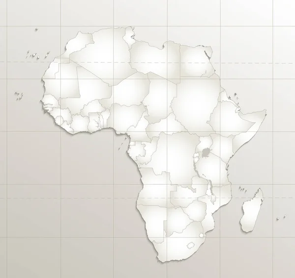
Africa Map Colorful, New Political Detailed Map, Separate Individual States, With State City And Sea Names, Natural Paper 3D Shadow Blank

Image, 1.61MB, 4231 × 4000 jpg
stock vector Africa, Arabia Global World

Africa, Arabia Global World

Vector, 0.92MB, 5560 × 5534 eps
stock vector Africa Global World

Africa Global World

Vector, 0.82MB, 5560 × 5534 eps
stock vector Blue-gray detailed map of South Africa administrative divisions and location on the globe. Vector illustration

Blue-gray Detailed Map Of South Africa Administrative Divisions And Location On The Globe. Vector Illustration

Vector, 15.12MB, 5304 × 6912 eps
stock vector Map of Mayotte

Map Of Mayotte

Vector, 8.78MB, 5221 × 7021 eps
stock image Detailed Earth. Africa and Madagascar on a moonlit night

Detailed Earth. Africa And Madagascar On A Moonlit Night

Image, 7.08MB, 5000 × 5000 jpg
stock vector Africa - map - illustration.

Africa - Map - Illustration.

Vector, 4.31MB, 5400 × 6562 eps
stock image African Great Lakes in planet earth,  aerial view from outer space

African Great Lakes In Planet Earth, Aerial View From Outer Space

Image, 18.68MB, 8000 × 4000 jpg
Page 1 >> Next