photo free
Home Images Vectors Videos

Stock image Map Of Limerick

stock vector Ireland

Ireland

Vector, 1.91MB, 4911 × 6142 eps
stock vector Republic of Ireland vector map with flag

Republic Of Ireland Vector Map With Flag

Vector, 1.76MB, 3100 × 3851 eps
stock vector Ireland Famous Landmarks Infographic Templates for Traveling Minimal Style and Icon, Symbol Set Vector Illustration Can be use for Poster Travel book, Postcard, Billboard

Ireland Famous Landmarks Infographic Templates For Traveling Minimal Style And Icon, Symbol Set Vector Illustration Can Be Use For Poster Travel Book, Postcard, Billboard

Vector, 5.64MB, 8334 × 6250 eps
stock vector The detailed map of the Ireland with regions or states and cities, capitals

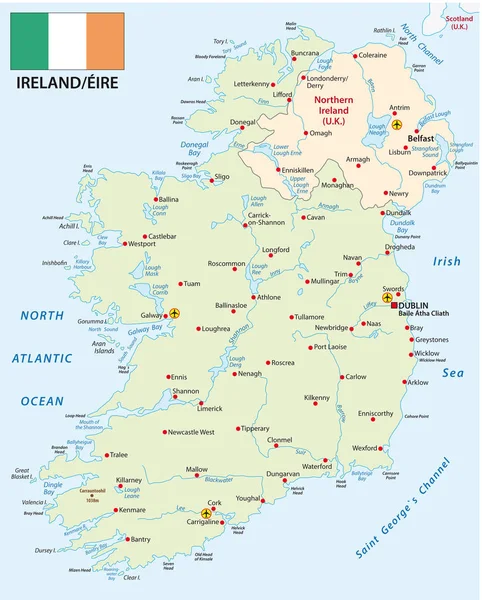
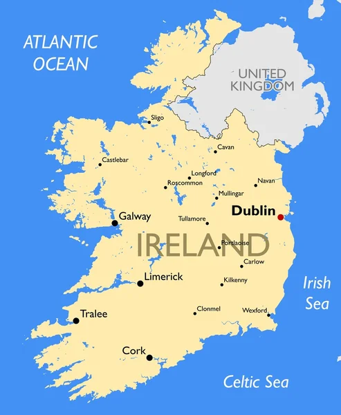
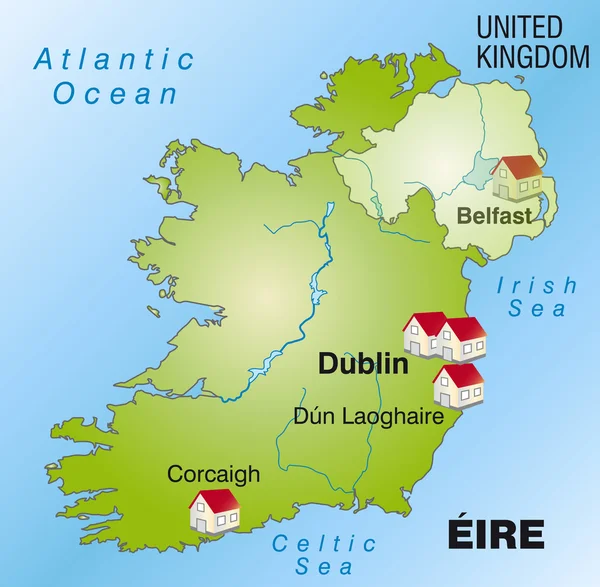
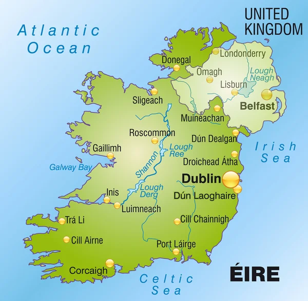
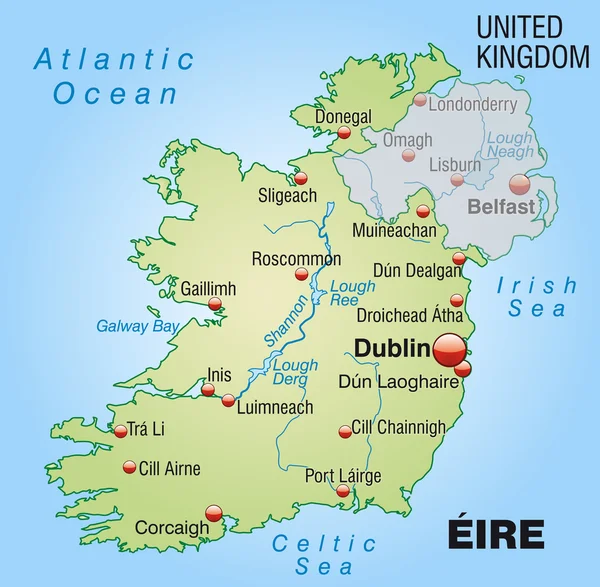
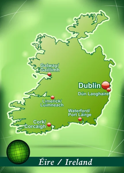
The Detailed Map Of The Ireland With Regions Or States And Cities, Capitals

Vector, 1.63MB, 5000 × 6500 eps
stock vector vector set of British Isles countries cities skylines abstract icons. Map and flags of British Isles: United Kingdom (England, Wales, Scotland, Northern Ireland) and Republic of Ireland

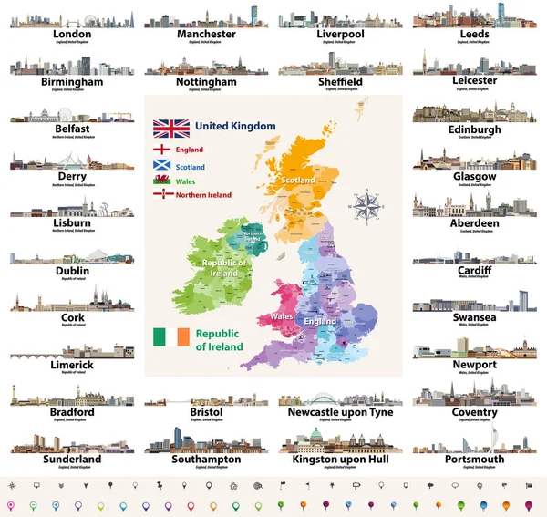
Vector Set Of British Isles Countries Cities Skylines Abstract Icons. Map And Flags Of British Isles: United Kingdom (England, Wales, Scotland, Northern Ireland) And Republic Of Ireland

Vector, 13.82MB, 8333 × 7874 eps
stock vector Map of Ireland

Map Of Ireland

Vector, 0.84MB, 3829 × 5000 ai
stock vector Vector map of Republic of Ireland with flag

Vector Map Of Republic Of Ireland With Flag

Vector, 2.09MB, 3100 × 3833 eps
stock vector Republic of Ireland traditional countries and provinces map and Irish largest cities skylines. All elements separated in editable and detachable layers. Vector illustration

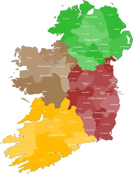
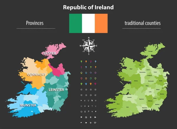
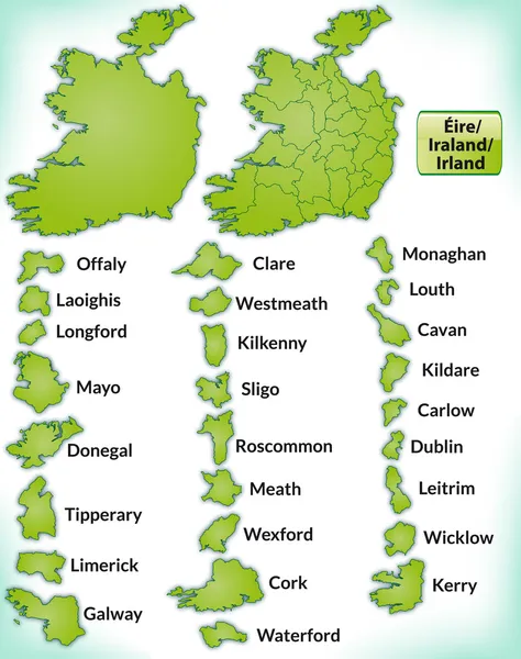
Republic Of Ireland Traditional Countries And Provinces Map And Irish Largest Cities Skylines. All Elements Separated In Editable And Detachable Layers. Vector Illustration

Vector, 7.04MB, 8333 × 8333 eps
stock vector vector set of British Isles countries cities skylines icons in black and white color palette. Flags and high detailed vector map of British countries.

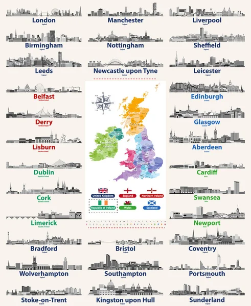
Vector Set Of British Isles Countries Cities Skylines Icons In Black And White Color Palette. Flags And High Detailed Vector Map Of British Countries.

Vector, 13.32MB, 6824 × 8333 eps
stock vector Ireland and counties

Ireland And Counties

Vector, 1.26MB, 5079 × 5079 eps
stock vector Detailed map of Ireland with administrative divisions into provinces and counties, major cities of the country, vector illustration onwhite background

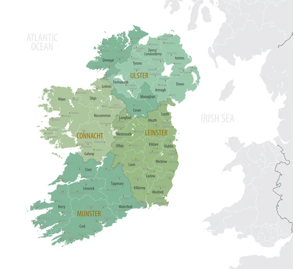
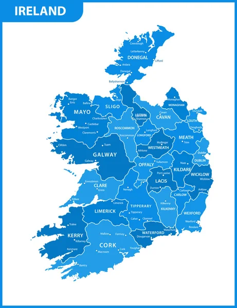
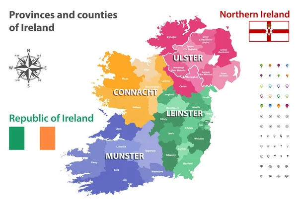
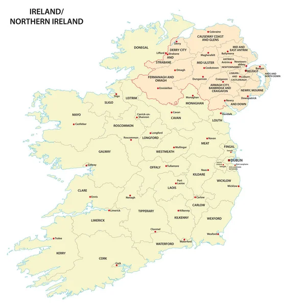
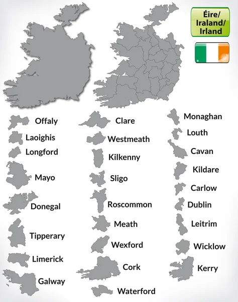
Detailed Map Of Ireland With Administrative Divisions Into Provinces And Counties, Major Cities Of The Country, Vector Illustration Onwhite Background

Vector, 4.12MB, 7087 × 6510 eps
stock vector Ireland Political Map

Ireland Political Map

Vector, 3.66MB, 6000 × 7468 eps
stock vector Ireland map | Vector detailed color Ireland map

Ireland Map | Vector Detailed Color Ireland Map

Vector, 0.19MB, 7400 × 9000 eps
stock vector Ireland map

Ireland Map

Vector, 0.19MB, 4440 × 5400 eps
stock vector Republic of Ireland provinces and traditional counties vector map

Republic Of Ireland Provinces And Traditional Counties Vector Map

Vector, 6.34MB, 7284 × 5315 eps
stock vector Provinces and counties of Ireland vector map

Provinces And Counties Of Ireland Vector Map

Vector, 6.25MB, 7292 × 5126 eps
stock vector Ireland map made from Irish slang words in vector format.

Ireland Map Made From Irish Slang Words In Vector Format.

Vector, 5.32MB, 5001 × 5379 eps
stock vector Ireland and counties

Ireland And Counties

Vector, 17.11MB, 5079 × 5079 eps
stock vector Ireland and counties

Ireland And Counties

Vector, 2.26MB, 5079 × 5079 eps
stock vector administrative map of Ireland and Northern Ireland

Administrative Map Of Ireland And Northern Ireland

Vector, 1.97MB, 4338 × 4663 eps
stock vector Map of Ireland

Map Of Ireland

Vector, 0.37MB, 4042 × 3958 ai
stock vector Vector Ireland map

Vector Ireland Map

Vector, 0.14MB, 4236 × 6021 eps
stock vector Map of Ireland

Map Of Ireland

Vector, 0.67MB, 4042 × 3958 ai
stock vector Ireland cities stamps

Ireland Cities Stamps

Vector, 4.03MB, 5145 × 5925 eps
stock vector Map of Ireland

Map Of Ireland

Vector, 0.63MB, 4042 × 3958 ai
stock vector Ireland map made from Irish slang words in vector format.

Ireland Map Made From Irish Slang Words In Vector Format.

Vector, 5.33MB, 5001 × 5379 eps
stock vector Map of Ireland

Map Of Ireland

Vector, 1.42MB, 3558 × 4497 ai
stock vector Map of Ireland

Map Of Ireland

Vector, 5.22MB, 3558 × 4497 ai
stock vector Map of Ireland

Map Of Ireland

Vector, 0.59MB, 3177 × 5033 ai
stock vector Ireland map made from Irish slang words in vector format.

Ireland Map Made From Irish Slang Words In Vector Format.

Vector, 5.33MB, 5001 × 5379 eps
stock vector Map of Ireland

Map Of Ireland

Vector, 0.52MB, 4067 × 4225 ai
stock vector Map of Ireland

Map Of Ireland

Vector, 0.59MB, 3391 × 4717 ai
stock vector Limerick map, Ireland. Grayscale color city map, vector streetmap with buildings, roads and rivers.

Limerick Map, Ireland. Grayscale Color City Map, Vector Streetmap With Buildings, Roads And Rivers.

Vector, 2.99MB, 4000 × 4000 eps
stock vector european country Ireland and counties in details

European Country Ireland And Counties In Details

Vector, 1.1MB, 5079 × 5079 eps
stock vector Map of Limerick, Ireland. Detailed city vector map, metropolitan area. Streetmap with roads and water.

Map Of Limerick, Ireland. Detailed City Vector Map, Metropolitan Area. Streetmap With Roads And Water.

Vector, 2.82MB, 5019 × 3600 eps
stock vector Indigo Limerick map, Ireland. Vector city streetmap, municipal area.

Indigo Limerick Map, Ireland. Vector City Streetmap, Municipal Area.

Vector, 1.27MB, 5333 × 3000 eps
stock vector Ireland region silhouettes set and blank map of the country isolated on white background. Vector illustration design

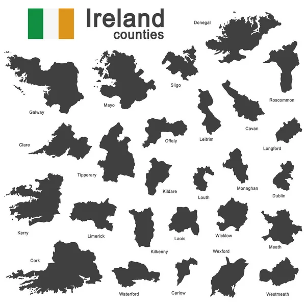
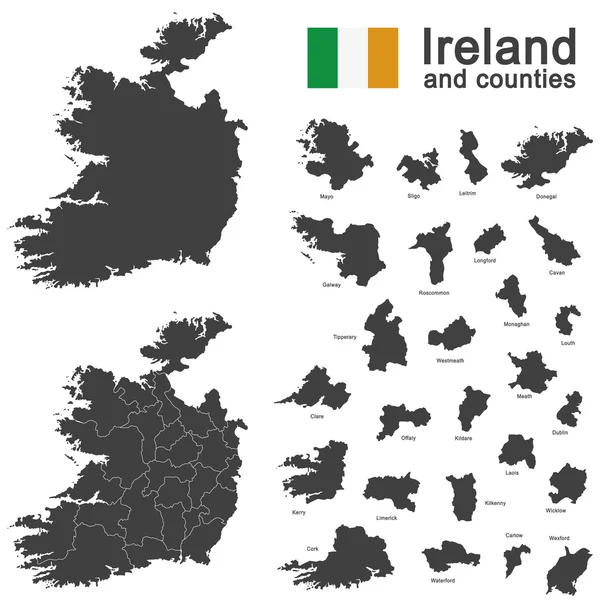
Ireland Region Silhouettes Set And Blank Map Of The Country Isolated On White Background. Vector Illustration Design

Vector, 2.95MB, 5500 × 4000 eps
Page 1 >> Next