photo free
Home Images Vectors Videos

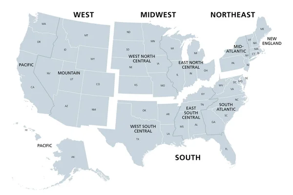
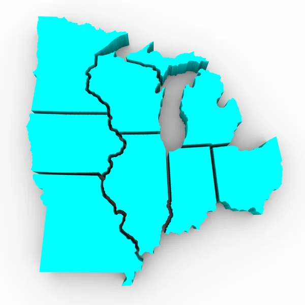
Stock image Midwest States

stock vector Detailed vintage map of the United States of America split into

Detailed Vintage Map Of The United States Of America Split Into

Vector, 24.72MB, 7296 × 4104 eps
stock vector United States divided in Census regions and divisions, gray map. Region definition used for data collection and analysis. Most commonly used classification system. English. Illustration. Vector.

United States Divided In Census Regions And Divisions, Gray Map. Region Definition Used For Data Collection And Analysis. Most Commonly Used Classification System. English. Illustration. Vector.

Vector, 3.11MB, 9000 × 6000 eps
stock vector Map of United States split into Census regions and divisions. Region definition, widely used for data collection and analysis. Most commonly used classification system. English. Illustration. Vector

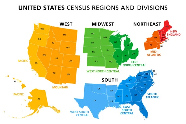
Map Of United States Split Into Census Regions And Divisions. Region Definition, Widely Used For Data Collection And Analysis. Most Commonly Used Classification System. English. Illustration. Vector

Vector, 3.06MB, 9000 × 6000 eps
stock vector Retro US State illustrations Indiana, Ohio, Michigan

Retro US State Illustrations Indiana, Ohio, Michigan

Vector, 3.16MB, 6600 × 6600 eps
stock vector United States, geographic regions, colored political map. Five regions, according to their geographic position on the continent. Common but unofficial way of referring to regions of the United States.

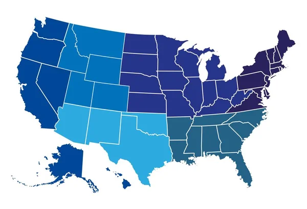
United States, Geographic Regions, Colored Political Map. Five Regions, According To Their Geographic Position On The Continent. Common But Unofficial Way Of Referring To Regions Of The United States.

Vector, 3.6MB, 8832 × 6000 eps
stock image Chicago, Illinois, United States - May 06, 2011: Seniors on Nichols Bridgeway at Millennium Park with the city skyline

Chicago, Illinois, United States - May 06, 2011: Seniors On Nichols Bridgeway At Millennium Park With The City Skyline

Image, 12.78MB, 5616 × 3744 jpg
stock image American flag on old weathered farm barn

American Flag On Old Weathered Farm Barn

Image, 17.97MB, 5202 × 3478 jpg
stock image Rushmore

Rushmore

Image, 3.04MB, 3000 × 3000 jpg
stock vector United States, Census regions and divisions, political map. Region definition widely used for data collection and analysis. The most commonly used classification system. English. Illustration. Vector.

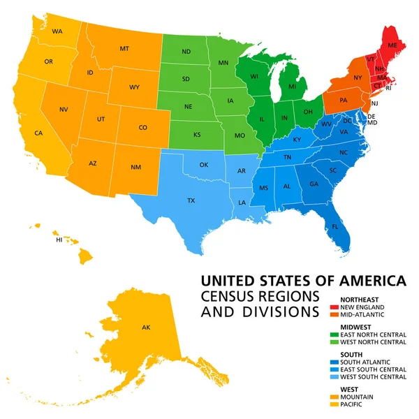
United States, Census Regions And Divisions, Political Map. Region Definition Widely Used For Data Collection And Analysis. The Most Commonly Used Classification System. English. Illustration. Vector.

Vector, 3.89MB, 6000 × 6000 eps
stock vector Telecommunications network of the USA, Abstract mesh polygonal ggeographic map, detailed map of the states of America blank for design

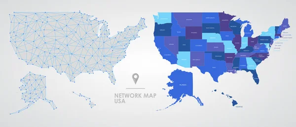
Telecommunications Network Of The USA, Abstract Mesh Polygonal Ggeographic Map, Detailed Map Of The States Of America Blank For Design

Vector, 5.38MB, 10431 × 4488 eps
stock vector Regions of the United States of America, political map. The nine regions New England, Great Plains, Rocky Mountain, Mid Atlantic, South, West Coast, Midwest, Southwest, Alaska and Hawaii. Illustration

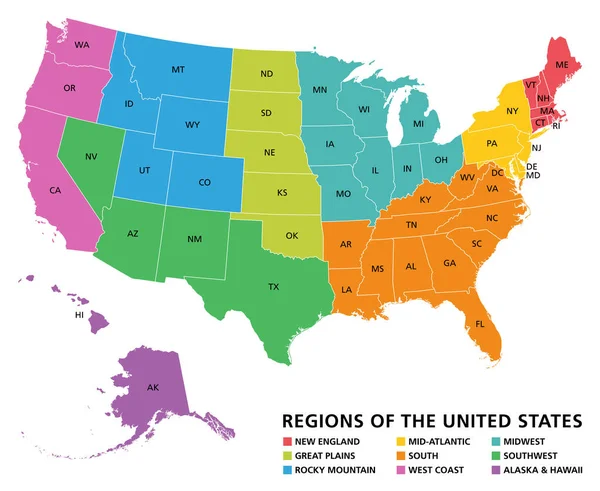
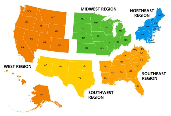
Regions Of The United States Of America, Political Map. The Nine Regions New England, Great Plains, Rocky Mountain, Mid Atlantic, South, West Coast, Midwest, Southwest, Alaska And Hawaii. Illustration

Vector, 3.42MB, 7322 × 6000 eps
stock vector Illustrated pictorial map of Midwest United States. Includes North and South Dakota, Nebraska, Minnesota, Iowa and Wisconsin. Vector Illustration.

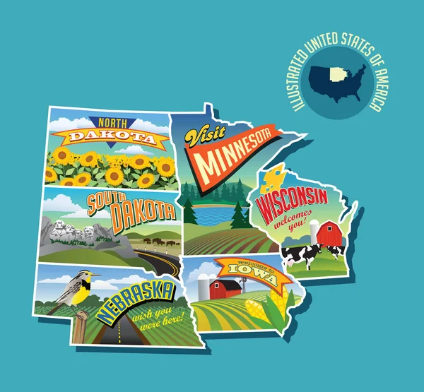
Illustrated Pictorial Map Of Midwest United States. Includes North And South Dakota, Nebraska, Minnesota, Iowa And Wisconsin. Vector Illustration.

Vector, 6.61MB, 5340 × 4946 eps
stock vector Illustrated pictorial map of Midwest United States. Includes Wisconsin, Michigan, Missouri, Illinois, Indiana, Kentucky and Ohio. Vector Illustration.

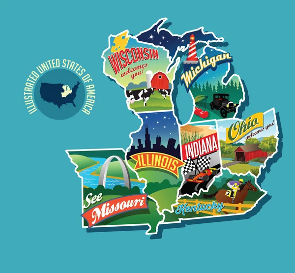
Illustrated Pictorial Map Of Midwest United States. Includes Wisconsin, Michigan, Missouri, Illinois, Indiana, Kentucky And Ohio. Vector Illustration.

Vector, 3.86MB, 5429 × 5028 eps
stock vector United States census bureau regions and divisions vector map. Flag of United States of America

United States Census Bureau Regions And Divisions Vector Map. Flag Of United States Of America

Vector, 6.79MB, 7292 × 3543 eps
stock vector Oklahoma County Map

Oklahoma County Map

Vector, 0.82MB, 5000 × 3011 ai
stock vector Midwest United States Minnesota Wisconsin Iowa vector illustrations designs

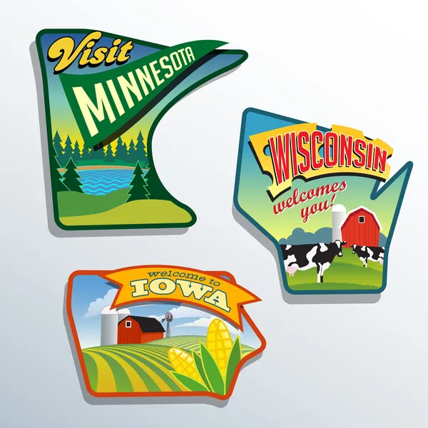
Midwest United States Minnesota Wisconsin Iowa Vector Illustrations Designs

Vector, 2.46MB, 6600 × 6600 eps
stock vector San Francisco on USA map

San Francisco On USA Map

Vector, 0.54MB, 4976 × 3508 eps
stock vector Map of USA regions

Map Of USA Regions

Vector, 0.85MB, 7103 × 4859 eps
stock vector Montana, Nebraska travel stickers with scenic attractions and retro text on vintage suitcase background

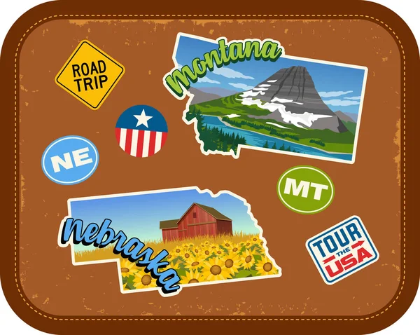
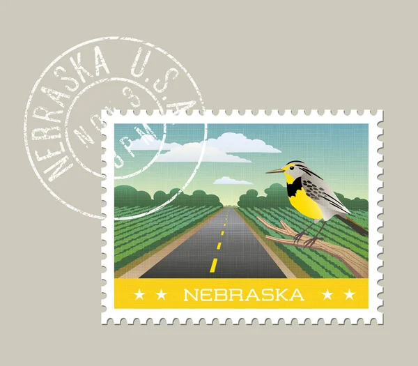
Montana, Nebraska Travel Stickers With Scenic Attractions And Retro Text On Vintage Suitcase Background

Vector, 7.15MB, 5037 × 4020 eps
stock vector Iowa vector illustration of scenic corn field and red barn.

Iowa Vector Illustration Of Scenic Corn Field And Red Barn.

Vector, 4.45MB, 5200 × 4550 eps
stock image United States of America map

United States Of America Map

Image, 3.33MB, 4000 × 2930 jpg
stock vector North Dakota, Oklahoma travel stickers with scenic attractions and retro text on vintage suitcase background

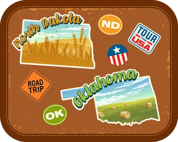
North Dakota, Oklahoma Travel Stickers With Scenic Attractions And Retro Text On Vintage Suitcase Background

Vector, 3.47MB, 5037 × 4020 eps
stock vector South Dakota vector illustration of scenic Badlands.

South Dakota Vector Illustration Of Scenic Badlands.

Vector, 2.82MB, 5200 × 4550 eps
stock vector Wisconsin vector illustration of sandstone bluffs on the Wisconsin River.

Wisconsin Vector Illustration Of Sandstone Bluffs On The Wisconsin River.

Vector, 3.55MB, 5200 × 4550 eps
stock vector Iowa Interstate Highway Map

Iowa Interstate Highway Map

Vector, 2.29MB, 8287 × 5868 eps
stock vector Kansas, KS, political map with capital Topeka, important rivers and lakes. State in the Midwestern United States of America nicknamed The Sunflower State, also The Wheat or The Jayhawker State. Vector

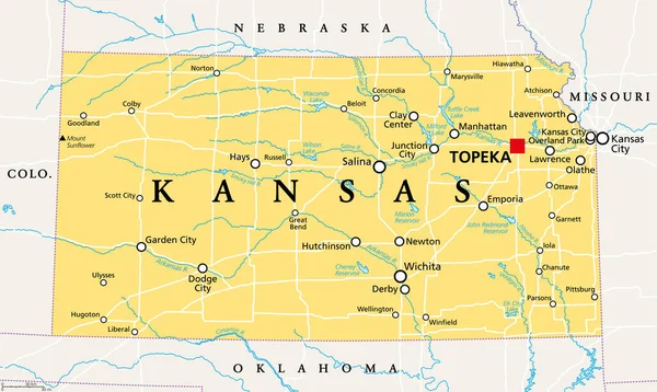
Kansas, KS, Political Map With Capital Topeka, Important Rivers And Lakes. State In The Midwestern United States Of America Nicknamed The Sunflower State, Also The Wheat Or The Jayhawker State. Vector

Vector, 3.32MB, 9000 × 5379 eps
stock vector Ohio vector illustration of park overlooking lake erie.

Ohio Vector Illustration Of Park Overlooking Lake Erie.

Vector, 2.91MB, 5200 × 4550 eps
stock image Missouri

Missouri

Image, 1.69MB, 4300 × 2800 jpg
stock image Wisconsin USA Flag

Wisconsin USA Flag

Image, 5.6MB, 5000 × 3333 jpg
stock vector 32 of 50 states of the United States with a name, nickname, and

32 Of 50 States Of The United States With A Name, Nickname, And

Vector, 2.17MB, 7311 × 4112 eps
stock vector USA Map Illustration

USA Map Illustration

Vector, 3.53MB, 5000 × 5000 eps
stock vector USA Map Illustration

USA Map Illustration

Vector, 3.21MB, 5000 × 5000 eps
stock vector Kansas vector illustration of farm with tornado, storm and rainbow.

Kansas Vector Illustration Of Farm With Tornado, Storm And Rainbow.

Vector, 4.09MB, 5200 × 4550 eps
stock image Autumn Red Barn and Hillside

Autumn Red Barn And Hillside

Image, 21.34MB, 4534 × 3500 jpg
stock image Commonwealth of Massachusetts map

Commonwealth Of Massachusetts Map

Image, 0.94MB, 4300 × 2800 jpg
stock vector Indiana postage stamp design. Vector illustration of rural scenic red barn with sunflowers. Grunge postmark on separate layer.

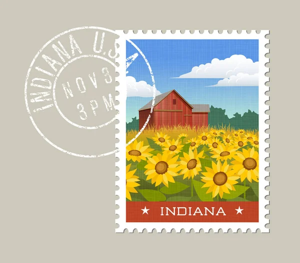
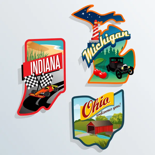
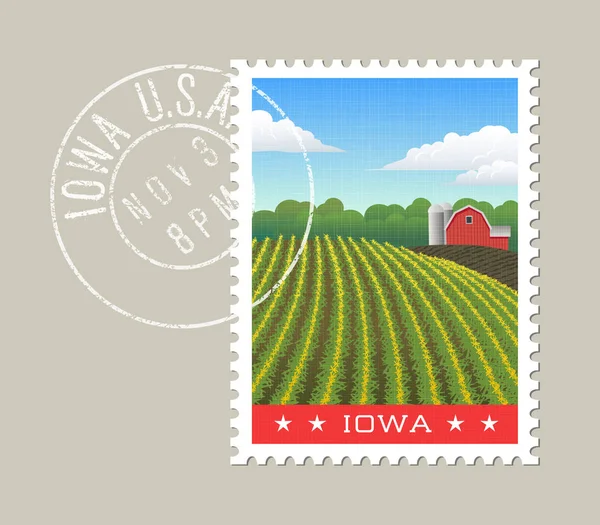
Indiana Postage Stamp Design. Vector Illustration Of Rural Scenic Red Barn With Sunflowers. Grunge Postmark On Separate Layer.

Vector, 4.51MB, 5200 × 4550 eps
stock vector South Dakota, SD, political map, with capital Pierre, and largest city Sioux Falls. State in the upper Midwestern subregion of the United States of America, nicknamed The Mount Rushmore State. Vector.

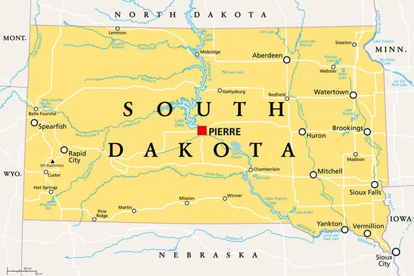
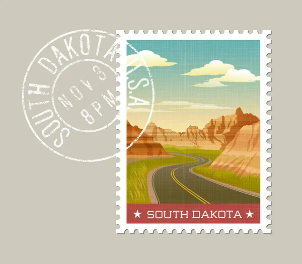
South Dakota, SD, Political Map, With Capital Pierre, And Largest City Sioux Falls. State In The Upper Midwestern Subregion Of The United States Of America, Nicknamed The Mount Rushmore State. Vector.

Vector, 3.62MB, 9000 × 5999 eps
stock image Aerial view of american countryside landscape. Farm, red barn, cows. Rural scenery, farmland. Sunny morning, spring summer season

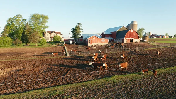
Aerial View Of American Countryside Landscape. Farm, Red Barn, Cows. Rural Scenery, Farmland. Sunny Morning, Spring Summer Season

Image, 4.52MB, 2800 × 1575 jpg
stock image Barn and Evening Sky

Barn And Evening Sky

Image, 5.5MB, 3000 × 4399 jpg
stock vector Nebraska vector illustration of scenic farmland and Meadowlark.

Nebraska Vector Illustration Of Scenic Farmland And Meadowlark.

Vector, 4.28MB, 5200 × 4550 eps
stock image Autumn Tranquility

Autumn Tranquility

Image, 13.71MB, 5616 × 2565 jpg
stock image Illinois Red Abstract 3D State Map United States America

Illinois Red Abstract 3D State Map United States America

Image, 5.27MB, 4096 × 4096 jpg
stock image West Union Covered Bridge

West Union Covered Bridge

Image, 16.68MB, 5760 × 3840 jpg
stock image Illinois IL USA Flag

Illinois IL USA Flag

Image, 4.76MB, 5000 × 3333 jpg
stock image Fall Colors Reflected on a Lake

Fall Colors Reflected On A Lake

Image, 8.47MB, 4805 × 3181 jpg
stock image Great Lakes Region of States - 3d Map

Great Lakes Region Of States - 3d Map

Image, 2.62MB, 4096 × 4096 jpg
stock image Red Barn on a Dairy Farm

Red Barn On A Dairy Farm

Image, 5.4MB, 4655 × 3083 jpg
stock image Small church

Small Church

Image, 10.07MB, 4605 × 3070 jpg
stock vector Tennessee vector illustration of smoky mountains.

Tennessee Vector Illustration Of Smoky Mountains.

Vector, 5.36MB, 5200 × 4550 eps
stock image Illinois  State Map

Illinois State Map

Image, 9.71MB, 5000 × 2888 jpg
Page 1 >> Next