
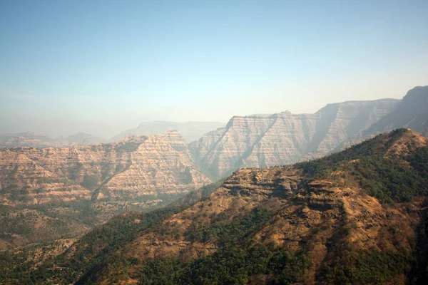
Stock image Mountain West

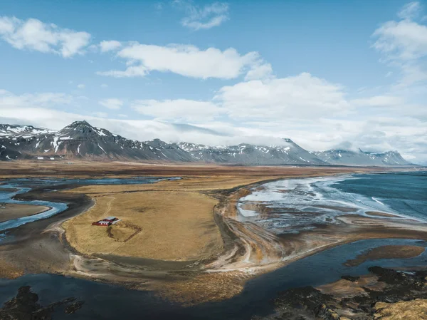
Aerial View Of Road Between Fields And Mountains With Snow, Snaefellsnes, Iceland
Image, 8.04MB, 4048 × 3032 jpg


A Beautiful Colorful Sunrise At Showshoe Mountain Resort In West Virginia
Image, 4.77MB, 5735 × 3823 jpg
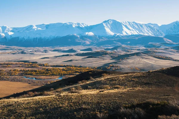
Panoramic Of The Altai-Chuya Ridge, Altai Mountain, West Siberia, Russia.
Image, 9.45MB, 4200 × 2800 jpg
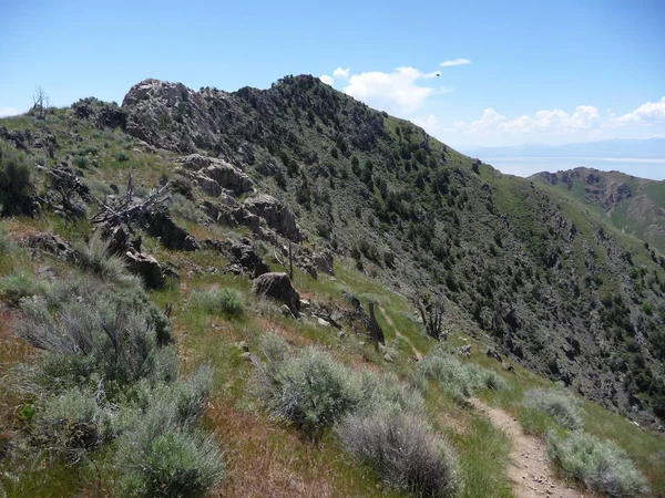
Awesome Nature Mountain View With Clear Sky Along The Great Salt Lake In Utah
Image, 4.6MB, 3456 × 2592 jpg
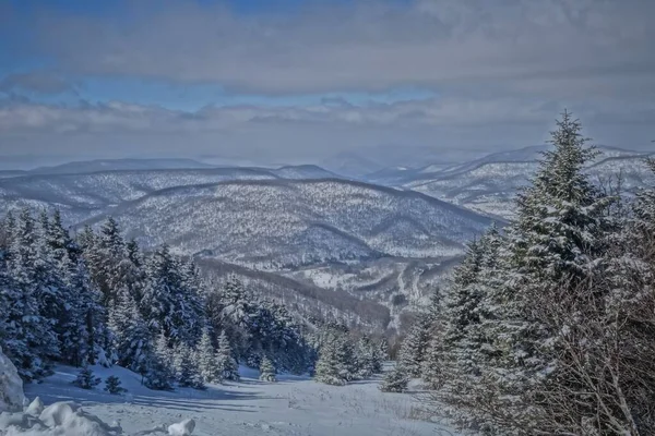
A Horizontal Shot Of A Snowscape View From The Top Of Snowshoe Mountain Located In West Virginia Taken In February
Image, 8.41MB, 5472 × 3648 jpg
Awesome Lake View With Amazing Sky Along The Great Salt Lake In Utah 2009
Image, 3.8MB, 3456 × 2592 jpg


Awesome Ocean View With Amazing Sky Along The Great Salt Lake In Utah
Image, 4.09MB, 3456 × 2592 jpg


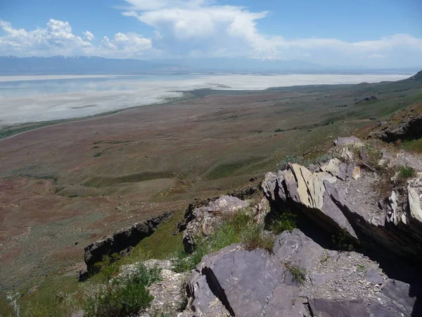
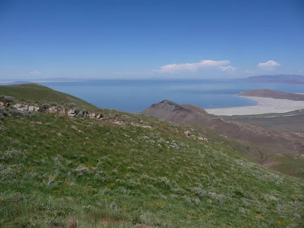
Awesome Nature Mountain View With Clear Sky Along The Great Salt Lake In Utah
Image, 4.25MB, 3456 × 2592 jpg
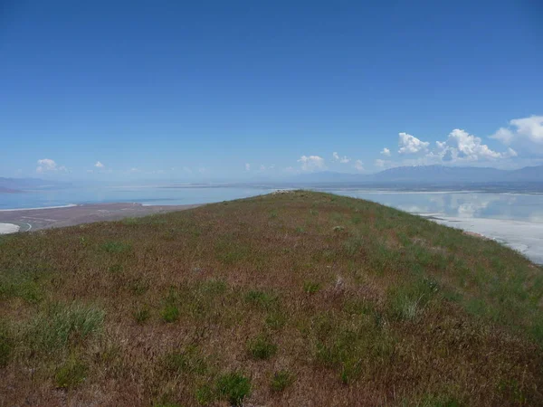
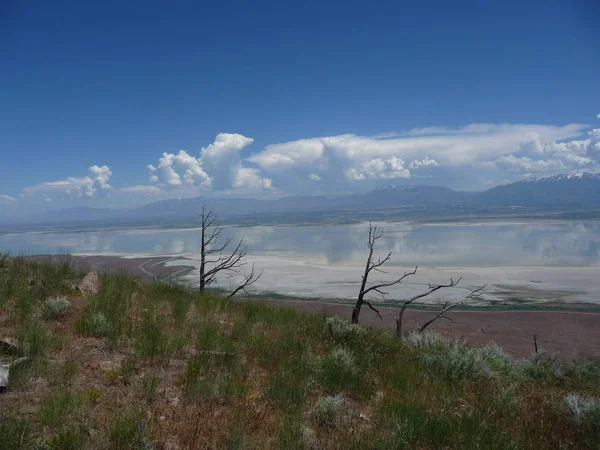
Awesome Nature Mountain View With Clear Sky Along The Great Salt Lake In Utah
Image, 4.18MB, 3456 × 2592 jpg

Fort Collins, Colorado, USA September 19, 2021: Colorado State Univerisity Sign.
Image, 17.58MB, 5176 × 3451 jpg

Fort Collins, CO - July 16, 2022: Entrance Sign To The Colorado State University In Fort Collins, Colorado
Image, 17.42MB, 7952 × 5304 jpg

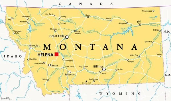
Montana, MT, Political Map With The Capital Helena. State In The Mountain West Subregion Of The Western United States Of America, Nicknamed Big Sky Country And The Treasure State. Illustration. Vector
Vector, 3.56MB, 9000 × 5349 eps
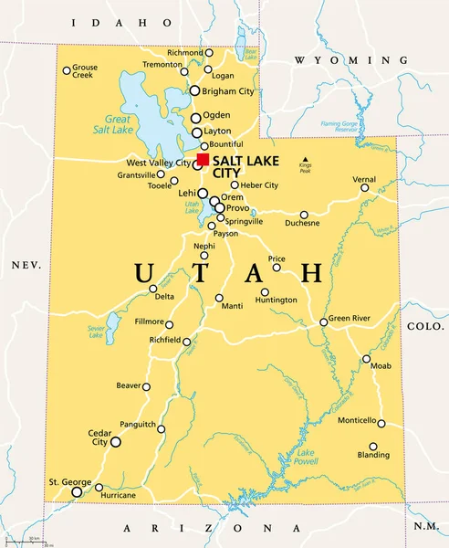
Utah, UT, Political Map, With The Capital Salt Lake City. State In The Mountain West Subregion Of The Western United States Of America, Nicknamed Beehive State, The Mormon State, And Deseret. Vector.
Vector, 3.74MB, 6000 × 7304 eps


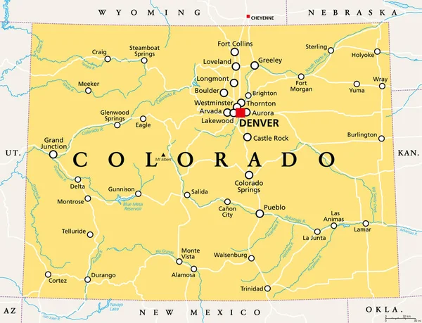
Colorado, CO Political Map With The Capital Denver, Most Important Rivers And Lakes. State In The Mountain West Subregion Of The Western United States Of America Nicknamed The Centennial State. Vector
Vector, 3.43MB, 7840 × 6000 eps
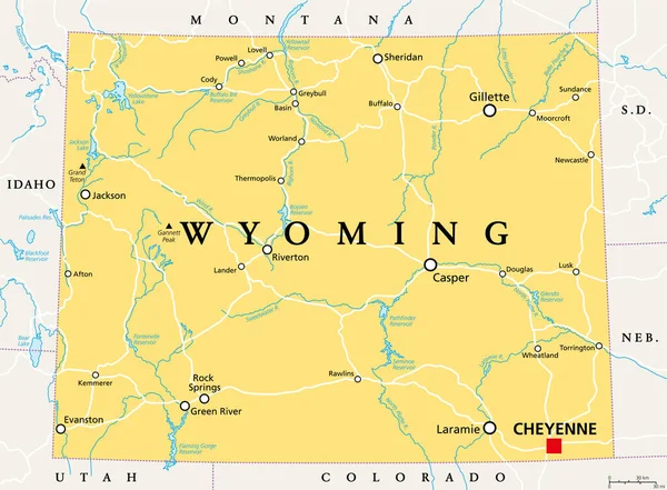
Wyoming, WY, Political Map, With The Capital Cheyenne. State In The Mountain West Subregion Of The Western United States Of America, Nicknamed Equality State, Cowboy State And Big Wyoming. Vector.
Vector, 3.77MB, 8152 × 6000 eps


Montana, U.S. State, Subdivided Into 56 Counties, Political Map With Borders And County Names. State In The Mountain West Region Of The United States, Nicknamed Big Sky Country, And Treasure State.
Vector, 2.32MB, 9000 × 5355 eps

Wyoming, U.S. State, Subdivided Into 23 Counties, Gray Political Map With County Names. State In The Mountain West Region Of The United States, Nicknamed Equality And Cowboy State, And Big Wyoming.
Vector, 2.19MB, 7519 × 6000 eps

Idaho, U.S. State, Subdivided Into 44 Counties, Gray Political Map With Borders And County Names. State In The Mountain West Region Of The United States, Nicknamed The Gem State, Or The Potato State.
Vector, 2.32MB, 6000 × 8868 eps

Hawaii - September 19 2015: UH Football And UC Davis Players Standing Ready For Play With Fans In The Stands During College Game At Aloha Stadium In Honolulu, .
Image, 10.14MB, 5184 × 3888 jpg

Wyoming, U.S. State, Subdivided Into 23 Counties, Political Map With Borders And County Names. State In The Mountain West Region Of United States, Nicknamed Equality And Cowboy State, And Big Wyoming.
Vector, 2.19MB, 8152 × 6000 eps

Montana, U.S. State, Subdivided Into 56 Counties, Gray Political Map With Borders And County Names. State In The Mountain West Region Of United States, Nicknamed Big Sky Country, And Treasure State.
Vector, 2.14MB, 9000 × 5562 eps

Colorado Counties, Gray Political Map With Borders And County Names. State In The Mountain West Subregion Of The United States, Subdivided Into 64 Counties. Nicknamed Centennial State. Illustration
Vector, 2.23MB, 7915 × 6000 eps

Utah, U.S. State Subdivided Into 29 Counties, Political Map With Borders And County Names. State In The Mountain West Region Of Western USA. Nicknamed Beehive State, The Mormon State, And Deseret.
Vector, 2.66MB, 6000 × 7304 eps
Page 1 >> Next