Home
Images
Vectors
Videos
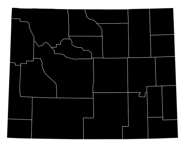
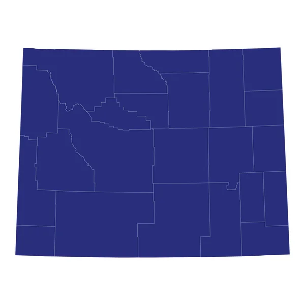
Stock vector Wyoming, U.S. state, subdivided into 23 counties, gray political map with county names. State in the Mountain West region of the United States, nicknamed Equality and Cowboy State, and Big Wyoming.
Published:
Aug.06, 2024 16:45:26
Author:
Furian
Views:
0
Downloads:
0
File type:
vector
/
eps
File size:
2.19 MB
Orginal size:
7519
x
6000
px
Available sizes:
S
(500 x 399)
M
(1000 x 798)
L
(2000 x 1596)
XL
(7519 x 6000)
VECT
(7519 x 6000)
EL0
(7519 x 6000)
Level:
silver
Download Vector
Vector topics:
Vector
Illustration
Isolated
Travel
Silhouette
Border
Gray
Structure
Usa
Country
Western
West
Map
Cartography
Geography
Land
Overview
State
Cowboy
America
Boundary
Administrative
Destination
States
Region
Division
Federal
Atlas
Americas
Nation
Subdivision
County
Mapping
Wyoming
Names
Counties
Laramie
Wy
Sweetwater
Infographic
United States
Subdivided
Mountain West
Political Map
Natrona
Goshen
Cowboy State
Equality State
Big Wyoming
Similar stock vectors
High Quality Map Of Wyoming Is A State Of United States Of America With Borders Of The Counties
4000 × 4000
Colorado Counties, Gray Political Map With Borders And County Names. State In The Mountain West Subregion Of The United States, Subdivided Into 64 Counties. Nicknamed Centennial State. Illustration
7915 × 6000
Accurate Map Of Wyoming
5000 × 4000
High Quality Map Of Colorado Is A State Of United States Of America With Borders Of The Counties
4000 × 4000
Montana, U.S. State, Subdivided Into 56 Counties, Gray Political Map With Borders And County Names. State In The Mountain West Region Of United States, Nicknamed Big Sky Country, And Treasure State.
9000 × 5562
Accurate Map Of Colorado
5000 × 4000
Accurate Map Of Wyoming
5000 × 4000