photo free
Home Images Vectors Videos

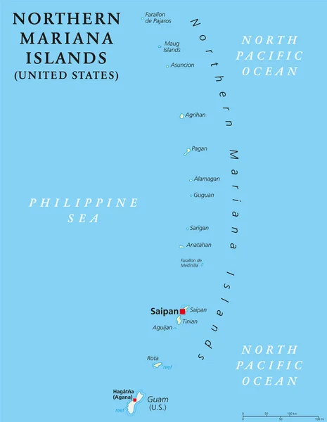
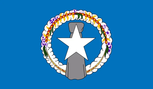
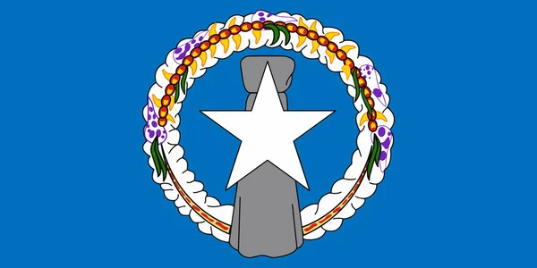
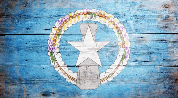
Stock image Northern Mariana Islands

stock image Tachogna Beach, Tinian

Tachogna Beach, Tinian

Image, 2.5MB, 3924 × 2224 jpg
stock image Leaves from a tree frames a portion of the Wing Beach in Saipan, Northern Mariana Islands.

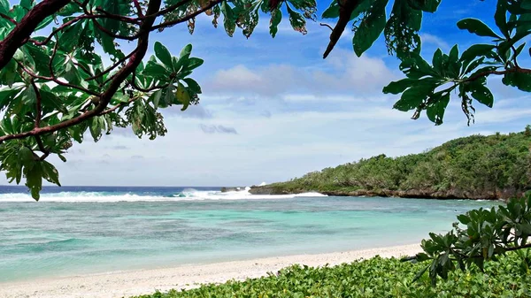
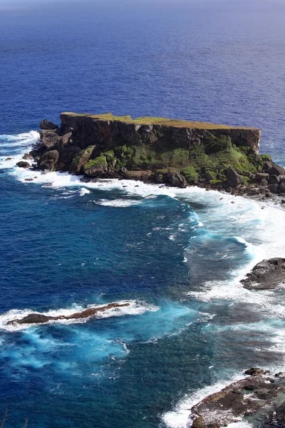
Leaves From A Tree Frames A Portion Of The Wing Beach In Saipan, Northern Mariana Islands.

Image, 7.91MB, 4592 × 2584 jpg
stock image Saipans east coast is a display of lush scenery, golf courses with steep cliff lines with waves rolling in from the Pacific Ocean.

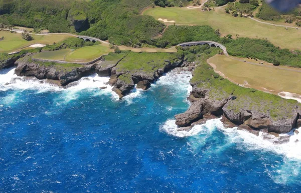
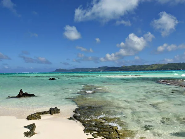
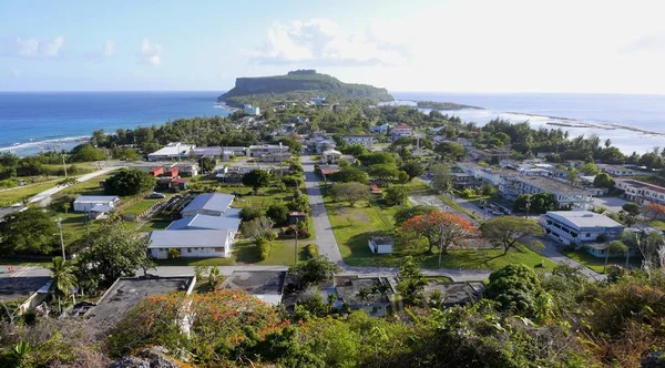
Saipans East Coast Is A Display Of Lush Scenery, Golf Courses With Steep Cliff Lines With Waves Rolling In From The Pacific Ocean.

Image, 10.92MB, 5000 × 3222 jpg
stock vector Guam map

Guam Map

Vector, 1.11MB, 6168 × 7183 eps
stock image Geyser at Tinian Blow hole

Geyser At Tinian Blow Hole

Image, 7.19MB, 3872 × 2592 jpg
stock image Taga Beach, Tinian, Northern Mariana Islands

Taga Beach, Tinian, Northern Mariana Islands

Image, 6.71MB, 4592 × 2584 jpg
stock vector Northern Mariana Islands political map

Northern Mariana Islands Political Map

Vector, 2.47MB, 6974 × 8999 eps
stock vector northern mariana islands map

Northern Mariana Islands Map

Vector, 1.32MB, 5523 × 6803 eps
stock vector High Quality map state of United States

High Quality Map State Of United States

Vector, 1.71MB, 4000 × 4000 eps
stock vector Northern Mariana Islands Independence Day Patriotic Design Expressive Brush Stroke in National Flag

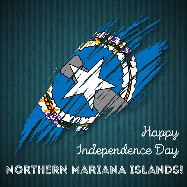
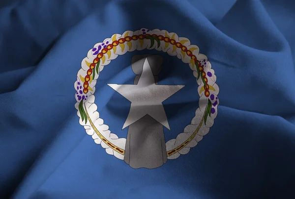
Northern Mariana Islands Independence Day Patriotic Design Expressive Brush Stroke In National Flag

Vector, 3.42MB, 8333 × 8333 eps
stock vector Northern Mariana Islands Independence Day Seamless Pattern Flying Rubber Balloons in Colors of the

Northern Mariana Islands Independence Day Seamless Pattern Flying Rubber Balloons In Colors Of The

Vector, 5.67MB, 8333 × 8333 eps
stock image US and Northern Mariana Island flags

US And Northern Mariana Island Flags

Image, 3.92MB, 3072 × 2304 jpg
stock vector Flag of Northern Mariana Islands (USA), Saipan - Micronesia

Flag Of Northern Mariana Islands (USA), Saipan - Micronesia

Vector, 8.22MB, 8338 × 5538 eps
stock image Waving Flag of Northern Mariana Islands

Waving Flag Of Northern Mariana Islands

Image, 16.18MB, 5184 × 3456 jpg
stock vector Northern Mariana Islands football player. Soccer uniform.

Northern Mariana Islands Football Player. Soccer Uniform.

Vector, 3.64MB, 6400 × 6400 eps
stock image Flag of Northern Mariana Islands (USA), Saipan - Micronesia

Flag Of Northern Mariana Islands (USA), Saipan - Micronesia

Image, 7.89MB, 4288 × 2848 jpg
stock vector Northern Mariana Islands Flag

Northern Mariana Islands Flag

Vector, 0.88MB, 4600 × 2683 eps
stock image Northern Mariana Islands flag on butterfly

Northern Mariana Islands Flag On Butterfly

Image, 2.58MB, 3300 × 3197 jpg
stock vector Farallon de Medinilla Island (Commonwealth of the Northern Mariana Islands, Pacific Ocean, United States of America, USA) map vector illustration, scribble sketch map

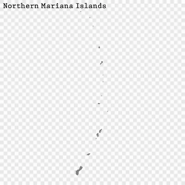
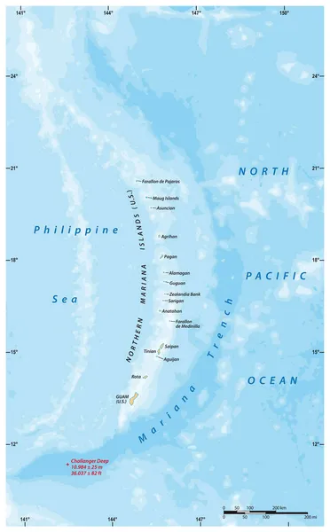
Farallon De Medinilla Island (Commonwealth Of The Northern Mariana Islands, Pacific Ocean, United States Of America, USA) Map Vector Illustration, Scribble Sketch Map

Vector, 0.8MB, 7087 × 4726 eps
stock vector Flag Northern Mariana Islands in official, vector

Flag Northern Mariana Islands In Official, Vector

Vector, 0.61MB, 7000 × 3500 eps
stock vector Saipan and Tinian, Northern Mariana Islands, gray political map. Islands of the Mariana Archipelago. Unincorporated territory and commonwealth of United States with administrative center Capitol Hill.

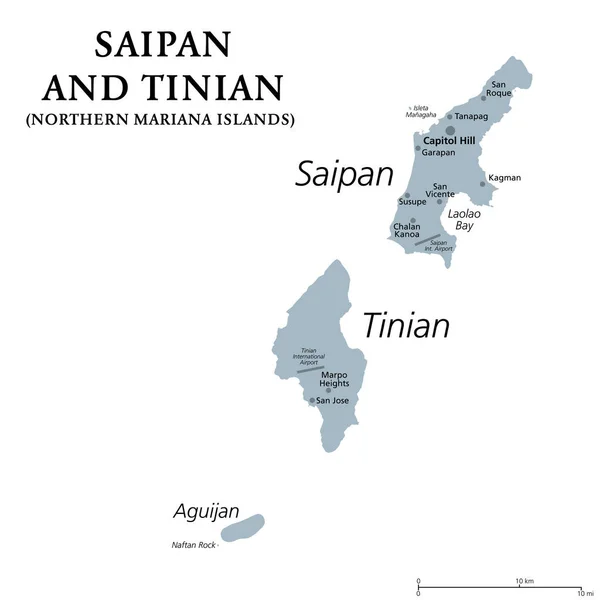
Saipan And Tinian, Northern Mariana Islands, Gray Political Map. Islands Of The Mariana Archipelago. Unincorporated Territory And Commonwealth Of United States With Administrative Center Capitol Hill.

Vector, 1.42MB, 6000 × 6000 eps
stock image Rocks and corals are visible through the crystal clear waters of the northern marianas

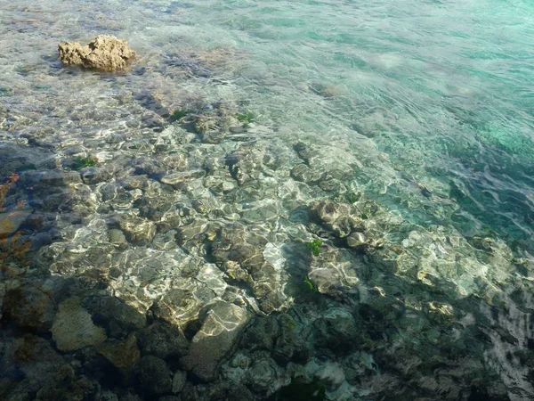
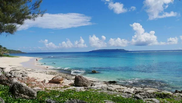
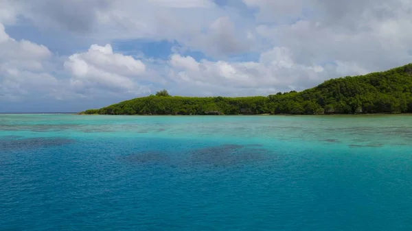
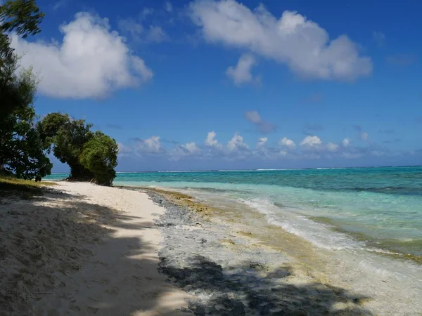
Rocks And Corals Are Visible Through The Crystal Clear Waters Of The Northern Marianas

Image, 10.37MB, 4592 × 3448 jpg
stock vector Northern Mariana Islands political map

Northern Mariana Islands Political Map

Vector, 2.05MB, 6444 × 9666 eps
stock vector Vector map of the Mariana Islands and the Mariana Trench, U.S

Vector Map Of The Mariana Islands And The Mariana Trench, U.S

Vector, 1.95MB, 3100 × 4990 eps
stock vector the Marianas national vector drawing map on white background

The Marianas National Vector Drawing Map On White Background

Vector, 3.14MB, 5000 × 5769 eps
stock image Closeup of Ruffled Northern Mariana Islands Flag

Closeup Of Ruffled Northern Mariana Islands Flag

Image, 23.99MB, 5910 × 4000 jpg
stock image A contestant displays a creation during the 11th Asian Supermodel Contest at Imperial Palace in Saipan, Northern Mariana Islands, 16 December 2017

A Contestant Displays A Creation During The 11th Asian Supermodel Contest At Imperial Palace In Saipan, Northern Mariana Islands, 16 December 2017

Image, 2.67MB, 4000 × 6000 jpg
stock vector Guam and Northern Mariana Islands, political map. Two separate unincorporated territories of the United States of America in the Micronesia subregion of the Western Pacific Ocean. Illustration. Vector

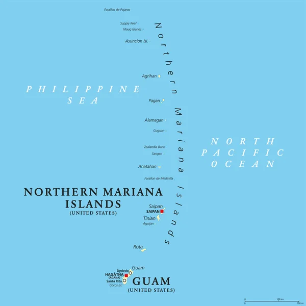
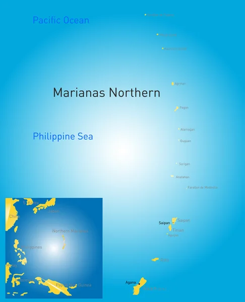
Guam And Northern Mariana Islands, Political Map. Two Separate Unincorporated Territories Of The United States Of America In The Micronesia Subregion Of The Western Pacific Ocean. Illustration. Vector

Vector, 3.12MB, 6000 × 6000 eps
stock image A contestant displays a creation during the 11th Asian Supermodel Contest at Imperial Palace in Saipan, Northern Mariana Islands, 16 December 2017

A Contestant Displays A Creation During The 11th Asian Supermodel Contest At Imperial Palace In Saipan, Northern Mariana Islands, 16 December 2017

Image, 2.84MB, 4000 × 6000 jpg
stock vector Guam and Northern Mariana Islands, gray political map. Two separate unincorporated territories of the United States of America in the Micronesia subregion of the Western Pacific Ocean. Illustration.

Guam And Northern Mariana Islands, Gray Political Map. Two Separate Unincorporated Territories Of The United States Of America In The Micronesia Subregion Of The Western Pacific Ocean. Illustration.

Vector, 2.02MB, 6000 × 8996 eps
stock image Flag of the Northern Mariana Islands

Flag Of The Northern Mariana Islands

Image, 25.41MB, 5420 × 3000 jpg
stock image Tumon Bay coastline, Guam

Tumon Bay Coastline, Guam

Image, 5.8MB, 4390 × 2469 jpg
stock image Soft white sands and corals,  Managaha Island, Saipan

Soft White Sands And Corals, Managaha Island, Saipan

Image, 8.88MB, 4592 × 3448 jpg
stock image A speedboat sails along the pristine blue waters of the Saipan lagoon.

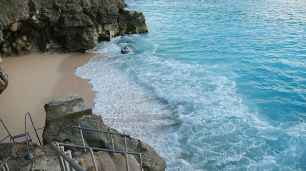
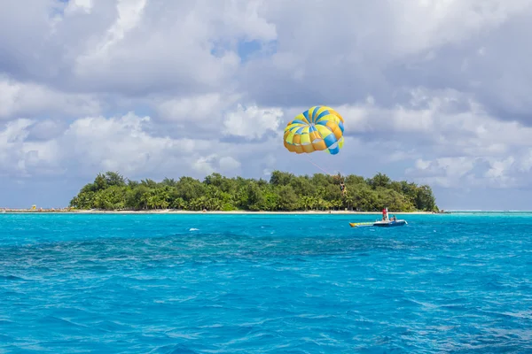
A Speedboat Sails Along The Pristine Blue Waters Of The Saipan Lagoon.

Image, 8.17MB, 4592 × 3448 jpg
stock image Forbidden Island of the Northern Mariana Islands

Forbidden Island Of The Northern Mariana Islands

Image, 9.01MB, 2400 × 3600 jpg
stock image Fiery skies at sunset with reflection in water

Fiery Skies At Sunset With Reflection In Water

Image, 5.56MB, 4363 × 2584 jpg
stock image Managaha Island shoreline, Saipan

Managaha Island Shoreline, Saipan

Image, 8.07MB, 4592 × 3448 jpg
stock image Saipan tropical sunset

Saipan Tropical Sunset

Image, 4.74MB, 4592 × 2584 jpg
stock image Songsong Village, Rota

Songsong Village, Rota

Image, 7.92MB, 4608 × 2551 jpg
stock image Wide beautiful sunset creating magic in the beach in a tropical island

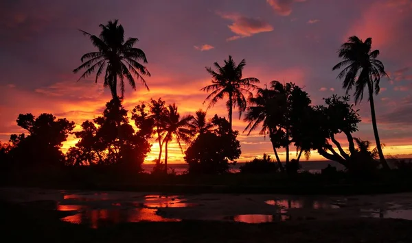
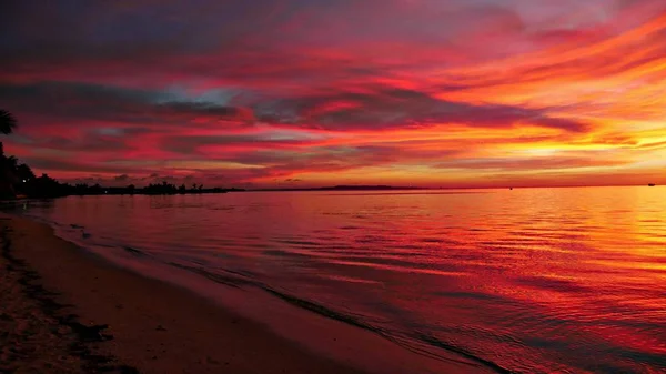
Wide Beautiful Sunset Creating Magic In The Beach In A Tropical Island

Image, 8.12MB, 5184 × 3456 jpg
stock image Chunga Changa

Chunga Changa

Image, 9.47MB, 4997 × 3331 jpg
stock image Coconut leaves silhouetted in sunset, portrait view

Coconut Leaves Silhouetted In Sunset, Portrait View

Image, 4.03MB, 2584 × 4592 jpg
stock image Silhouette of coconut fronds and a faint golden sunset in the background

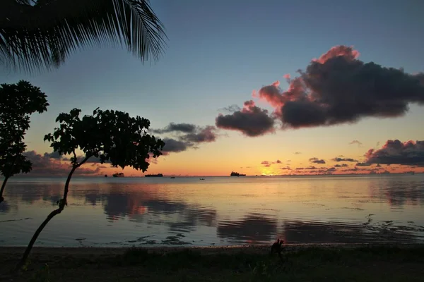
Silhouette Of Coconut Fronds And A Faint Golden Sunset In The Background

Image, 9.57MB, 5184 × 3456 jpg
stock image Reddish streaks of Saipan sunset

Reddish Streaks Of Saipan Sunset

Image, 7.34MB, 4592 × 2584 jpg
stock image Blooming flame tree fowers growing by the beach

Blooming Flame Tree Fowers Growing By The Beach

Image, 4.53MB, 3072 × 2304 jpg
stock image Northern Mariana Islands 3d Golden Map

Northern Mariana Islands 3d Golden Map

Image, 0.06MB, 2714 × 2218 jpg
stock vector Map markers with flags - Oceania. Original colors.

Map Markers With Flags - Oceania. Original Colors.

Vector, 5.12MB, 4000 × 7091 eps
stock vector Pinned countries flags on map of Oceania

Pinned Countries Flags On Map Of Oceania

Vector, 0.53MB, 5156 × 2950 ai
stock image A boy somersaults off the edge of the Taga Beach cliff on Tinian, Northern Mariana Islands in February 2015. Taga Beach is the most popular destination in the island.

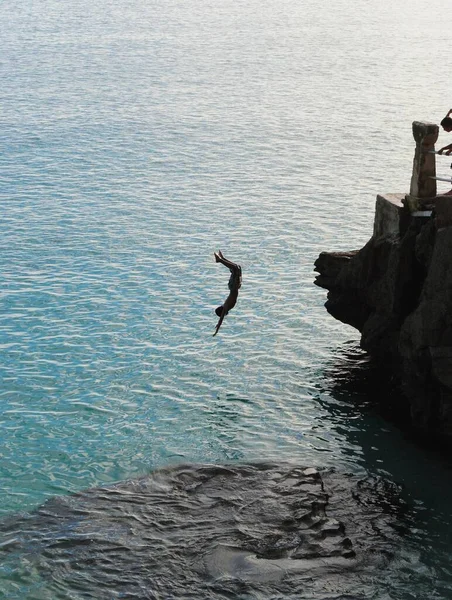
A Boy Somersaults Off The Edge Of The Taga Beach Cliff On Tinian, Northern Mariana Islands In February 2015. Taga Beach Is The Most Popular Destination In The Island.

Image, 3.16MB, 2592 × 3440 jpg
stock image Aerial view of Super Typhoon Hagibis, Spinning in the western Pacific Ocean, typhoon grew from a tropical storm to category 5 storm, Northern Mariana Islands. Elements of this image furnished by NASA

Aerial View Of Super Typhoon Hagibis, Spinning In The Western Pacific Ocean, Typhoon Grew From A Tropical Storm To Category 5 Storm, Northern Mariana Islands. Elements Of This Image Furnished By NASA

Image, 30.6MB, 6967 × 6685 jpg
Page 1 >> Next