photo free
Home Images Vectors Videos

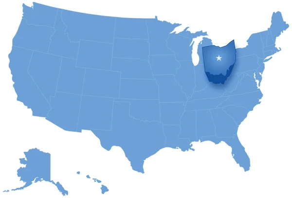
Stock image Ohio Region

stock vector Accurate map of Ohio

Accurate Map Of Ohio

Vector, 0.69MB, 5000 × 4000 eps
stock vector Accurate map of Ohio

Accurate Map Of Ohio

Vector, 0.7MB, 5000 × 4000 eps
stock vector Accurate map of Ohio

Accurate Map Of Ohio

Vector, 0.66MB, 5000 × 4000 eps
stock vector Accurate map of Ohio

Accurate Map Of Ohio

Vector, 0.7MB, 5000 × 4000 eps
stock vector Accurate map of Ohio

Accurate Map Of Ohio

Vector, 0.7MB, 5000 × 4000 eps
stock vector Accurate map of Ohio

Accurate Map Of Ohio

Vector, 0.65MB, 5000 × 4000 eps
stock vector Accurate map of Ohio

Accurate Map Of Ohio

Vector, 0.67MB, 5000 × 4000 eps
stock vector Accurate map of Ohio

Accurate Map Of Ohio

Vector, 0.66MB, 5000 × 4000 eps
stock image Flag of american state of Ohio, region of the United States of America

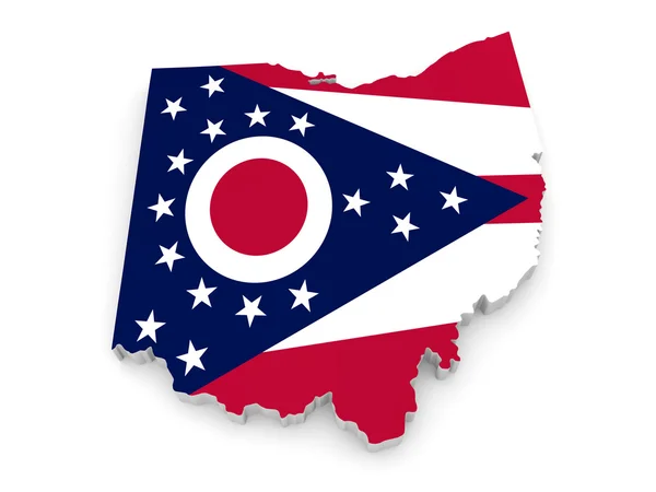
Flag Of American State Of Ohio, Region Of The United States Of America

Image, 6.28MB, 7000 × 4000 jpg
stock vector ohio

Ohio

Vector, 2.35MB, 4000 × 4000 eps
stock vector Ohio map shape, united states of america. Flat concept icon symbol vector illustration .

Ohio Map Shape, United States Of America. Flat Concept Icon Symbol Vector Illustration .

Vector, 0.19MB, 4096 × 4096 eps
stock vector Ohio, state of USA - solid black outline map of country area. Simple flat vector illustration

Ohio, State Of USA - Solid Black Outline Map Of Country Area. Simple Flat Vector Illustration

Vector, 0.22MB, 5000 × 5000 eps
stock image Map of Ohio - USA

Map Of Ohio - USA

Image, 8.98MB, 8000 × 8000 jpg
stock vector Ohio map on white background

Ohio Map On White Background

Vector, 5.27MB, 4000 × 4000 eps
stock vector map of the U.S. state of Ohio

Map Of The U.S. State Of Ohio

Vector, 0.72MB, 5000 × 5000 eps
stock vector Accurate map of Ohio

Accurate Map Of Ohio

Vector, 0.65MB, 5000 × 4000 eps
stock vector U.S. state of Ohio

U.S. State Of Ohio

Vector, 0.61MB, 5000 × 5000 eps
stock vector High Quality map of Ohio is a state of United States of America with borders of the counties

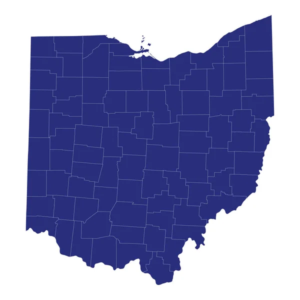
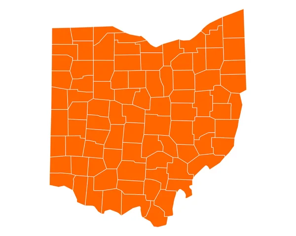
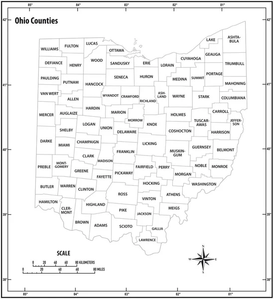
High Quality Map Of Ohio Is A State Of United States Of America With Borders Of The Counties

Vector, 1.07MB, 4000 × 4000 eps
stock vector Set of separated American states. Divided USA map. All the countries are named in the layer panel

Set Of Separated American States. Divided USA Map. All The Countries Are Named In The Layer Panel

Vector, 0.57MB, 6000 × 3200 eps
stock vector US election map. American Presidential Election results infographics template. All the states are separated and named in the layer panel.

US Election Map. American Presidential Election Results Infographics Template. All The States Are Separated And Named In The Layer Panel.

Vector, 1.51MB, 8192 × 4975 eps
stock vector Icons States map. America states map icons on a white background

Icons States Map. America States Map Icons On A White Background

Vector, 1.51MB, 5000 × 5000 eps
stock vector Cincinnati on Ohio State Map. Detailed OH State Map with Location Pin on Cincinnati City. Black silhouette vector map isolated on white background.

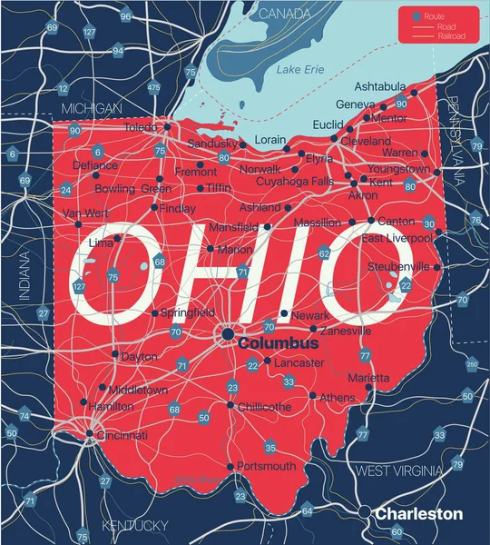
Cincinnati On Ohio State Map. Detailed OH State Map With Location Pin On Cincinnati City. Black Silhouette Vector Map Isolated On White Background.

Vector, 5.55MB, 8334 × 8334 eps
stock vector Outline United States Of America map. US background template. Map of America with separated countries and interstate borders. All states and regions are named in the layer panel.

Outline United States Of America Map. US Background Template. Map Of America With Separated Countries And Interstate Borders. All States And Regions Are Named In The Layer Panel.

Vector, 1.14MB, 5000 × 3500 eps
stock vector Accurate map of Ohio

Accurate Map Of Ohio

Vector, 0.52MB, 5000 × 4000 eps
stock image Desaturated shape of Mainland United States with its capital, main regional division and the separated Ohio area. Labels. Colored elevation map. 3D rendering

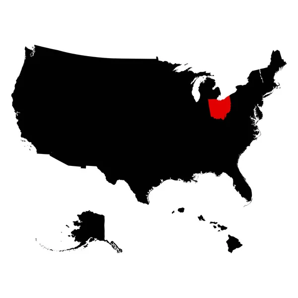
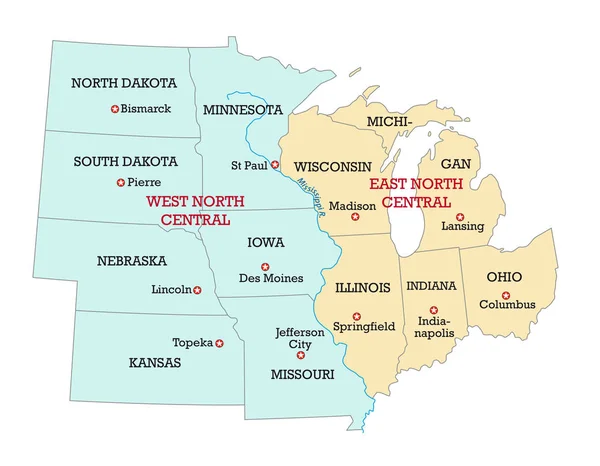
Desaturated Shape Of Mainland United States With Its Capital, Main Regional Division And The Separated Ohio Area. Labels. Colored Elevation Map. 3D Rendering

Image, 1MB, 2880 × 1620 jpg
stock vector US election map. American Presidential Election results infographics template. All the states are separated and named in the layer panel.

US Election Map. American Presidential Election Results Infographics Template. All The States Are Separated And Named In The Layer Panel.

Vector, 1.5MB, 8192 × 4975 eps
stock vector Terrestrial map of USA

Terrestrial Map Of USA

Vector, 0.68MB, 4724 × 4724 eps
stock vector flag and silhouette of the American state of Ohio vector illustratio

Flag And Silhouette Of The American State Of Ohio Vector Illustratio

Vector, 5.11MB, 5650 × 7271 eps
stock image Map of Ohio - USA

Map Of Ohio - USA

Image, 7.54MB, 8000 × 8000 jpg
stock vector map of the U.S. state of Ohio

Map Of The U.S. State Of Ohio

Vector, 1.82MB, 5000 × 5000 eps
stock vector Detailed vintage map of United States of America with names of 5

Detailed Vintage Map Of United States Of America With Names Of 5

Vector, 25.88MB, 7296 × 4104 eps
stock vector South Carolina, Tennessee, Georgia, Alabama, Florida USA state o

South Carolina, Tennessee, Georgia, Alabama, Florida USA State O

Vector, 14.5MB, 5000 × 5000 eps
stock vector map of the U.S. state  Ohio

Map Of The U.S. State Ohio

Vector, 0.62MB, 5000 × 5000 eps
stock vector Map of America. United States Political map. US blueprint with the titles of states and regions. All countries are named in the layer panel.

Map Of America. United States Political Map. US Blueprint With The Titles Of States And Regions. All Countries Are Named In The Layer Panel.

Vector, 0.63MB, 8192 × 3657 eps
stock vector map of the U.S. state  Ohio

Map Of The U.S. State Ohio

Vector, 1.84MB, 5000 × 5000 eps
stock vector Ohio state outline administrative and political vector map in black and white

Ohio State Outline Administrative And Political Vector Map In Black And White

Vector, 0.95MB, 3100 × 3651 eps
stock vector Ohio state detailed editable map

Ohio State Detailed Editable Map

Vector, 0.97MB, 5000 × 5552 eps
stock vector map of the U.S. state of Ohio

Map Of The U.S. State Of Ohio

Vector, 0.62MB, 5000 × 5000 eps
stock vector Map of States of the United States where Ohio is pulled out

Map Of States Of The United States Where Ohio Is Pulled Out

Vector, 2.13MB, 5666 × 3849 eps
stock image Geographic border map and flag of Ohio, The Buckeye State

Geographic Border Map And Flag Of Ohio, The Buckeye State

Image, 0.74MB, 4000 × 3000 jpg
stock vector Columbus, Ohio. Downtown vector map.

Columbus, Ohio. Downtown Vector Map.

Vector, 4.26MB, 8000 × 8000 eps
stock vector Map of USA set

Map Of USA Set

Vector, 4.86MB, 4724 × 4724 eps
stock vector Michigan - Wisconsin - Illinois - Indiana - Ohio Map labelled bl

Michigan - Wisconsin - Illinois - Indiana - Ohio Map Labelled Bl

Vector, 3.33MB, 5000 × 5511 eps
stock vector The detailed map of the USA with regions. United States of America.

The Detailed Map Of The USA With Regions. United States Of America.

Vector, 1.18MB, 5500 × 5500 eps
stock vector ohio state outline administrative and political vector map in black and white

Ohio State Outline Administrative And Political Vector Map In Black And White

Vector, 0.92MB, 3100 × 3379 eps
stock vector Map of the Midwest United States of America

Map Of The Midwest United States Of America

Vector, 0.7MB, 3988 × 3100 eps
stock vector Washington, Idaho, Oregon, California, Nevada USA state outline

Washington, Idaho, Oregon, California, Nevada USA State Outline

Vector, 14.36MB, 5000 × 5000 eps
stock vector Detailed map of the USA, each state is signed and highlighted, the states are located on the largest territory, Colorful infographic of the United States of America, vector illustration

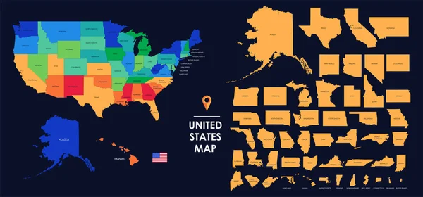
Detailed Map Of The USA, Each State Is Signed And Highlighted, The States Are Located On The Largest Territory, Colorful Infographic Of The United States Of America, Vector Illustration

Vector, 5.89MB, 11205 × 5237 eps
stock vector Vector set 4 of 10 Highly detailed silhouettes of US state maps, divided into counties with names and territory nicknames

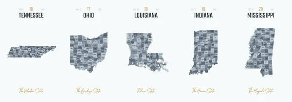
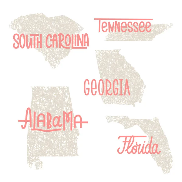
Vector Set 4 Of 10 Highly Detailed Silhouettes Of US State Maps, Divided Into Counties With Names And Territory Nicknames

Vector, 6.15MB, 9585 × 3348 eps
stock vector Contour map of USA

Contour Map Of USA

Vector, 1.92MB, 4724 × 4724 eps
Page 1 >> Next