
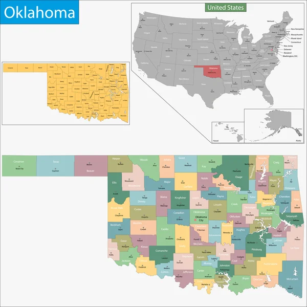
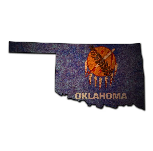
Stock image Oklahoma Administrative


United States Census Bureau Regions And Divisions Vector Map. Flag Of United States Of America
Vector, 6.79MB, 7292 × 3543 eps
Oklahoma State Outline Administrative And Political Vector Map In Black And White
Vector, 0MB, 4000 × 3853 zip

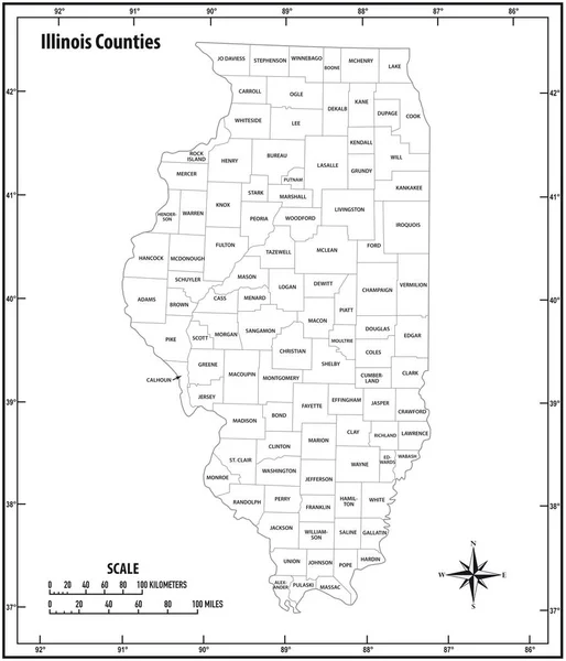
Illinois State Outline Administrative And Political Vector Map In Black And White
Vector, 1.07MB, 3100 × 3613 eps


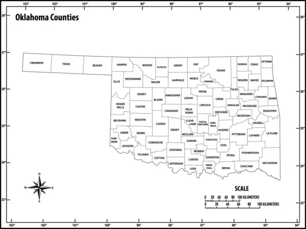
Oklahoma State Outline Administrative And Political Vector Map In Black And White
Vector, 0.92MB, 4627 × 3100 eps


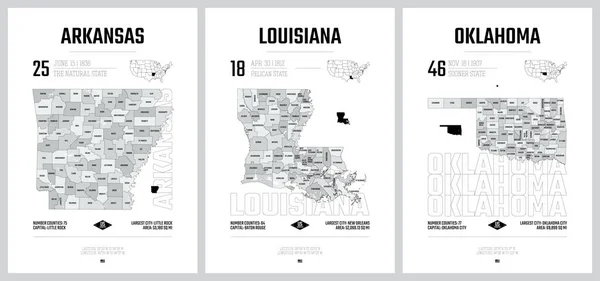
Typography Composition Of City Names, Silhouettes Maps Of The States Of America, Vector Detailed Posters, Division West South Central - Arkansas, Louisiana, Oklahoma - Set 12 Of 17
Vector, 4.32MB, 8896 × 4168 eps

Highly Detailed Vector Silhouettes Of US State Maps, Division United States Into Counties, Political And Geographic Subdivisions Of A States, West South Central - Arkansas, Louisiana, Oklahoma - Set 12 Of 17
Vector, 11.98MB, 9608 × 4501 eps

Oklahoma Flag On Stick On Sky Background. Realistic Flag Illustration
Image, 12.15MB, 5000 × 4000 jpg
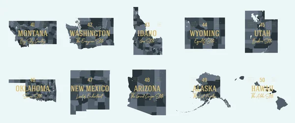
Set 5 Of 5 Division United States Into Counties, Political And Geographic Subdivisions Of A States, Highly Detailed Vector Maps With Names And Territory Nicknames
Vector, 5.97MB, 9585 × 4010 eps

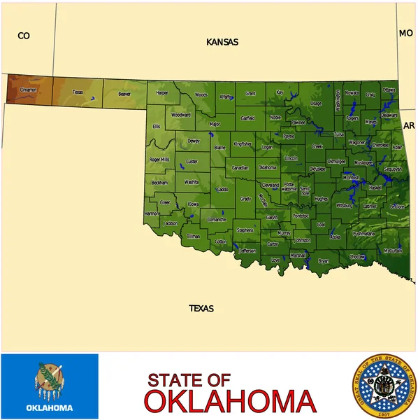
Oklahoma, U.S. State, Subdivided Into 77 Counties, Multi Colored Political Map With Capital Oklahoma City, Borders And County Names. State In The South Central Region Of United States. Native America.
Vector, 1.98MB, 9000 × 4955 eps

Symbol Map Of The State Oklahoma (United States Of America) Showing The Outline Of The State As An Asphalt Surface
Image, 11.93MB, 6000 × 3095 jpg
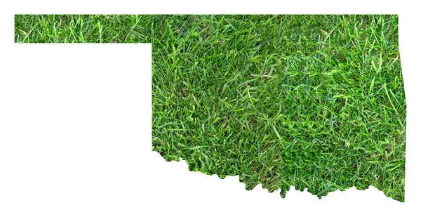
Symbol Map Of The State Oklahoma (United States Of America) Showing The Territory Of The State As A Lawn Football Field
Image, 11.3MB, 6000 × 3095 jpg

Oklahoma, U.S. State, Gray Political Map With Borders And County Names. State In The South Central Region Of USA, Subdivided Into 77 Counties. Native America, Land Of The Red Man, And Sooner State.
Vector, 1.96MB, 9000 × 4955 eps

Map Of The State Oklahoma (United States Of America) Showing The Isolated Territory With Relief Representation, Water Bodies Like Seas, Rivers, Lakes And With Borders. No Labels At All.
Image, 1.73MB, 6000 × 3029 jpg
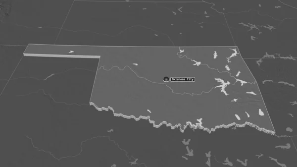
Zoom In On Oklahoma (state Of United States) Extruded. Oblique Perspective. Bilevel Elevation Map With Surface Waters. 3D Rendering
Image, 0.85MB, 3840 × 2160 jpg

Oklahoma, U.S. State, Political Map With Borders And County Names. State In The South Central Region Of The USA, Subdivided Into 77 Counties. Native America, Land Of The Red Man, And Sooner State.
Vector, 2.25MB, 9000 × 5113 eps

West South Central States, Multi Colored Political Map. United States Census Division Of The South Region, Consisting Of The States Arkansas, Louisiana, Oklahoma, And Texas. Illustration. Vector
Vector, 0.72MB, 6423 × 6000 eps
Vector Set 10 Of 10 Highly Detailed Silhouettes Of US State Maps, Divided Into Counties With Names And Territory Nicknames
Vector, 4.76MB, 9585 × 3348 eps

Page 1 >> Next