
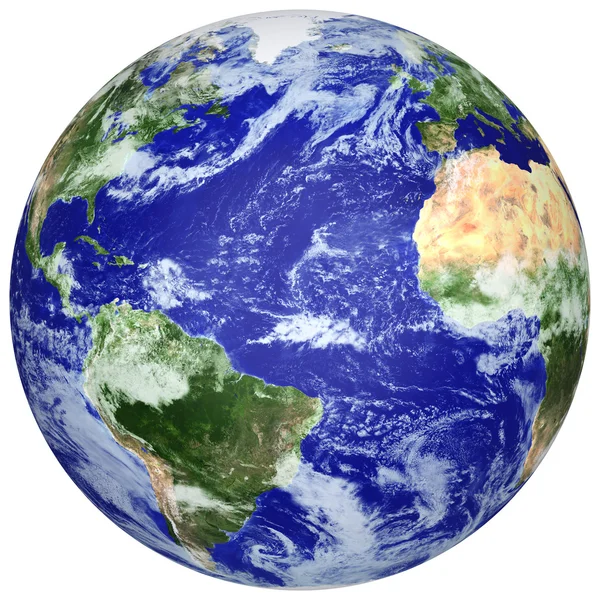
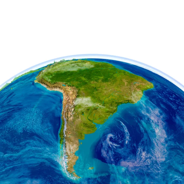
Stock image Physical Globe


Ecological Concept Of The Environment With The Cultivation Of Trees On The Ground In The Hands. Planet Earth. Physical Globe Of The Earth. Elements Of This Image Furnished By NASA. 3D Illustration
Image, 4.44MB, 3036 × 2413 jpg

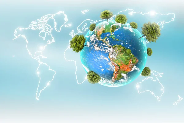
Ecological Concept Of The Environment With The Cultivation Of Trees . Planet Earth. Physical Globe Of The Earth. Elements Of This Image Furnished By NASA. 3D Illustration
Image, 1.97MB, 3036 × 2413 jpg
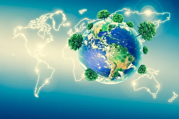
Ecological Concept Of The Environment With The Cultivation Of Trees. Planet Earth. Physical Globe Of The Earth. Elements Of This Image Furnished By NASA. 3D Illustration
Image, 3.86MB, 3456 × 2304 jpg

Ecological Concept Of The Environment With The Cultivation Of Trees On The Ground In The Hands. Planet Earth. Physical Globe Of The Earth. Elements Of This Image Furnished By NASA. 3D Illustration
Image, 3.66MB, 3456 × 2304 jpg

Ecological Concept Of The Environment With The Cultivation Of Trees On The Ground In The Hands. Planet Earth. Physical Globe Of The Earth. Elements Of This Image Furnished By NASA. 3D Illustration
Image, 1.55MB, 2678 × 2097 jpg
Ecological Concept Of The Environment With The Cultivation Of Trees . Planet Earth. Physical Globe Of The Earth. Elements Of This Image Furnished By NASA. 3D Illustration
Image, 3.9MB, 3456 × 2304 jpg
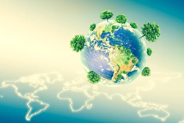
Ecological Concept Of The Environment With The Cultivation Of Trees . Planet Earth. Physical Globe Of The Earth. Elements Of This Image Furnished By NASA. 3D Illustration
Image, 3.53MB, 3456 × 2304 jpg

Ecological Concept Of The Environment With The Cultivation Of Trees . Planet Earth. Physical Globe Of The Earth. Elements Of This Image Furnished By NASA. 3D Illustration
Image, 10.21MB, 4000 × 3000 jpg
Neighborhoods Of The Pacific Tectonic Plate On The Physical Map In The Van Der Grinten I Projection (oblique Transformation). Raw Composite - No Outlines
Image, 6.81MB, 2880 × 1620 jpg

Ecological Concept Of The Environment With The Cultivation Of Trees On The Ground In The Hands. Planet Earth. Physical Globe Of The Earth. Elements Of This Image Furnished By NASA. 3D Illustration
Image, 1.69MB, 2678 × 2097 jpg

Ecological Concept Of The Environment With The Cultivation Of Trees . Planet Earth. Physical Globe Of The Earth. Elements Of This Image Furnished By NASA. 3D Illustration
Image, 11.5MB, 4745 × 4309 jpg

Ecological Concept Of The Environment With The Cultivation Of Trees . Planet Earth. Physical Globe Of The Earth. Elements Of This Image Furnished By NASA. 3D Illustration
Image, 10.8MB, 4408 × 4058 jpg
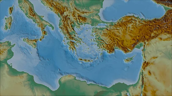
Neighborhoods Of The Aegean Sea Tectonic Plate On The Relief Map In The Van Der Grinten I Projection (oblique Transformation). Raw Composite - No Outlines
Image, 5.12MB, 2880 × 1620 jpg

Ecological Concept Of The Environment With The Cultivation Of Trees . Planet Earth. Physical Globe Of The Earth. Elements Of This Image Furnished By NASA. 3D Illustration
Image, 2.32MB, 3208 × 2052 jpg

Ecological Concept Of The Environment With The Cultivation Of Trees . Planet Earth. Physical Globe Of The Earth. Elements Of This Image Furnished By NASA. 3D Illustration
Image, 10.99MB, 4745 × 4309 jpg
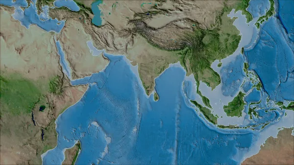
Neighborhoods Of The Indian Tectonic Plate On The Satellite A Map In The Van Der Grinten I Projection (oblique Transformation). Raw Composite - No Outlines
Image, 6.18MB, 2880 × 1620 jpg

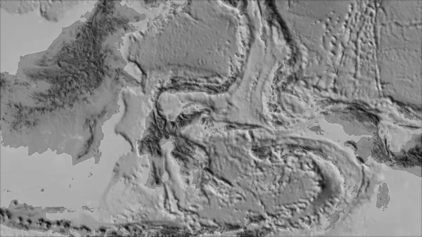
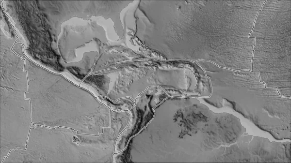
Neighborhoods Of The Altiplano Tectonic Plate On The Grayscale Map In The Van Der Grinten I Projection (oblique Transformation). Raw Composite - No Outlines
Image, 2.34MB, 2880 × 1620 jpg
Neighborhoods Of The Molucca Sea Tectonic Plate On The Grayscale Map In The Van Der Grinten I Projection (oblique Transformation). Raw Composite - No Outlines
Image, 2.24MB, 2880 × 1620 jpg
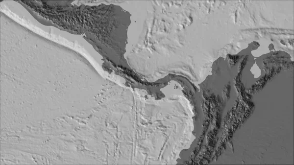
Neighborhoods Of The Panama Tectonic Plate On The Bilevel Elevation Map In The Van Der Grinten I Projection (oblique Transformation). Raw Composite - No Outlines
Image, 2.12MB, 2880 × 1620 jpg

Neighborhoods Of The Solomon Sea Tectonic Plate On The Grayscale Map In The Van Der Grinten I Projection (oblique Transformation). Raw Composite - No Outlines
Image, 1.96MB, 2880 × 1620 jpg

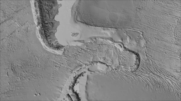
White Mask Of Lands Within Areas Adjacent To The Altiplano Tectonic Plate. Black Background. Van Der Grinten I Projection (oblique Transformation). Compositing Tool
Image, 0.09MB, 2880 × 1620 jpg
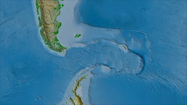
Neighborhoods Of The Scotia Tectonic Plate On The Grayscale Map In The Van Der Grinten I Projection (oblique Transformation). Raw Composite - No Outlines
Image, 2.06MB, 2880 × 1620 jpg

Neighborhoods Of The Caribbean Tectonic Plate On The Grayscale Map In The Van Der Grinten I Projection (oblique Transformation). Raw Composite - No Outlines
Image, 2.65MB, 2880 × 1620 jpg

Neighborhoods Of The Juan De Fuca Tectonic Plate On The Physical Map In The Van Der Grinten I Projection (oblique Transformation). Raw Composite - No Outlines
Image, 4.81MB, 2880 × 1620 jpg

Neighborhoods Of The North Bismarck Tectonic Plate On The Relief Map In The Van Der Grinten I Projection (oblique Transformation). Raw Composite - No Outlines
Image, 3.79MB, 2880 × 1620 jpg
Neighborhoods Of The Scotia Tectonic Plate On The Physical Map In The Van Der Grinten I Projection (oblique Transformation). Raw Composite - No Outlines
Image, 3.92MB, 2880 × 1620 jpg
Tectonic Plates Borders On The Grayscale Map Of Areas Adjacent To The Caribbean Plate Area. Van Der Grinten I Projection (oblique Transformation)
Image, 2.7MB, 2880 × 1620 jpg
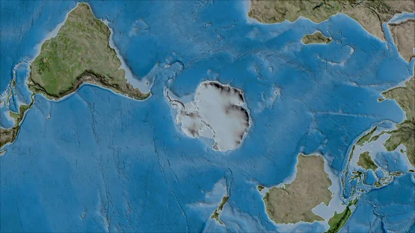
Neighborhoods Of The Antarctica Tectonic Plate On The Satellite B Map In The Van Der Grinten I Projection (oblique Transformation). Raw Composite - No Outlines
Image, 6.47MB, 2880 × 1620 jpg

Neighborhoods Of The Anatolian Tectonic Plate On The Topographic Map In The Van Der Grinten I Projection (oblique Transformation). Raw Composite - No Outlines
Image, 5.95MB, 2880 × 1620 jpg
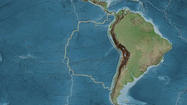
Area Of The Nazca Tectonic Plate Marked With A Solid Line On A Pale Colored Elevation Map In The Patterson Cylindrical Projection
Image, 7.51MB, 3840 × 2160 jpg
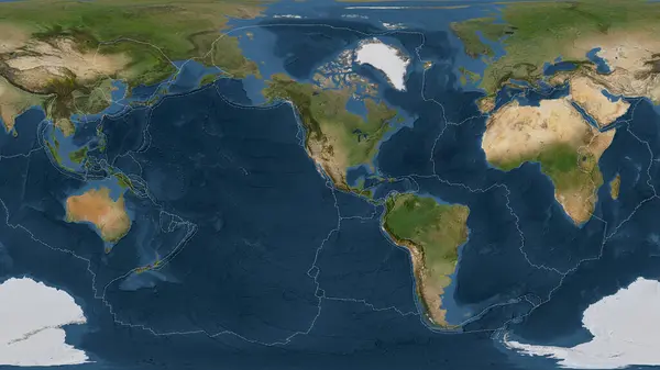
Satellite Imagery Map Of The World In The Patterson Cylindrical Projection Transformed To The Center Of The Rivera Tectonic Plate
Image, 6.56MB, 3840 × 2160 jpg

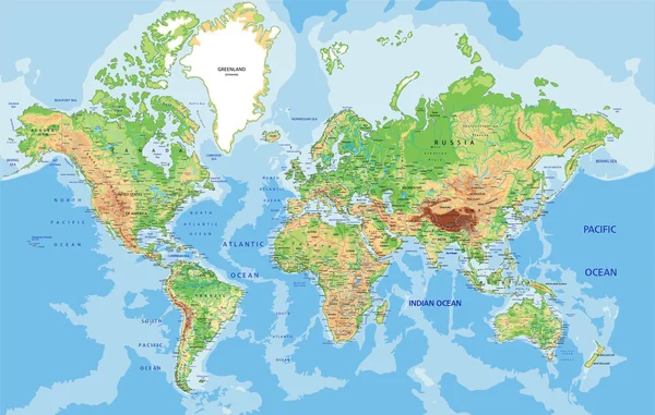
Map Of Earth's Principal Tectonic Plates, Tectonic Plate World Map Concept Design, The Sixteen Major Pieces Of Crust And Uppermost Mantle Of The Earth, Called The Lithosphere, Earth's Surface, Geology
Image, 1.06MB, 4800 × 2700 jpg
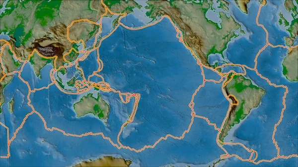
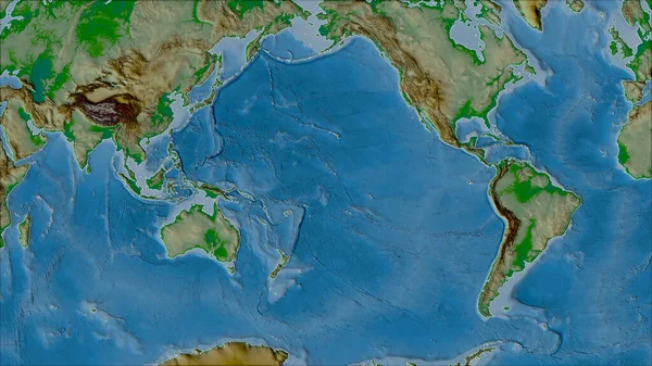
Tectonic Plates Borders On The Physical Map Of Areas Adjacent To The Pacific Plate Area. Van Der Grinten I Projection (oblique Transformation)
Image, 7.14MB, 2880 × 1620 jpg

Satellite Imagery Map Of The World In The Patterson Cylindrical Projection Transformed To The Center Of The Maoke Tectonic Plate
Image, 6.58MB, 3840 × 2160 jpg

Illuminated Globe Showing Earth With Continents And Oceans On A Plain Background, Sunlight Highlighting Details.
Image, 3.43MB, 4000 × 2242 jpg
Page 1 >> Next