photo free
Home Images Vectors Videos

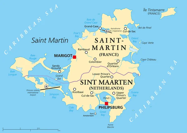
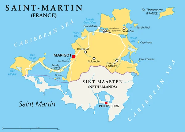
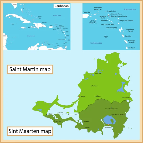
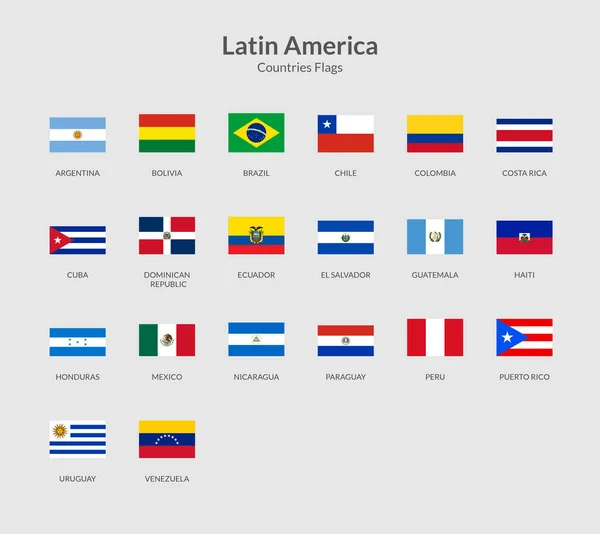
Stock image Saint Martin Map

stock vector Saint Martin Island Political Map

Saint Martin Island Political Map

Vector, 1.03MB, 8445 × 6000 eps
stock vector Saint-Martin Country Political Map

Saint-Martin Country Political Map

Vector, 0.95MB, 8445 × 6000 eps
stock vector Detailed vector map of Saint-Martin and capital city Marigot

Detailed Vector Map Of Saint-Martin And Capital City Marigot

Vector, 3.3MB, 5867 × 5867 eps
stock vector Saint Martin vector map Grunge rubber stamp with the name and map of island vector illustration

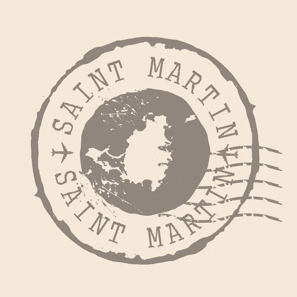
Saint Martin Vector Map Grunge Rubber Stamp With The Name And Map Of Island Vector Illustration

Vector, 3.46MB, 8350 × 8350 eps
stock vector Saint Martin map on road sign Square poster with Saint Martin island map on yellow rhomb road sign

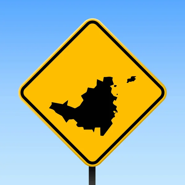
Saint Martin Map On Road Sign Square Poster With Saint Martin Island Map On Yellow Rhomb Road Sign

Vector, 0.29MB, 4900 × 4900 eps
stock vector Saint Martin vector map. Editable template with regions, cities, red pins and blue surface on white background.

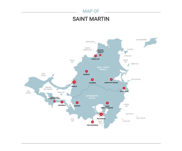
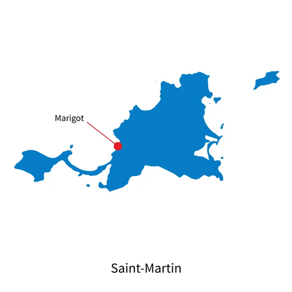
Saint Martin Vector Map. Editable Template With Regions, Cities, Red Pins And Blue Surface On White Background.

Vector, 1.15MB, 3600 × 3000 eps
stock vector Saint Martin and Sint Maarten

Saint Martin And Sint Maarten

Vector, 7.52MB, 7000 × 7000 eps
stock vector Leeward Islands, political map. Part of the Lesser Antilles, north of Windward Islands in the Caribbean. Virgin Islands, Anguilla, St Kitts and Nevis, Antigua and Barbuda, Montserrat, and Guadeloupe.

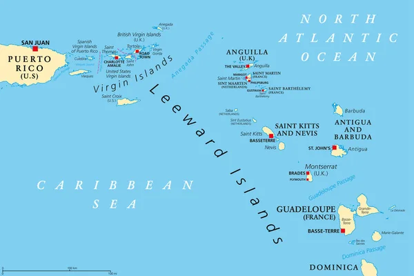
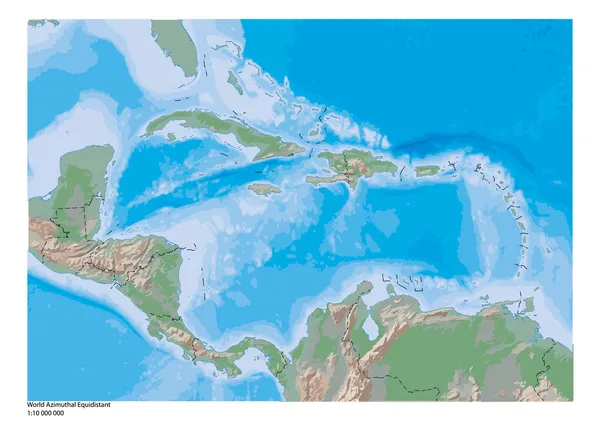
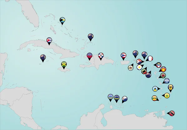
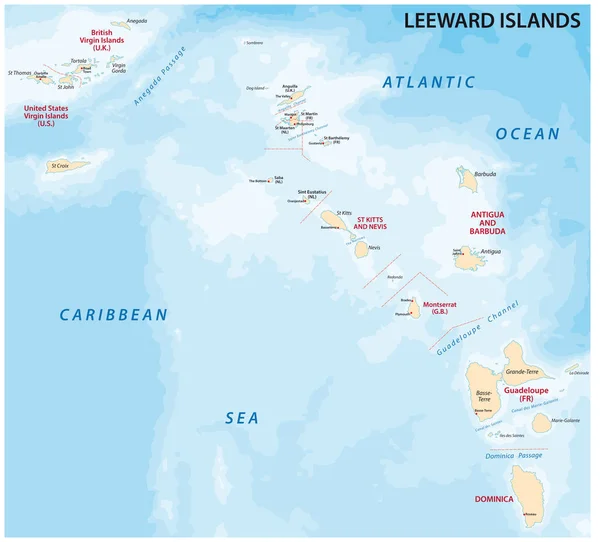
Leeward Islands, Political Map. Part Of The Lesser Antilles, North Of Windward Islands In The Caribbean. Virgin Islands, Anguilla, St Kitts And Nevis, Antigua And Barbuda, Montserrat, And Guadeloupe.

Vector, 3.54MB, 9000 × 6000 eps
stock vector Anguilla, Saint-Martin, Sint Maarten and Saint Barthelemy map

Anguilla, Saint-Martin, Sint Maarten And Saint Barthelemy Map

Vector, 3.44MB, 8033 × 8033 eps
stock vector Sint Maarten Political Map

Sint Maarten Political Map

Vector, 0.95MB, 7790 × 6000 eps
stock vector Stamp Postal of Saint Martin . Map Silhouette rubber Seal.  Design Retro Travel. Seal  Map of Saint Martin grunge  for your design.  EPS10

Stamp Postal Of Saint Martin . Map Silhouette Rubber Seal. Design Retro Travel. Seal Map Of Saint Martin Grunge For Your Design. EPS10

Vector, 3.84MB, 5000 × 5000 eps
stock vector Saint Martin island political map

Saint Martin Island Political Map

Vector, 2.22MB, 9433 × 6702 eps
stock vector Saint Martin Map black and white

Saint Martin Map Black And White

Vector, 4.21MB, 6662 × 5000 eps
stock vector Saint Martin map in vintage discover the world insignia Hipster style nautical postage stamp with

Saint Martin Map In Vintage Discover The World Insignia Hipster Style Nautical Postage Stamp With

Vector, 3.88MB, 8333 × 8333 eps
stock vector Saint Martin flag painted with Grunge brush stroke, watercolor flag style.

Saint Martin Flag Painted With Grunge Brush Stroke, Watercolor Flag Style.

Vector, 2.49MB, 5000 × 3500 eps
stock vector Saint Maarten Island map icon illustration element design

Saint Maarten Island Map Icon Illustration Element Design

Vector, 0.93MB, 8333 × 8333 eps
stock vector Saint Maarten Island map icon illustration element design

Saint Maarten Island Map Icon Illustration Element Design

Vector, 0.94MB, 8333 × 8333 eps
stock vector Latin American countries Rectangle flag icon

Latin American Countries Rectangle Flag Icon

Vector, 9.57MB, 4286 × 3817 eps
stock vector Saint Maarten Island map icon illustration element design

Saint Maarten Island Map Icon Illustration Element Design

Vector, 0.92MB, 8333 × 8333 eps
stock image Saint Martin Island in the Caribbean Sea on a topographic, OSM Humanitarian style map

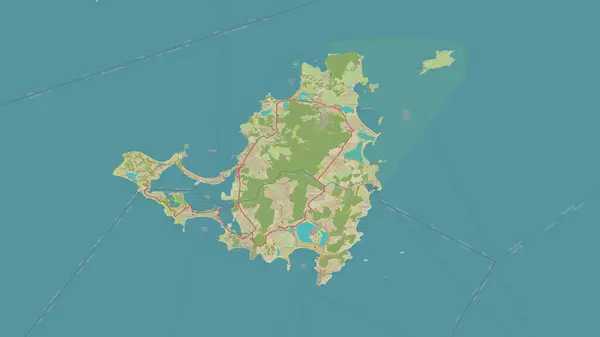
Saint Martin Island In The Caribbean Sea On A Topographic, OSM Humanitarian Style Map

Image, 1.36MB, 2880 × 1620 jpg
stock vector Saint Maarten Island map icon illustration element design

Saint Maarten Island Map Icon Illustration Element Design

Vector, 0.94MB, 8333 × 8333 eps
stock vector Locator map showing the location of the country Saint Martin in North America. The country is highlighted with a red polygon. No labels at all. Made with Natural Earth.

Locator Map Showing The Location Of The Country Saint Martin In North America. The Country Is Highlighted With A Red Polygon. No Labels At All. Made With Natural Earth.

Vector, 1.36MB, 4223 × 4474 eps
stock vector Saint Martin badge Colorful polygonal island symbol Multicolored geometric Saint Martin logos set

Saint Martin Badge Colorful Polygonal Island Symbol Multicolored Geometric Saint Martin Logos Set

Vector, 15.03MB, 5229 × 5752 eps
stock vector Saint Martin Map Outline Vintage Discover the World Rubber Stamp with Island Map Hipster Style

Saint Martin Map Outline Vintage Discover The World Rubber Stamp With Island Map Hipster Style

Vector, 3.15MB, 8333 × 8333 eps
stock vector Abstract map of Saint Martin showing the area ot the country with concentric rings in rainbow colors like a shooting target.

Abstract Map Of Saint Martin Showing The Area Ot The Country With Concentric Rings In Rainbow Colors Like A Shooting Target.

Vector, 0.65MB, 2400 × 2000 eps
stock image Saint Martin Island in the Caribbean Sea on a colored elevation map

Saint Martin Island In The Caribbean Sea On A Colored Elevation Map

Image, 0.76MB, 2880 × 1620 jpg
stock vector SAINT-MARTIN round sign. Futuristic satelite view of the world centered to SAINT-MARTIN. Geographical badge with map, round text and binary background. Radiant vector illustration.

SAINT-MARTIN Round Sign. Futuristic Satelite View Of The World Centered To SAINT-MARTIN. Geographical Badge With Map, Round Text And Binary Background. Radiant Vector Illustration.

Vector, 5.1MB, 5477 × 5477 eps
stock image Saint Martin Island in the Caribbean Sea, shared between: Netherlands, France, isolated on a topographic, OSM Humanitarian style map, with distance scale

Saint Martin Island In The Caribbean Sea, Shared Between: Netherlands, France, Isolated On A Topographic, OSM Humanitarian Style Map, With Distance Scale

Image, 1.45MB, 2160 × 2160 jpg
stock image Saint Martin Island in the Caribbean Sea on a satellite image taken in March 5, 2023

Saint Martin Island In The Caribbean Sea On A Satellite Image Taken In March 5, 2023

Image, 5.58MB, 2880 × 1620 jpg
stock vector Abstract map of Saint Martin showing the country with concentric rings in rainbow colors.

Abstract Map Of Saint Martin Showing The Country With Concentric Rings In Rainbow Colors.

Vector, 0.58MB, 2400 × 1870 eps
stock vector Saint Martin round rubber stamp with island map Vintage red passport stamp with circular text and

Saint Martin Round Rubber Stamp With Island Map Vintage Red Passport Stamp With Circular Text And

Vector, 1.4MB, 5488 × 5488 eps
stock vector Lesser Antilles of the Caribbean, multicolored political map. Group of islands between Greater Antilles and South America. Divided into the Leeward Islands, Windward Islands, and the Leeward Antilles.

Lesser Antilles Of The Caribbean, Multicolored Political Map. Group Of Islands Between Greater Antilles And South America. Divided Into The Leeward Islands, Windward Islands, And The Leeward Antilles.

Vector, 3.35MB, 8985 × 6000 eps
stock vector Silhouette of the state borders of Saint Martin. An island state located in the Caribbean Sea. Vector illustration.

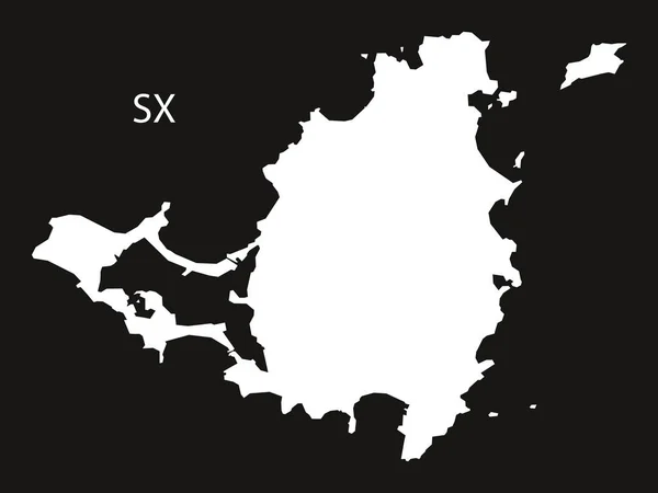
Silhouette Of The State Borders Of Saint Martin. An Island State Located In The Caribbean Sea. Vector Illustration.

Vector, 0.42MB, 5749 × 3290 eps
stock image Saint Martin Island in the Caribbean Sea, shared between: Netherlands, France, isolated on a satellite image taken in June 23, 2020, with distance scale

Saint Martin Island In The Caribbean Sea, Shared Between: Netherlands, France, Isolated On A Satellite Image Taken In June 23, 2020, With Distance Scale

Image, 1.6MB, 2160 × 2160 jpg
stock vector Saint Martin seal Vintage island map sticker Grunge rubber stamp with Made in text and map

Saint Martin Seal Vintage Island Map Sticker Grunge Rubber Stamp With Made In Text And Map

Vector, 1.81MB, 8333 × 8333 eps
stock vector Saint Maarten Island map icon illustration element design

Saint Maarten Island Map Icon Illustration Element Design

Vector, 0.95MB, 8333 × 8333 eps
stock image Saint Martin Island in the Caribbean Sea - shared between: Netherlands, France. Described location diagram with yellow shape of the island and sample maps of its surroundings

Saint Martin Island In The Caribbean Sea - Shared Between: Netherlands, France. Described Location Diagram With Yellow Shape Of The Island And Sample Maps Of Its Surroundings

Image, 2.48MB, 3840 × 2160 jpg
stock image Saint Martin Island in the Caribbean Sea, shared between: Netherlands, France, isolated on a bilevel elevation map, with distance scale

Saint Martin Island In The Caribbean Sea, Shared Between: Netherlands, France, Isolated On A Bilevel Elevation Map, With Distance Scale

Image, 0.38MB, 2160 × 2160 jpg
stock vector Caribbean geography map

Caribbean Geography Map

Vector, 0.84MB, 5004 × 3552 ai
stock vector map of the city of Rennes, Ille-et-Vilaine, Brittany, France

Map Of The City Of Rennes, Ille-et-Vilaine, Brittany, France

Vector, 4.23MB, 3752 × 5529 eps
stock vector map of the city of Rennes, Ille-et-Vilaine, Brittany, France

Map Of The City Of Rennes, Ille-et-Vilaine, Brittany, France

Vector, 6.44MB, 4872 × 4168 eps
stock vector map of the city of Rennes, Ille-et-Vilaine, Brittany, France

Map Of The City Of Rennes, Ille-et-Vilaine, Brittany, France

Vector, 6.66MB, 4872 × 4168 eps
stock vector America Pointer Flag Icons with american Map set2

America Pointer Flag Icons With American Map Set2

Vector, 10.31MB, 5000 × 5000 eps
stock vector society island

Society Island

Vector, 0.49MB, 8326 × 5305 eps
stock vector Vector halftone Dotted map of Saint Martin country for your design, Travel Illustration concept.

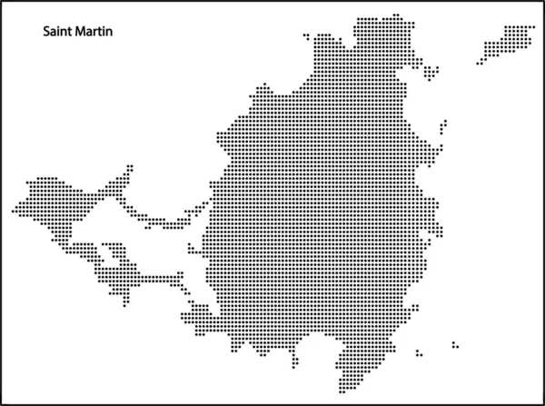
Vector Halftone Dotted Map Of Saint Martin Country For Your Design, Travel Illustration Concept.

Vector, 1.62MB, 3956 × 2948 eps
stock vector Pinned countries flags on map of Caribbean

Pinned Countries Flags On Map Of Caribbean

Vector, 0.5MB, 5000 × 3477 ai
stock vector Set of vector polygonal Saint Martin maps filled with bright gradient of low poly art.

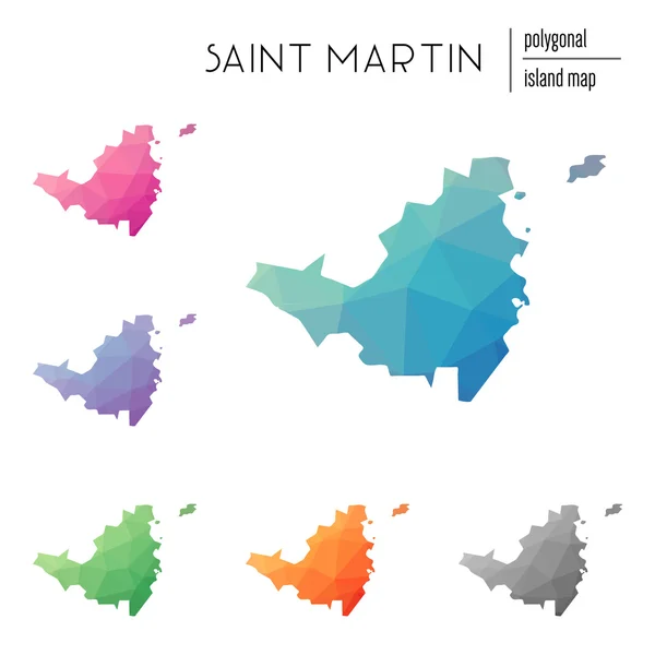
Set Of Vector Polygonal Saint Martin Maps Filled With Bright Gradient Of Low Poly Art.

Vector, 0.61MB, 8333 × 8333 eps
stock vector Map of leeward islands, Caribbean island group

Map Of Leeward Islands, Caribbean Island Group

Vector, 1.82MB, 3601 × 3257 eps
stock vector Slovakia infographics, statistical data, sights

Slovakia Infographics, Statistical Data, Sights

Vector, 1.03MB, 5000 × 5000 eps
stock vector Vector isometric Paris architecture elements

Vector Isometric Paris Architecture Elements

Vector, 9.75MB, 5272 × 4506 eps
Page 1 >> Next