photo free
Home Images Vectors Videos

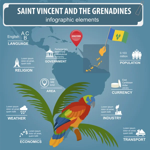
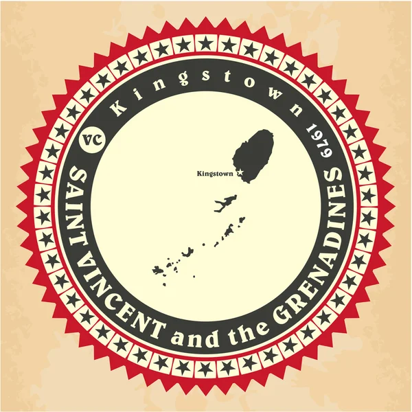
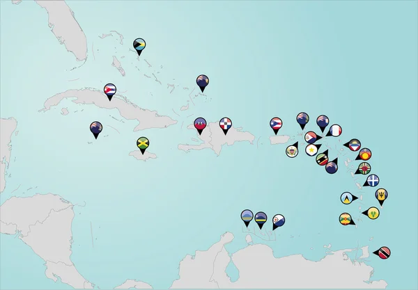
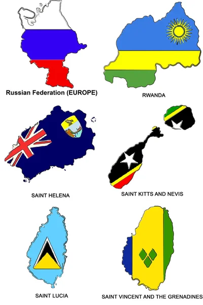
Stock image Saint Vincent Map

stock vector America Pointer Flag Icons with american Map set2

America Pointer Flag Icons With American Map Set2

Vector, 10.31MB, 5000 × 5000 eps
stock vector South America and part of the South Pole Background with Globe Icon 3D illustration, Glossy, Shiny Sphere with Global Map in Subtle Blues giving a transparent feel

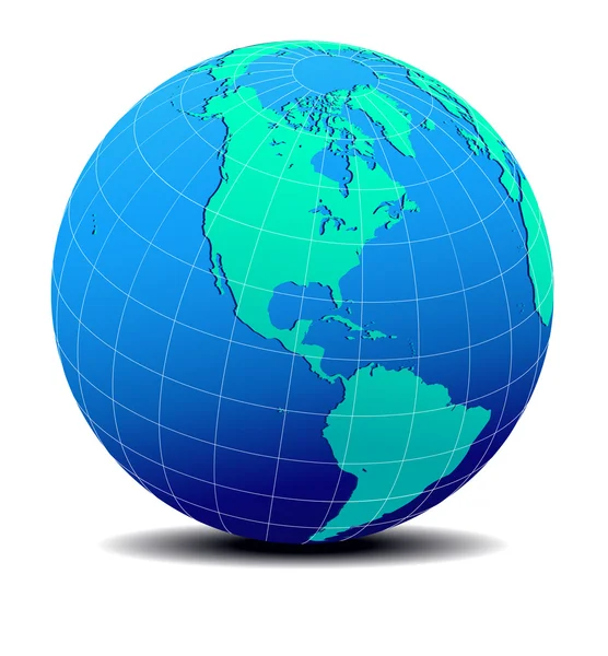
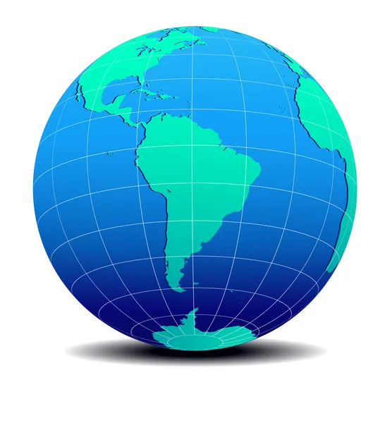
South America And Part Of The South Pole Background With Globe Icon 3D Illustration, Glossy, Shiny Sphere With Global Map In Subtle Blues Giving A Transparent Feel

Vector, 1MB, 5547 × 5547 eps
stock vector Saint Vincent and the Grenadines infographics, statistical data,

Saint Vincent And The Grenadines Infographics, Statistical Data,

Vector, 1.18MB, 4500 × 4500 eps
stock vector Abstract blue world map with magnified Saint Vincent and the Gre

Abstract Blue World Map With Magnified Saint Vincent And The Gre

Vector, 12MB, 8000 × 5000 eps
stock vector South America Global World

South America Global World

Vector, 0.71MB, 5560 × 5534 eps
stock vector Saint Vincent and the Grenadines Map black

Saint Vincent And The Grenadines Map Black

Vector, 3.43MB, 5000 × 10124 eps
stock vector Grenada Political Map

Grenada Political Map

Vector, 0.95MB, 6000 × 7429 eps
stock vector Lesser Antilles, Haiti, Dominican Republic

Lesser Antilles, Haiti, Dominican Republic

Vector, 1.92MB, 10000 × 6682 eps
stock vector Outline maps collection, nine black lined vector map

Outline Maps Collection, Nine Black Lined Vector Map

Vector, 0.79MB, 5170 × 5000 eps
stock vector Saint Vincent and the Grenadines

Saint Vincent And The Grenadines

Vector, 0.27MB, 3819 × 4298 eps
stock vector Detailed vector map of Saint Vincent and the Grenadines and capital city Kingstown

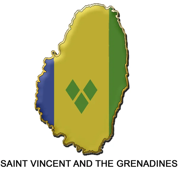
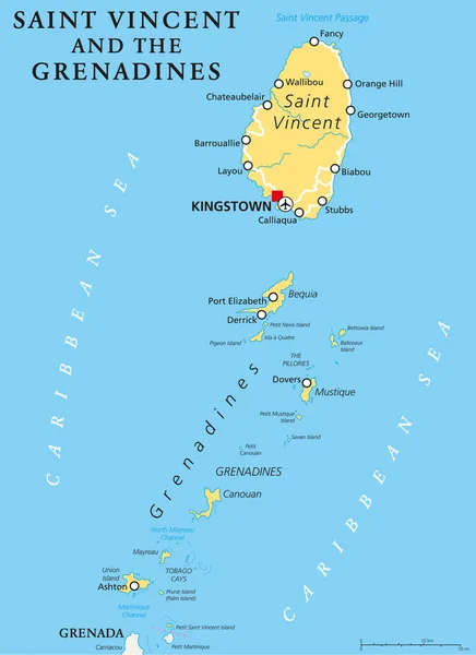
Detailed Vector Map Of Saint Vincent And The Grenadines And Capital City Kingstown

Vector, 3.3MB, 5867 × 5867 eps
stock image Low Poly Saint Vincent and The Grenadines Map with National Flag

Low Poly Saint Vincent And The Grenadines Map With National Flag

Image, 3.72MB, 7000 × 7000 jpg
stock vector World map with magnified Saint Vincent and the Grenadines

World Map With Magnified Saint Vincent And The Grenadines

Vector, 2.14MB, 5000 × 3125 eps
stock vector Vintage label-sticker cards of Saint Vincent and the Grenadines.

Vintage Label-sticker Cards Of Saint Vincent And The Grenadines.

Vector, 0.38MB, 3100 × 3100 eps
stock image Saint Vincent and the Grenadines badge

Saint Vincent And The Grenadines Badge

Image, 0.4MB, 2000 × 2000 jpg
stock vector Saint Lucia, Saint Vincent and the Grenadines, USA, Canada flag.

Saint Lucia, Saint Vincent And The Grenadines, USA, Canada Flag.

Vector, 2.81MB, 5000 × 5000 eps
stock vector Saint Vincent and the Grenadines map with waving flag of country

Saint Vincent And The Grenadines Map With Waving Flag Of Country

Vector, 1.78MB, 5000 × 5000 eps
stock vector Saint Vincent and the Grenadines map vector

Saint Vincent And The Grenadines Map Vector

Vector, 0.47MB, 7087 × 4724 eps
stock vector Saint Vincent Travel Logo

Saint Vincent Travel Logo

Vector, 0.71MB, 3333 × 3333 eps
stock vector Coronavirus cell with Saint Vincent and the Grenadines flag and map. Stop COVID-19 sign, slogan save lives stay home with flag of Saint Vincent and the Grenadines on abstract medical bacteria background.

Coronavirus Cell With Saint Vincent And The Grenadines Flag And Map. Stop COVID-19 Sign, Slogan Save Lives Stay Home With Flag Of Saint Vincent And The Grenadines On Abstract Medical Bacteria Background.

Vector, 2.32MB, 6000 × 3800 eps
stock vector Map of Saint Vincent and Grenadines with flag

Map Of Saint Vincent And Grenadines With Flag

Vector, 4.07MB, 5984 × 5984 eps
stock vector Map on flag button of Saint Vincent and the Grenadines

Map On Flag Button Of Saint Vincent And The Grenadines

Vector, 0.99MB, 5526 × 5526 eps
stock vector Caribbean geography map

Caribbean Geography Map

Vector, 0.84MB, 5004 × 3552 ai
stock vector Saint Vincent and Grenadines blue marked in the map of Caribbean. Vector illustration

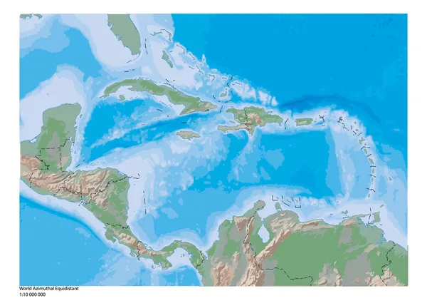
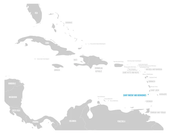
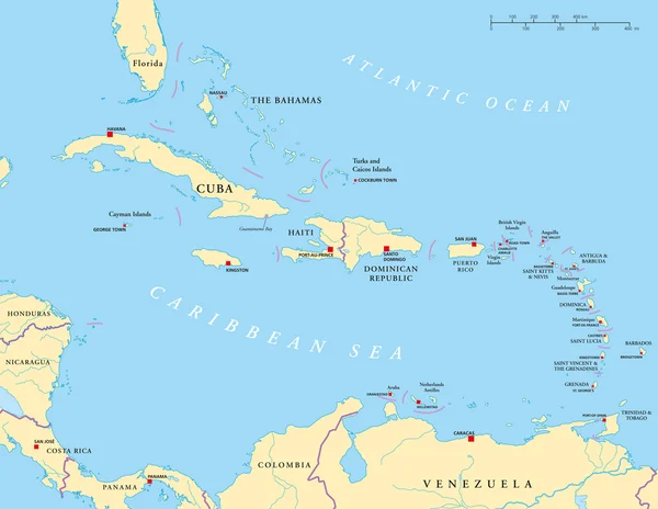
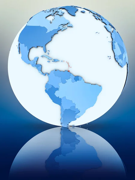
Saint Vincent And Grenadines Blue Marked In The Map Of Caribbean. Vector Illustration

Vector, 1.19MB, 6000 × 4500 eps
stock vector South America Global World in Space

South America Global World In Space

Vector, 1.45MB, 5343 × 5760 eps
stock vector Windward Islands political map. Islands of the Lesser Antilles, south of the Leeward Islands in the Caribbean Sea. From Dominica, Martinique, Saint Lucia, Saint Vincent and the Grenadines, to Grenada.

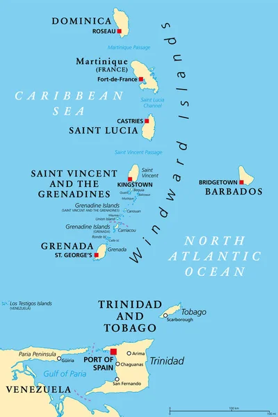
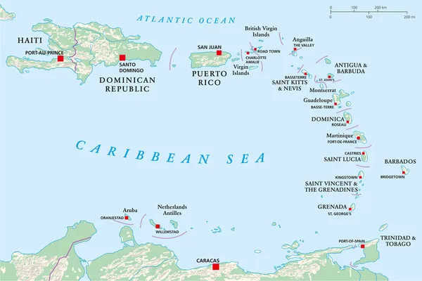
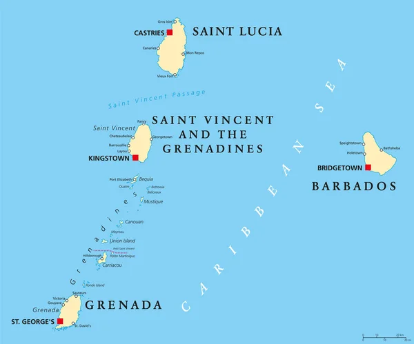
Windward Islands Political Map. Islands Of The Lesser Antilles, South Of The Leeward Islands In The Caribbean Sea. From Dominica, Martinique, Saint Lucia, Saint Vincent And The Grenadines, To Grenada.

Vector, 2.87MB, 6000 × 9000 eps
stock vector AMERICA Countries Part  Five

AMERICA Countries Part Five

Vector, 2.67MB, 5512 × 5512 eps
stock vector North and South America Global World

North And South America Global World

Vector, 1.95MB, 5340 × 5757 eps
stock image Caribbean on 3D model of Earth with country borders and water in oceans. 3D illustration isolated on white background.

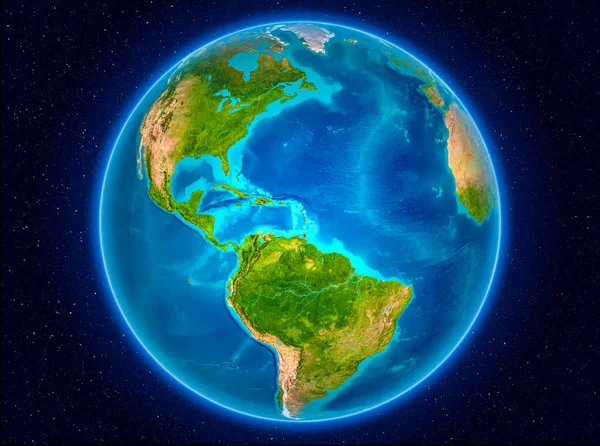
Caribbean On 3D Model Of Earth With Country Borders And Water In Oceans. 3D Illustration Isolated On White Background.

Image, 13.73MB, 5000 × 3750 jpg
stock vector South America Global World

South America Global World

Vector, 5.46MB, 5410 × 5687 eps
stock vector Pinned countries flags on map of Caribbean

Pinned Countries Flags On Map Of Caribbean

Vector, 0.5MB, 5000 × 3477 ai
stock vector Flag of Saint Vincent and the Grenadines cropped inside it's map

Flag Of Saint Vincent And The Grenadines Cropped Inside It's Map

Vector, 0.4MB, 3085 × 7500 eps
stock vector South America Global World

South America Global World

Vector, 1.01MB, 5340 × 5757 eps
stock vector Barbados, Grenada, Saint Lucia and Saint Vincent political map

Barbados, Grenada, Saint Lucia And Saint Vincent Political Map

Vector, 3.53MB, 8777 × 7301 eps
stock image Caribbean on digital planet Earth with international network representing communication, travel and connections. 3D illustration. Elements of this image furnished by NASA.

Caribbean On Digital Planet Earth With International Network Representing Communication, Travel And Connections. 3D Illustration. Elements Of This Image Furnished By NASA.

Image, 15.57MB, 5000 × 3750 jpg
stock vector Caribbean - Large And Lesser Antilles - Political Map

Caribbean - Large And Lesser Antilles - Political Map

Vector, 3.35MB, 9287 × 7191 eps
stock image Caribbean on planet Earth in space

Caribbean On Planet Earth In Space

Image, 12.19MB, 5000 × 3722 jpg
stock vector AMERICA Countries - Part Six

AMERICA Countries - Part Six

Vector, 4.25MB, 5512 × 5512 eps
stock image Caribbean on blue globe on reflective surface. 3D illustration.

Caribbean On Blue Globe On Reflective Surface. 3D Illustration.

Image, 4.62MB, 3750 × 5000 jpg
stock vector Saint Vincent and the Grenadines Political Map

Saint Vincent And The Grenadines Political Map

Vector, 0.95MB, 6000 × 8254 eps
stock vector Vector map Saint Vincent and the Grenadines. Isolated vector Illustration. Black on White background. EPS 10 Illustration.

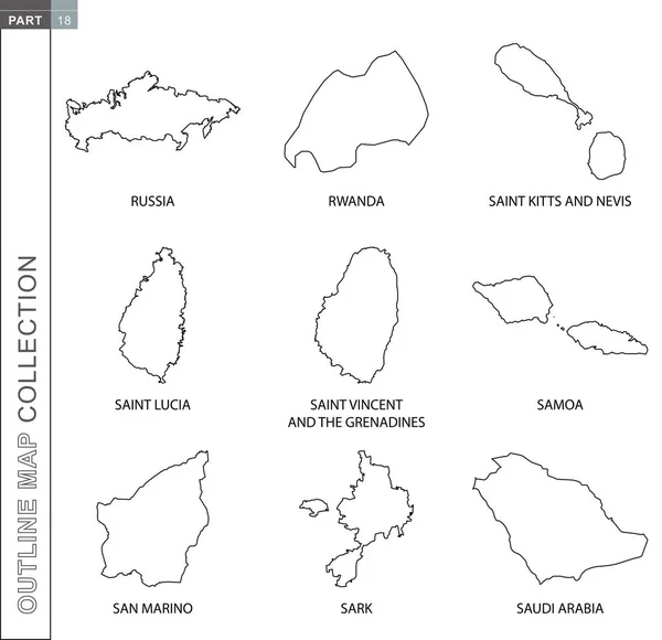
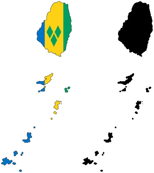
Vector Map Saint Vincent And The Grenadines. Isolated Vector Illustration. Black On White Background. EPS 10 Illustration.

Vector, 0.6MB, 5000 × 5000 eps
stock vector Bequia map Island silhouette icon Isolated Bequia black map outline Vector illustration

Bequia Map Island Silhouette Icon Isolated Bequia Black Map Outline Vector Illustration

Vector, 0.2MB, 8333 × 8333 eps
stock vector Saint Vincent and the Grenadines infographics, statistical data,

Saint Vincent And The Grenadines Infographics, Statistical Data,

Vector, 1.1MB, 4500 × 4500 eps
stock vector Saint Vincent and the Grenadines - vector map

Saint Vincent And The Grenadines - Vector Map

Vector, 0.19MB, 3258 × 3533 eps
stock image Caribbean from space on planet Earth with blue digital network representing international communication, technology and travel. 3D illustration. Elements of this image furnished by NASA.

Caribbean From Space On Planet Earth With Blue Digital Network Representing International Communication, Technology And Travel. 3D Illustration. Elements Of This Image Furnished By NASA.

Image, 11.63MB, 5000 × 3750 jpg
stock vector American countries set, maps and flags

American Countries Set, Maps And Flags

Vector, 2.03MB, 5000 × 3966 eps
stock vector Saint Vincent and Grenadines national flag. Vector illustration.

Saint Vincent And Grenadines National Flag. Vector Illustration.

Vector, 0.54MB, 6000 × 4000 eps
stock image Caribbean on Earth

Caribbean On Earth

Image, 10.97MB, 5000 × 3722 jpg
stock image World flag map stylized sketches 27

World Flag Map Stylized Sketches 27

Image, 2.17MB, 4000 × 6000 jpg
stock image Caribbean from space on model of blue digital planet Earth. Concept of blue digital technology, connectivity and travel. 3D illustration. Elements of this image furnished by NASA.

Caribbean From Space On Model Of Blue Digital Planet Earth. Concept Of Blue Digital Technology, Connectivity And Travel. 3D Illustration. Elements Of This Image Furnished By NASA.

Image, 15.63MB, 5000 × 3750 jpg
Page 1 >> Next