
Stock image Southern Maryland Usa


Solomons, Maryland USA The Underside Of The Solomons Bridge At Dusk.
Image, 13.41MB, 6240 × 4160 jpg

Solomons, Maryland USA A Young Couple On A Pier Below The The Solomons Bridge At Night, Or Gov. Thomas Johnson Bridge
Image, 20.65MB, 6240 × 4160 jpg


Solomons Island, Maryland USA Boats At Sunrise In A Marina On The Patuxent River.
Image, 9.15MB, 5472 × 3648 jpg


Solomons, Maryland USA A Senior Man Sits On A Bench Outdoors Looking Out Over The Patuxent River In The Daytime.
Image, 10.85MB, 5472 × 3648 jpg

Solomons, Maryland USA A A Wooden Pier And Lighthouse On The Shore Of The Patuxent River At Daybreak.
Image, 17.6MB, 6240 × 4160 jpg
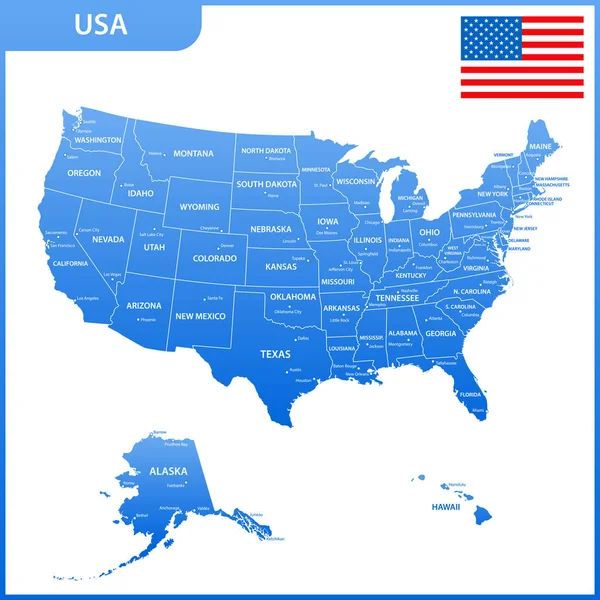
The Detailed Map Of The USA With Regions Or States And Cities, Capital. United States Of America With National Flag
Vector, 1.77MB, 5500 × 5500 eps
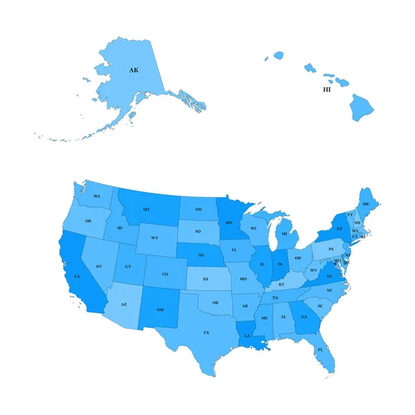
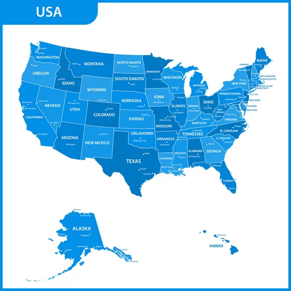
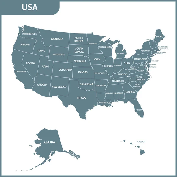
Detailed Map Of The United States, Including Alaska And Hawaii. United States With Each State Abbreviation
Vector, 1.64MB, 5000 × 5000 eps
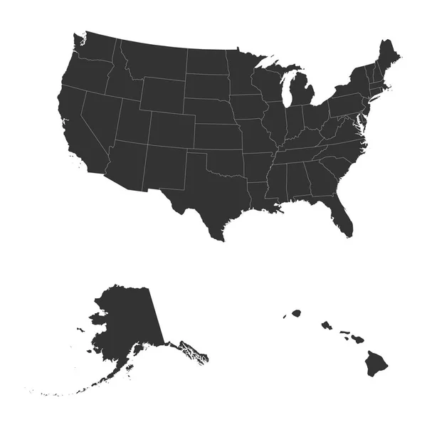
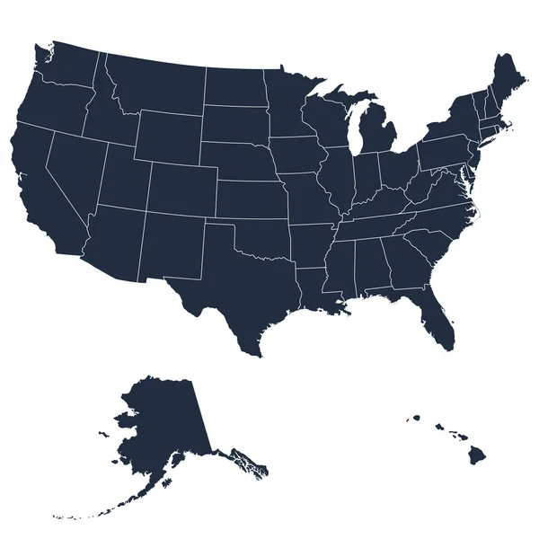
The Detailed Map Of The USA Including Alaska And Hawaii. The United States Of America
Vector, 0.68MB, 5000 × 5000 eps
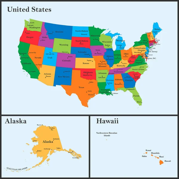
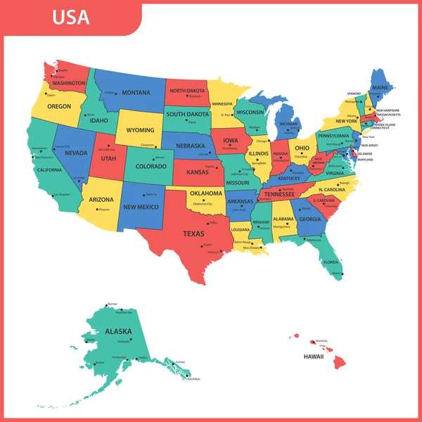
The Detailed Map Of The USA Including Alaska And Hawaii. The United States Of America With The Capitals And The Biggest Cities
Vector, 3.49MB, 5000 × 5000 eps
The Detailed Map Of The USA Including Alaska And Hawaii. The United States Of America
Vector, 0.92MB, 5000 × 5000 eps
The Detailed Map Of The USA With Regions Or States And Cities, Capital. United States Of America
Vector, 1.69MB, 5500 × 5500 eps
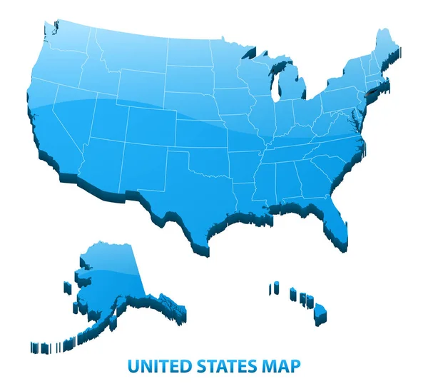
Highly Detailed Three Dimensional Map Of USA With Regions Border. United States Of America.
Vector, 4.83MB, 5500 × 5000 eps
The Detailed Map Of The USA With Regions Or States And Cities, Capital. United States Of America
Vector, 1.69MB, 5500 × 5500 eps


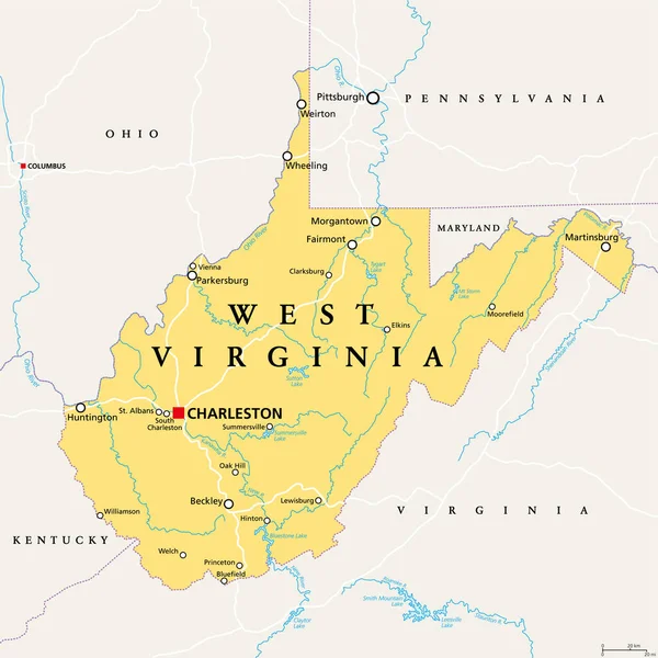
West Virginia, WV, Political Map. State In The Appalachian Region Of Southern United States Of America. Part Of Mid-Atlantic Southeast Region. Capital Charleston. Mountain State. Illustration. Vector.
Vector, 3.98MB, 6000 × 6000 eps


Solomons, Maryland, USA, The Solomons Isalnd Bridge Over The Patuxent River.
Image, 4.56MB, 5182 × 3455 jpg


South, Census Region Of The United States Of America, Gray Political Map Of Census Region 3, Consisting Of 13 Single States And The District Of Columbia. Map With Geographical Borders And Capitals.
Vector, 2.45MB, 8955 × 6000 eps

South Atlantic States, Multi Colored Political Map. United States Census Division Of The South Region. Delaware, Florida, Georgia, Maryland, North And South Carolina, Virginia, DC, And West Virginia.
Vector, 0.85MB, 6000 × 7818 eps

South, U.S. Census Region, Colored Political Map. Census Region 3 Of United States, Consisting Of 16 Single States And District Of Columbia. Colored Silhouettes Of States With Borders And Capitals.
Vector, 2.46MB, 8955 × 6000 eps
Page 1 >> Next