
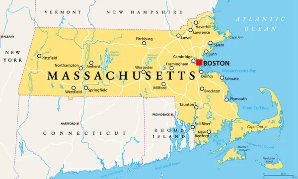
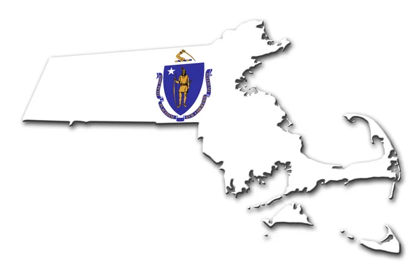
Stock image The Bay State

Massachusetts, Gray Political Map, With Capital Boston. Commonwealth Of Massachusetts, MA. Most Populous State In The New England Region Of United States. The Bay State. English. Illustration. Vector.
Vector, 2.72MB, 9000 × 5358 eps


Half Moon Bay State Beach In California. USA. Empty Beach, Pacific Ocean Waves And Blue Sky In Background
Image, 19.4MB, 7936 × 5291 jpg
Massachusetts, Political Map With Capital Boston. Commonwealth Of Massachusetts, MA. Most Populous State In The New England Region Of The United States. The Bay State. English. Illustration. Vector.
Vector, 4.72MB, 9000 × 5401 eps


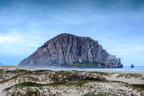
Morro Rock With Sandy Dunes Of Morro Creek Beach. Morro Bay, San Luis Obispo County, California, USA.
Image, 16.14MB, 6720 × 4480 jpg


Emerald Bay View With Fannette Island In South Lake Tahoe California In The Sierra Nevada Mountains. Sunshine In The Summer, Boats On The Water
Image, 19.27MB, 6000 × 4000 jpg
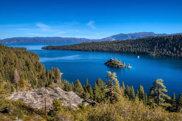
Stunning Panoramic View Of Emerald Bay And Fannette Island From A Scenic Overlook At Emerald Bay State Park, South Lake Tahoe, California
Image, 21.81MB, 6240 × 4160 jpg
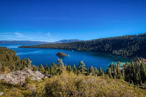
Stunning Panoramic View Of Emerald Bay And Fannette Island From A Scenic Overlook At Emerald Bay State Park, South Lake Tahoe, California
Image, 24.56MB, 6240 × 4160 jpg


Massachusetts Counties, Gray Political Map. Commonwealth Of Massachusetts, State In The New England Region Of Northeastern United States, Subdivided Into 14 Counties. With Boundaries And County Names.
Vector, 2.12MB, 9000 × 5555 eps

Close-up Of Massachusetts State Flag Waving In The Wind On A Clear Day. 3d Illustration Render. Rippled Fabric. Selective Focus
Image, 5.78MB, 4096 × 2160 jpg

Massachusetts, U.S. State, Multi Colored Political Map With Borders, County Names And Capital Boston. State In The New England Region Of The Northeastern United States, Subdivided Into 14 Counties.
Vector, 2.14MB, 9000 × 5580 eps

Massachusetts Counties, Political Map. Commonwealth Of Massachusetts, A State In The New England Region Of Northeastern United States, Subdivided Into 14 Counties. With Boundaries And County Names.
Vector, 3.69MB, 9000 × 5555 eps


South Shore Or Irish Riviera Of Massachusetts, Political Map With Municipalities. Geographic Region Stretching From Boston Toward Cape Cod Along The Shores Of Massachusetts Bay And Cape Cod Bay.
Vector, 1.81MB, 8893 × 6000 eps


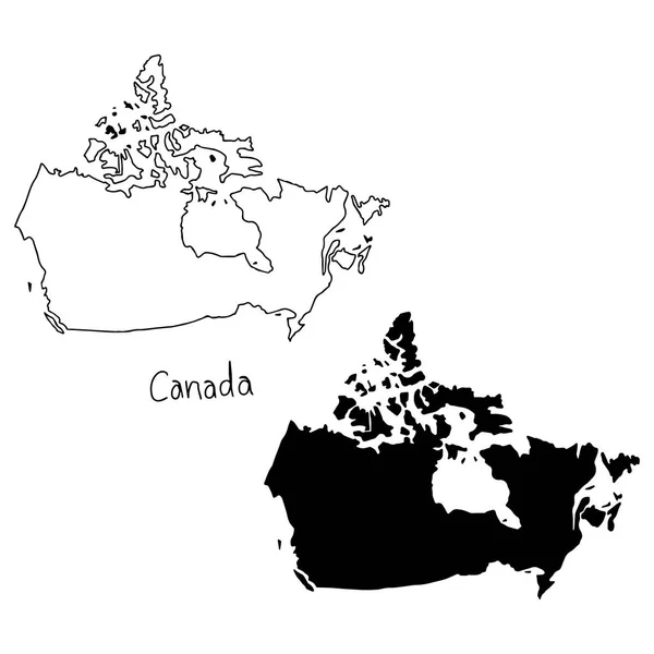
Outline And Silhouette Map Of Canada - Vector Illustration Hand Drawn With Black Lines, Isolated On White Background
Vector, 5.5MB, 5000 × 5000 eps
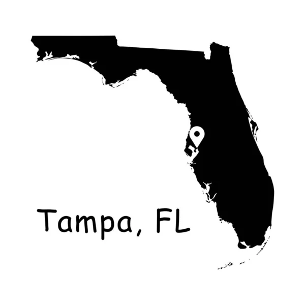
Tampa On Florida State Map. Detailed FL State Map With Location Pin On Tampa City. Black Silhouette Vector Map Isolated On White Background.
Vector, 5.6MB, 8334 × 8334 eps
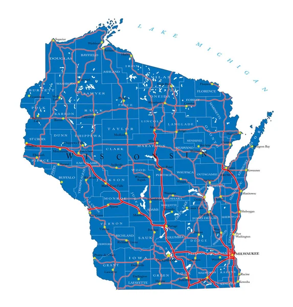
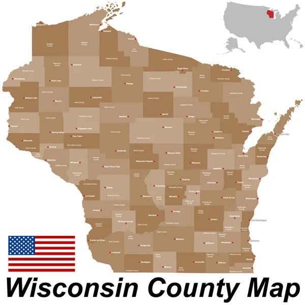
Detailed Map Of Wisconsin State,in Vector Format,with County Borders,roads And Major Cities
Vector, 3.68MB, 4778 × 4998 eps


Vector Logo For New Zealand Country, Fridge Magnet With New Zealandian State Flag, Original Brush Typeface For Words New Zealand And National Symbol Of NZ - Akaroa Lighthouse On Cloudy Sky Background.
Vector, 0.44MB, 5236 × 5236 eps
Vector Logo For Singapore Country, Fridge Magnet With State Flag, Original Brush Typeface For Word Singapore And National Symbol - Resort Hotel Marina Bay Sands On Blue Cloudy Sky Background.
Vector, 0.82MB, 5236 × 5236 eps

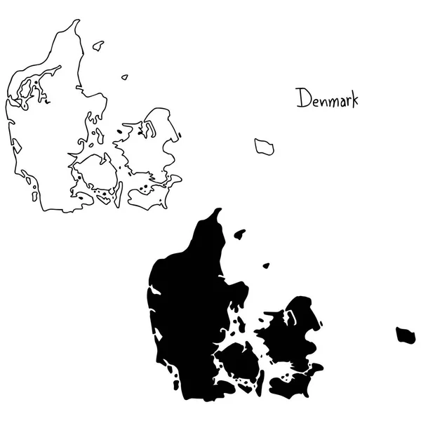
Outline And Silhouette Map Of Denmark - Vector Illustration Hand Drawn With Black Lines, Isolated On White Background
Vector, 5.16MB, 5000 × 5000 eps

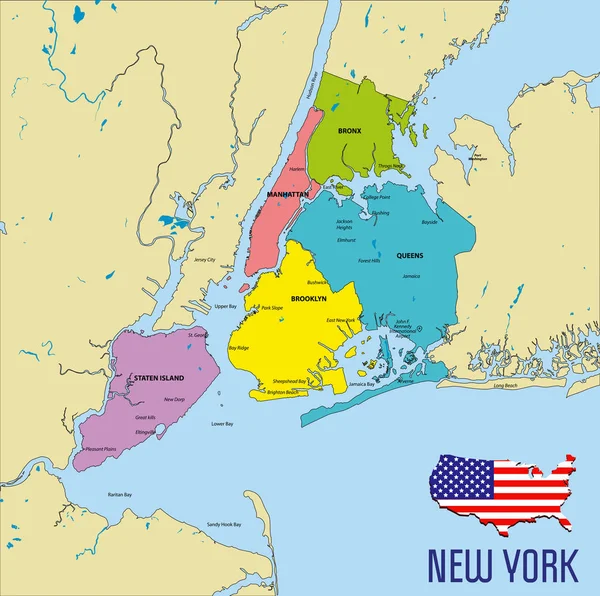
Vector Highly Detailed Political Map Of New York With All Regions, Roads And Rivers. All Elements Are Separated In Editable Layers Clearly Labeled.EPS 10
Vector, 8.47MB, 7000 × 6960 eps

Baldwin County, Alabama (Counties In Alabama, United States Of America,USA, U.S., US) Map Vector Illustration, Scribble Sketch Baldwin Map
Vector, 1.27MB, 7087 × 4726 eps
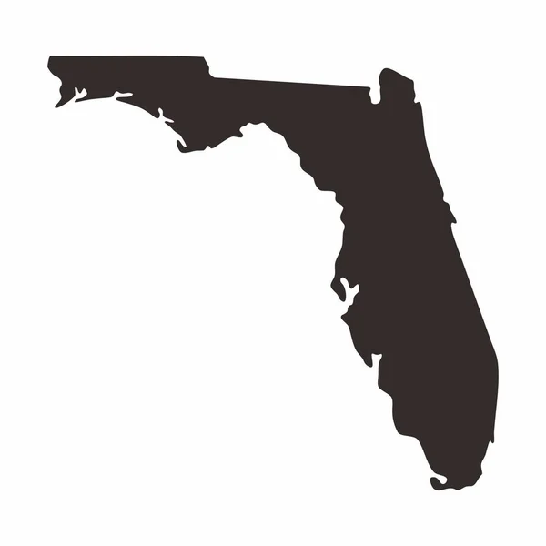
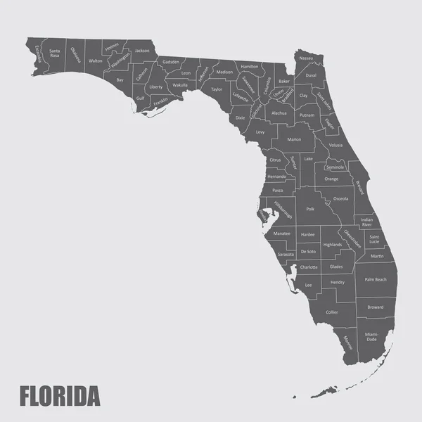
Florida Map. Simply And Flat Design. Silhouettes Blank Map On White Background.
Vector, 0.46MB, 2050 × 2050 eps

Welcome To Massachusetts Vintage Rusty Metal Sign Vector Illustration. Vector State Map In Grunge Style With Typography Hand Drawn Lettering
Vector, 3.2MB, 7000 × 3821 eps


Page 1 >> Next