
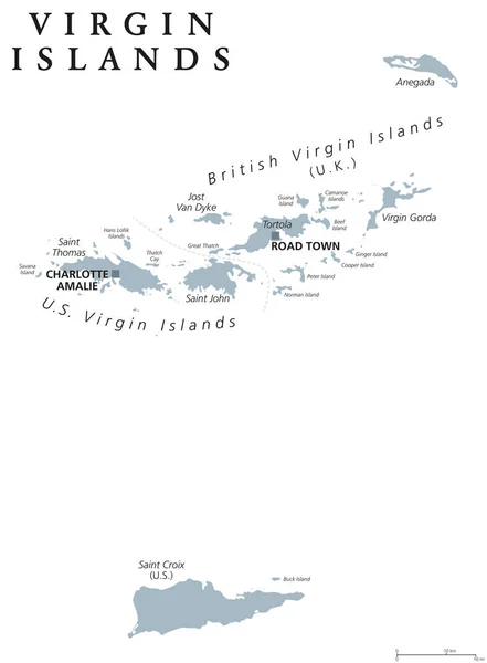
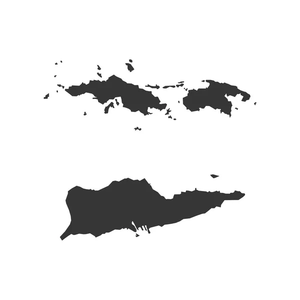
Stock image Virgin Islands Map page 2

Set Of Separated American States. Divided USA Map. All The Countries Are Named In The Layer Panel
Vector, 0.57MB, 6000 × 3200 eps

Outline United States Of America Map. US Background Template. Map Of America With Separated Countries And Interstate Borders. All States And Regions Are Named In The Layer Panel.
Vector, 1.14MB, 5000 × 3500 eps
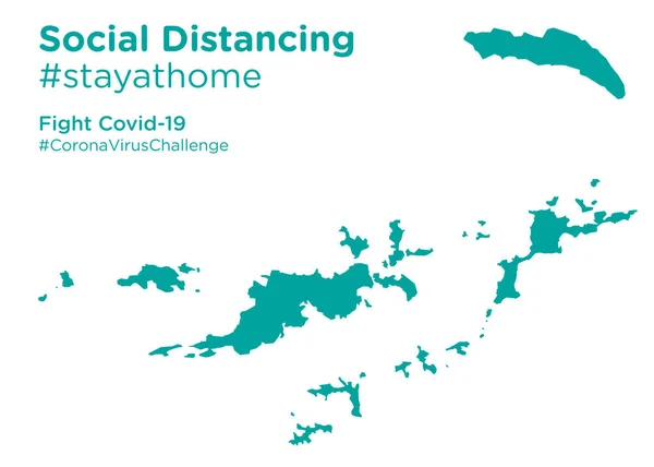
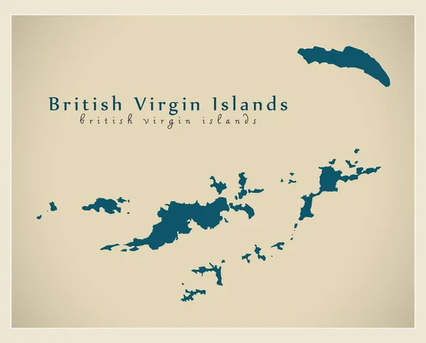
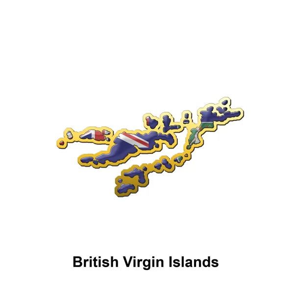
British Virgin Islands Map With Social Distancing #stayathome Tag.eps
Vector, 7.19MB, 8403 × 6000 eps
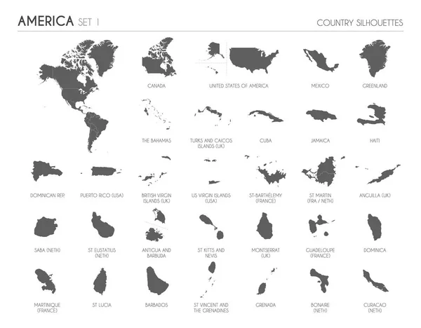
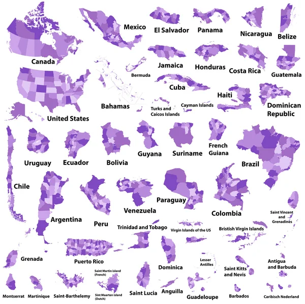
Set Of 30 High Detailed Silhouette Maps Of American Countries And Territories, And Map Of America Vector Illustration.
Vector, 21.56MB, 6000 × 4685 eps
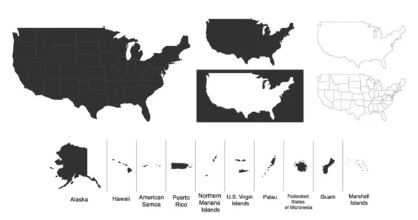
Map Of The United States Of America USA With Territories And Islands. Different Map Variations For Your Design. Stock Vector Illustration Isolated On White Background
Vector, 0.65MB, 6000 × 3164 eps
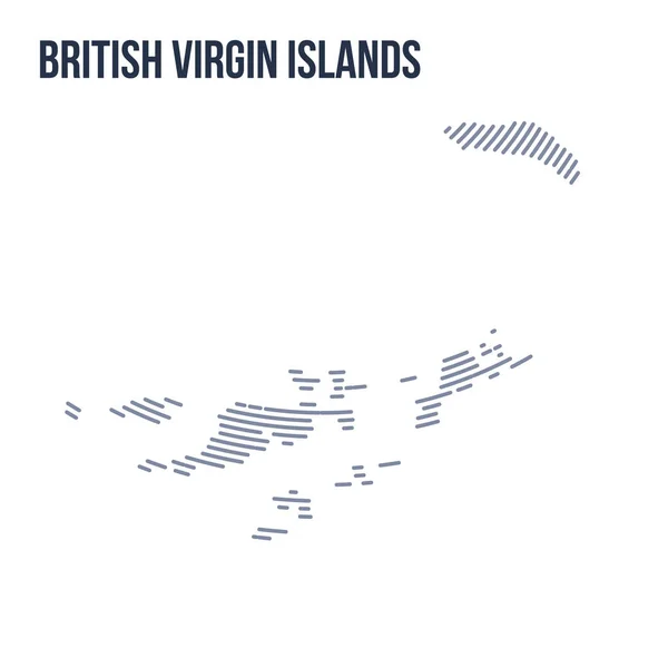
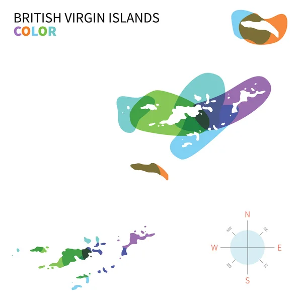
Vector Abstract Hatched Map Of British Virgin Islands With Curve Lines Isolated On A White Background.
Vector, 0.28MB, 5000 × 5000 eps

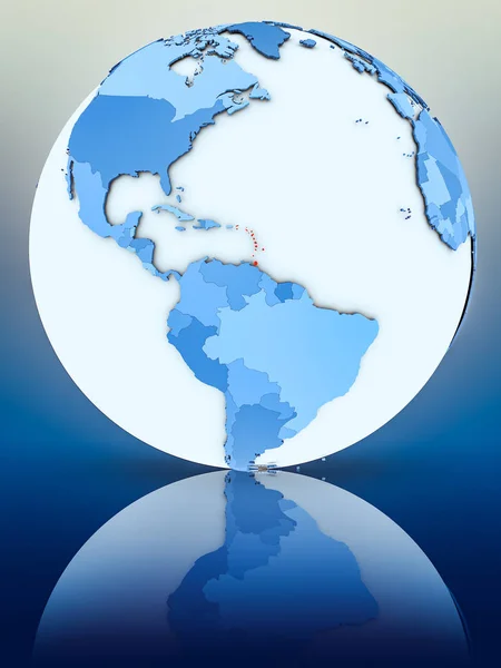
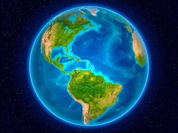
Caribbean On 3D Model Of Earth With Country Borders And Water In Oceans. 3D Illustration Isolated On White Background.
Image, 13.73MB, 5000 × 3750 jpg


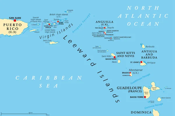
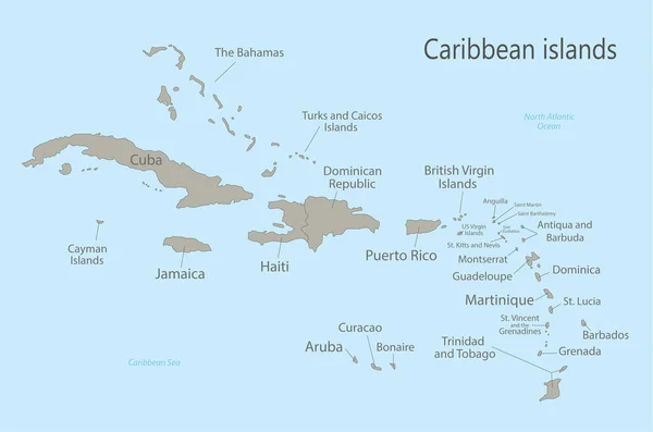
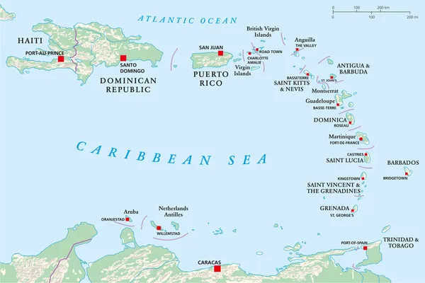
Leeward Islands, Political Map. Part Of The Lesser Antilles, North Of Windward Islands In The Caribbean. Virgin Islands, Anguilla, St Kitts And Nevis, Antigua And Barbuda, Montserrat, And Guadeloupe.
Vector, 3.54MB, 9000 × 6000 eps
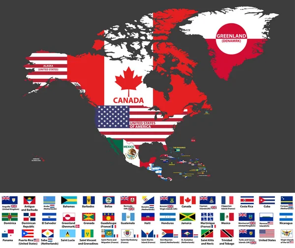
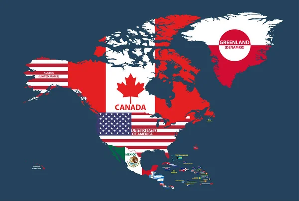
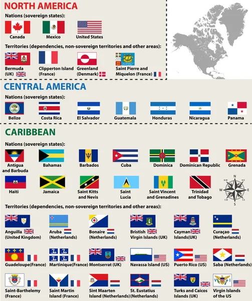
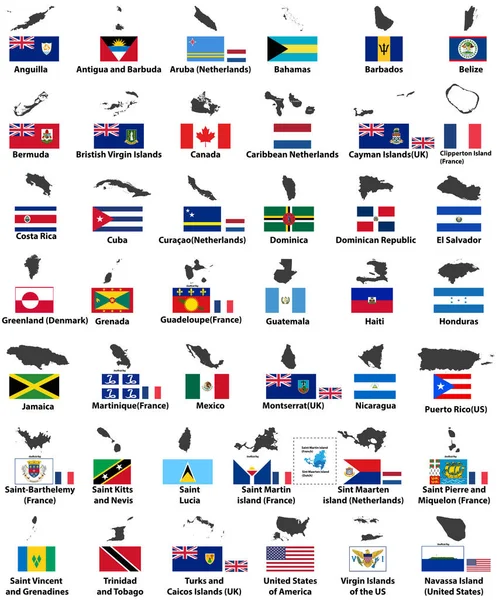
Vector Illustration Of North America Map (include Northern America, Central America And Caribbean Regions) With Country Names And Flags Of Countries.
Vector, 13.27MB, 8334 × 7009 eps

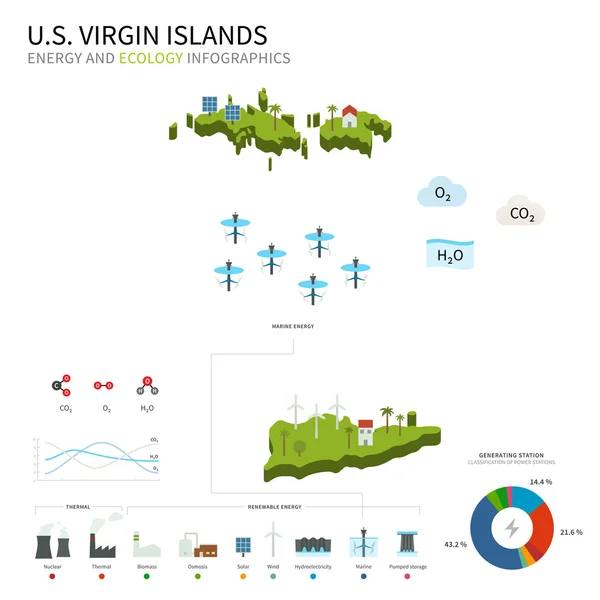
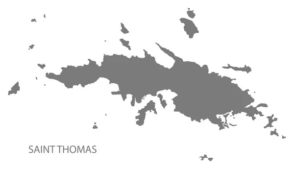
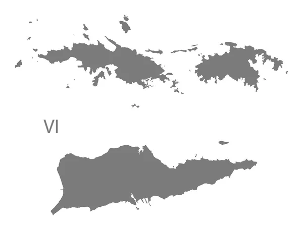
Virgin Islands Of The United States Of America (United States Of America, USA, US) Map Vector Illustration, Scribble Sketch United States Virgin Islands (Saint Thomas, Saint John, Saint Croix) Map
Vector, 1.02MB, 7087 × 4726 eps
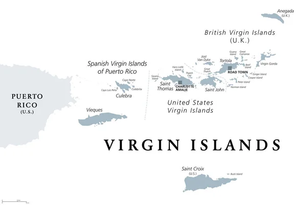
British, Spanish And United States Virgin Islands, Gray Political Map. Archipelago In The Caribbean Sea. British Overseas Territory And Unincorporated Territories Of The USA. Illustration. Vector.
Vector, 2.26MB, 9000 × 6000 eps

Caribbean On Digital Planet Earth With International Network Representing Communication, Travel And Connections. 3D Illustration. Elements Of This Image Furnished By NASA.
Image, 15.57MB, 5000 × 3750 jpg
Vector Illustration Of North America Map (include Northern America, Central America And Caribbean Regions) With Country Names And Flags Of Countries.
Vector, 13.59MB, 8334 × 5618 eps


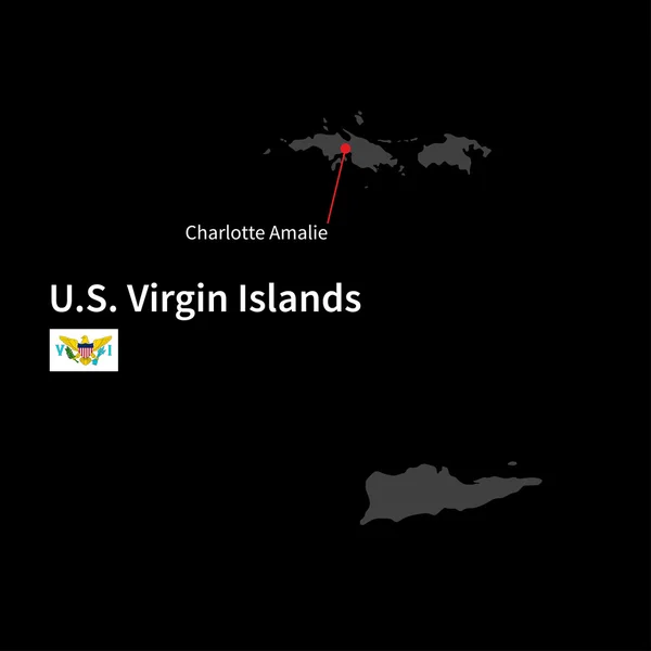
Detailed Map Of U.S. Virgin Islands And Capital City Charlotte Amalie With Flag On Black Background
Vector, 3.44MB, 5867 × 5867 eps
Vector Isolated Flags Of North America(include Central America And Caribbean Countries)
Vector, 14.36MB, 8348 × 9936 eps
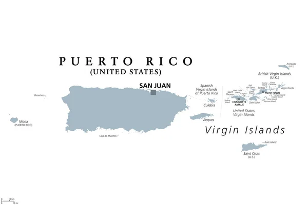
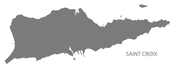
Puerto Rico And Virgin Islands, Gray Political Map. British, Spanish And U.S. Virgin Islands. British Overseas Territory And Unincorporated Territories Of The USA. Illustration Over White. Vector.
Vector, 2.28MB, 9000 × 6000 eps

Vector Illustration Of North America Map (include Northern America, Central America And Caribbean Regions) With Country Names And Flags Of Countries.
Vector, 12.4MB, 8334 × 7596 eps

Caribbean From Space On Planet Earth With Blue Digital Network Representing International Communication, Technology And Travel. 3D Illustration. Elements Of This Image Furnished By NASA.
Image, 11.63MB, 5000 × 3750 jpg

Saint John District, United States Virgin Islands (U.S. County, United States Of America, USA, U.S., US) Map Vector Illustration, Scribble Sketch St. John Island Map
Vector, 0.89MB, 7087 × 4726 eps

QR Code Set The Color Of Virgin Islands Flag. The Coat Of Arms Of The United States Between The Letters V And I With Text US Virgin Islands.
Vector, 5.24MB, 8165 × 8191 eps


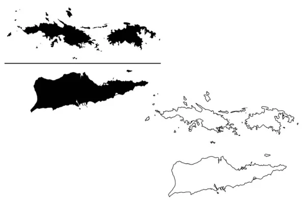
Virgin Islands Of The United States Of America (United States Of America, USA, US) Map Vector Illustration, Scribble Sketch United States Virgin Islands (Saint Thomas, Saint John, Saint Croix) Map
Vector, 1.58MB, 7087 × 4726 eps

Caribbean From Space On Model Of Blue Digital Planet Earth. Concept Of Blue Digital Technology, Connectivity And Travel. 3D Illustration. Elements Of This Image Furnished By NASA.
Image, 15.63MB, 5000 × 3750 jpg


Stamp Postal Of Necker Island. Map Silhouette Rubber Seal. Design Retro Travel. Seal Of Map Necker Island Grunge For Your Design. British Virgin Islands. EPS10
Vector, 3.97MB, 5000 × 5000 eps

Virgin Islands Flag Painted With Grunge Brush Stroke, Watercolor Flag Style.
Vector, 2.48MB, 5000 × 3500 eps
Previous << Page 2 >> Next