Home
Images
Vectors
Videos
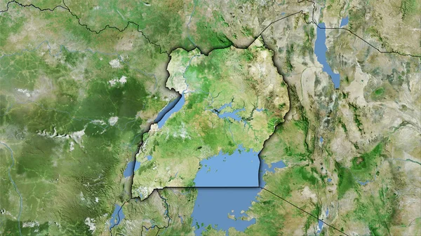
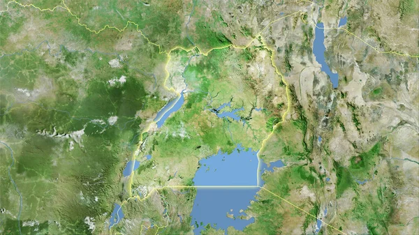
Stock image Uganda area on the satellite D map in the stereographic projection - raw composition of raster layers
Published:
Sep.16, 2020 07:02:36
Author:
Yarr65
Views:
3
Downloads:
0
File type:
image
/
jpg
File size:
7.23 MB
Orginal size:
2880
x
1620
px
Available sizes:
S
(500 x 281)
M
(1000 x 563)
L
(2000 x 1125)
XL
(2880 x 1620)
EL0
(2880 x 1620)
Level:
bronze
Download Image
Image topics:
Isolated
Shape
Nature
Texture
Sea
Border
Global
Earth
Planet
World
Science
Capital
Elevation
Outline
Country
Map
Geography
Area
Africa
Land
Political
Projection
Satellite
Shoreline
Territory
Atlas
Graticule
Uganda
Kampala
Bumped
Cartographic
Stereographic
Bathymetry
Raw Data
Similar stock images
Uganda Area On The Satellite D Map In The Stereographic Projection - Raw Composition Of Raster Layers With Light Glowing Outline
2880 × 1620
Dodoma, Region Of Tanzania. Satellite Imagery. Shape Outlined Against Its Country Area. 3D Rendering
2880 × 1620
Uganda Area On The Satellite A Map In The Stereographic Projection - Raw Composition Of Raster Layers With Light Glowing Outline
2880 × 1620
Uganda Area On The Satellite C Map In The Stereographic Projection - Raw Composition Of Raster Layers With Dark Glowing Outline
2880 × 1620
Ben Arous , Governorate Of Tunisia. Satellite Imagery. Shape Outlined Against Its Country Area. 3D Rendering
2880 × 1620
Uganda Area On The Satellite D Map In The Stereographic Projection - Raw Composition Of Raster Layers With Dark Glowing Outline
2880 × 1620
Rwanda Area On The Satellite A Map In The Stereographic Projection - Raw Composition Of Raster Layers With Light Glowing Outline
2880 × 1620
Central African Republic Area On The Satellite A Map In The Stereographic Projection - Raw Composition Of Raster Layers
2880 × 1620