Home
Images
Vectors
Videos
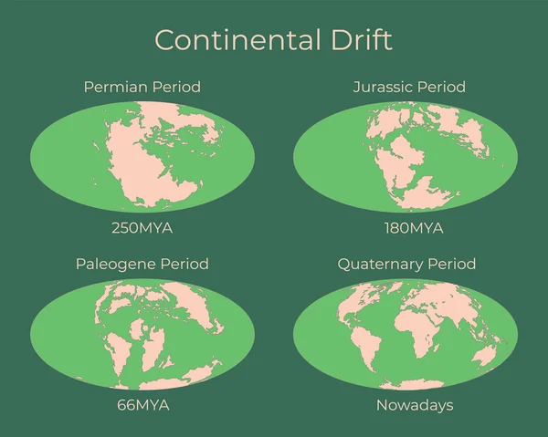
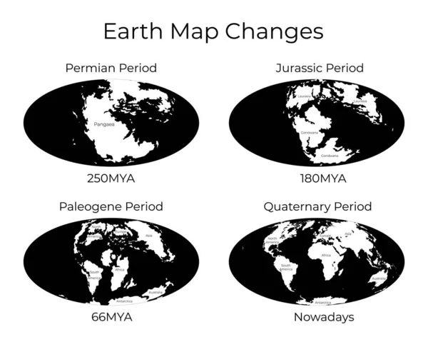
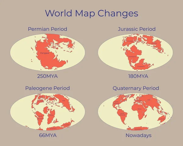
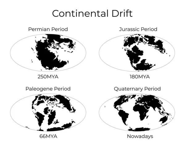
Stock vector Monochrome vector illustration silhouettes of Worldmap at Permian, Jurassic, Paleogen and Quartenary periods isolated on background. Continental drift and changes of Earth map.
Published:
Jan.29, 2020 07:39:36
Author:
tinki.v
Views:
293
Downloads:
6
File type:
vector
/
eps
File size:
3.6 MB
Orginal size:
6250
x
5000
px
Available sizes:
S
(500 x 400)
M
(1000 x 800)
L
(2000 x 1600)
XL
(6250 x 5000)
VECT
(6250 x 5000)
EL0
(6250 x 5000)
Level:
beginner
Download Vector
Vector topics:
Vector
Background
Graphic
Illustration
Design
Set
Isolated
Present
Art
Plate
Silhouette
Style
Concept
Flat
Monochrome
Education
Earth
Planet
World
Science
Ancient
Print
Study
Map
Crust
History
Continent
Geology
Move
Changes
Continental
Poster
Plane
Projection
Mainland
Period
Prehistoric
Jurassic
Drift
Permian
Quaternary
Tectonic
Laurasia
Nowadays
Paleogene
Gondwana
Mya
Pangaea
Pangea
Continental Drift
Similar stock vectors
Continental Drift And Changes Of Earth Map. Colorful Vector Illustration Of Worldmap At Permian, Jurassic, Paleogen And Quartenary Periods Isolated On Background.
6250 × 5000
Monochrome Vector Illustration Of Worldmap With Names Of Continents Isolated On Background. Map Of The World And Changes In Different Geological Periods. 250mya, 180mya, 66mya And Nowadays Projections
6250 × 5000
Map Of The World And Changes In Different Geological Periods. Colorful Vector Illustration Of Worldmap With Names Of Continents Isolated On Background. 250mya, 180mya, 66mya And Nowadays Projections.
6250 × 5000
World Map In The Hufnagel Projection Centered On 170 West Longitude. Grayscale Elevation Map - Composite Of Raster With Graticule And Tectonic Plates Borders. 3D Illustration
4000 × 2000
Ice Sheet And Polar Desert Biome. Terrestrial Ecosystem World Map. Arctic Animals, Birds, Fish And Plants Infographic Design. Vector Illustration
4724 × 4500
World Map In The Apian Projection Centered On 90 East Longitude. Grayscale Elevation Map - Raw Composite Of Raster With Graticule. 3D Illustration
4000 × 2000
World Map In The Apian Projection Centered On 11 East Longitude. Topographic Relief Map - Composite Of Raster With Graticule And Tectonic Plates Borders. 3D Illustration
4000 × 2000
World Map In The Mcbryde-Thomas Projection Centered On 170 West Longitude. Grayscale Elevation Map - Composite Of Raster With Graticule And Tectonic Plates Borders. 3D Illustration
4000 × 2000