Home
Images
Vectors
Videos
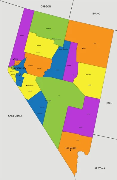
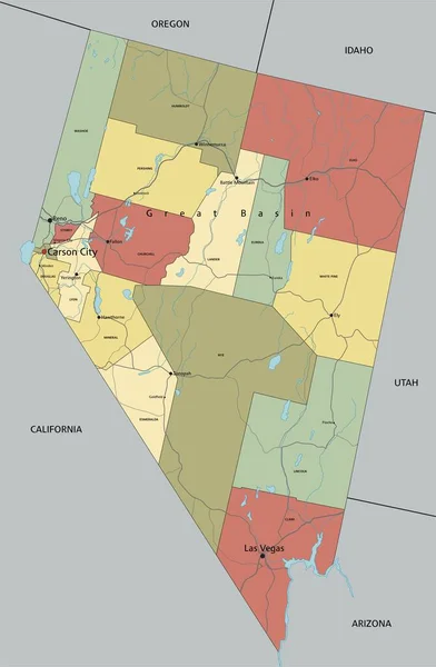
Stock vector Nevada, U.S. state, multi colored political map with borders and county names. State in the Western region of the USA, subdivided into 16 counties and the independent city and capital Carson City.
Published:
Aug.27, 2024 14:49:17
Author:
Furian
Views:
0
Downloads:
0
File type:
vector
/
eps
File size:
2.37 MB
Orginal size:
6000
x
8605
px
Available sizes:
S
(349 x 500)
M
(697 x 1000)
L
(1395 x 2000)
XL
(6000 x 8605)
VECT
(6000 x 8605)
EL0
(6000 x 8605)
Level:
silver
Download Vector
Vector topics:
Colors
Vector
Illustration
Isolated
Silhouette
Border
Structure
Usa
Capital
Country
Western
District
Map
Cartography
Geography
Land
Overview
Desert
State
Nevada
America
Boundary
Administrative
Division
Federal
Atlas
Americas
Nation
Subdivision
County
Mapping
Names
Sagebrush
NV
Counties
Landlocked
Infographic
Multi Colored
Travel Destination
United States
Subdivided
Political Map
Carson City
Clark County
Silver State
Swing State
Battle Born
Independent City
Similar stock vectors
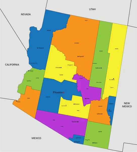
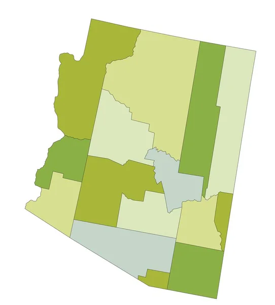
Colorful Arizona Political Map With Clearly Labeled, Separated Layers. Vector Illustration.
6299 × 6953
Mancio Lima Municipality (Acre State, Municipalities Of Brazil, Federative Republic Of Brazil) Map Vector Illustration, Scribble Sketch Mancio Lima Map
7087 × 4726
Colorful Nevada Political Map With Clearly Labeled, Separated Layers. Vector Illustration.
5445 × 8321
Highly Detailed Editable Political Map With Separated Layers. Arizona.
6293 × 6962
El Paso Texas City Map USA Labelled Black Illustration
5355 × 5000
Nevada - Highly Detailed Editable Political Map With Labeling.
5445 × 8322
Gray Vector Map Of The Islamic Republic Of Mauritania With White Borders Of Its Regions
4734 × 5207
Feliz Deserto Municipality (Alagoas State, Municipalities Of Brazil, Federative Republic Of Brazil) Map Vector Illustration, Scribble Sketch Feliz Deserto Map
7087 × 4726