photo free
Home Images Vectors Videos

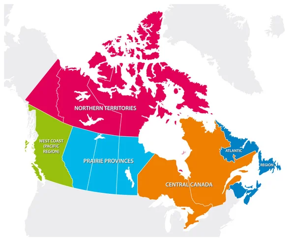
Stock image North West Territories

stock vector Political map of United Kingdom with regions and their capitals

Political Map Of United Kingdom With Regions And Their Capitals

Vector, 2.43MB, 6000 × 5729 eps
stock vector Political map of England with regions and their capitals

Political Map Of England With Regions And Their Capitals

Vector, 2.43MB, 5500 × 5438 eps
stock vector Political map of England with regions and their capitals

Political Map Of England With Regions And Their Capitals

Vector, 2.43MB, 5500 × 6050 eps
stock vector Political map of United Kingdom with regions and their capitals

Political Map Of United Kingdom With Regions And Their Capitals

Vector, 2.5MB, 6000 × 6405 eps
stock vector Political map of United Kingdom with regions and their capitals

Political Map Of United Kingdom With Regions And Their Capitals

Vector, 1.02MB, 6000 × 6000 eps
stock image Mountain Scene In The Arctic

Mountain Scene In The Arctic

Image, 3.79MB, 5640 × 3728 jpg
stock image Thick Ice

Thick Ice

Image, 4.37MB, 3872 × 2592 jpg
stock vector Blue-green detailed map of Dominican Republic administrative divisions with country flag and location on the globe. Vector illustration

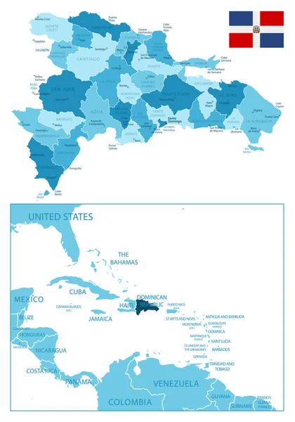
Blue-green Detailed Map Of Dominican Republic Administrative Divisions With Country Flag And Location On The Globe. Vector Illustration

Vector, 29.01MB, 7405 × 5218 eps
stock image Church With Steeple

Church With Steeple

Image, 4.68MB, 5610 × 3740 jpg
stock vector Medieval world map. Old paper with painted continents and meridians with wind rose antique geography.

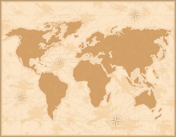
Medieval World Map. Old Paper With Painted Continents And Meridians With Wind Rose Antique Geography.

Vector, 43.23MB, 4574 × 3554 eps
stock vector Dominican Republic administrative blue-green map with country flag and location on a globe. Vector illustration

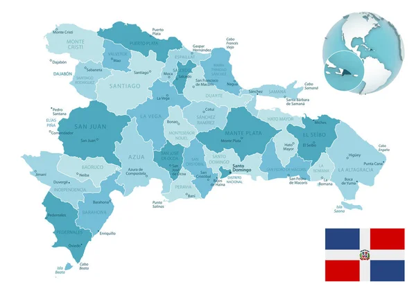
Dominican Republic Administrative Blue-green Map With Country Flag And Location On A Globe. Vector Illustration

Vector, 13.25MB, 7405 × 5218 eps
stock vector Dominican Republic - highly detailed blue map. Vector illustration

Dominican Republic - Highly Detailed Blue Map. Vector Illustration

Vector, 1.76MB, 5251 × 7488 eps
stock image 3d Render of Canada Highlighting Northwest Territories

3d Render Of Canada Highlighting Northwest Territories

Image, 2.37MB, 5565 × 4300 jpg
stock vector Outline map of the five Canadian regions

Outline Map Of The Five Canadian Regions

Vector, 1.17MB, 3793 × 3100 eps
stock image Arctic Shoreline

Arctic Shoreline

Image, 5.12MB, 5715 × 3810 jpg
stock image Cape May Warbler

Cape May Warbler

Image, 2.21MB, 2000 × 3000 jpg
stock vector Barbados - detailed map of the country in brown colors, divided into regions. Vector illustration

Barbados - Detailed Map Of The Country In Brown Colors, Divided Into Regions. Vector Illustration

Vector, 0.67MB, 5293 × 6351 eps
stock vector Barbados - detailed country map with cities and regions. Infographic icons. Vector illustration

Barbados - Detailed Country Map With Cities And Regions. Infographic Icons. Vector Illustration

Vector, 0.7MB, 6965 × 8710 eps
stock image USA - United States of America acronym text stamp, concept background

USA - United States Of America Acronym Text Stamp, Concept Background

Image, 3.24MB, 5760 × 3840 jpg
stock vector Cuba - detailed map of the country in brown colors, divided into regions. Vector illustration

Cuba - Detailed Map Of The Country In Brown Colors, Divided Into Regions. Vector Illustration

Vector, 1.4MB, 7047 × 4850 eps
stock image Flag of the United States of America

Flag Of The United States Of America

Image, 12.08MB, 4706 × 2945 jpg
stock image Cape May Warbler

Cape May Warbler

Image, 1.96MB, 3000 × 2000 jpg
stock vector Haiti - detailed map of the country in brown colors, divided into regions. Vector illustration

Haiti - Detailed Map Of The Country In Brown Colors, Divided Into Regions. Vector Illustration

Vector, 1.24MB, 7010 × 4840 eps
stock vector Barbados - detailed blue country map with cities and regions. Vector illustration.

Barbados - Detailed Blue Country Map With Cities And Regions. Vector Illustration.

Vector, 0.63MB, 6965 × 8248 eps
Page 1 >> Next