photo free
Home Images Vectors Videos

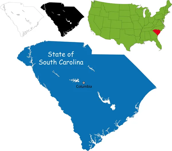
Stock image South Carolina Administrative

stock vector South carolina map

South Carolina Map

Vector, 4.96MB, 5302 × 4654 eps
stock vector South Carolina counties emblem map

South Carolina Counties Emblem Map

Vector, 2.36MB, 4044 × 4050 eps
stock vector South Carolina state outline administrative and political map in black and white

South Carolina State Outline Administrative And Political Map In Black And White

Vector, 0.93MB, 3685 × 3100 eps
stock vector Map of the United States of America, with borders and abbreviati

Map Of The United States Of America, With Borders And Abbreviati

Vector, 25.75MB, 7296 × 4104 eps
stock vector South Carolina map with American national flag illustration

South Carolina Map With American National Flag Illustration

Vector, 5.73MB, 6187 × 5000 eps
stock image Map of South Carolina state, USA

Map Of South Carolina State, USA

Image, 2.81MB, 4651 × 3000 jpg
stock image Map of South Carolina state, USA

Map Of South Carolina State, USA

Image, 2.81MB, 4651 × 3000 jpg
stock vector Vector set 2 of 10 Highly detailed silhouettes of US state maps, divided into counties with names and territory nicknames

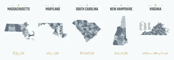
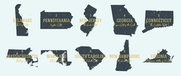
Vector Set 2 Of 10 Highly Detailed Silhouettes Of US State Maps, Divided Into Counties With Names And Territory Nicknames

Vector, 5.14MB, 9585 × 3348 eps
stock vector South Carolina map

South Carolina Map

Vector, 8.99MB, 7002 × 7002 eps
stock vector United States census bureau regions and divisions vector map. Flag of United States of America

United States Census Bureau Regions And Divisions Vector Map. Flag Of United States Of America

Vector, 6.79MB, 7292 × 3543 eps
stock vector administrative vector map of the US American State of Georgia

Administrative Vector Map Of The US American State Of Georgia

Vector, 2.55MB, 3100 × 3610 eps
stock vector Tennessee - North Carolina - Alabama - Georgia - South Carolina

Tennessee - North Carolina - Alabama - Georgia - South Carolina

Vector, 3.2MB, 8991 × 5000 eps
stock vector north carolina administrative and political vector map with flag

North Carolina Administrative And Political Vector Map With Flag

Vector, 1.95MB, 6724 × 3100 eps
stock vector Set 1 of 5 Highly detailed vector silhouettes of USA state maps

Set 1 Of 5 Highly Detailed Vector Silhouettes Of USA State Maps

Vector, 4.79MB, 8858 × 3738 eps
stock image architecture and buildings in union south carolina

Architecture And Buildings In Union South Carolina

Image, 10.94MB, 8000 × 4587 jpg
stock vector Pennsylvania - Maryland - Delaware - Virginia - North and South

Pennsylvania - Maryland - Delaware - Virginia - North And South

Vector, 3.31MB, 5000 × 6153 eps
stock image architecture and buildings in union south carolina

Architecture And Buildings In Union South Carolina

Image, 13.15MB, 5333 × 8000 jpg
stock vector Set 1 of 5 Division United States into counties, political and geographic subdivisions of a states, Highly detailed vector maps with names and territory nicknames

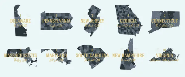
Set 1 Of 5 Division United States Into Counties, Political And Geographic Subdivisions Of A States, Highly Detailed Vector Maps With Names And Territory Nicknames

Vector, 5.93MB, 9585 × 4010 eps
stock image Glowing Map of South Carolina, modern blue outline map, on dark Background

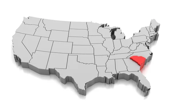
Glowing Map Of South Carolina, Modern Blue Outline Map, On Dark Background

Image, 3.71MB, 7500 × 5000 jpg
stock image Map of the State South Carolina (United States of America) showing the isolated territory with relief representation, water bodies like seas, rivers, lakes and with borders. No labels at all.

Map Of The State South Carolina (United States Of America) Showing The Isolated Territory With Relief Representation, Water Bodies Like Seas, Rivers, Lakes And With Borders. No Labels At All.

Image, 1.83MB, 6000 × 4784 jpg
stock image Symbol Map of the State South Carolina (United States of America) showing the outline of the state as an asphalt surface

Symbol Map Of The State South Carolina (United States Of America) Showing The Outline Of The State As An Asphalt Surface

Image, 16.46MB, 6000 × 4900 jpg
stock image Symbol Map of the State South Carolina (United States of America) showing the territory of the state as a lawn football field

Symbol Map Of The State South Carolina (United States Of America) Showing The Territory Of The State As A Lawn Football Field

Image, 15.1MB, 6000 × 4900 jpg
stock vector flag and silhouette of the American state of South Carolina vector illustration

Flag And Silhouette Of The American State Of South Carolina Vector Illustration

Vector, 5.09MB, 7572 × 6273 eps
stock image architecture and buildings in union south carolina

Architecture And Buildings In Union South Carolina

Image, 11.51MB, 8000 × 5333 jpg
stock image architecture and buildings in union south carolina

Architecture And Buildings In Union South Carolina

Image, 14.42MB, 8000 × 5333 jpg
stock vector South, census region of the United States of America, gray political map of census region 3, consisting of 13 single states and the District of Columbia. Map with geographical borders and capitals.

South, Census Region Of The United States Of America, Gray Political Map Of Census Region 3, Consisting Of 13 Single States And The District Of Columbia. Map With Geographical Borders And Capitals.

Vector, 2.45MB, 8955 × 6000 eps
stock vector North Carolina counties, gray political map with borders and county names. State in the Southeastern region of United States subdivided into 100 counties. Nicknamed Tar Heel State and Old North State.

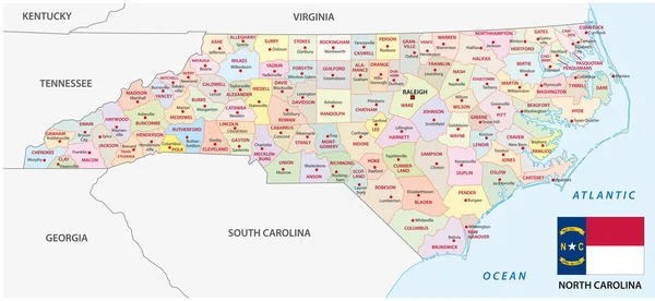
North Carolina Counties, Gray Political Map With Borders And County Names. State In The Southeastern Region Of United States Subdivided Into 100 Counties. Nicknamed Tar Heel State And Old North State.

Vector, 2.27MB, 9000 × 3935 eps
stock vector South Carolina counties, political map with borders and county names. State in the Southeastern region of the United States, subdivided into 46 counties. Nicknamed The Palmetto State. Illustration

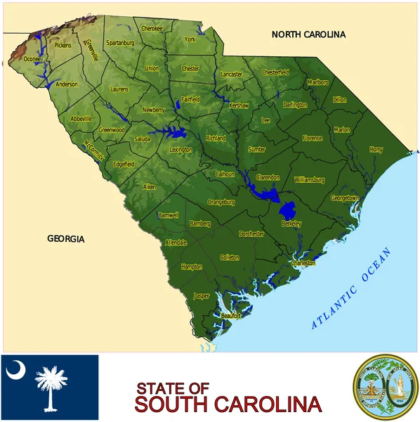
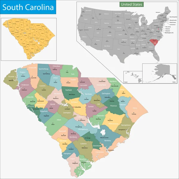
South Carolina Counties, Political Map With Borders And County Names. State In The Southeastern Region Of The United States, Subdivided Into 46 Counties. Nicknamed The Palmetto State. Illustration

Vector, 3.25MB, 7193 × 6000 eps
stock vector North Carolina counties, political map with borders county names. State in the Southeastern region of United States, subdivided into 100 counties. Nicknamed The Tar Heel State and The Old North State.

North Carolina Counties, Political Map With Borders County Names. State In The Southeastern Region Of United States, Subdivided Into 100 Counties. Nicknamed The Tar Heel State And The Old North State.

Vector, 3.61MB, 9000 × 5155 eps
stock vector South Atlantic states, multi colored political map. United States Census division of the South region. Delaware, Florida, Georgia, Maryland, North and South Carolina, Virginia, DC, and West Virginia.

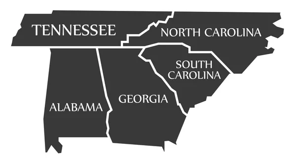
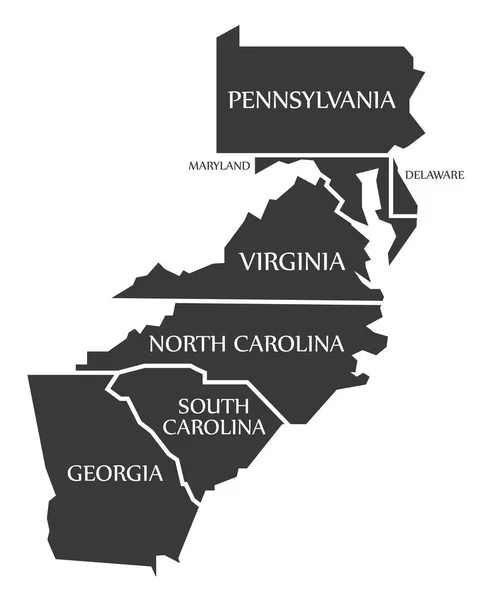
South Atlantic States, Multi Colored Political Map. United States Census Division Of The South Region. Delaware, Florida, Georgia, Maryland, North And South Carolina, Virginia, DC, And West Virginia.

Vector, 0.85MB, 6000 × 7818 eps
stock vector South Carolina counties, gray political map with borders and county names. State in the Southeastern region of the United States, subdivided into 46 counties. Nicknamed The Palmetto State. Vector

South Carolina Counties, Gray Political Map With Borders And County Names. State In The Southeastern Region Of The United States, Subdivided Into 46 Counties. Nicknamed The Palmetto State. Vector

Vector, 2.76MB, 7200 × 6000 eps
Page 1 >> Next