
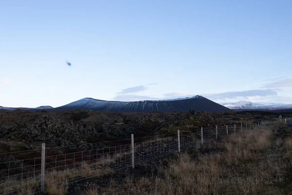
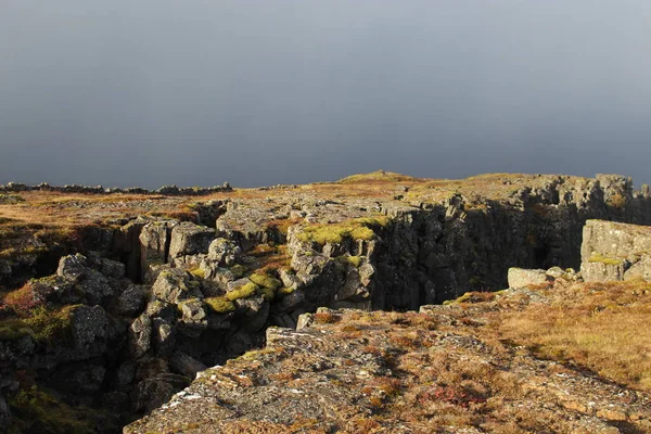
Stock image Continental Rift


Le Goubet In The Gulf Of Tadjoura Near Lac Asal And Djibouti City, East Africa
Image, 3.19MB, 3504 × 1671 jpg
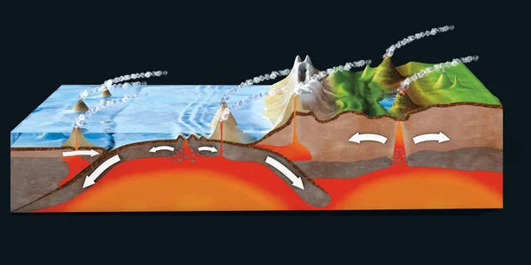
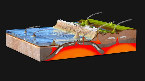
Scientific Ground Cross-section To Explain Subduction And Plate Tectonics - 3d Illustration
Image, 19.77MB, 10000 × 5000 jpg
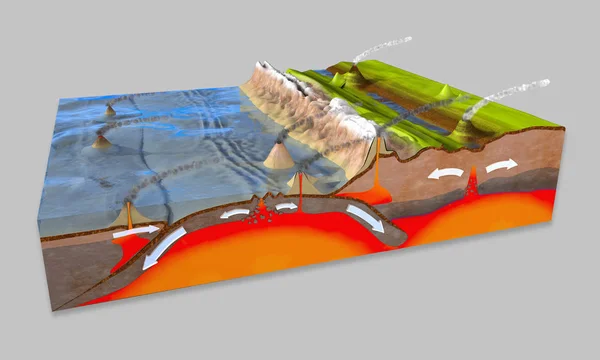
3d Illustration Of A Scientific Ground Cross-section To Explain Subduction And Plate Tectonics
Image, 14.41MB, 10000 × 6000 jpg


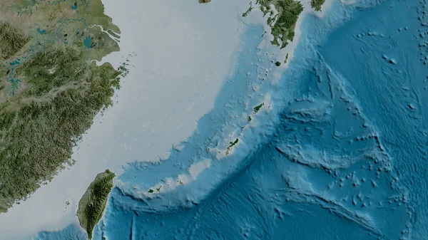
Okinawa Tectonic Plate Outlined On The Globe. Satellite Imagery. 3D Rendering
Image, 3.53MB, 2880 × 1620 jpg

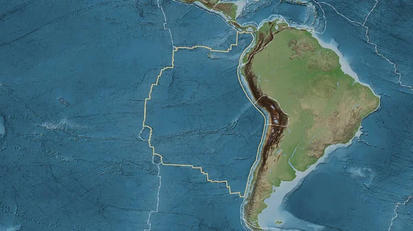
South American Tectonic Plate Enlarged And Extruded The Global Grayscale Elevation Map In The Azimuthal Equidistant Projection With Dashed Plates Borders. 3D Rendering
Image, 2.87MB, 2880 × 1620 jpg
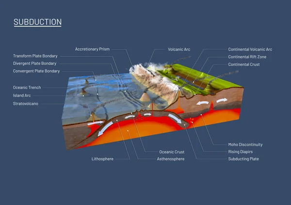
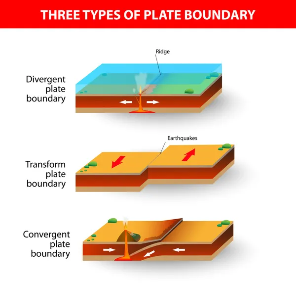
3d Illustration Of A Scientific Ground Cross-section To Explain Subduction And Plate Tectonics With Labels
Image, 15.9MB, 14043 × 9933 jpg

Scientific Ground Cross-section To Explain Subduction And Plate Tectonics - 3d Illustration
Image, 17.16MB, 10000 × 5625 jpg

White Mask Of Lands Within Areas Adjacent To The Altiplano Tectonic Plate. Black Background. Van Der Grinten I Projection (oblique Transformation). Compositing Tool
Image, 0.09MB, 2880 × 1620 jpg

Scientific Ground Cross-section To Explain Subduction And Plate Tectonics
Image, 9.35MB, 9800 × 6932 jpg
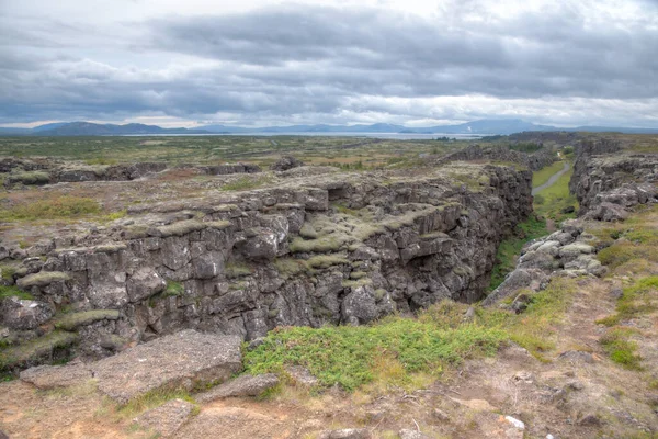
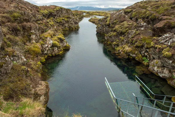
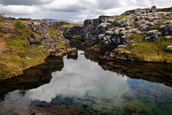
The Silfra Fissure, Ingvellir, Where The European And American Plates Meet. Thingvellir National Park Near Reykjavik, Iceland .
Image, 17.65MB, 6016 × 4016 jpg
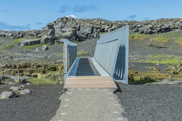
Path With Wooden Ramp To Metal Bridge In Cross Section. Landscape On Iceland Of Reykjanes Peninsula. Bridge Over American And Eurasian Tectonic Plates. Walls Of Lava Stone And Black Lava Sand
Image, 32.47MB, 6960 × 4640 jpg


Relief Map Of The Area Around The Molucca Sea Tectonic Plate. 3D Rendering
Image, 4.05MB, 2880 × 1620 jpg
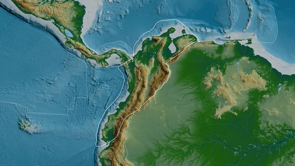
Outline Of The North Andes Tectonic Plate With The Borders Of Surrounding Plates Against The Background Of A Physical Map. 3D Rendering
Image, 4.76MB, 2880 × 1620 jpg
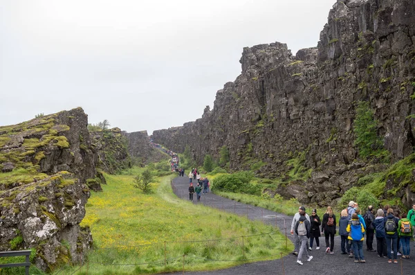
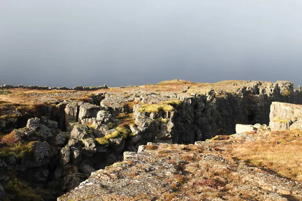
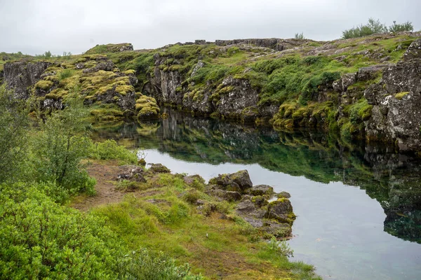
Thingvellir, Iceland - July 19, 2017: Tourists Walk Through The Almannagja Fault Line In The Mid-atlantic Ridge North American Plate In Thingvellir National Park. Iceland
Image, 13.83MB, 5644 × 3740 jpg

Pattern Map Of The Area Around The Pacific Tectonic Plate. 3D Rendering
Image, 5.52MB, 2880 × 1620 jpg

Neighborhoods Of The Caribbean Tectonic Plate On The Grayscale Map In The Van Der Grinten I Projection (oblique Transformation). Raw Composite - No Outlines
Image, 2.65MB, 2880 × 1620 jpg
Area Of The Nazca Tectonic Plate Marked With A Solid Line On A Pale Colored Elevation Map In The Patterson Cylindrical Projection
Image, 7.51MB, 3840 × 2160 jpg
Satellite Imagery Map Of The World In The Patterson Cylindrical Projection Transformed To The Center Of The Rivera Tectonic Plate
Image, 6.56MB, 3840 × 2160 jpg

Relief Map Of The Area Around The Pacific Tectonic Plate. 3D Rendering
Image, 5.32MB, 2880 × 1620 jpg
Satellite Map Of The Area Around The Okinawa Tectonic Plate. 3D Rendering
Image, 4.05MB, 2880 × 1620 jpg
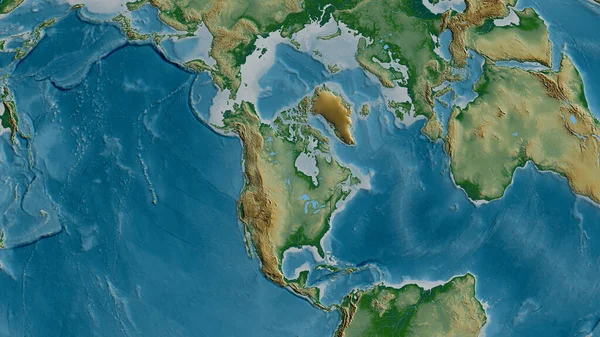
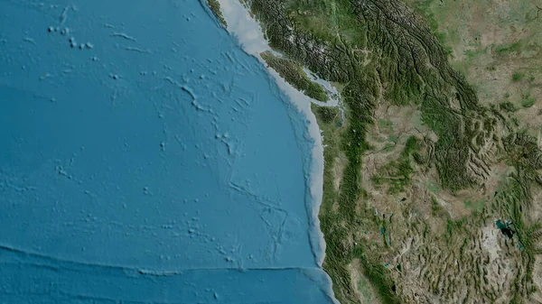
Physical Map Of The Area Around The North American Tectonic Plate. 3D Rendering
Image, 5.52MB, 2880 × 1620 jpg
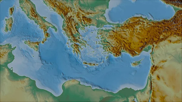
Neighborhoods Of The Aegean Sea Tectonic Plate On The Relief Map In The Van Der Grinten I Projection (oblique Transformation). Raw Composite - No Outlines
Image, 5.12MB, 2880 × 1620 jpg
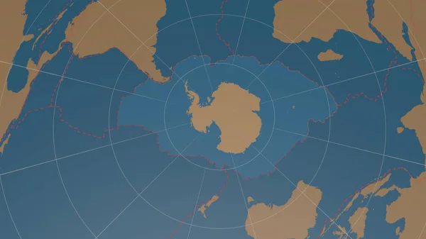
Antarctic Tectonic Plate Overview The Global Shapes Only - Land/ocean Mask In The Azimuthal Equidistant Projection With Dashed Plates Borders. 3D Rendering
Image, 1.56MB, 2880 × 1620 jpg

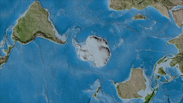
Antarctica Tectonic Plate Extruded On The Globe. Color Physical Map. 3D Rendering
Image, 3.72MB, 2880 × 1620 jpg
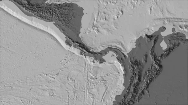
Neighborhoods Of The Panama Tectonic Plate On The Bilevel Elevation Map In The Van Der Grinten I Projection (oblique Transformation). Raw Composite - No Outlines
Image, 2.12MB, 2880 × 1620 jpg
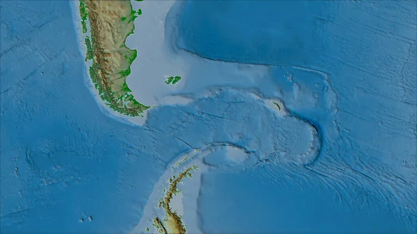
Neighborhoods Of The Scotia Tectonic Plate On The Physical Map In The Van Der Grinten I Projection (oblique Transformation). Raw Composite - No Outlines
Image, 3.92MB, 2880 × 1620 jpg
Tectonic Plates Borders On The Grayscale Map Of Areas Adjacent To The Caribbean Plate Area. Van Der Grinten I Projection (oblique Transformation)
Image, 2.7MB, 2880 × 1620 jpg
Satellite Map Of The Area Around The Juan De Fuca Tectonic Plate. 3D Rendering
Image, 5.02MB, 2880 × 1620 jpg

Outlined Pacific Tectonic Plate And Borders Of Adjacent Plates On The Physical Map In The Van Der Grinten I Projection (oblique Transformation)
Image, 7.06MB, 2880 × 1620 jpg

Juan De Fuca Tectonic Plate Outlined On The Globe. Topographic Map. 3D Rendering
Image, 4.54MB, 2880 × 1620 jpg
Neighborhoods Of The Antarctica Tectonic Plate On The Satellite B Map In The Van Der Grinten I Projection (oblique Transformation). Raw Composite - No Outlines
Image, 6.47MB, 2880 × 1620 jpg

Niuafou Tectonic Plate Outlined On The Globe. Topography And Bathymetry Colored Elevation Map. 3D Rendering
Image, 2.45MB, 2880 × 1620 jpg
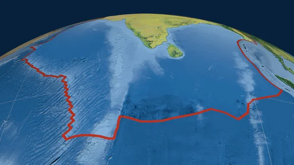
Indian Tectonic Plate Outlined On The Globe. Topographic Map. 3D Rendering
Image, 3.52MB, 2880 × 1620 jpg

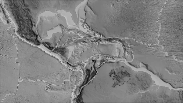
Neighborhoods Of The Altiplano Tectonic Plate On The Grayscale Map In The Van Der Grinten I Projection (oblique Transformation). Raw Composite - No Outlines
Image, 2.34MB, 2880 × 1620 jpg
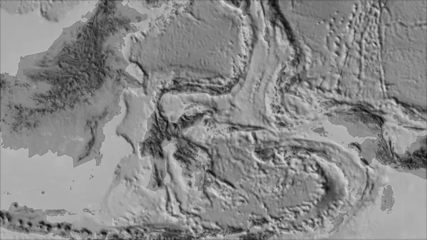
Neighborhoods Of The Molucca Sea Tectonic Plate On The Grayscale Map In The Van Der Grinten I Projection (oblique Transformation). Raw Composite - No Outlines
Image, 2.24MB, 2880 × 1620 jpg

Neighborhoods Of The North Bismarck Tectonic Plate On The Relief Map In The Van Der Grinten I Projection (oblique Transformation). Raw Composite - No Outlines
Image, 3.79MB, 2880 × 1620 jpg

Eurasian Tectonic Plate Outlined On The Globe. Natural Earth Topographic Map. 3D Rendering
Image, 4.55MB, 2880 × 1620 jpg

Neighborhoods Of The Anatolian Tectonic Plate On The Topographic Map In The Van Der Grinten I Projection (oblique Transformation). Raw Composite - No Outlines
Image, 5.95MB, 2880 × 1620 jpg
Page 1 >> Next