photo free
Home Images Vectors Videos

Stock image Corsica Map

stock vector  Road map of the french mediterranean island corsica

Road Map Of The French Mediterranean Island Corsica

Vector, 1.27MB, 3100 × 4612 eps
stock vector Doodle Map of Corsica

Doodle Map Of Corsica

Vector, 7.36MB, 5983 × 5983 eps
stock vector Corsica map vector

Corsica Map Vector

Vector, 0.55MB, 8858 × 5906 eps
stock image Ancient map

Ancient Map

Image, 11.26MB, 3750 × 2500 jpg
stock vector Corsica map filled with golden glitter Luxurious design element vector illustration

Corsica Map Filled With Golden Glitter Luxurious Design Element Vector Illustration

Vector, 10.88MB, 8333 × 8333 eps
stock vector Corsica map shape

Corsica Map Shape

Vector, 0.04MB, 3673 × 4898 eps
stock image Map of Corsica region, France

Map Of Corsica Region, France

Image, 2.64MB, 4200 × 3675 jpg
stock vector Corsica vector map Grunge rubber stamp with the name and map of island vector illustration Can be

Corsica Vector Map Grunge Rubber Stamp With The Name And Map Of Island Vector Illustration Can Be

Vector, 3.71MB, 8350 × 8350 eps
stock vector Corsica sticker Hipster round rubber stamp with island map Vintage passport sign with circular

Corsica Sticker Hipster Round Rubber Stamp With Island Map Vintage Passport Sign With Circular

Vector, 4.28MB, 8333 × 8333 eps
stock vector Corsica flag badge Vintage travel stamp with circular text stars and island flag inside it Vector

Corsica Flag Badge Vintage Travel Stamp With Circular Text Stars And Island Flag Inside It Vector

Vector, 5.31MB, 8333 × 8333 eps
stock vector Political map of Italy with national borders, cities and rivers

Political Map Of Italy With National Borders, Cities And Rivers

Vector, 2.76MB, 4000 × 4080 eps
stock vector Corse region outline map set

Corse Region Outline Map Set

Vector, 3.91MB, 6000 × 3000 eps
stock vector Detailed map of the French region of Corsica (Corse, France) with borders of municipalities, subdistricts (cantons), districts (arrondissements), departments (departements), and region

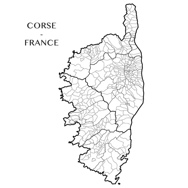
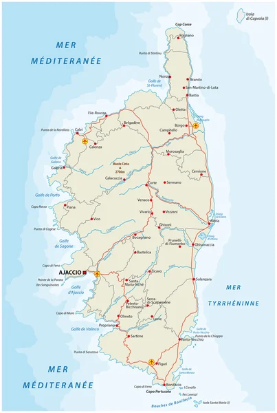
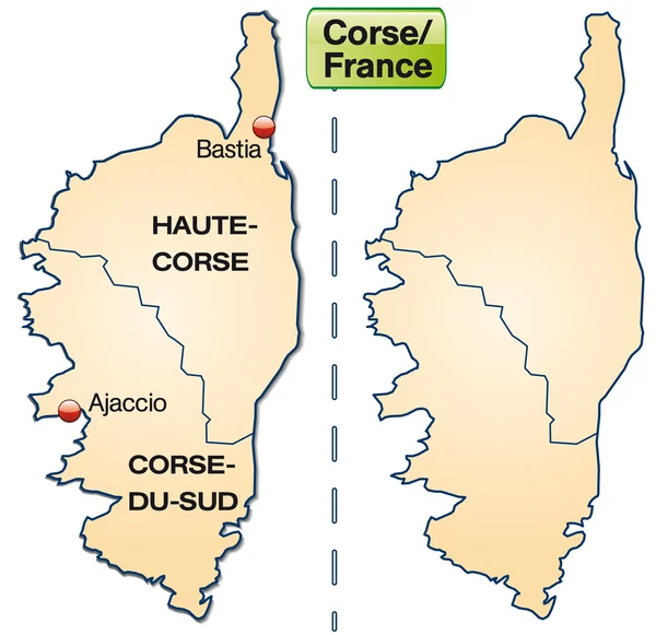
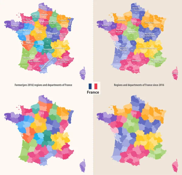
Detailed Map Of The French Region Of Corsica (Corse, France) With Borders Of Municipalities, Subdistricts (cantons), Districts (arrondissements), Departments (departements), And Region

Vector, 2.07MB, 5000 × 5000 eps
stock vector Map pins with flag of Corsica

Map Pins With Flag Of Corsica

Vector, 6.25MB, 7087 × 7087 eps
stock vector  Road map of the french mediterranean island corsica with flag

Road Map Of The French Mediterranean Island Corsica With Flag

Vector, 1.32MB, 3100 × 4612 eps
stock vector Road map of the italian mediterranean island sardinia with flag

Road Map Of The Italian Mediterranean Island Sardinia With Flag

Vector, 1.61MB, 4161 × 5343 eps
stock vector Vintage sticker in form of Corsica

Vintage Sticker In Form Of Corsica

Vector, 1.84MB, 5500 × 5500 eps
stock vector Map of corsica

Map Of Corsica

Vector, 0.37MB, 4170 × 4044 ai
stock vector World mapp

World Mapp

Vector, 6.38MB, 5860 × 3000 ai
stock vector Italy travel map

Italy Travel Map

Vector, 12.59MB, 3480 × 4640 eps
stock image Ancient map of the Mediterranean Sea

Ancient Map Of The Mediterranean Sea

Image, 5MB, 3000 × 2000 jpg
stock vector France old map with grunge and crumpled paper

France Old Map With Grunge And Crumpled Paper

Vector, 9.61MB, 4167 × 4167 eps
stock vector Map of France vintage engraved illustration sketch

Map Of France Vintage Engraved Illustration Sketch

Vector, 3.77MB, 4000 × 5000 eps
stock image Old map of Italy, Sicily, Corsica, Croatia and Sardinia

Old Map Of Italy, Sicily, Corsica, Croatia And Sardinia

Image, 2.81MB, 4000 × 2670 jpg
stock vector France map with flag and navigation icons

France Map With Flag And Navigation Icons

Vector, 4.59MB, 8192 × 7410 eps
stock vector France_Map

France_Map

Vector, 2.56MB, 4724 × 4724 eps
stock vector color map of france with pins on main cities. simple flat style trend modern logo graphic design isolated on green background. concept of abstract french outline mapping like infographics element

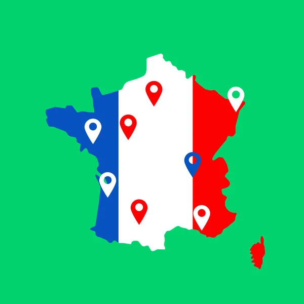
Color Map Of France With Pins On Main Cities. Simple Flat Style Trend Modern Logo Graphic Design Isolated On Green Background. Concept Of Abstract French Outline Mapping Like Infographics Element

Vector, 0.24MB, 5000 × 5000 eps
stock image the hand of a young caucasian man with a red marker pointing the port of Bastia, in Corsica, France, with the commercial port on the right and the Notre-Dame de Lourdes church in the background

The Hand Of A Young Caucasian Man With A Red Marker Pointing The Port Of Bastia, In Corsica, France, With The Commercial Port On The Right And The Notre-Dame De Lourdes Church In The Background

Image, 8.21MB, 5649 × 3766 jpg
stock vector Map of France

Map Of France

Vector, 2.77MB, 5000 × 5000 eps
stock image Italy space background

Italy Space Background

Image, 7.01MB, 2500 × 2500 jpg
stock vector Road and administrative map of France

Road And Administrative Map Of France

Vector, 1.74MB, 3900 × 3900 ai
stock image old map of Sardinia, Italy

Old Map Of Sardinia, Italy

Image, 0MB, 3144 × 4500 jpg
stock vector wine-growing areas in France

Wine-growing Areas In France

Vector, 0MB, 5424 × 4688 zip
stock vector France map geometric polygonal design

France Map Geometric Polygonal Design

Vector, 1.58MB, 4278 × 4698 eps
stock vector Blank Map of France

Blank Map Of France

Vector, 5.67MB, 5278 × 6000 eps
stock vector Highly detailed editable political map with separated layers. France.

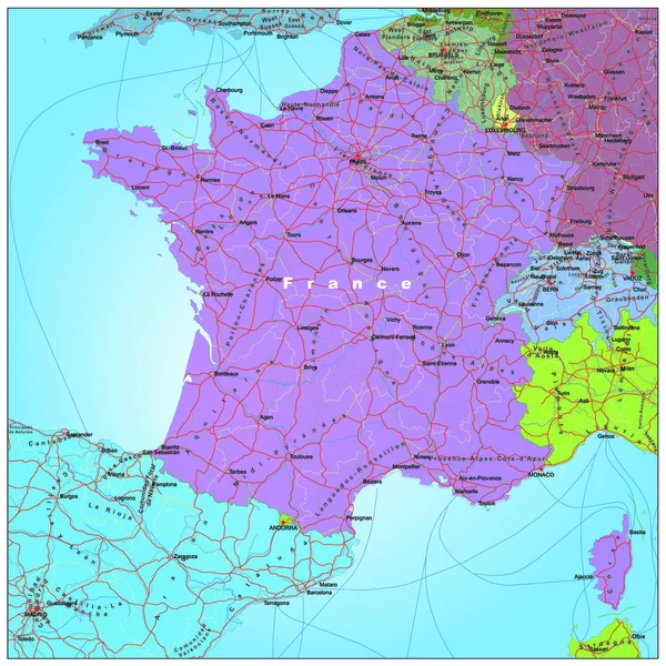
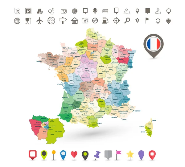
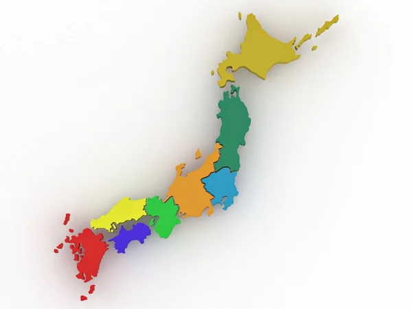
Highly Detailed Editable Political Map With Separated Layers. France.

Vector, 7.4MB, 4787 × 4649 eps
stock vector Blue-gray detailed map of Italy and administrative divisions and location on the globe.

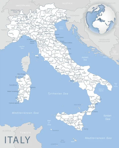
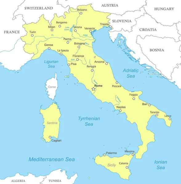
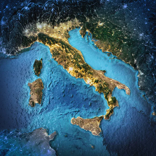
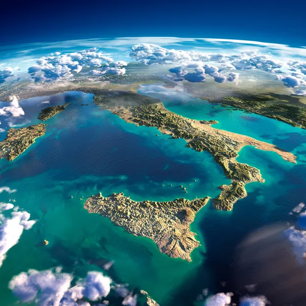
Blue-gray Detailed Map Of Italy And Administrative Divisions And Location On The Globe.

Vector, 16.7MB, 5212 × 6478 eps
stock vector Corsica highly detailed physical map

Corsica Highly Detailed Physical Map

Vector, 2.81MB, 4940 × 7500 eps
stock vector Colorful France political map with clearly labeled, separated layers. Vector illustration.

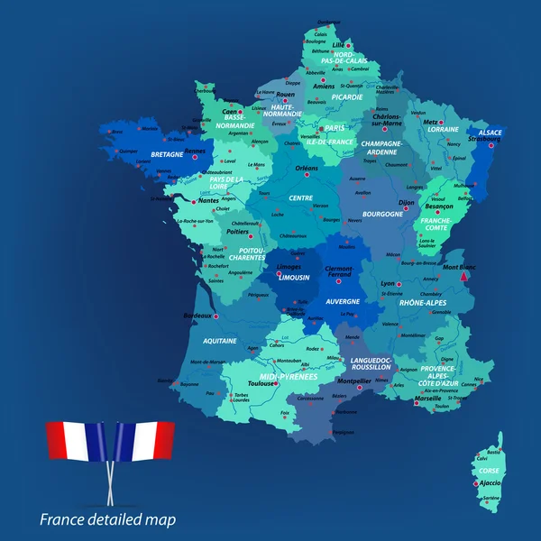
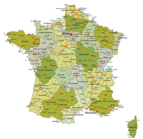
Colorful France Political Map With Clearly Labeled, Separated Layers. Vector Illustration.

Vector, 7.07MB, 4791 × 4652 eps
stock vector Detailed road vector map of France and colorful map pointers

Detailed Road Vector Map Of France And Colorful Map Pointers

Vector, 9.22MB, 7287 × 8192 eps
stock vector administrative regions and departments of France vector map

Administrative Regions And Departments Of France Vector Map

Vector, 8.94MB, 7292 × 7011 eps
stock vector Map of European Union with the indication of France

Map Of European Union With The Indication Of France

Vector, 1.78MB, 3996 × 4000 eps
stock vector France - detailed map - illustration.

France - Detailed Map - Illustration.

Vector, 13.07MB, 5400 × 5523 eps
stock vector Vector map of France and infographic elements collection

Vector Map Of France And Infographic Elements Collection

Vector, 6.78MB, 8192 × 8153 eps
stock vector Map of France on blue background

Map Of France On Blue Background

Vector, 0.23MB, 6000 × 6000 eps
stock image Fragments of the planet Earth. Italy and the Mediterranean Sea

Fragments Of The Planet Earth. Italy And The Mediterranean Sea

Image, 10.22MB, 5000 × 5000 jpg
stock vector polygonal blue vector map of France

Polygonal Blue Vector Map Of France

Vector, 1.55MB, 4000 × 4000 eps
stock vector Blue similar France map with capital city Paris. France map blank. France map vector. France map flat. France map template. France map object. France map eps. France map infographic. France map clean

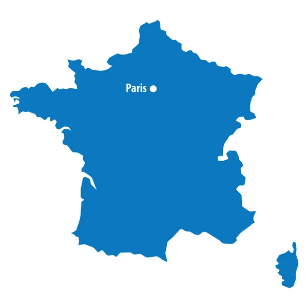
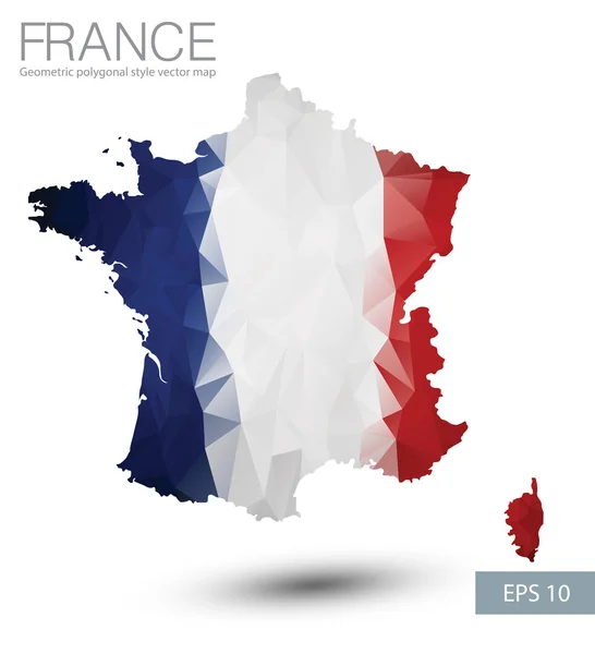
Blue Similar France Map With Capital City Paris. France Map Blank. France Map Vector. France Map Flat. France Map Template. France Map Object. France Map Eps. France Map Infographic. France Map Clean

Vector, 2.27MB, 4167 × 4167 eps
stock image Map of Japan on white isolated background. 3d

Map Of Japan On White Isolated Background. 3d

Image, 0.82MB, 3600 × 2700 jpg
stock vector Map of France

Map Of France

Vector, 3.8MB, 6250 × 5000 eps
Page 1 >> Next