photo free
Home Images Vectors Videos

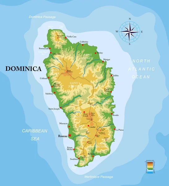
Stock image Dominica Map page 2

stock vector Dominica island highly detailed physical map

Dominica Island Highly Detailed Physical Map

Vector, 1.97MB, 5579 × 6129 eps
stock image waving colorful national flag of dominica on a gray world map background.

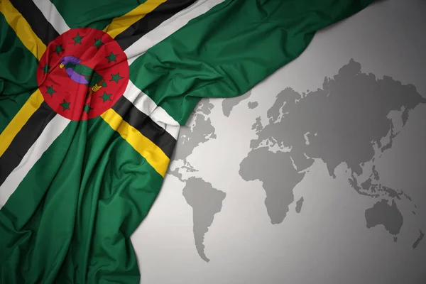
Waving Colorful National Flag Of Dominica On A Gray World Map Background.

Image, 9.29MB, 6558 × 4377 jpg
stock image Famous flag of Dominica in hands near river. Concept of humanity and nature. Promoting nature and the state. Young boy holds Dominican flag and waves on others.

Famous Flag Of Dominica In Hands Near River. Concept Of Humanity And Nature. Promoting Nature And The State. Young Boy Holds Dominican Flag And Waves On Others.

Image, 13.57MB, 6000 × 4000 jpg
stock vector Map of Dominica with flag

Map Of Dominica With Flag

Vector, 5.76MB, 5984 × 5984 eps
stock vector Map on flag button of Commonwealth of Dominica

Map On Flag Button Of Commonwealth Of Dominica

Vector, 1.38MB, 5555 × 5555 eps
stock vector Caribbean geography map

Caribbean Geography Map

Vector, 0.84MB, 5004 × 3552 ai
stock vector Map of Caribbean

Map Of Caribbean

Vector, 9.89MB, 7001 × 4401 eps
stock vector Caribbean Map with Flags and Location

Caribbean Map With Flags And Location

Vector, 8.34MB, 6350 × 4245 eps
stock vector Central America - map - illustration.

Central America - Map - Illustration.

Vector, 4.36MB, 7400 × 5548 eps
stock vector Central America - map and navigation icons - illustration.

Central America - Map And Navigation Icons - Illustration.

Vector, 4.63MB, 7400 × 5923 eps
stock vector Central America - map, navigation icons - illustration.

Central America - Map, Navigation Icons - Illustration.

Vector, 4.97MB, 7400 × 5913 eps
stock vector Central America - map and navigation icons - illustration.

Central America - Map And Navigation Icons - Illustration.

Vector, 4.54MB, 7400 × 5903 eps
stock vector Vector maps set.  High detailed 23 maps of North American

Vector Maps Set. High Detailed 23 Maps Of North American

Vector, 13.98MB, 6000 × 3600 eps
stock vector Vector isometric maps set - America continent.  Maps of North American countries with administrative division and cities.

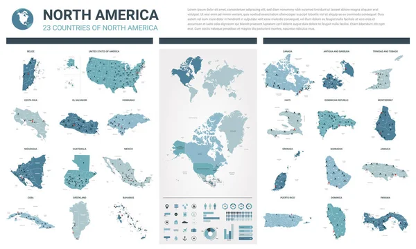
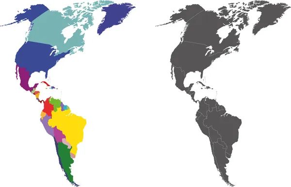
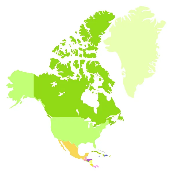
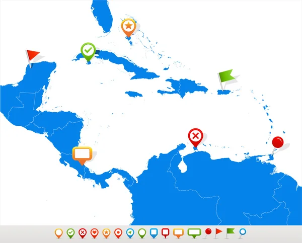
Vector Isometric Maps Set - America Continent. Maps Of North American Countries With Administrative Division And Cities.

Vector, 13.9MB, 4500 × 3500 eps
stock vector South America and Africa Global World in Space

South America And Africa Global World In Space

Vector, 1.86MB, 5343 × 5760 eps
stock vector The world with flag of Dominica

The World With Flag Of Dominica

Vector, 1.05MB, 5431 × 3613 eps
stock vector Central America - map - illustration.

Central America - Map - Illustration.

Vector, 4.91MB, 7400 × 5549 eps
stock vector America

America

Vector, 22.35MB, 6056 × 3909 eps
stock vector Association of Caribbean States map

Association Of Caribbean States Map

Vector, 3MB, 5370 × 4295 eps
stock vector Latin, Caribbean, North and South American country regions' maps

Latin, Caribbean, North And South American Country Regions' Maps

Vector, 12.29MB, 7286 × 7255 eps
stock vector Map of Dominica connection. Vector low-poly image of a global map with lights in the form of cities or population density, consisting of points and shapes in the form of stars and space.

Map Of Dominica Connection. Vector Low-poly Image Of A Global Map With Lights In The Form Of Cities Or Population Density, Consisting Of Points And Shapes In The Form Of Stars And Space.

Vector, 1.42MB, 2800 × 4100 eps
stock vector America Pointer Flag Icons with american Map set2

America Pointer Flag Icons With American Map Set2

Vector, 10.31MB, 5000 × 5000 eps
stock vector AMERICA Global World

AMERICA Global World

Vector, 3.43MB, 5343 × 5760 eps
stock vector Map of Central America and Caribbean. Simlified schematic vector map in shades of green

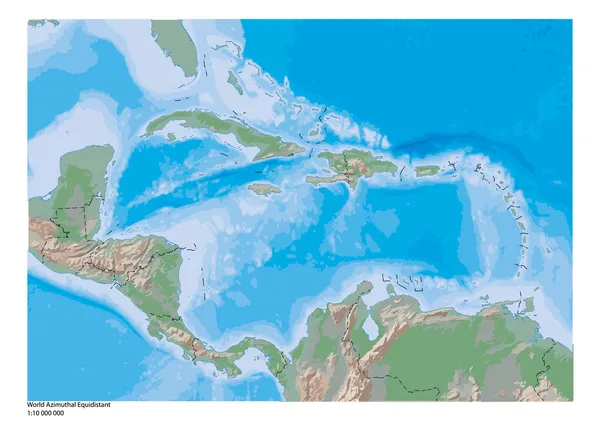
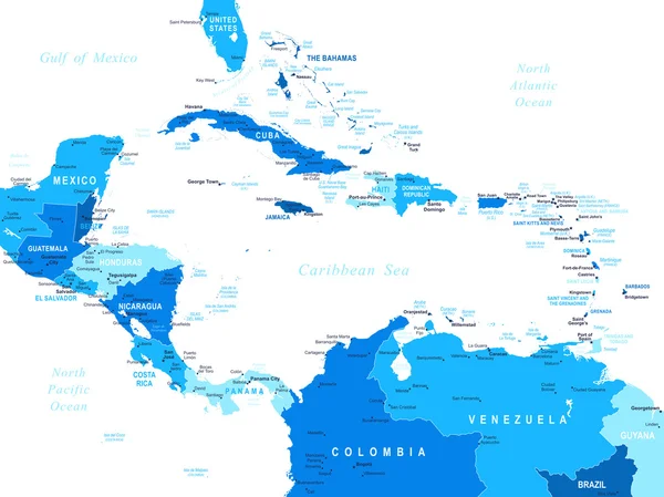
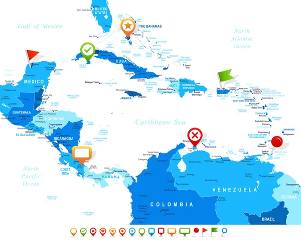
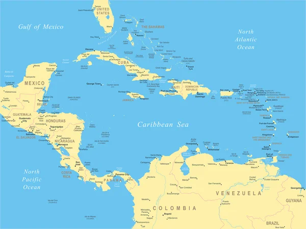
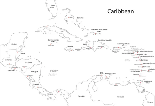
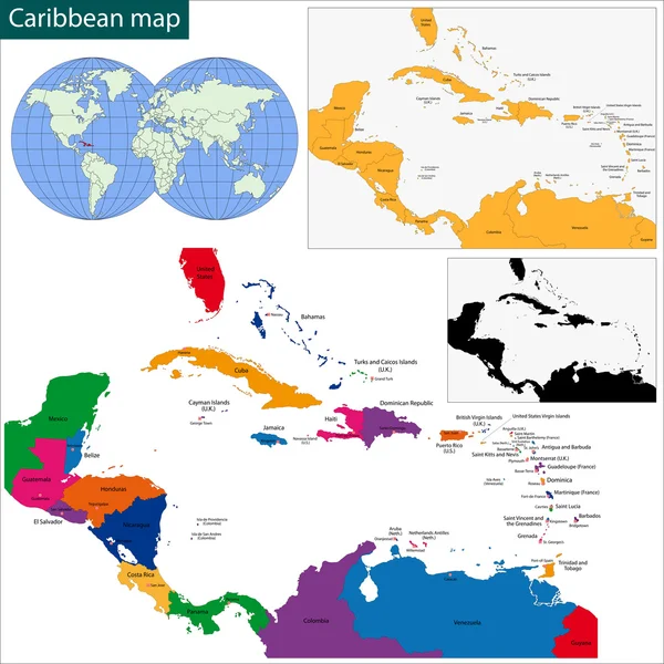
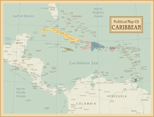
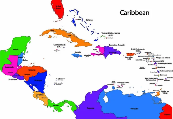
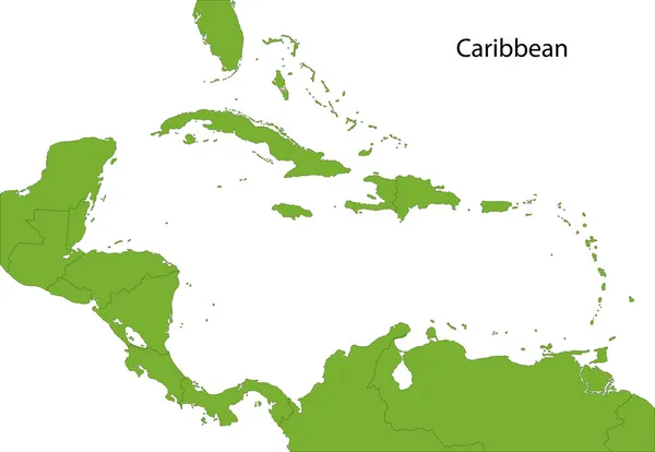
Map Of Central America And Caribbean. Simlified Schematic Vector Map In Shades Of Green

Vector, 0.68MB, 6000 × 4000 eps
stock vector South America and part of the South Pole Background with Globe Icon 3D illustration, Glossy, Shiny Sphere with Global Map in Subtle Blues giving a transparent feel

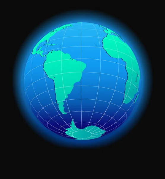
South America And Part Of The South Pole Background With Globe Icon 3D Illustration, Glossy, Shiny Sphere With Global Map In Subtle Blues Giving A Transparent Feel

Vector, 1MB, 5547 × 5547 eps
stock vector West Indies - vector maps of countries

West Indies - Vector Maps Of Countries

Vector, 0.53MB, 4665 × 4188 eps
stock vector Map and Flag in Circle, America Countries Collection.

Map And Flag In Circle, America Countries Collection.

Vector, 14.16MB, 6646 × 5000 eps
stock vector Caribbean map

Caribbean Map

Vector, 3.56MB, 6000 × 4132 eps
stock vector South America Global World in Space

South America Global World In Space

Vector, 1.45MB, 5343 × 5760 eps
stock vector Central America - map - illustration.

Central America - Map - Illustration.

Vector, 3.9MB, 7400 × 5548 eps
stock vector Retro Style North and South America Global World

Retro Style North And South America Global World

Vector, 2.64MB, 5343 × 5760 eps
stock vector Caribbean map

Caribbean Map

Vector, 5.28MB, 7000 × 7000 eps
stock vector South America and Africa Global World Globe Icon 3D illustration, Glossy, Shiny Sphere with Global Map in Subtle Blues giving a transparent feel

South America And Africa Global World Globe Icon 3D Illustration, Glossy, Shiny Sphere With Global Map In Subtle Blues Giving A Transparent Feel

Vector, 1.02MB, 5547 × 5547 eps
stock vector Nothern America

Nothern America

Vector, 0.44MB, 4278 × 4319 eps
stock vector Grand Bahama

Grand Bahama

Vector, 1.8MB, 7666 × 4217 eps
stock vector Caribbean -highly detailed map.

Caribbean -highly Detailed Map.

Vector, 10.74MB, 5001 × 3803 eps
stock vector Caribbean -highly detailed map.

Caribbean -highly Detailed Map.

Vector, 10.74MB, 5001 × 3803 eps
stock vector South America and Africa Global World

South America And Africa Global World

Vector, 1.41MB, 5340 × 5757 eps
stock vector Colorful Caribbean map with countries and capital cities

Colorful Caribbean Map With Countries And Capital Cities

Vector, 0MB, 5000 × 3442 zip
stock vector Central America map and navigation icons - Illustration.

Central America Map And Navigation Icons - Illustration.

Vector, 1.29MB, 7400 × 5970 eps
stock vector Windward Islands political map. Islands of the Lesser Antilles, south of the Leeward Islands in the Caribbean Sea. From Dominica, Martinique, Saint Lucia, Saint Vincent and the Grenadines, to Grenada.

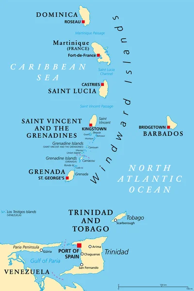
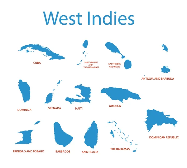
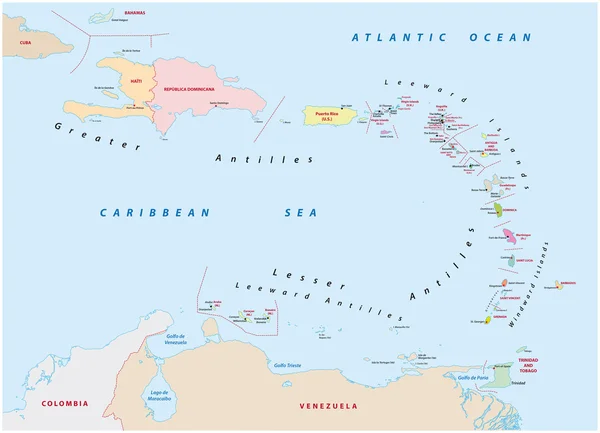
Windward Islands Political Map. Islands Of The Lesser Antilles, South Of The Leeward Islands In The Caribbean Sea. From Dominica, Martinique, Saint Lucia, Saint Vincent And The Grenadines, To Grenada.

Vector, 2.87MB, 6000 × 9000 eps
stock vector South America and Africa Global World

South America And Africa Global World

Vector, 0.86MB, 5560 × 5534 eps
stock vector Caribbean map

Caribbean Map

Vector, 3MB, 6000 × 4150 eps
stock vector Dominica vector grey polygonal map of America

Dominica Vector Grey Polygonal Map Of America

Vector, 0.3MB, 5000 × 6538 eps
stock vector North and South America Global World

North And South America Global World

Vector, 1.95MB, 5340 × 5757 eps
stock vector vector illustration of North and South America map with country names and flags of countries

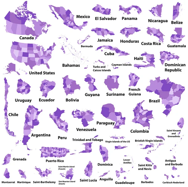
Vector Illustration Of North And South America Map With Country Names And Flags Of Countries

Vector, 13.65MB, 7238 × 8334 eps
stock vector AMERICA Countries - Part Three

AMERICA Countries - Part Three

Vector, 3.06MB, 5512 × 5512 eps
stock vector map of the states of the lesser Antilles

Map Of The States Of The Lesser Antilles

Vector, 1.33MB, 6772 × 4893 eps
stock image Caribbean on 3D model of Earth with country borders and water in oceans. 3D illustration isolated on white background.

Caribbean On 3D Model Of Earth With Country Borders And Water In Oceans. 3D Illustration Isolated On White Background.

Image, 13.73MB, 5000 × 3750 jpg
stock vector North and South America Global World

North And South America Global World

Vector, 1.18MB, 5560 × 5534 eps
Previous << Page 2 >> Next