
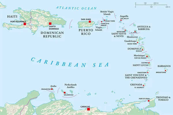
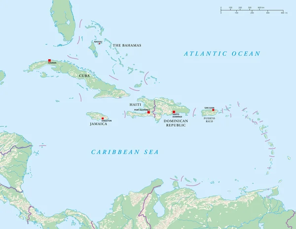
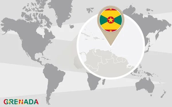
Stock image Grenada Island Map


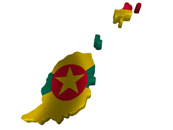
Grenada Island In The Caribbean Sea - Belonging To Grenada. Described Location Diagram With Yellow Shape Of The Island And Sample Maps Of Its Surroundings
Image, 2.15MB, 3840 × 2160 jpg

Grenada Island In The Caribbean Sea, Belonging To Grenada, Isolated On A Satellite Image Taken In October 15, 2020, With Distance Scale
Image, 1.79MB, 2160 × 2160 jpg

Grenada Island In The Caribbean Sea On A Satellite Image Taken In October 20, 2020
Image, 2.24MB, 2880 × 1620 jpg

Grenada Island In The Caribbean Sea, Belonging To Grenada, Isolated On A Bilevel Elevation Map, With Distance Scale
Image, 0.57MB, 2160 × 2160 jpg
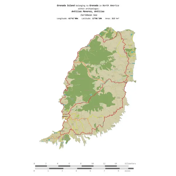
Grenada Island In The Caribbean Sea, Belonging To Grenada, Isolated On A Topographic, OSM Humanitarian Style Map, With Distance Scale
Image, 1.2MB, 2160 × 2160 jpg

Grenada Island In The Caribbean Sea On A Topographic, OSM Humanitarian Style Map
Image, 0.88MB, 2880 × 1620 jpg


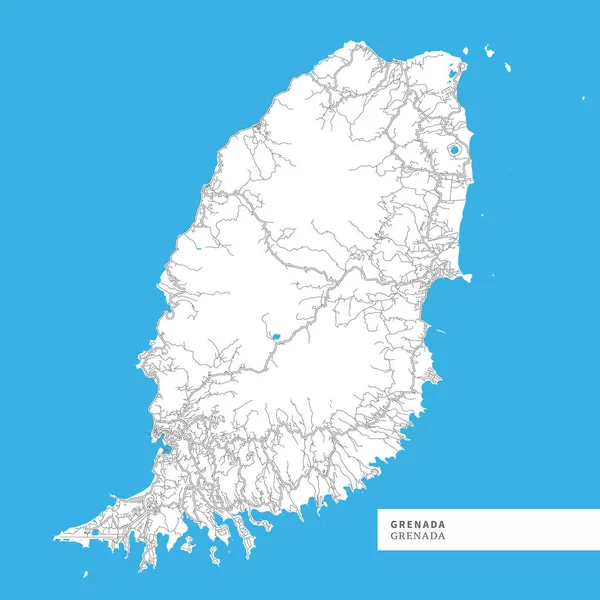
Map Of Grenada Island, Grenada, Contains Geography Outlines For Land Mass, Water, Major Roads And Minor Roads.
Vector, 4.42MB, 8000 × 8000 eps


Set Of Flags In The Form Of A Glossy Textured Label Or Bookmark. Yemen Vatican Indonesia Guinea Bissau Guinea Grenada Ghana Gambia Gabon East Timor
Vector, 3.61MB, 5850 × 3900 eps

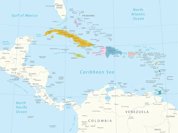
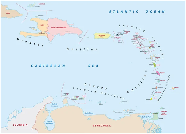
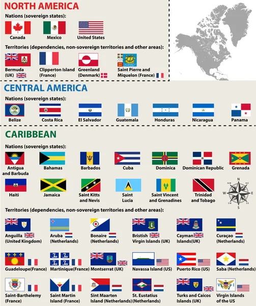
Political Map Of Carribean. Blue Highlighted States And Dependent Territories. Simple Flat Vector Illustration
Vector, 1.2MB, 6000 × 4500 eps

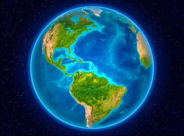
Caribbean On 3D Model Of Earth With Country Borders And Water In Oceans. 3D Illustration Isolated On White Background.
Image, 13.73MB, 5000 × 3750 jpg

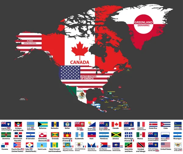
Vector Illustration Of North America Map (include Northern America, Central America And Caribbean Regions) With Country Names And Flags Of Countries.
Vector, 13.27MB, 8334 × 7009 eps

Lake Grenada Reservoir (United States Of America, North America, Us, Usa, Mississippi) Map Vector Illustration, Scribble Sketch Grenada Dam Map
Vector, 1.49MB, 7087 × 4726 eps
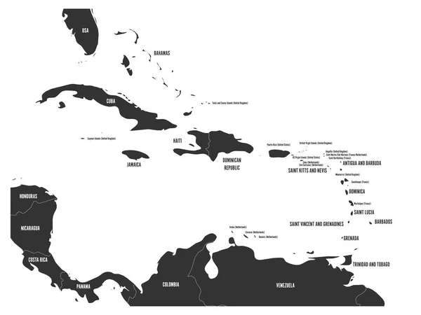
Political Map Of Carribean. Gray Lands On White Background. Simple Flat Vector Illustration
Vector, 1.2MB, 6000 × 4500 eps
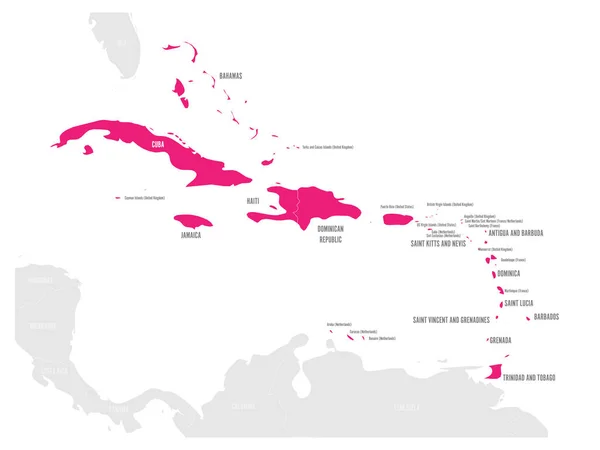
Political Map Of Carribean. Pink Highlighted States And Dependent Territories. Simple Flat Vector Illustration
Vector, 1.2MB, 6000 × 4500 eps


Caribbean On Digital Planet Earth With International Network Representing Communication, Travel And Connections. 3D Illustration. Elements Of This Image Furnished By NASA.
Image, 15.57MB, 5000 × 3750 jpg
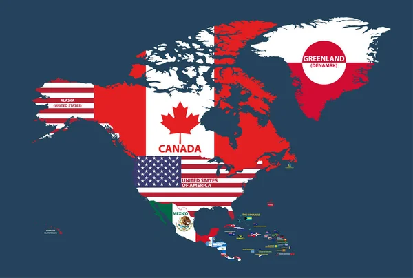
Vector Illustration Of North America Map (include Northern America, Central America And Caribbean Regions) With Country Names And Flags Of Countries.
Vector, 13.59MB, 8334 × 5618 eps
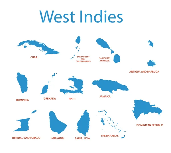
Vector Isolated Flags Of North America(include Central America And Caribbean Countries)
Vector, 14.36MB, 8348 × 9936 eps


Vector Map Saint Vincent And The Grenadines. Isolated Vector Illustration. Black On White Background. EPS 10 Illustration.
Vector, 0.6MB, 5000 × 5000 eps


Caribbean From Space On Planet Earth With Blue Digital Network Representing International Communication, Technology And Travel. 3D Illustration. Elements Of This Image Furnished By NASA.
Image, 11.63MB, 5000 × 3750 jpg


Caribbean From Space On Model Of Blue Digital Planet Earth. Concept Of Blue Digital Technology, Connectivity And Travel. 3D Illustration. Elements Of This Image Furnished By NASA.
Image, 15.63MB, 5000 × 3750 jpg

Page 1 >> Next