photo free
Home Images Vectors Videos

Stock image Michigan Region page 2

stock vector Terrestrial map of USA

Terrestrial Map Of USA

Vector, 0.68MB, 4724 × 4724 eps
stock vector The detailed map of the USA with regions. United States of America.

The Detailed Map Of The USA With Regions. United States Of America.

Vector, 1.18MB, 5500 × 5500 eps
stock vector United States (USA) - map, flag and navigation icons - illustration.

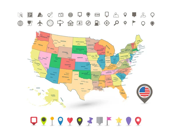
United States (USA) - Map, Flag And Navigation Icons - Illustration.

Vector, 2.64MB, 5400 × 4986 eps
stock image Downtown Detroit

Downtown Detroit

Image, 12.82MB, 5616 × 3744 jpg
stock image View of downtown Detroit riverfront in Michigan USA

View Of Downtown Detroit Riverfront In Michigan USA

Image, 4.23MB, 3000 × 2001 jpg
stock vector United States census bureau regions and divisions vector map. Flag of United States of America

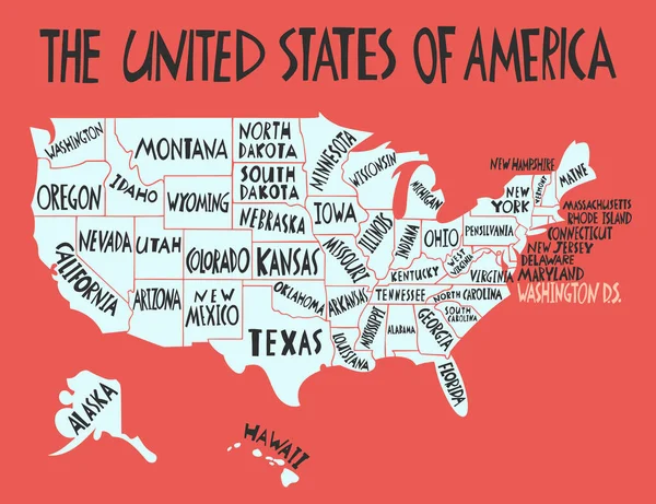
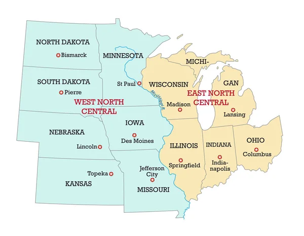
United States Census Bureau Regions And Divisions Vector Map. Flag Of United States Of America

Vector, 6.79MB, 7292 × 3543 eps
stock vector Information vector map of Lake Huron in North America

Information Vector Map Of Lake Huron In North America

Vector, 0.84MB, 4505 × 3100 eps
stock vector Michigan counties emblem map

Michigan Counties Emblem Map

Vector, 3.18MB, 4012 × 4019 eps
stock vector High Quality map of Michigan is a state of United States of America with borders of the counties

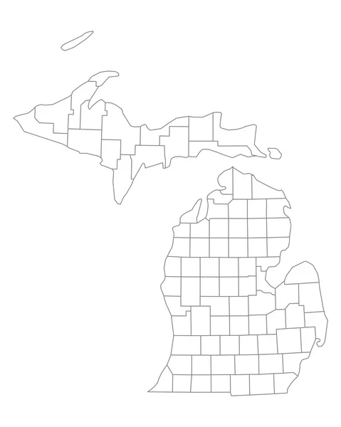
High Quality Map Of Michigan Is A State Of United States Of America With Borders Of The Counties

Vector, 1.34MB, 4000 × 4000 eps
stock vector Map of USA set

Map Of USA Set

Vector, 4.86MB, 4724 × 4724 eps
stock image Downtown Detroit

Downtown Detroit

Image, 13.25MB, 5760 × 3840 jpg
stock vector Vector hand drawn stylized map of The United States of America with states names. Travel illustration of USA shape. North America map element

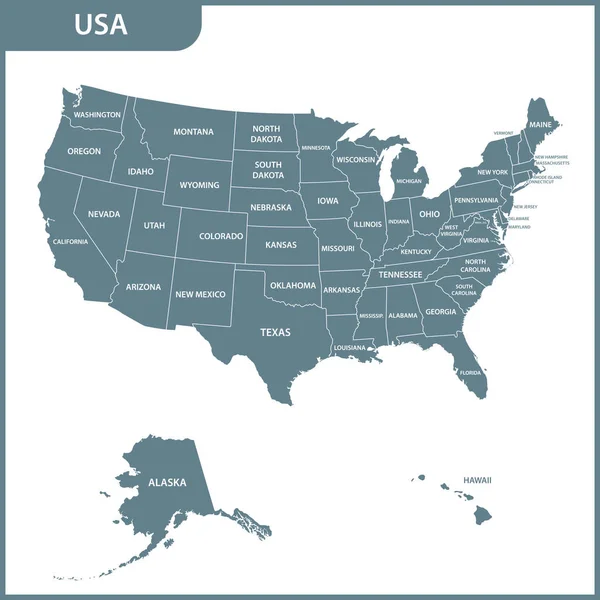
Vector Hand Drawn Stylized Map Of The United States Of America With States Names. Travel Illustration Of USA Shape. North America Map Element

Vector, 0.85MB, 5200 × 4000 eps
stock vector Information vector map of Lake Ontario in North America

Information Vector Map Of Lake Ontario In North America

Vector, 0.8MB, 4505 × 3100 eps
stock image Downtown Detroit

Downtown Detroit

Image, 14.97MB, 4350 × 2900 jpg
stock vector Map of the great lakes and st lawrence river with major cities

Map Of The Great Lakes And St Lawrence River With Major Cities

Vector, 0.69MB, 6119 × 3100 eps
stock image Downtown Detroit

Downtown Detroit

Image, 10.83MB, 4350 × 2900 jpg
stock image View of downtown Detroit riverfront in Michigan USA

View Of Downtown Detroit Riverfront In Michigan USA

Image, 5.45MB, 3500 × 2335 jpg
stock image Downtown Detroit

Downtown Detroit

Image, 15.8MB, 4350 × 2900 jpg
stock image Summer landscape

Summer Landscape

Image, 10.01MB, 4288 × 2848 jpg
stock vector Map of the Midwest United States of America

Map Of The Midwest United States Of America

Vector, 3MB, 4387 × 3100 eps
stock vector Michigan USA Map grey

Michigan USA Map Grey

Vector, 4.8MB, 5000 × 5526 eps
stock vector Modern City Map - Detroit Michigan city of the USA with districts and titles outline map

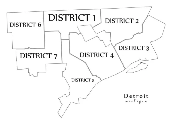
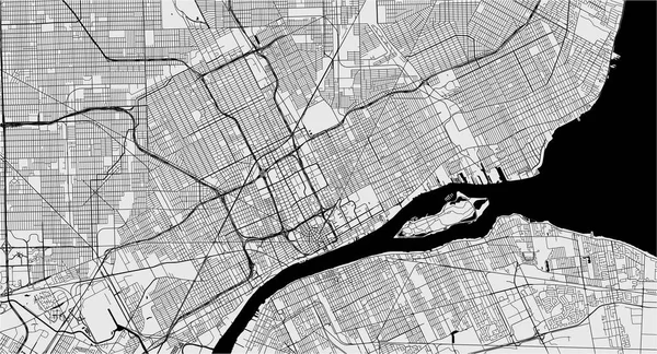
Modern City Map - Detroit Michigan City Of The USA With Districts And Titles Outline Map

Vector, 7.65MB, 6902 × 5000 eps
stock vector Michigan map

Michigan Map

Vector, 8.12MB, 7002 × 7002 eps
stock image Downtown Detroit

Downtown Detroit

Image, 11.17MB, 5444 × 3321 jpg
stock vector Ohio state detailed editable map

Ohio State Detailed Editable Map

Vector, 0.97MB, 5000 × 5552 eps
stock vector Michigan, MI, political map, with capital Lansing and metropolitan area Detroit. State in Great Lakes region of upper Midwestern United States, nicknamed The Great Lake State, and The Wolverine State.

Michigan, MI, Political Map, With Capital Lansing And Metropolitan Area Detroit. State In Great Lakes Region Of Upper Midwestern United States, Nicknamed The Great Lake State, And The Wolverine State.

Vector, 6.65MB, 6000 × 6000 eps
stock vector Map of the region Rust Belt in the United States of America

Map Of The Region Rust Belt In The United States Of America

Vector, 0.9MB, 4185 × 3100 eps
stock vector map of the city of Detroit, Michigan, USA

Map Of The City Of Detroit, Michigan, USA

Vector, 5.95MB, 6968 × 3773 eps
stock image USA map. States and territories of United States of America

USA Map. States And Territories Of United States Of America

Image, 1.4MB, 5000 × 5000 jpg
stock image Map of Michigan - USA

Map Of Michigan - USA

Image, 6.86MB, 8000 × 8000 jpg
stock vector Map of the Midwest United States of America

Map Of The Midwest United States Of America

Vector, 0.7MB, 3988 × 3100 eps
stock vector Michigan map flag and text. Map pointer with American flag. vector illustration

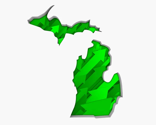
Michigan Map Flag And Text. Map Pointer With American Flag. Vector Illustration

Vector, 1.33MB, 4005 × 4005 eps
stock vector Ohio administrative and political vector map with flag

Ohio Administrative And Political Vector Map With Flag

Vector, 1.61MB, 3100 × 3453 eps
stock vector Accurate map of Michigan

Accurate Map Of Michigan

Vector, 0.65MB, 4000 × 5000 eps
stock vector Map of the great lakes and st lawrence river drainage aregions

Map Of The Great Lakes And St Lawrence River Drainage Aregions

Vector, 1.7MB, 5064 × 3100 eps
stock vector USA map with flag and navigation icons

USA Map With Flag And Navigation Icons

Vector, 3.03MB, 8192 × 6357 eps
stock vector Vector Flat Map of Michigan State with Caption

Vector Flat Map Of Michigan State With Caption

Vector, 0.08MB, 4792 × 4667 eps
stock vector Indiana, IN, political map, with the capital Indianapolis, and most important cities, rivers and lakes. State in the Midwestern region of the United States of America, nicknamed The Hoosier State.

Indiana, IN, Political Map, With The Capital Indianapolis, And Most Important Cities, Rivers And Lakes. State In The Midwestern Region Of The United States Of America, Nicknamed The Hoosier State.

Vector, 3.4MB, 6000 × 9000 eps
stock vector Illinois, IL, political map, with capital Springfield and metropolitan area Chicago. State in the Midwestern region of United States, nicknamed Land of Lincoln, Prairie State, and Inland Empire State.

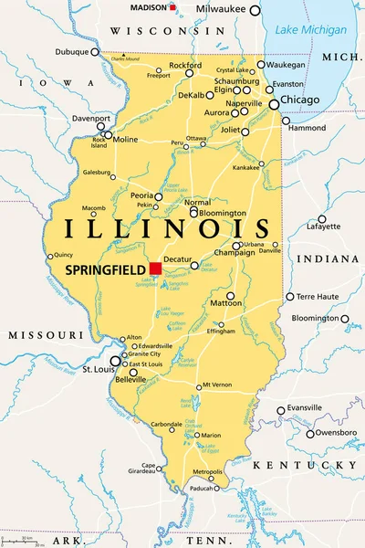
Illinois, IL, Political Map, With Capital Springfield And Metropolitan Area Chicago. State In The Midwestern Region Of United States, Nicknamed Land Of Lincoln, Prairie State, And Inland Empire State.

Vector, 4.08MB, 6000 × 9000 eps
stock vector map of the U.S. state  Michigan

Map Of The U.S. State Michigan

Vector, 1.84MB, 5000 × 5000 eps
stock vector Welcome to Detroit entrance road sign

Welcome To Detroit Entrance Road Sign

Vector, 0.5MB, 8500 × 5941 ai
stock vector North America Political Map. Highly detailed map. All elements are separated in editable layers clearly labeled. Vector

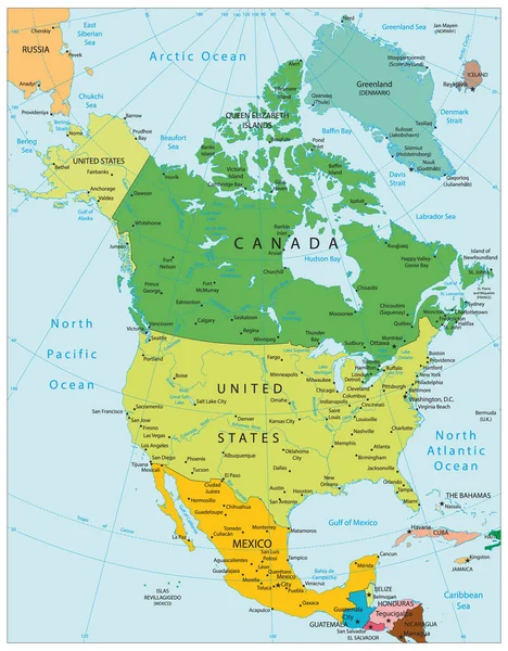
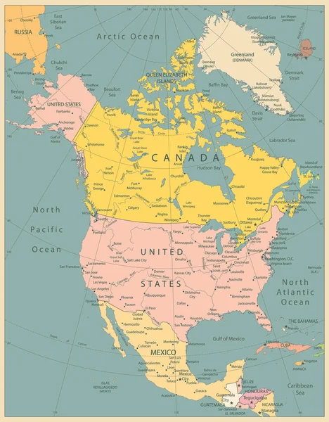
North America Political Map. Highly Detailed Map. All Elements Are Separated In Editable Layers Clearly Labeled. Vector

Vector, 12.15MB, 3767 × 4826 eps
stock image Silhouette of Michigan with green arrows on white background

Silhouette Of Michigan With Green Arrows On White Background

Image, 2.2MB, 5000 × 4000 jpg
stock image Wooden bridge in the park

Wooden Bridge In The Park

Image, 12.2MB, 3614 × 2761 jpg
stock vector Information vector map of Lake Michigan in North America

Information Vector Map Of Lake Michigan In North America

Vector, 0.92MB, 4505 × 3100 eps
stock vector North America Political Map Vintage Colors. Highly detailed map. All elements are separated in editable layers clearly labeled.

North America Political Map Vintage Colors. Highly Detailed Map. All Elements Are Separated In Editable Layers Clearly Labeled.

Vector, 12.9MB, 3767 × 4826 eps
stock vector vector map of the Great Lakes Basin

Vector Map Of The Great Lakes Basin

Vector, 1.47MB, 4022 × 3100 eps
stock vector Michigan State in the United States map

Michigan State In The United States Map

Vector, 1.86MB, 5000 × 5000 eps
stock vector Information vector map of Lake Erie in North America

Information Vector Map Of Lake Erie In North America

Vector, 0.8MB, 4505 × 3100 eps
stock vector Black United States Of America map. US background template. Map of America with separated countries and interstate borders. All states and regions are named in the layer panel.

Black United States Of America Map. US Background Template. Map Of America With Separated Countries And Interstate Borders. All States And Regions Are Named In The Layer Panel.

Vector, 1.41MB, 5000 × 3200 eps
Previous << Page 2 >> Next