
Stock image Northern Latitude
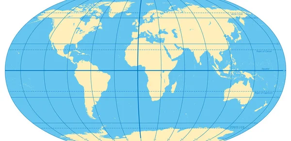
World Map With Most Important Circles Of Latitudes And Longitudes, Showing Equator, Greenwich Meridian, Arctic And Antarctic Circle, Tropic Of Cancer And Capricorn. English. Illustration. Vector.
Vector, 3.17MB, 9000 × 4378 eps
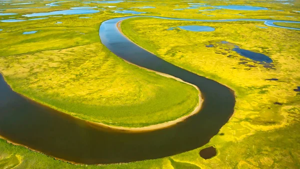
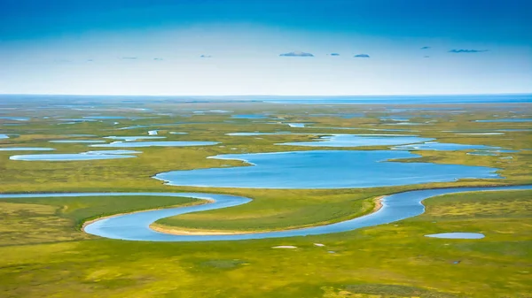
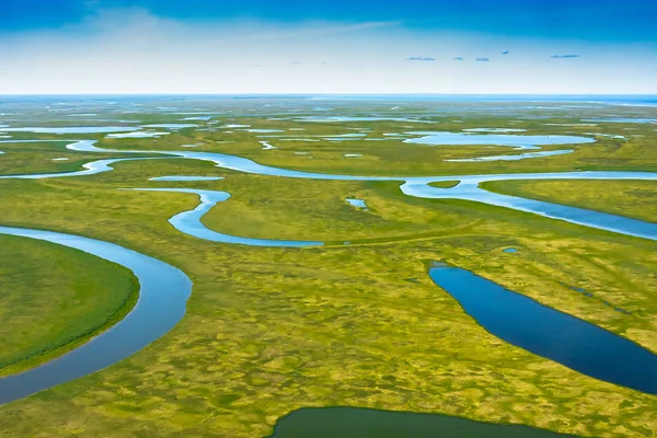
Landscape Of The Arctic Tundra In Summer. Rivers, Lakes, Northern Vegetation. View From Above. The Concept Of Climate Change, Warming In The Arctic.
Image, 7.24MB, 3500 × 1969 jpg
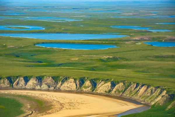
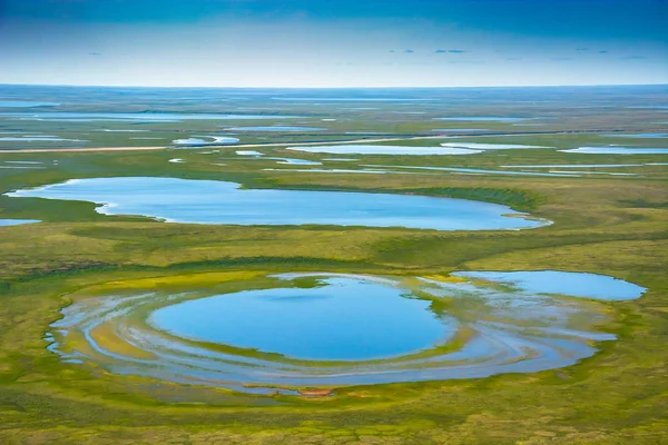
Landscape Of The Arctic Tundra In Summer. Rivers, Lakes, Northern Vegetation. View From Above. The Concept Of Climate Change, Warming In The Arctic.
Image, 7.62MB, 3500 × 2334 jpg
Green Tundra On The Coast Of The Arctic Ocean. Summer Arctic Landscape. The Concept Of Climate Change, Warming In The Arctic.
Image, 4.75MB, 3000 × 1688 jpg
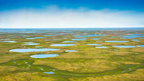
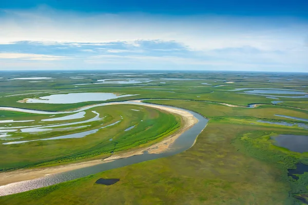
Landscape Of The Arctic Tundra In Summer. Rivers, Lakes, Northern Vegetation. View From Above. The Concept Of Climate Change, Warming In The Arctic.
Image, 6.54MB, 3500 × 1969 jpg
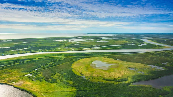
Landscape Of The Arctic Tundra In Summer. Rivers, Lakes, Northern Vegetation. View From Above. The Concept Of Climate Change, Warming In The Arctic.
Image, 5.72MB, 3000 × 2000 jpg
Landscape Of The Arctic Tundra In Summer. Rivers, Lakes, Northern Vegetation. View From Above. The Concept Of Climate Change, Warming In The Arctic.
Image, 4.73MB, 3000 × 2000 jpg
Landscape Of The Arctic Tundra In Summer. Rivers, Lakes, Northern Vegetation. View From Above. The Concept Of Climate Change, Warming In The Arctic.
Image, 6.56MB, 3500 × 1969 jpg
Landscape Of The Arctic Tundra In Summer. Rivers, Lakes, Northern Vegetation. View From Above. The Concept Of Climate Change, Warming In The Arctic.
Image, 5.85MB, 3000 × 2000 jpg

Landscape Of The Arctic Tundra In Summer. Rivers, Lakes, Northern Vegetation. View From Above. The Concept Of Climate Change, Warming In The Arctic.
Image, 5.66MB, 3000 × 2000 jpg

Snow-Covered Road Stretching Into Arctic Landscape. High Quality 4k Footage
Image, 2.28MB, 4096 × 2160 jpg
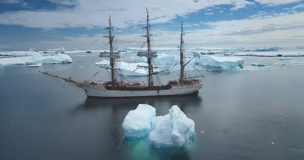
Old Fashioned Three-masted Sailing Vessel Yacht In Antarctica. Serene Arctic Winter Landscape, Icebergs Float Polar Ocean Under Blue Sky. Exploration, Scientific Expedition, Travel. Aerial Panorama
Image, 1.42MB, 4096 × 2160 jpg
The World With Most Important Circles Of Latitudes And Longitudes, Gray Political Map. Equator, Greenwich Meridian, Arctic And Antarctic Circle, Tropic Of Cancer And Capricorn. Illustration. Vector.
Vector, 3.37MB, 9000 × 5115 eps
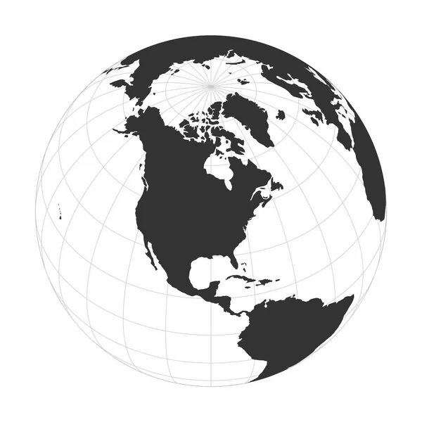
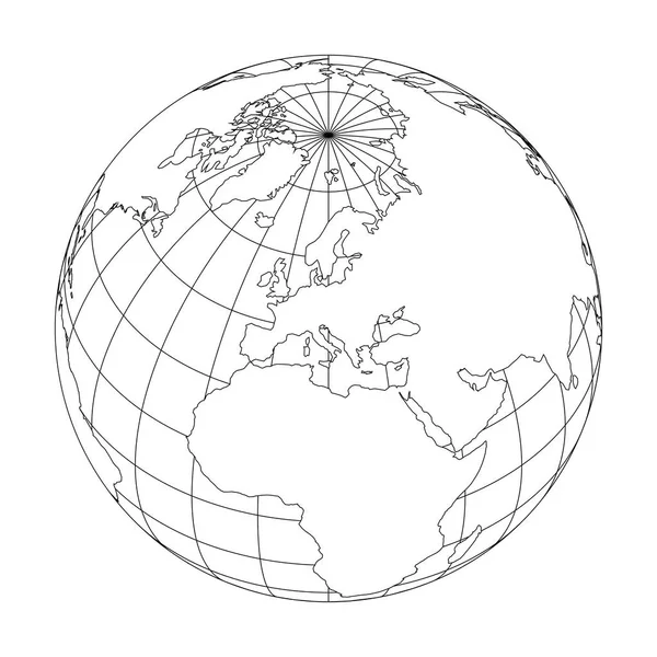
Outline Earth Globe With Map Of World Focused On Europe. Vector Illustration
Vector, 1.06MB, 6000 × 6000 eps
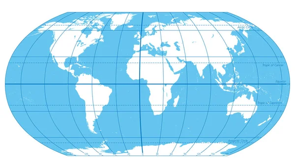
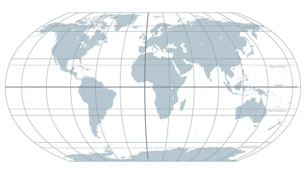
The World, Important Circles Of Latitudes And Longitudes, Blue Colored Political Map. Equator, Greenwich Meridian, Arctic And Antarctic Circle, Tropic Of Cancer And Capricorn. Illustration. Vector.
Vector, 3.38MB, 9000 × 5115 eps


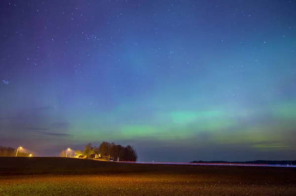
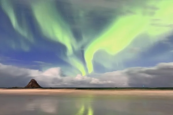
Green Lights-aurora Borealis Illuminate The Beach SW.of Bleik Village And Bleiksoya Island-biggest Puffin Resort In Norway On A High Wind Night. Andenes Town-Andoy Kommune-Andoya Island-Nordland Fylke
Image, 5.14MB, 4500 × 3000 jpg
Map Of The Arctic With The Least And Largest Extent Of The Ice Cap 2018
Vector, 2.37MB, 3100 × 3585 eps


Daxinganling Mohe, Heilongjiang Province Latitude Arctic Village Chinese People The Most Northern One
Image, 3.9MB, 6048 × 4032 jpg
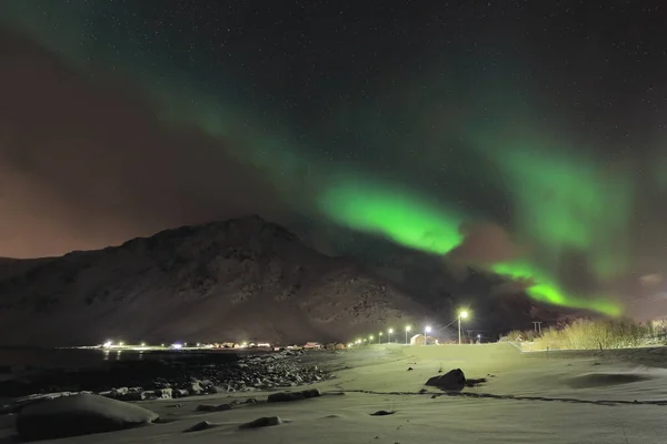
Green Lights-aurora Borealis Illuminate From The N.the Beach To The S.of Vareid Village On The Vareidsundet-Flakstadpollen Fjord Mouth On A Cold Quiet Night. Flakstadoya-Lofoten-Nordland Fylke-Norway.
Image, 6.2MB, 4500 × 3000 jpg
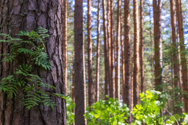
Pine Trees In A Forest In Northern Russia On A Sunny Summer Day. Coniferous Forests Of The Middle Latitude. Straight Vertical Tree Trunks.
Image, 10.47MB, 5184 × 3456 jpg


Named Latitudes On The Earth. The Equator Is The Largest Of The Parallels Of Significance On Earth. The Four Others Are Arctic Circle, Tropic Of Cancer, Tropic Of Capricorn And The Antarctic Circle.
Vector, 1.62MB, 9000 × 6000 eps

A Sculpture North Of Alice Springs Marking The Spot Where The Tropic Of Capricorn Crosses The Northern Territory Of Australia. June 2024.
Image, 20.66MB, 4000 × 6016 jpg

The Angus Tower Sinkhole In The Karst Topography In Wood Buffalo National Park In Canada's Northwest Territories
Image, 8.09MB, 4227 × 2818 jpg

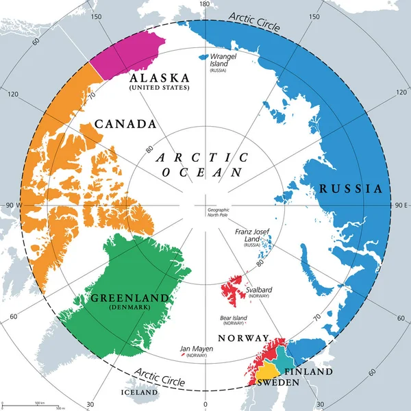
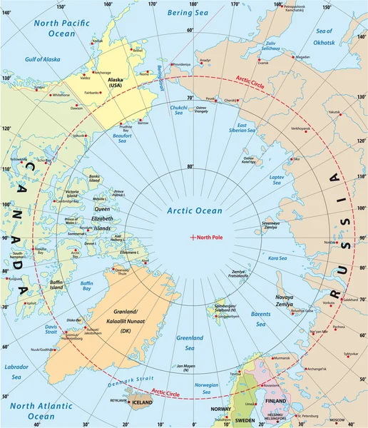
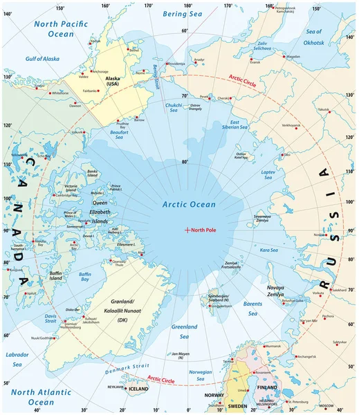
Countries Within The Arctic Circle, Political Map. Countries Within About 66 Degrees North The Equator And North Pole. Alaska (U.S.), Canada, Finland, Greenland (Denmark), Norway, Sweden And Russia.
Vector, 4MB, 6000 × 6000 eps
Page 1 >> Next