
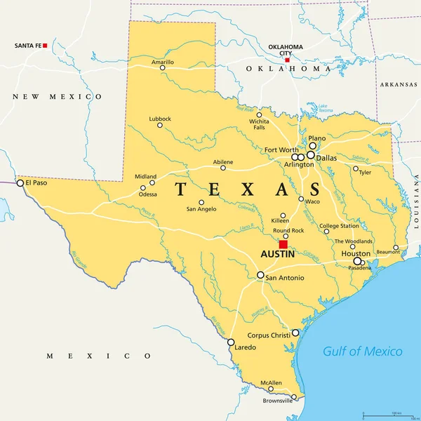
Stock image South Central Region


CINCINNATI, OH - CIRCA 2011: Baseball Stadium In Cincinnati, OH, USA At Summer 2011.
Image, 6.76MB, 4491 × 2994 jpg

Typography Composition Of City Names, Silhouettes Maps Of The States Of America, Vector Detailed Posters, Division West South Central - Arkansas, Louisiana, Oklahoma - Set 12 Of 17
Vector, 4.32MB, 8896 × 4168 eps
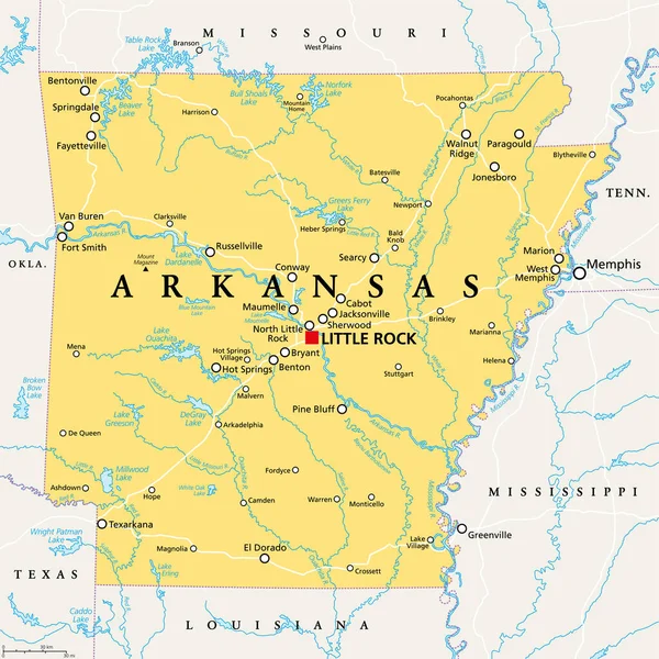
Arkansas, AR, Political Map, With Capital Little Rock, And Largest Cities, Lakes And Rivers. Landlocked State In The South Central United States, Nicknamed The Natural State, And Land Of Opportunity.
Vector, 5.71MB, 6000 × 6000 eps

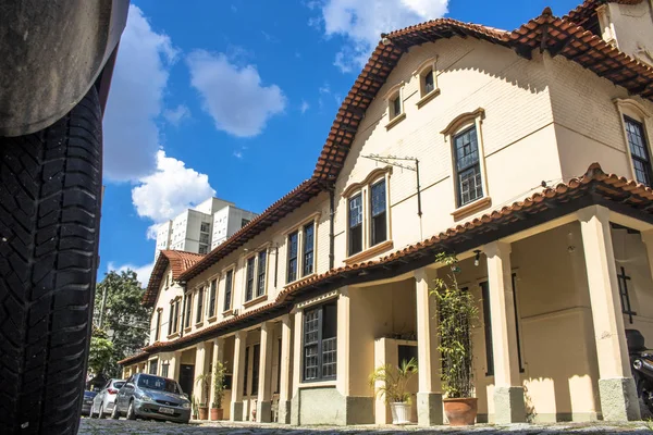
Sao Paulo, SP, Brazil, 02/23/2017. Facade Of The Houses Of Vila Dos Ingleses, In The District Of Luz, Central Region Of Sao Paulo, SP. The English Village, Located In The Central Region Of The City Of Sao Paulo
Image, 13.93MB, 5726 × 3817 jpg

Vector Posters States Of The United States With A Name, Nickname, Date Admitted To The Union, Division East South Central - Mississippi, Kentucky, Tennessee - Set 11 Of 17
Vector, 2.04MB, 8896 × 4168 eps

Vector Map Of China Provinces Colored By Regions. Chinese Names Gives In Parentheses
Vector, 6.93MB, 7292 × 6152 eps
Sao Paulo, SP, Brazil, 02/23/2017. Facade Of The Houses Of Vila Dos Ingleses, In The District Of Luz, Central Region Of Sao Paulo, SP. The English Village, Located In The Central Region Of The City Of Sao Paulo
Image, 13.2MB, 5885 × 3923 jpg
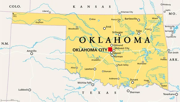
Oklahoma, OK, Political Map With Capital Oklahoma City, Important Cities, Rivers And Lakes. US State In The South Central Region, Nicknamed Native America, Land Of The Red Man, Or Sooner State. Vector
Vector, 3.68MB, 9000 × 5113 eps
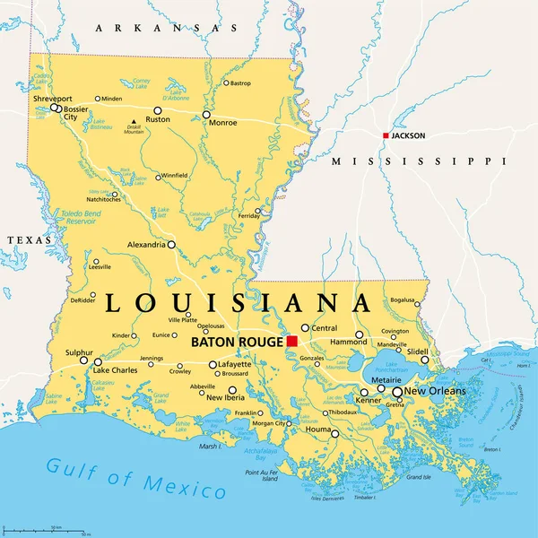
Louisiana, LA, Political Map, With Capital Baton Rouge And Metropolitan Area New Orleans. State In Deep South And South Central Regions Of The United States, Nicknamed Pelican, Bayou And Creole State.
Vector, 7.18MB, 6000 × 6000 eps

United States Census Bureau Regions And Divisions Vector Map. Flag Of United States Of America
Vector, 6.79MB, 7292 × 3543 eps

Louisiana, U.S. State, Gray Political Map With Borders And Parish Names. State In The Deep South And South Central Regions Of The United States, Subdivided Into 64 Parishes. Nicknamed Pelican State.
Vector, 3.54MB, 6413 × 6000 eps

Sao Paulo, SP, Brazil. November 14, 2021. View Of The Buildings In The Central Region Of The City From The Major Quedinho Viaduct In Downtown Sao Paulo
Image, 15.07MB, 6000 × 4000 jpg
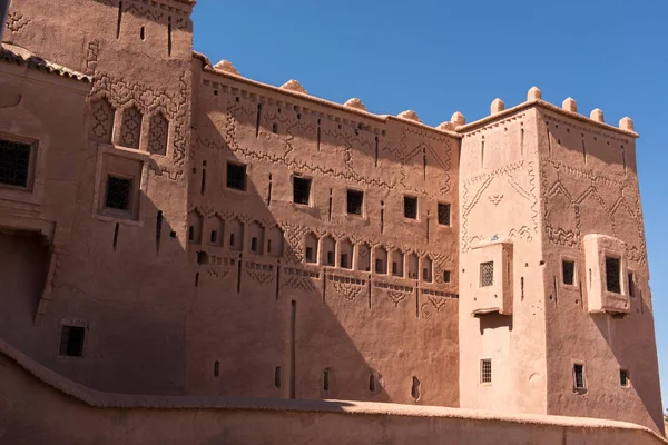
Ouarzazate Nicknamed The Door Of The Desert, Is A City And Capital Of Ouarzazate Province In Dra Tafilalet Region Of South Central Morocco.
Image, 12.27MB, 6016 × 4016 jpg

Sao Paulo, SP, Brazil. November 14, 2021. View Of The Buildings In The Central Region Of The City From The Major Quedinho Viaduct In Downtown Sao Paulo
Image, 14.63MB, 4000 × 6000 jpg

Oklahoma, U.S. State, Gray Political Map With Borders And County Names. State In The South Central Region Of USA, Subdivided Into 77 Counties. Native America, Land Of The Red Man, And Sooner State.
Vector, 1.96MB, 9000 × 4955 eps

Sao Paulo, SP, Brazil. November 14, 2021. View Of The Buildings In The Central Region Of The City From The Major Quedinho Viaduct In Downtown Sao Paulo
Image, 12.9MB, 4000 × 6000 jpg

Oklahoma, U.S. State, Political Map With Borders And County Names. State In The South Central Region Of The USA, Subdivided Into 77 Counties. Native America, Land Of The Red Man, And Sooner State.
Vector, 2.25MB, 9000 × 5113 eps

West South Central States, Multi Colored Political Map. United States Census Division Of The South Region, Consisting Of The States Arkansas, Louisiana, Oklahoma, And Texas. Illustration. Vector
Vector, 0.72MB, 6423 × 6000 eps

Sao Paulo, SP, Brazil. November 14, 2021. View Of The Buildings In The Central Region Of The City From The Major Quedinho Viaduct In Downtown Sao Paulo
Image, 14.4MB, 6000 × 4000 jpg

Louisiana, U.S. State, Political Map With Borders And Names Of Parishes. State In The Deep South And South Central Regions Of The United States, Subdivided Into 64 Parishes. Nicknamed Pelican State.
Vector, 4.66MB, 6000 × 6000 eps


Vineyard At Palava At Czech Republic, National Park, Wine And Agriculture, Summer Sky With White Clouds
Image, 10.2MB, 6000 × 4000 jpg

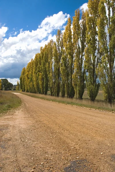
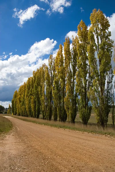
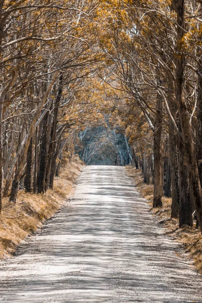
A Long Dirt Road In A Forest Of Overhanging Trees Recovering From Bushfire In Kanangra-Boyd National Park In The Central Tablelands In Regional New South Wales Australia
Image, 19.13MB, 5792 × 8688 jpg


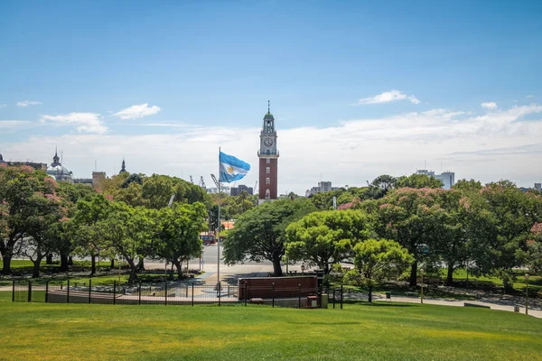
Torre Monumental Or Torre De Los Ingleses (Tower Of The English) And General San Martin Plaza In Retiro - Buenos Aires, Argentina
Image, 15.23MB, 6000 × 4000 jpg


Fisherman's Hut On The Bank Of The Tuyen Lam Lake, Dalat, Central Highlands, Vietnam, Asia
Image, 1.68MB, 5132 × 3409 jpg

Wine Cellars In Petrov Plze. Winemaking Region In South Moravia, Czech Republic
Image, 5.68MB, 5568 × 3712 jpg

Shymkent, Kazakhstan, 10.10.2021. View Of The City Of Shymkent, The Monument "Mother Earth" And The Hotel "Ordabasy" ("The Beginning Of The Horde" - English) In The Autumn Morning
Image, 20.8MB, 8256 × 5504 jpg

CINCINNATI, OH - CIRCA 2011: Carousel In The Amusement Park Kings Island In Cincinnati, OH, USA At Summer 2011.
Image, 10.32MB, 4408 × 2939 jpg


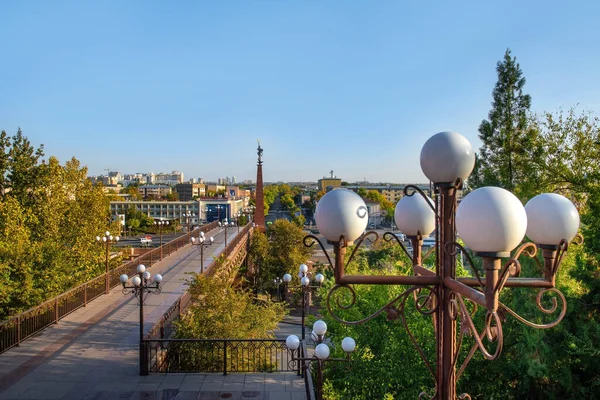
Bridge As A Part Of Central Otago Railway Bicycle Trail In New Zealand
Image, 14.48MB, 6016 × 4016 jpg


Page 1 >> Next