
Stock image Tectonic Plates Map

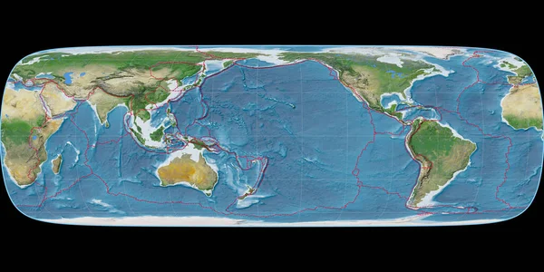
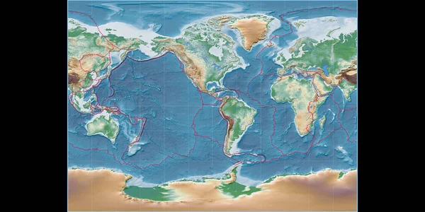
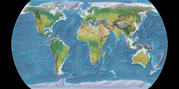
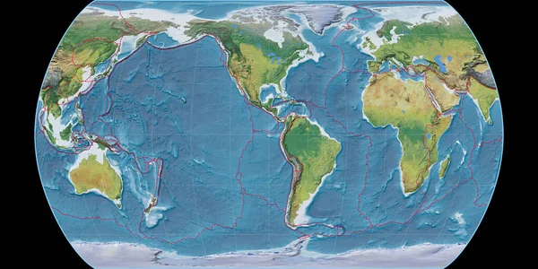
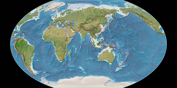
World Map In The Miller Cylindrical Projection Centered On 90 East Longitude. Main Physiographic Landscape Features - Composite Of Raster With Graticule And Tectonic Plates Borders. 3D Illustration
Image, 7.71MB, 4000 × 2000 jpg
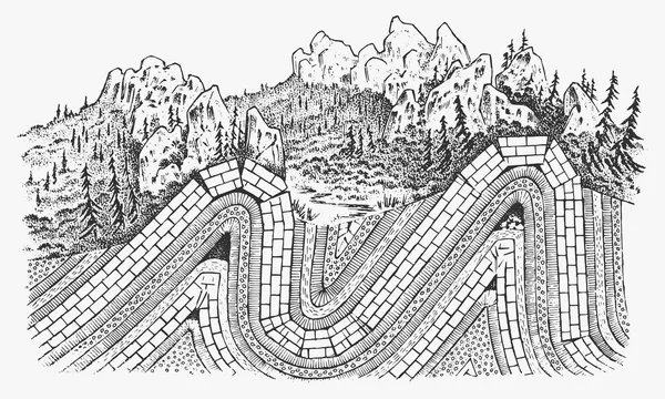
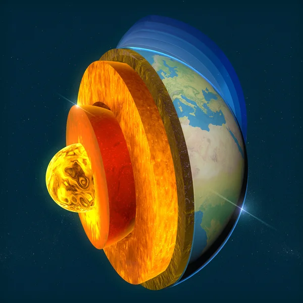
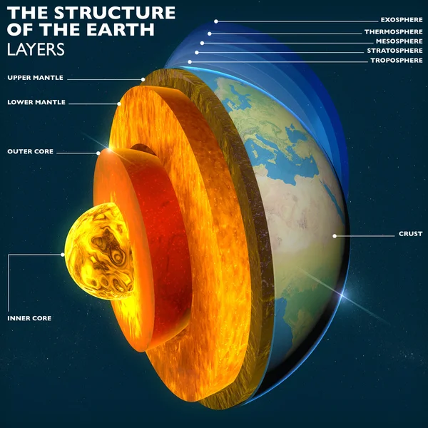
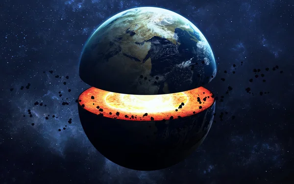
Layers Of Tectonic Plates Concept. Lithosphere And The Structure Of The Earth. Soil And Limestone. Geography Geology Background. The Scheme Of The Formation Of Mountains.
Vector, 8.92MB, 6000 × 3600 eps
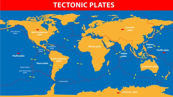
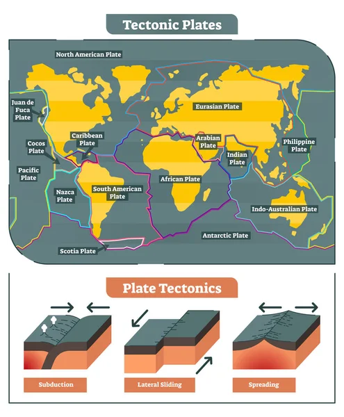
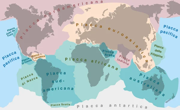
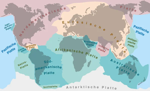
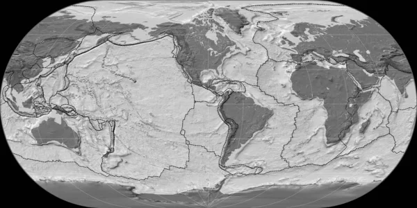
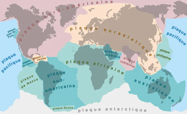
Map Of The Principal Tectonic Plates Of The Earth. The Sixteen Major Pieces Of Crust And Uppermost Mantle Of The Earth, Called The Lithosphere, And Consisting Of Oceanic And Continental Crust. Vector
Vector, 4.27MB, 9000 × 4681 eps

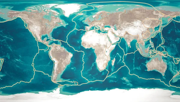
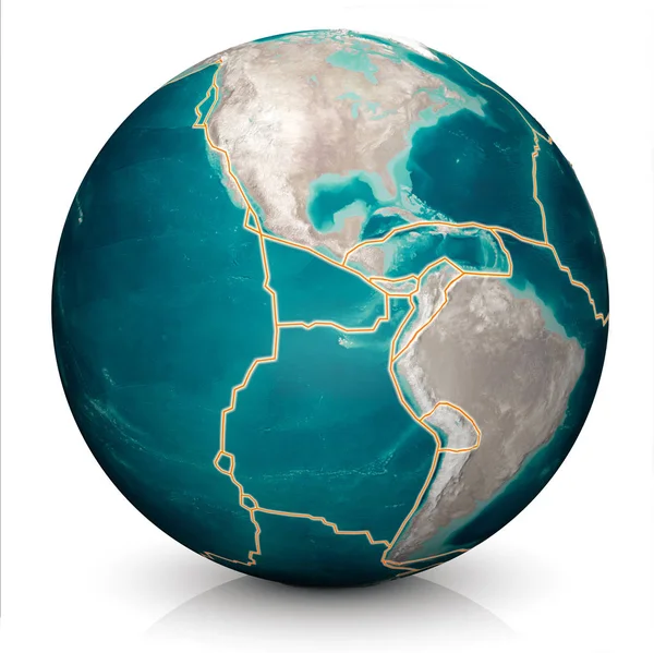
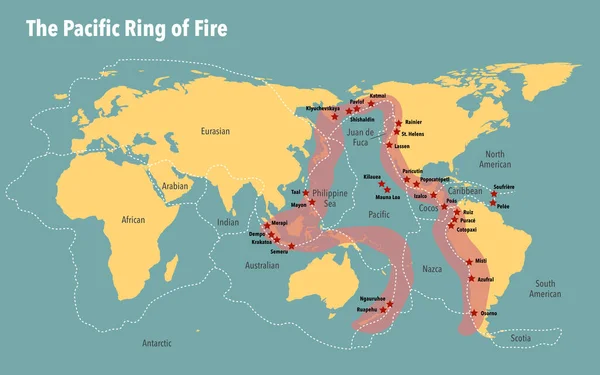
Tectonic Plates Move Constantly, Making New Areas Of Ocean Floor, Building Mountains, Causing Earthquakes, And Creating Volcanoes. 3d Rendering. Map. Element Of This Image Are Furnished By Nasa
Image, 16.33MB, 6675 × 3800 jpg
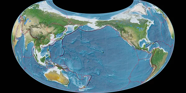
World Map In The Tobler G1 Projection Centered On 170 West Longitude. Satellite Imagery A - Composite Of Raster With Graticule And Tectonic Plates Borders. 3D Illustration
Image, 7.98MB, 4000 × 2000 jpg

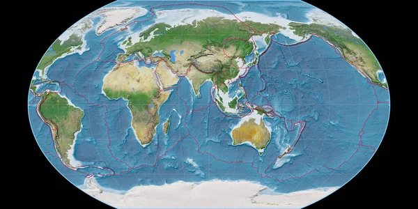
World Map In The Kavraisky VII Projection Centered On 90 East Longitude. Satellite Imagery A - Composite Of Raster With Graticule And Tectonic Plates Borders. 3D Illustration
Image, 8.84MB, 4000 × 2000 jpg

World Map In The Miller Cylindrical Projection Centered On 90 West Longitude. Colored Shader, Elevation Map - Composite Of Raster With Graticule And Tectonic Plates Borders. 3D Illustration
Image, 7.56MB, 4000 × 2000 jpg

Tectonic Plates Move Constantly, Making New Areas Of Ocean Floor, Building Mountains, Causing Earthquakes, And Creating Volcanoes. 3d Rendering. Map. Element Of This Image Are Furnished By Nasa
Image, 9.22MB, 5014 × 5010 jpg
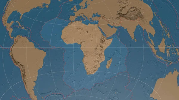
World Map In The Canters Pseudocylindric Projection Centered On 11 East Longitude. Main Physiographic Landscape Features - Composite Of Raster With Graticule And Tectonic Plates Borders. 3D Illustration
Image, 9.85MB, 4000 × 2000 jpg
World Map In The Raisz-Armadillo Projection Centered On 170 West Longitude. Satellite Imagery A - Composite Of Raster With Graticule And Tectonic Plates Borders. 3D Illustration
Image, 8.78MB, 4000 × 2000 jpg

World Map In The Mcbryde (Continents) Projection Centered On 0 East Longitude. Satellite Imagery A - Composite Of Raster With Graticule And Tectonic Plates Borders. 3D Illustration
Image, 8.15MB, 4000 × 2000 jpg

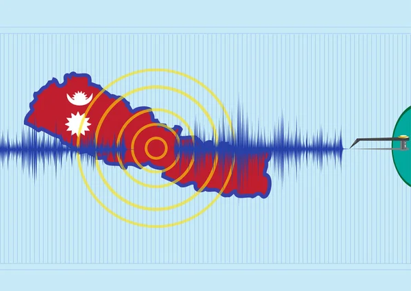
Dresden, Germany - February 13, 2023: Map Of Turkey And Syria With Recent Deadliest Earthquake Location Depicted As Dots By USGS Real Time Detection Service. Cumulative Data For One Week.
Image, 6.54MB, 3167 × 2000 jpg
Tectonic Plates Move Constantly, Making New Areas Of Ocean Floor, Building Mountains, Causing Earthquakes, And Creating Volcanoes. 3d Rendering. Map. Element Of This Image Are Furnished By Nasa
Image, 9.22MB, 5014 × 5010 jpg
Tectonic Plates Move Constantly, Making New Areas Of Ocean Floor, Building Mountains, Causing Earthquakes, And Creating Volcanoes. 3d Rendering. Map. Element Of This Image Are Furnished By Nasa
Image, 9.11MB, 5014 × 5010 jpg

World Map In The Gall Stereographic Projection Centered On 11 East Longitude. Satellite Imagery A - Composite Of Raster With Graticule And Tectonic Plates Borders. 3D Illustration
Image, 7.17MB, 4000 × 2000 jpg

World Map In The Mcbryde-Thomas Projection Centered On 90 West Longitude. Main Physiographic Landscape Features - Composite Of Raster With Graticule And Tectonic Plates Borders. 3D Illustration
Image, 9.57MB, 4000 × 2000 jpg

World Map In The Miller Cylindrical Projection Centered On 11 East Longitude. Bilevel Topographic Map - Composite Of Raster With Graticule And Tectonic Plates Borders. 3D Illustration
Image, 3.38MB, 4000 × 2000 jpg
World Map In The Ortelius Oval Projection Centered On 90 West Longitude. Bilevel Topographic Map - Composite Of Raster With Graticule And Tectonic Plates Borders. 3D Illustration
Image, 4.7MB, 4000 × 2000 jpg

World Map In The Robinson Projection Centered On 90 East Longitude. Mean Annual Temperature Map - Composite Of Raster With Graticule And Tectonic Plates Borders. 3D Illustration
Image, 4.34MB, 4000 × 2000 jpg

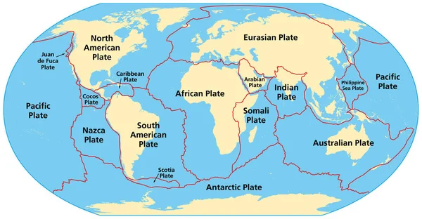
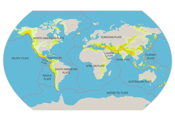
Map Of Earth's Principal Tectonic Plates, Tectonic Plate World Map Concept Design, The Sixteen Major Pieces Of Crust And Uppermost Mantle Of The Earth, Called The Lithosphere, Earth's Surface, Geology
Image, 1.06MB, 4800 × 2700 jpg

World Map In The Braun Stereographic Projection Centered On 90 West Longitude. Colored Shader, Elevation Map - Composite Of Raster With Graticule And Tectonic Plates Borders. 3D Illustration
Image, 8.8MB, 4000 × 2000 jpg
World Map In The Canters Pseudocylindric Projection Centered On 90 West Longitude. Main Physiographic Landscape Features - Composite Of Raster With Graticule And Tectonic Plates Borders. 3D Illustration
Image, 9.84MB, 4000 × 2000 jpg

World Map In The Canters Pseudocylindric Projection Centered On 11 East Longitude. Topographic Relief Map - Composite Of Raster With Graticule And Tectonic Plates Borders. 3D Illustration
Image, 9.85MB, 4000 × 2000 jpg


World Map In The Ortelius Oval Projection Centered On 11 East Longitude. Bilevel Topographic Map - Composite Of Raster With Graticule And Tectonic Plates Borders. 3D Illustration
Image, 4.73MB, 4000 × 2000 jpg
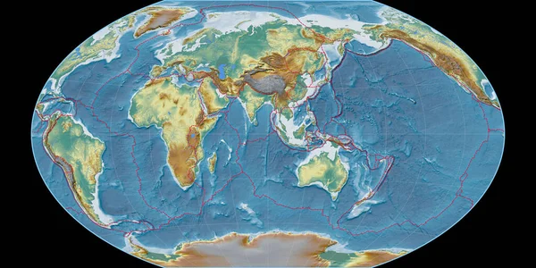
World Map In The Winkel Tripel Projection Centered On 90 East Longitude. Topographic Relief Map - Composite Of Raster With Graticule And Tectonic Plates Borders. 3D Illustration
Image, 9.18MB, 4000 × 2000 jpg
World Map In The Winkel Tripel Projection Centered On 90 East Longitude. Satellite Imagery B - Composite Of Raster With Graticule And Tectonic Plates Borders. 3D Illustration
Image, 9.16MB, 4000 × 2000 jpg
Africann Tectonic Plate Overview The Global Grayscale Elevation Map In The Azimuthal Equidistant Projection With Dashed Plates Borders. 3D Rendering
Image, 3.52MB, 2880 × 1620 jpg
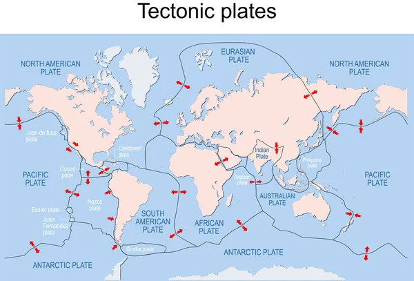
Map Of Earth's Principal Tectonic Plates. Earth's Lithosphere. Major And Minor Plates. Arrows Indicate Direction Of Movement At Plate Boundaries. Vector Illustration
Vector, 3.61MB, 11775 × 7995 eps
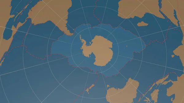
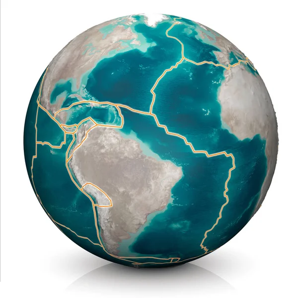
Antarctic Tectonic Plate Overview The Global Shapes Only - Land/ocean Mask In The Azimuthal Equidistant Projection With Dashed Plates Borders. 3D Rendering
Image, 1.56MB, 2880 × 1620 jpg
Page 1 >> Next