
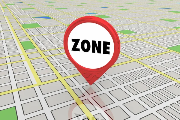
Stock image Zoning Regulation
Imaginary General Urban Plan And Buildings Permit With Indications Of Urban Destinations And Old Cityscape
Image, 12.03MB, 5751 × 4147 jpg
Imaginary Zoning Ordinance, General Urban Plan With Indications Of Urban Destinations With Buildings, Buildable Areas, Land Plot And Real Estate Land Property
Image, 7.76MB, 4752 × 3168 jpg
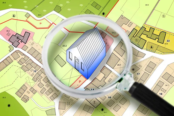
Searching New Home - Concept With An Imaginary General Urban Plan With Buildings, Roads And Magnifying Glass - NOTE: The Map Is Totally Invented And Does Not Represent Any Real Place
Image, 6.81MB, 4752 × 3168 jpg
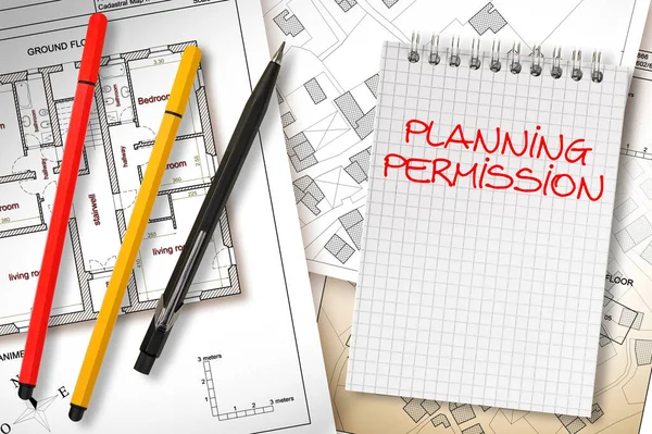
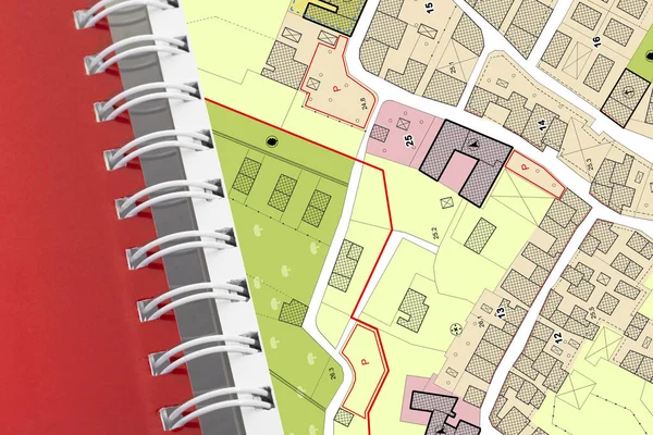
Planning Permission Concept With Imaginary General Urban Plan, Cadastral Map And Notebook
Image, 13.17MB, 7087 × 4722 jpg
Land Plot Management - Real Estate Concept With A Vacant Land For Building Construction And Imaginary General Urban Plan With Indications Of Urban Destinations
Image, 17.59MB, 6336 × 3168 jpg
Imaginary General Urban Plan With Indications Of Urban Destinations With Buildings, Roads, Buildable Areas And Land Plot - Problems And Solutions Concept In Jigsaw Puzzle Shape
Image, 26.81MB, 10000 × 5083 jpg
Engineer Drawing Over An Imaginary General Urban Plan Of Territory With Buildings, Roads And Land Parcel - Note: The Map Is Totally Invented And Does Not Represent Any Real Place
Image, 6.87MB, 4752 × 3168 jpg
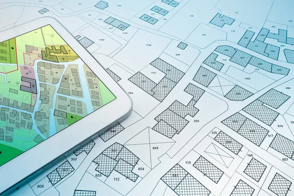
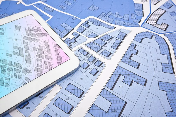
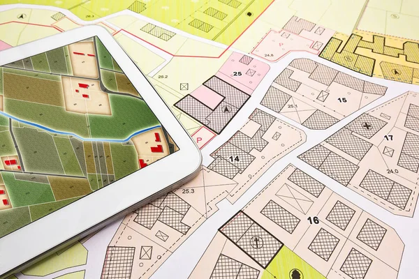
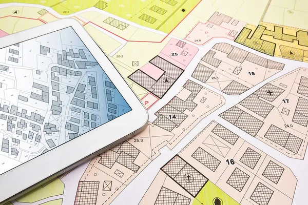
Buildings Permit Concept With Imaginary Cadastral On Digital Tablet - Building Activity And Construction Industry With General Urban Plan
Image, 12.16MB, 5760 × 3840 jpg
Buildings Permit Concept With Imaginary Cadastral On Digital Tablet - Building Activity And Construction Industry With General Urban Plan
Image, 17.49MB, 5760 × 3840 jpg

Imaginary General Urban Plan With Indications Of Urban Destinations With Buildings, Roads, Buildable Areas And Land Plot - Problems And Solutions Concept In Jigsaw Puzzle Shape
Image, 9.33MB, 5484 × 3528 jpg

Buildings Permit Concept With Imaginary Cadastral On Digital Tablet - Building Activity And Construction Industry With General Urban Plan
Image, 12.16MB, 5760 × 3840 jpg
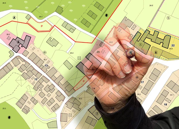
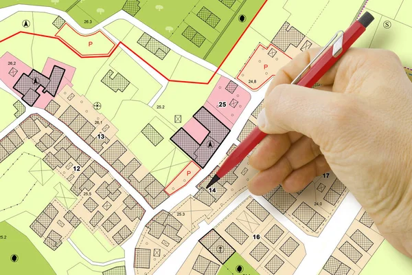
Imaginary General Urban Plan With Indications Of Urban Destinations With Buildings, Roads, Buildable Areas And Land Plot With Female Hand Writing
Image, 11.13MB, 5751 × 4147 jpg

Imaginary General Urban Plan With Urban Destinations Roads, Buildable Areas, Land Plot And Lone Tree On A Rural Scene - Note: The Map Is Totally Invented And Does Not Represent Any Real Place
Image, 15.04MB, 7872 × 3168 jpg
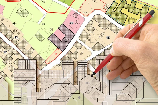
Architect Drawing Buildings Over An Imaginary Cadastral Map Of Territory And General Urban Plan With Indications Of Urban Destinations With Buildings, Roads, Buildable Areas And Land Plot
Image, 6.76MB, 4752 × 3168 jpg
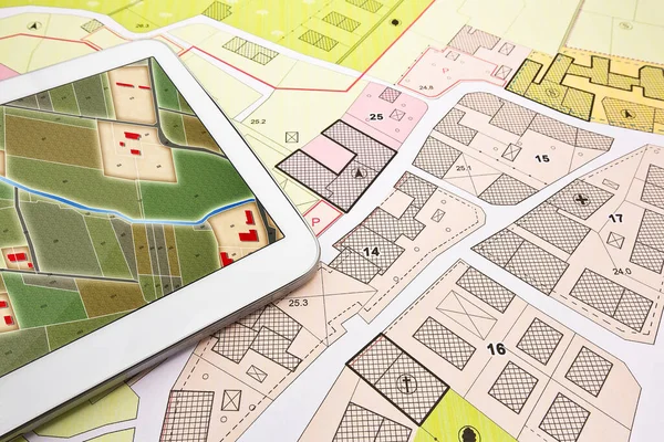
Buildings Permit Concept With Imaginary Cadastral On Digital Tablet - Building Activity And Construction Industry With General Urban Plan
Image, 10.71MB, 5760 × 3840 jpg
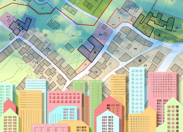
Imaginary General Urban Plan With Urban Destinations, Buildings, Buildable Areas, Land Plot And Cityscape On Foreground
Image, 10.18MB, 5751 × 4147 jpg

Buildings Permit Concept With Imaginary Cadastral On Digital Tablet - Building Activity And Construction Industry With General Urban Plan
Image, 17.49MB, 5760 × 3840 jpg
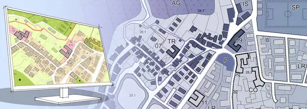
Imaginary General Urban Plan - Zoning Regulations With Zoning Districts, Urban Destinations, Land Use, Buildable Areas And Land Plot - Web Design Banner Concept With Copy Space And Space For Text
Image, 7MB, 7872 × 3168 jpg
Imaginary General Urban Plan And Cadastral Map With Indications Of Urban Destinations And Buildings Permit Stamp
Image, 10.99MB, 5760 × 3840 jpg
Buildings Permit Concept With Imaginary Cadastral On Digital Tablet - Building Activity And Construction Industry With General Urban Plan
Image, 10.71MB, 5760 × 3840 jpg

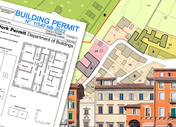
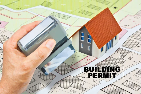
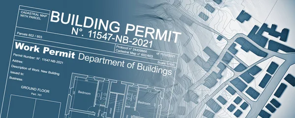
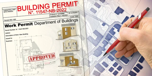
Building Permit Concept With Imaginary General Urban Plan And Cadastral Map
Image, 8.49MB, 5751 × 4147 jpg
Buildings Permit Concept With Imaginary Cadastral Map - Building Activity And Construction Industry Concept With City Map And Building Work Permission
Image, 13.58MB, 7872 × 3168 jpg

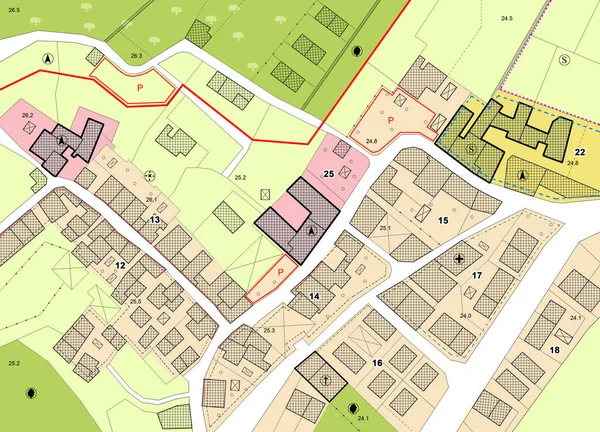
Lone Tree Against An Imaginary General Urban Plan With Urban Destinations Roads, Buildable Areas And Land Plot.
Image, 13.48MB, 5751 × 4147 jpg
Imaginary General Urban Plan Concept. Zoning Regulations With Zoning Districts, Urban Destinations, Land Use, Buildable Areas And Land Plot
Image, 22MB, 14049 × 5030 jpg

Buildings Permit Concept With Imaginary Cadastral Map And General Urban Plan - Building Activity And Construction Industry Concept With Magnifying Glass
Image, 11.27MB, 5760 × 2880 jpg
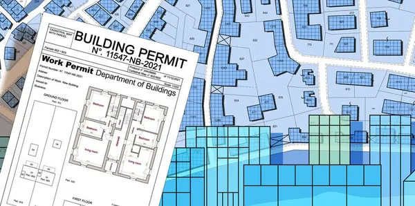
Building Permit Concept With Imaginary General Urban Plan And Cadastral Map
Image, 12.93MB, 7786 × 3874 jpg
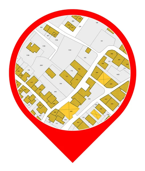
Imaginary General Urban Plan - Zoning Regulations With Zoning Districts, Urban Destinations, Land Use, Buildable Areas And Land Plot - Icon Concept
Image, 4.4MB, 3880 × 4574 jpg
Imaginary General Urban Plan Concept - Zoning Regulations With Zoning Districts, Urban Destinations, Land Use, Buildable Areas And Land Plot Concept
Image, 11.57MB, 5760 × 3840 jpg

Imaginary General Urban Plan Anda Cadastral Concept - Zoning Regulations With Zoning Districts, Urban Destinations, Land Use, Buildable Areas And Land Plot - Jigsaw Puzzle Shape Concept
Image, 8.15MB, 5760 × 3840 jpg
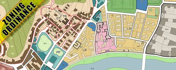
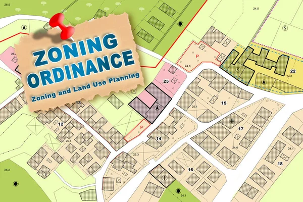
ZONING ORDINANCE CONCEPT With Imaginary General Urban Plan, Indications Of Urban Destinations With Buildings, Buildable Areas, Land Plot And Real Estate Land Property
Image, 19.01MB, 10368 × 4147 jpg
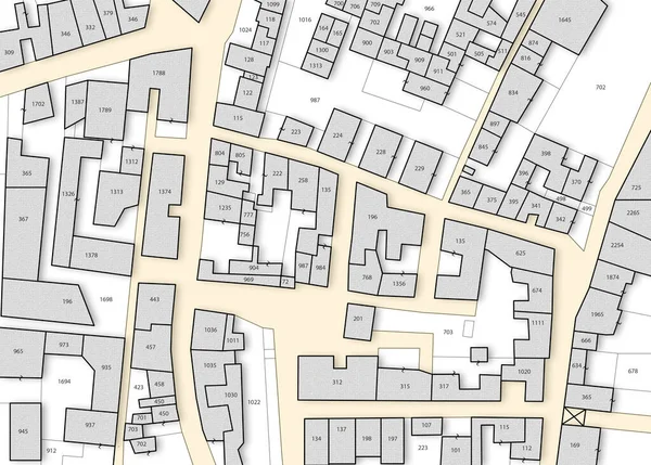
Imaginary General Urban Plan With Indications Of Urban Destinations With Buildings, Roads, Buildable Areas And Land Plot - Note: The Map Is Totally Invented And Does Not Represent Any Real Place
Image, 8.83MB, 5751 × 4147 jpg

ZONING ORDINANCE CONCEPT With Imaginary General Urban Plan, Indications Of Urban Destinations With Buildings, Buildable Areas, Land Plot And Real Estate Land Property
Image, 9.56MB, 5751 × 4147 jpg

Imaginary General Urban Plan With Urban Destinations, Roads, Buildable Areas And Land Plot - Banner Design With Copy Space - Note: The Map Is Totally Invented And Does Not Represent Any Real Place
Image, 6.14MB, 7872 × 3168 jpg

Installation Of Photovoltaic Park On Land And Urban Planning - Ground-mounted Photovoltaic System In A Rural Scene - Concept With Imaginary Cadastral And General Urban Planning
Image, 23.14MB, 6600 × 3300 jpg

Installation Of Photovoltaic Park On Land And Urban Planning - Ground-mounted Photovoltaic System In A Rural Scene - Concept With Imaginary Cadastral And General Urban Planning
Image, 24.56MB, 8000 × 3300 jpg
Buildings Permit Concept With Imaginary Cadastral On Digital Tablet - Building Activity And Construction Industry With General Urban Plan
Image, 15.55MB, 5760 × 3840 jpg
Buildings Permit Concept With Residential Building Project Against An Imaginary Floor Plans And Elevations Project Of A New Building
Image, 12.25MB, 6336 × 3168 jpg

Trend In The Construction Industry And Building Market - Concept With Imaginary General Urban Plan And Chart
Image, 7.39MB, 4752 × 3168 jpg
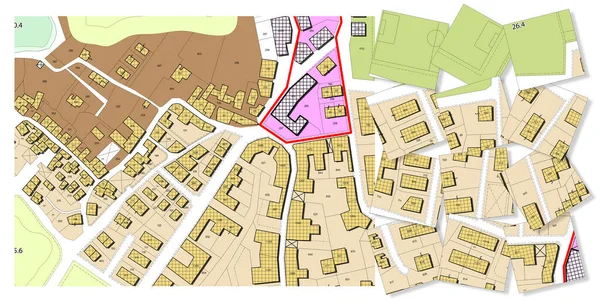
Imaginary Cadastral Map With Buildings, Land Parcel And Vacant Plot - Land Records And Property Registry Concept
Image, 11.3MB, 5745 × 4114 jpg
Imaginary Cadastral Map With Buildings, Land Parcel, Vacant Plot And Volumetric Format Plan
Image, 15.15MB, 5760 × 3840 jpg
Imaginary Cadastral Map With Buildings, Land Parcel And Vacant Plot - Icon Concept
Image, 4.6MB, 3880 × 4574 jpg

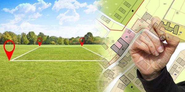
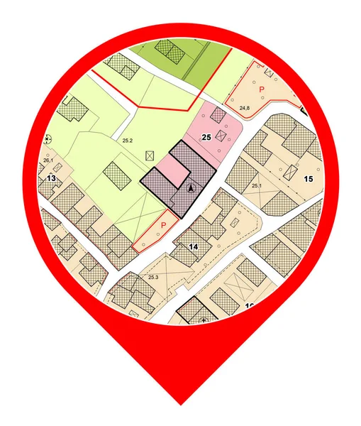
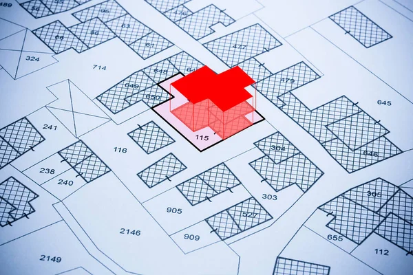
Building Activity With Red Location Pin Point Against An Imaginary General Urban Plan And Cadastral Map With Zoning Regulations, Urban Districts, Urban Destinations And Land Use - Real Estate Concept
Image, 9.24MB, 4752 × 3163 jpg

Imaginary Cadastral Map With Buildings, Land Parcel And Vacant Plot - Land Records And Property Registry Concept With Cadastral Parcel
Image, 13.82MB, 6000 × 3994 jpg

Expansion Of Cities And Construction On Natural Spaces. Expansion Of Human Settlements. Damage To Nature. Regulation And Environmental Protection.
Image, 11.75MB, 5923 × 3716 jpg

Buildings Permit Concept With Vacant Land Available For Building Construction, Work Permitl On Digital Tablet - Building Activity And Construction Industry Concept With Residential Building Project
Image, 20.38MB, 5669 × 3779 jpg

Imaginary Cadastral Map Of Territory With Building In The Center - Land Registry Concept Illustration
Image, 8.62MB, 5284 × 3520 jpg

Imaginary Cadastral Map With Buildings, Land Parcel And Vacant Plot - Land Records And Property Registry With Cadastre Documentation And Ownership Parcel Identification
Image, 17.89MB, 5760 × 3840 jpg

Imaginary Cadastral Map With Buildings, Land Parcel And Vacant Plot Printed On Paper
Image, 8.71MB, 5284 × 3520 jpg
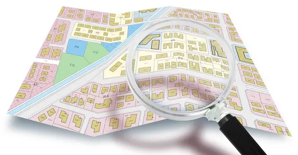
Imaginary Cadastral And General Urban Planning - Zoning Regulations, Building Codes With Zoning Districts, Urban Destinations, Land Use, Buildable Areas And Land Plot Concept With Magnifying Glass
Image, 10.43MB, 6686 × 3498 jpg
Page 1 >> Next