
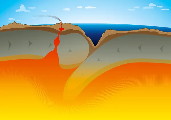
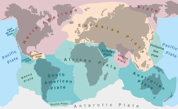
Stock image Tectonic Plate

Plate Boundaries Vector Illustration. Labeled Tectonic Movement Comparison.
Vector, 5.64MB, 4000 × 4000 eps

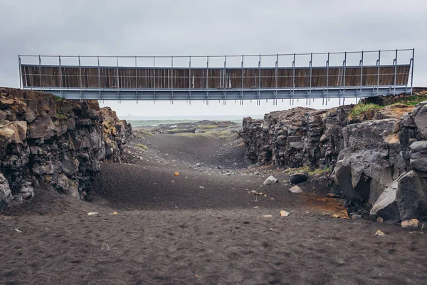
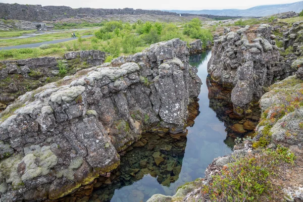
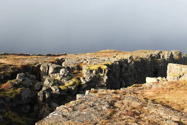
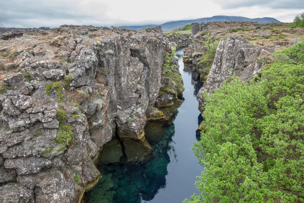
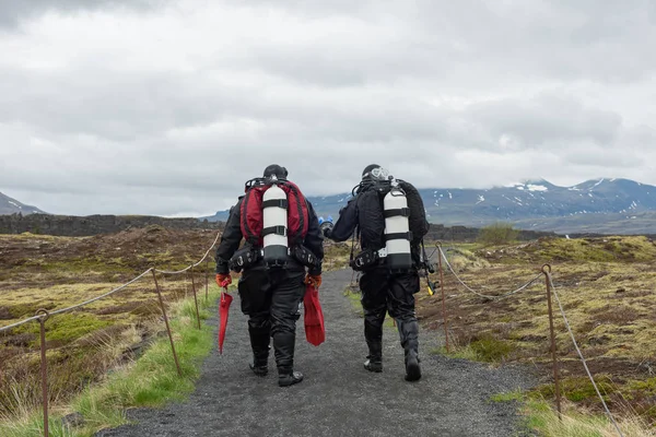
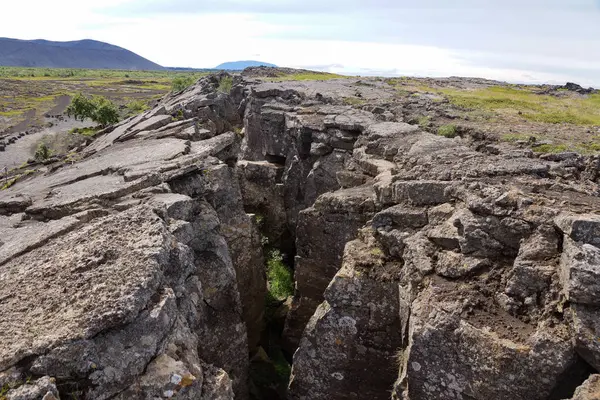
Midlina - The Small Symbolic Footbridge Between Two Continents In Reykjanes Peninsula In Iceland
Image, 7.45MB, 4200 × 2803 jpg
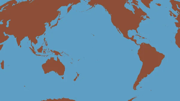
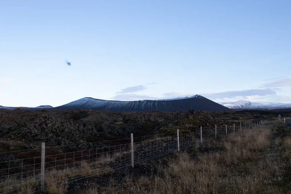
Pattern Map Of The Area Around The Pacific Tectonic Plate. 3D Rendering
Image, 5.52MB, 2880 × 1620 jpg
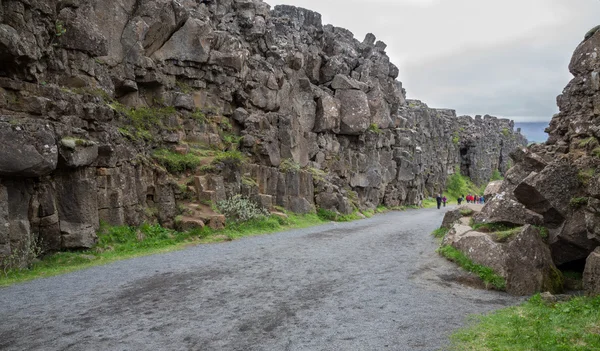

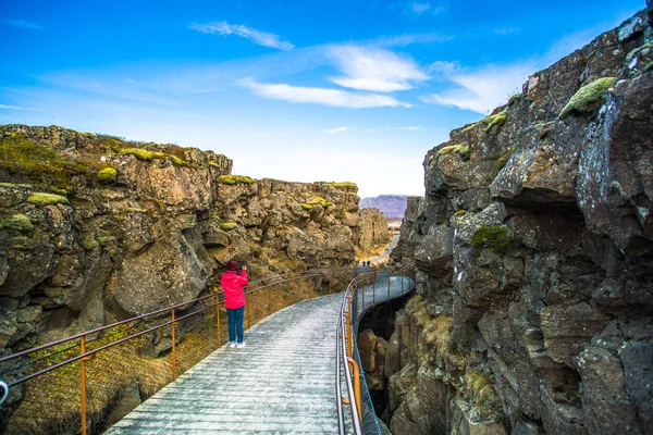
Rocks Next To Symbolic Footbridge Between Two Continents In Reykjanes Peninsula In Iceland
Image, 7.82MB, 4100 × 2737 jpg

South American Tectonic Plate Enlarged And Extruded The Global Grayscale Elevation Map In The Azimuthal Equidistant Projection With Dashed Plates Borders. 3D Rendering
Image, 2.87MB, 2880 × 1620 jpg

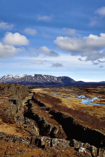
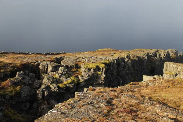
Pingvellir (Thingvellir), A Site Of Historical And Cultural National Park In Southwestern Iceland, Boundary Between The North American Tectonic Plate And The Eurasian
Image, 37.2MB, 7952 × 5304 jpg

Okinawa Tectonic Plate Outlined On The Globe. Satellite Imagery. 3D Rendering
Image, 3.53MB, 2880 × 1620 jpg

Solomon Sea Tectonic Plate Outlined On The Global Color Physical Map In The Kavrayskiy Projection. 3D Rendering
Image, 3.81MB, 2880 × 1620 jpg
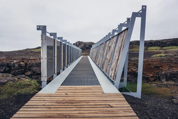
Midlina - The Small Symbolic Footbridge Between Two Continents In Reykjanes Peninsula In Iceland
Image, 7.92MB, 4600 × 3071 jpg
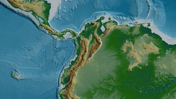
Outline Of The North Andes Tectonic Plate With The Borders Of Surrounding Plates Against The Background Of A Physical Map. 3D Rendering
Image, 4.76MB, 2880 × 1620 jpg

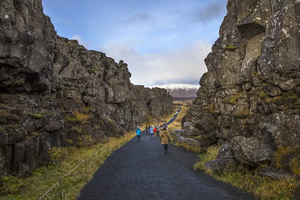
Thingvellir, Iceland - October 10th 2018: Visitors Walking Between The North American And Eurasian Tectonic Plates In The Historic Thingvellir National Park In Iceland.
Image, 27.7MB, 6720 × 4480 jpg
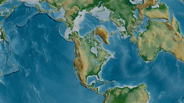
Physical Map Of The Area Around The North American Tectonic Plate. 3D Rendering
Image, 5.52MB, 2880 × 1620 jpg

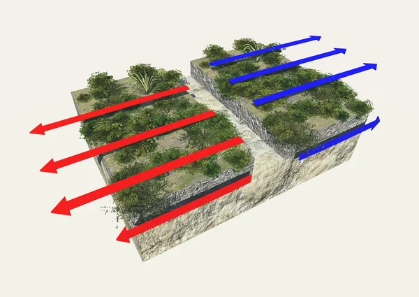
Different Types Of Plate Boundaries: Divergent Boundaries, Terrain Section, 3d Render. Tectonic Plates, Side Sliding Margin, Earthquake
Image, 12.36MB, 5511 × 4000 jpg

Relief Map Of The Area Around The Molucca Sea Tectonic Plate. 3D Rendering
Image, 4.05MB, 2880 × 1620 jpg
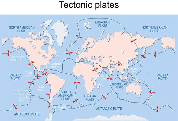
Map Of Earth's Principal Tectonic Plates. Earth's Lithosphere. Major And Minor Plates. Arrows Indicate Direction Of Movement At Plate Boundaries. Vector Illustration
Vector, 3.61MB, 11775 × 7995 eps
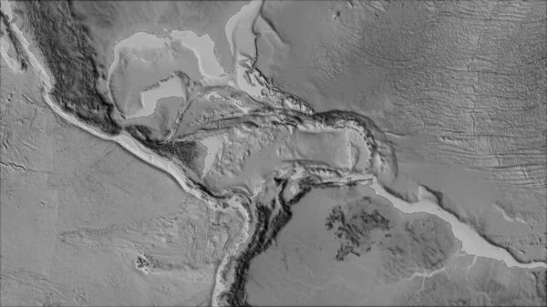
Neighborhoods Of The Caribbean Tectonic Plate On The Grayscale Map In The Van Der Grinten I Projection (oblique Transformation). Raw Composite - No Outlines
Image, 2.65MB, 2880 × 1620 jpg
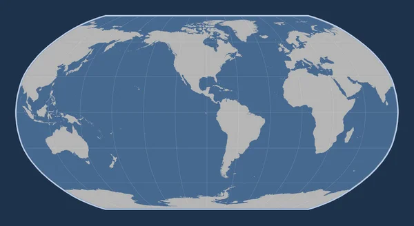
World Solid Contour Map In The Robinson Projection Centered On The 90th Meridian West Longitude
Image, 1.54MB, 4800 × 2625 jpg

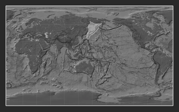
Somalian Tectonic Plate On The Bilevel Elevation Map In The Compact Miller Projection Centered Meridionally.
Image, 7.2MB, 4800 × 3010 jpg

Relief Map Of The Area Around The Pacific Tectonic Plate. 3D Rendering
Image, 5.32MB, 2880 × 1620 jpg
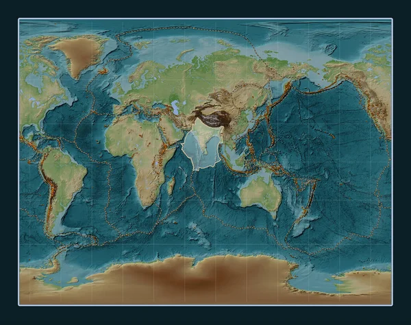
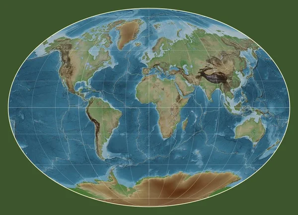
Indian Tectonic Plate On The Wiki Style Elevation Map In The Gall Stereographic Projection Centered Meridionally. Distribution Of Known Volcanoes
Image, 13.86MB, 4800 × 3792 jpg
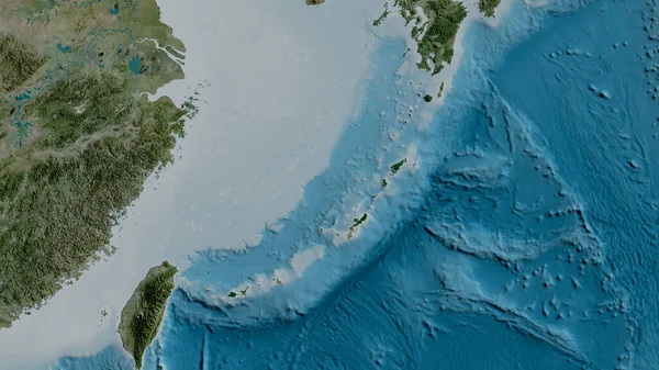
Satellite Map Of The Area Around The Okinawa Tectonic Plate. 3D Rendering
Image, 4.05MB, 2880 × 1620 jpg
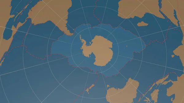
Antarctic Tectonic Plate Overview The Global Shapes Only - Land/ocean Mask In The Azimuthal Equidistant Projection With Dashed Plates Borders. 3D Rendering
Image, 1.56MB, 2880 × 1620 jpg

Antarctica Tectonic Plate Extruded On The Globe. Color Physical Map. 3D Rendering
Image, 3.72MB, 2880 × 1620 jpg
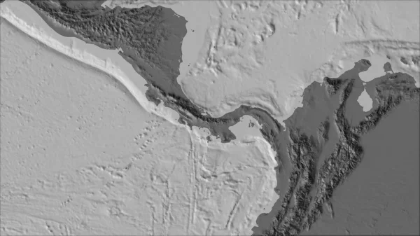
Neighborhoods Of The Panama Tectonic Plate On The Bilevel Elevation Map In The Van Der Grinten I Projection (oblique Transformation). Raw Composite - No Outlines
Image, 2.12MB, 2880 × 1620 jpg
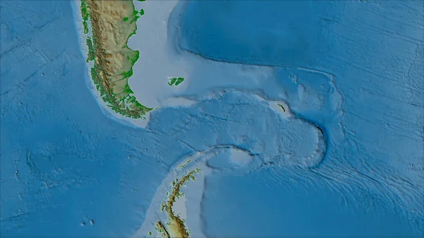
Neighborhoods Of The Scotia Tectonic Plate On The Physical Map In The Van Der Grinten I Projection (oblique Transformation). Raw Composite - No Outlines
Image, 3.92MB, 2880 × 1620 jpg
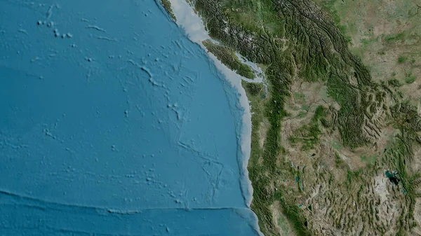
Satellite Map Of The Area Around The Juan De Fuca Tectonic Plate. 3D Rendering
Image, 5.02MB, 2880 × 1620 jpg

Juan De Fuca Tectonic Plate Outlined On The Globe. Topographic Map. 3D Rendering
Image, 4.54MB, 2880 × 1620 jpg
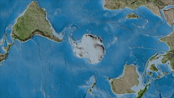
Neighborhoods Of The Antarctica Tectonic Plate On The Satellite B Map In The Van Der Grinten I Projection (oblique Transformation). Raw Composite - No Outlines
Image, 6.47MB, 2880 × 1620 jpg

Niuafou Tectonic Plate Outlined On The Globe. Topography And Bathymetry Colored Elevation Map. 3D Rendering
Image, 2.45MB, 2880 × 1620 jpg
Tectonic Plate Boundaries On A Colored Elevation Map Of The World In The Fahey Projection Centered On The Meridian 0 Longitude
Image, 6.6MB, 3977 × 2880 jpg
Okhotsk Tectonic Plate On The Bilevel Elevation Map In The Compact Miller Projection Centered Meridionally.
Image, 7.21MB, 4800 × 3010 jpg
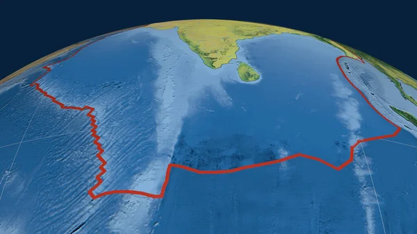
Indian Tectonic Plate Outlined On The Globe. Topographic Map. 3D Rendering
Image, 3.52MB, 2880 × 1620 jpg
Eurasian And North American Tectonic Plate In Iceland . C9086BD3 High Quality Photo
Image, 15.51MB, 6000 × 4000 jpg

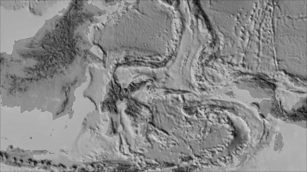
Neighborhoods Of The Molucca Sea Tectonic Plate On The Grayscale Map In The Van Der Grinten I Projection (oblique Transformation). Raw Composite - No Outlines
Image, 2.24MB, 2880 × 1620 jpg

Neighborhoods Of The North Bismarck Tectonic Plate On The Relief Map In The Van Der Grinten I Projection (oblique Transformation). Raw Composite - No Outlines
Image, 3.79MB, 2880 × 1620 jpg
Page 1 >> Next