Home
Images
Vectors
Videos
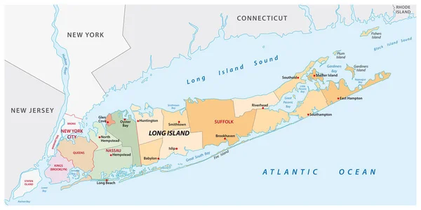
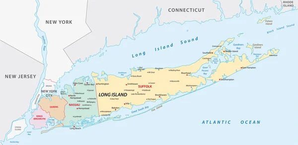
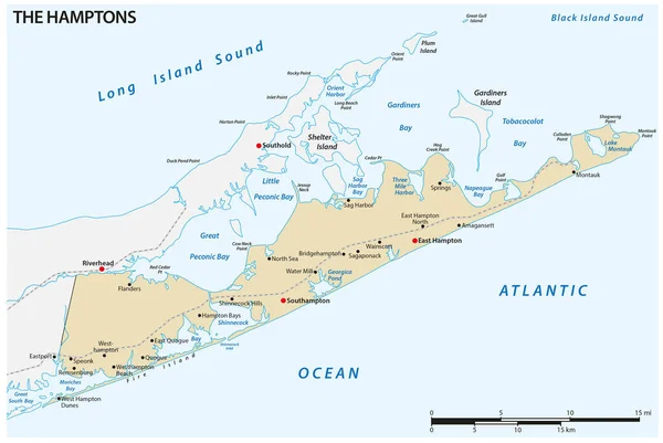
Stock vector Vector map of The Hamptons region at the east end of Long Island, New York, United States
Published:
May.21, 2023 06:29:35
Author:
Lesniewski
Views:
1
Downloads:
0
File type:
vector
/
eps
File size:
3.24 MB
Orginal size:
4626
x
3100
px
Available sizes:
S
(500 x 335)
M
(1000 x 670)
L
(2000 x 1340)
XL
(4626 x 3100)
VECT
(4626 x 3100)
EL0
(4626 x 3100)
Level:
bronze
Download Vector
Vector topics:
Vector
Graphic
Illustration
Shape
Travel
Abstract
Frame
Village
Concept
City
Sound
Contour
Scale
American
Bay
Town
Point
Outline
Country
Map
Cartography
Geography
Land
Railway
Topography
Location
Island
Seaside
Community
Cape
Geographic
Region
Inlet
Territory
Peninsula
Regional
Hamlet
Hamptons
Southampton
Infographic
New York
United States
Atlantic Ocean
Long Island
East End
The Hamptons
East Hampton
Riverhead
Similar stock vectors
Bermuda Political Map
7823 × 6000
Long Island Administrative And Political Vector Map
6198 × 3100
Long Iceland Map
6331 × 3100
Vector Map Of The Canadian Province Of Nova Scotia
4000 × 3891
Detailed Vector Map Of Bermuda And Capital City Hamilton
5867 × 5867
High Detailed Maine Physical Map With Labeling.
2950 × 4305
Vector Road Map Of The Four Canada Atlantic Provinces
3100 × 4561
Two-toned Map Of Long Island, New York With The Largest Highways, Roads And Surrounding Islands And Islets
6223 × 3501