photo free
Home Images Vectors Videos

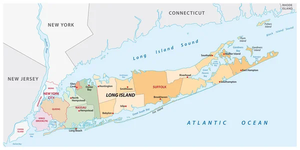
Stock image Suffolk Vector Map

stock vector City map Boston, travel vector poster design

City Map Boston, Travel Vector Poster Design

Vector, 3.67MB, 4219 × 5905 eps
stock vector City map Boston, monochrome detailed plan, vector illustration

City Map Boston, Monochrome Detailed Plan, Vector Illustration

Vector, 3.8MB, 4219 × 5906 eps
stock vector England counties vector map

England Counties Vector Map

Vector, 13.84MB, 7294 × 4690 eps
stock vector City map Boston, color detailed plan, vector illustration

City Map Boston, Color Detailed Plan, Vector Illustration

Vector, 3.95MB, 4219 × 5906 eps
stock vector United Kingdom high detailed vector map with administrative divisions borders

United Kingdom High Detailed Vector Map With Administrative Divisions Borders

Vector, 7.6MB, 5379 × 8333 eps
stock vector United Kingdom administrative districts high detailed vector map colored by regions with editable and labelled layers

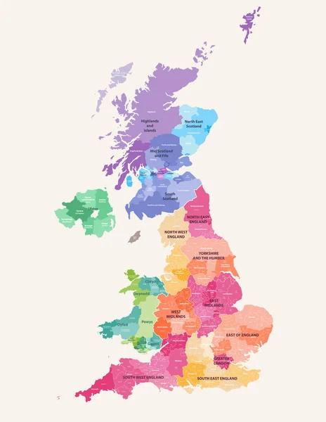
United Kingdom Administrative Districts High Detailed Vector Map Colored By Regions With Editable And Labelled Layers

Vector, 10.16MB, 6454 × 8333 eps
stock vector vector map of British Isles administrative divisions colored by countries and regions. Districts and counties maps and flags of United Kingdom,Northern Ireland, Wales, Scotland and Republic of Ireland

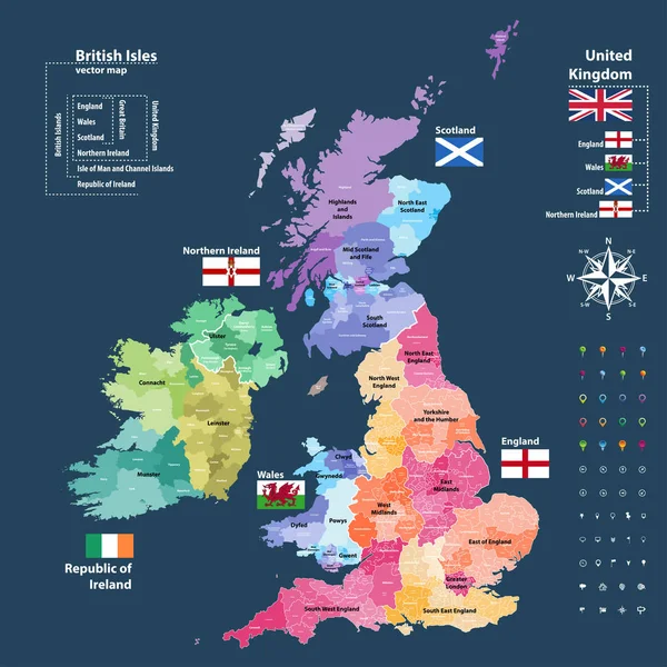
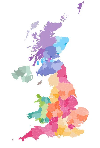
Vector Map Of British Isles Administrative Divisions Colored By Countries And Regions. Districts And Counties Maps And Flags Of United Kingdom,Northern Ireland, Wales, Scotland And Republic Of Ireland

Vector, 11.71MB, 7292 × 7292 eps
stock vector Map of Virginia

Map Of Virginia

Vector, 1.46MB, 5507 × 3000 ai
stock vector Massachusetts map

Massachusetts Map

Vector, 4.33MB, 5502 × 4691 eps
stock vector vector map of England ceremonial counties. Flag of England. Navigation and location icons

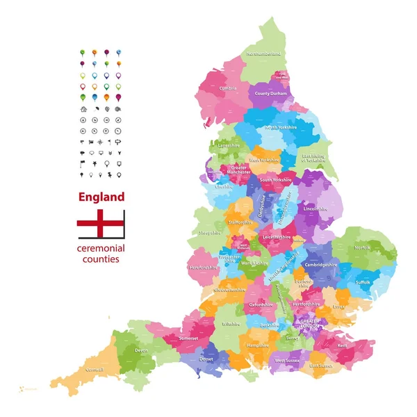
Vector Map Of England Ceremonial Counties. Flag Of England. Navigation And Location Icons

Vector, 9.37MB, 7292 × 7292 eps
stock vector United Kingdom administrative districts vector high detailed map colored by regions and counties

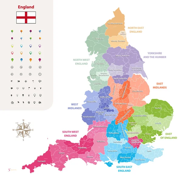
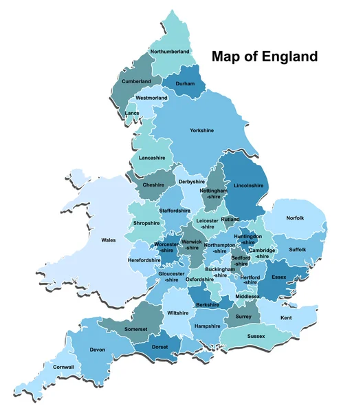
United Kingdom Administrative Districts Vector High Detailed Map Colored By Regions And Counties

Vector, 10MB, 5144 × 8333 eps
stock vector England ceremonial counties vector map colored by regions

England Ceremonial Counties Vector Map Colored By Regions

Vector, 9.96MB, 7292 × 7292 eps
stock vector Virginia County Map

Virginia County Map

Vector, 1.44MB, 5507 × 3000 ai
stock vector long Iceland map

Long Iceland Map

Vector, 1.23MB, 6331 × 3100 eps
stock vector long island administrative and political vector map

Long Island Administrative And Political Vector Map

Vector, 1.07MB, 6198 × 3100 eps
stock vector Virginia, VA, political map. Commonwealth of Virginia. State in Southeastern and Mid-Atlantic region of the United States. Capital Richmond. Old Dominion. Mother of Presidents. Illustration. Vector.

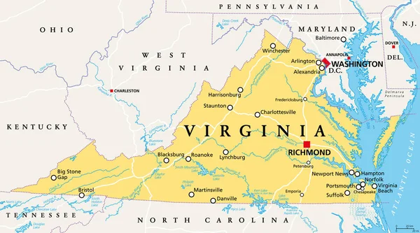
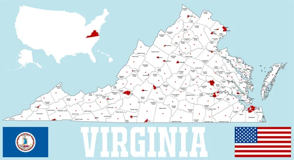
Virginia, VA, Political Map. Commonwealth Of Virginia. State In Southeastern And Mid-Atlantic Region Of The United States. Capital Richmond. Old Dominion. Mother Of Presidents. Illustration. Vector.

Vector, 5.44MB, 9000 × 4999 eps
stock vector vector map of United Kingdom administrative divisions colored by countries and regions. Districts and counties map of England, Wales, Scotland and Northern Ireland

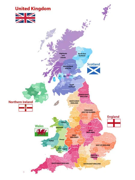
Vector Map Of United Kingdom Administrative Divisions Colored By Countries And Regions. Districts And Counties Map Of England, Wales, Scotland And Northern Ireland

Vector, 6.25MB, 5656 × 8333 eps
stock vector England ceremonial counties and their districts vector map. Each county distinctions between each other by different color palette

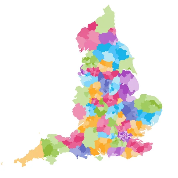
England Ceremonial Counties And Their Districts Vector Map. Each County Distinctions Between Each Other By Different Color Palette

Vector, 5.73MB, 7292 × 7292 eps
stock vector High quality colorful labeled map of England with borders of the counties

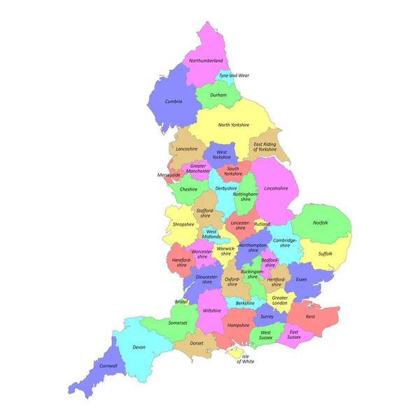
High Quality Colorful Labeled Map Of England With Borders Of The Counties

Vector, 3MB, 4000 × 4000 eps
stock vector vector map of United Kingdom colored by countries, counties and regions

Vector Map Of United Kingdom Colored By Countries, Counties And Regions

Vector, 10.75MB, 5458 × 7292 eps
stock vector Map of England

Map Of England

Vector, 2.79MB, 4000 × 4838 eps
stock vector Massachusetts counties, gray political map. Commonwealth of Massachusetts, state in the New England region of Northeastern United States, subdivided into 14 counties. With boundaries and county names.

Massachusetts Counties, Gray Political Map. Commonwealth Of Massachusetts, State In The New England Region Of Northeastern United States, Subdivided Into 14 Counties. With Boundaries And County Names.

Vector, 2.12MB, 9000 × 5555 eps
stock vector Massachusetts, U.S. state, multi colored political map with borders, county names and capital Boston. State in the New England region of the Northeastern United States, subdivided into 14 counties.

Massachusetts, U.S. State, Multi Colored Political Map With Borders, County Names And Capital Boston. State In The New England Region Of The Northeastern United States, Subdivided Into 14 Counties.

Vector, 2.14MB, 9000 × 5580 eps
stock vector Mid Suffolk blank outline map set

Mid Suffolk Blank Outline Map Set

Vector, 0.22MB, 6000 × 3000 eps
stock vector Massachusetts counties, political map. Commonwealth of Massachusetts, a state in the New England region of Northeastern United States, subdivided into 14 counties. With boundaries and county names.

Massachusetts Counties, Political Map. Commonwealth Of Massachusetts, A State In The New England Region Of Northeastern United States, Subdivided Into 14 Counties. With Boundaries And County Names.

Vector, 3.69MB, 9000 × 5555 eps
stock vector Suffolk Coastal blank outline map set

Suffolk Coastal Blank Outline Map Set

Vector, 0.51MB, 6000 × 3000 eps
stock vector Suffolk map, ceremonial county of England. Vector illustration.

Suffolk Map, Ceremonial County Of England. Vector Illustration.

Vector, 5.32MB, 8334 × 8334 eps
Page 1 >> Next