
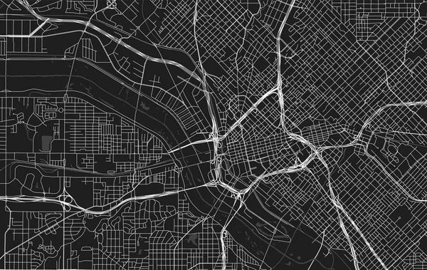
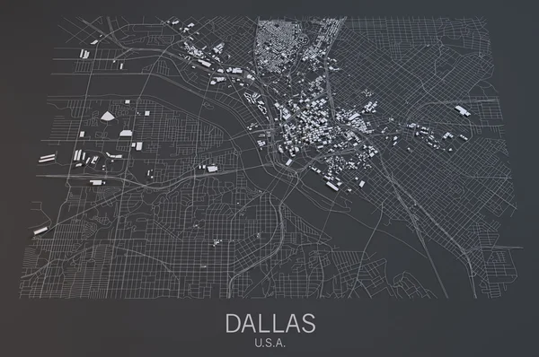
Stock image Dallas City Map
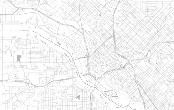

Minimal City Map Of Dallas (United States, North America) Black White Vector Illustration
Vector, 9.34MB, 4604 × 5201 eps

Dallas Silhouette Skyline. USA - Dallas Vector City, American Linear Architecture, Buildings. Dallas Travel Illustration, Outline Landmarks. USA Flat Icon, American Line Banner
Vector, 1.61MB, 6000 × 3000 eps

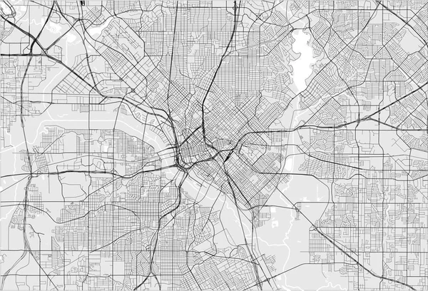
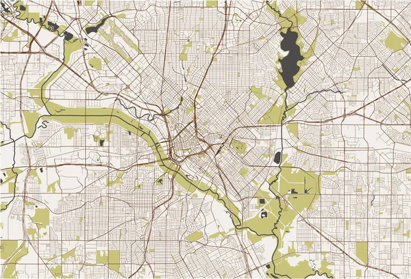
Dallas City Map Poster. Map Of Dallas Street Map Poster. Dallas Map Vector Illustration.
Vector, 10.14MB, 4111 × 4111 eps

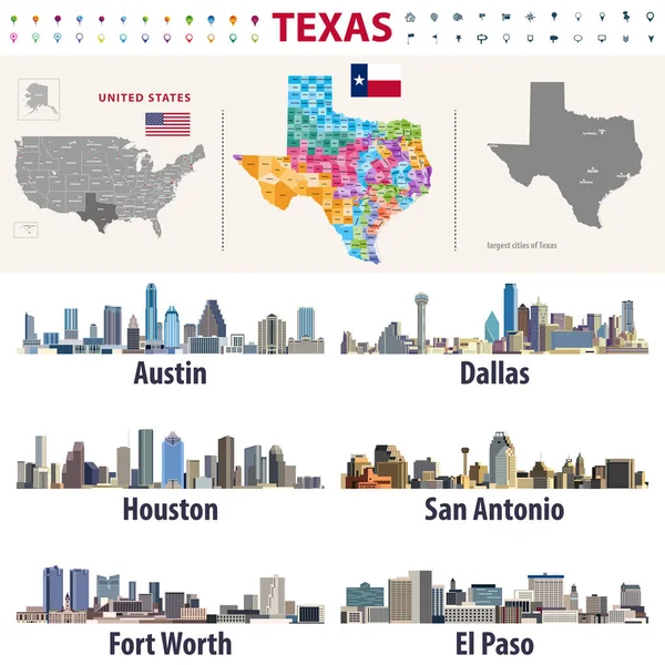
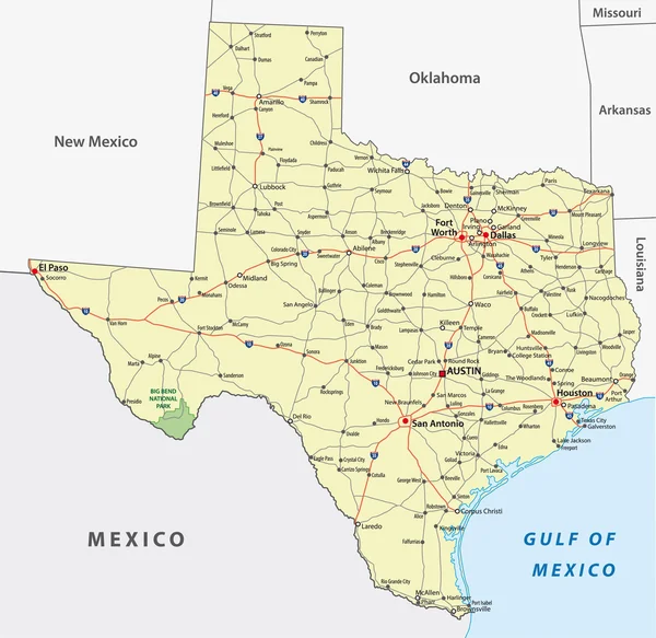
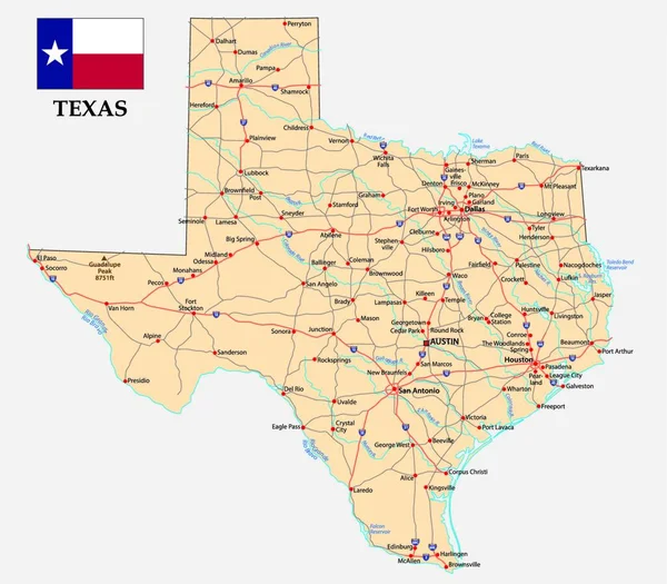
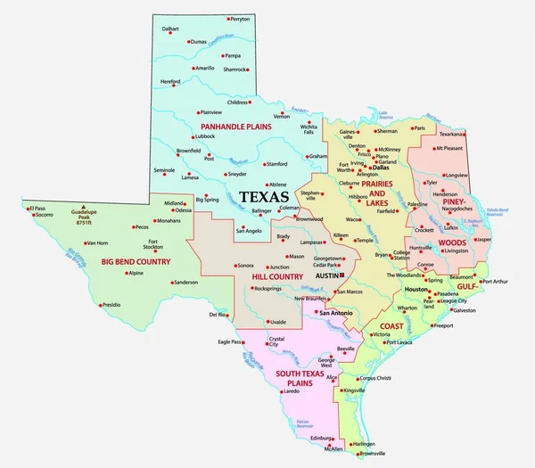
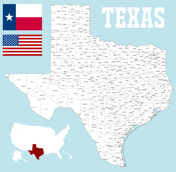
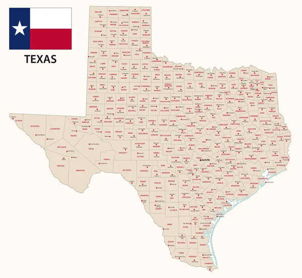
Texas's Vector High Detailed Map Showing Counties Formations. Largest Cities Skylines Of Texas
Vector, 12.33MB, 8333 × 8333 eps
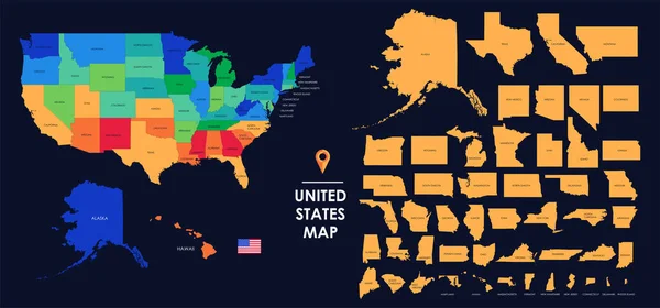
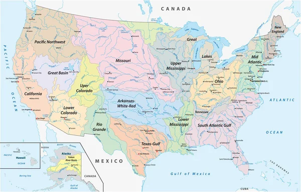
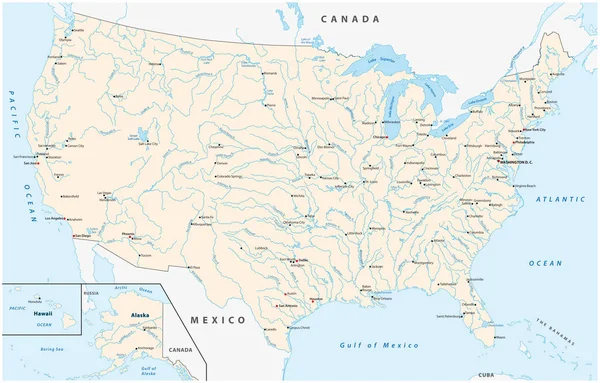
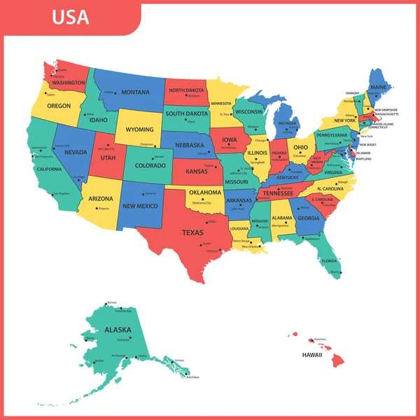
Detailed Map Of The USA, Each State Is Signed And Highlighted, The States Are Located On The Largest Territory, Colorful Infographic Of The United States Of America, Vector Illustration
Vector, 5.89MB, 11205 × 5237 eps


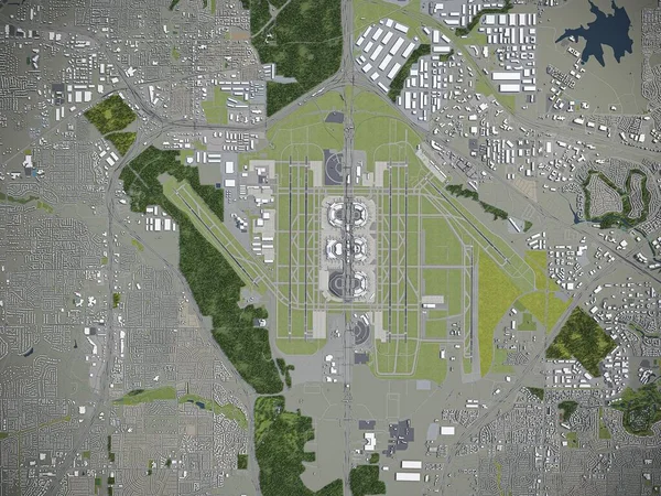
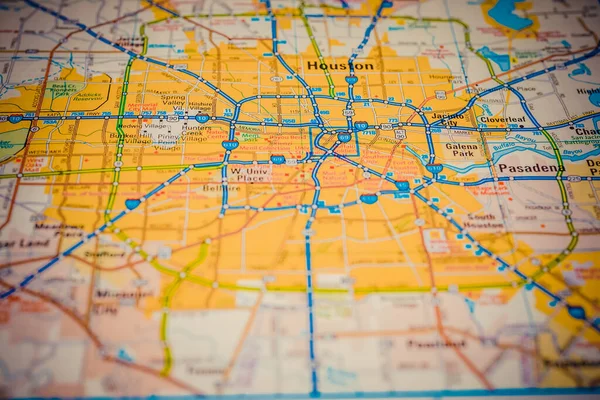
Dallas - Fort Worth International Airport - 3D Model Aerial Rendering
Image, 1.88MB, 2880 × 2160 jpg


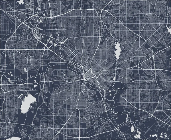
White Grey Dallas City Area Vector Background Map, Streets And Water Cartography Illustration. Widescreen Proportion, Digital Flat Design Streetmap.
Vector, 4.01MB, 11112 × 6251 eps

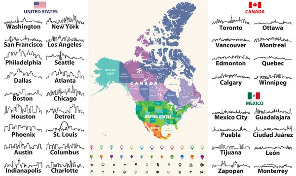
Canada, United States And Mexico Detailed Map With States Names And Borders. Flags And Largest Cities Skylines Outline Icons Of United States, Canada And Mexico
Vector, 13.55MB, 8333 × 4975 eps
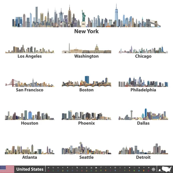
Vector Illustration Of Largest United States City Skylines. Navigation, Location And Travel Icons; Flag And Map Of United States Of America
Vector, 14.7MB, 7292 × 7292 eps

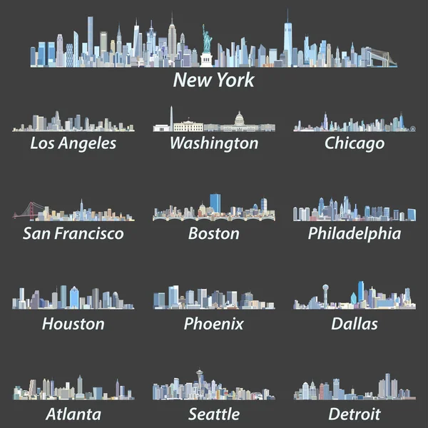
Vector Illustration Of Largest United States City Skylines In Black And White Color Palette. Navigation, Location And Travel Icons; Flag And Map Of United States Of America
Vector, 14.11MB, 7292 × 7292 eps


United States Largest Cities Skylines In Tints Of Blue Color Palette. Vector Illustration
Vector, 14.32MB, 7292 × 7292 eps


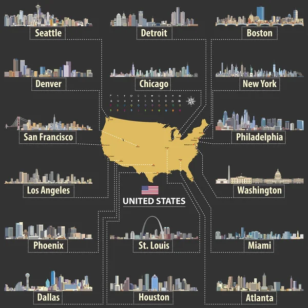
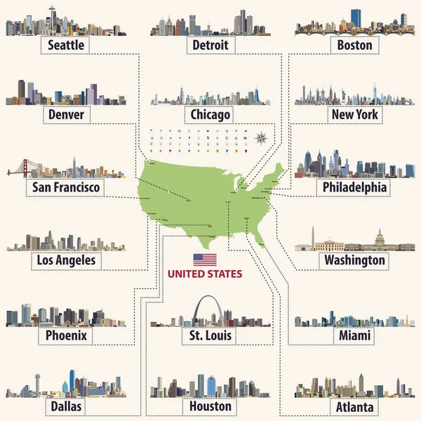
Vector Map Of United States Of America With Largest Cities' Skylines
Vector, 14.58MB, 7292 × 7292 eps

Red Skyline Of Dallas, A Modern Metropolis In North Texas, A Commercial And Cultural Hub Of The Region
Image, 8.86MB, 7200 × 5000 jpg
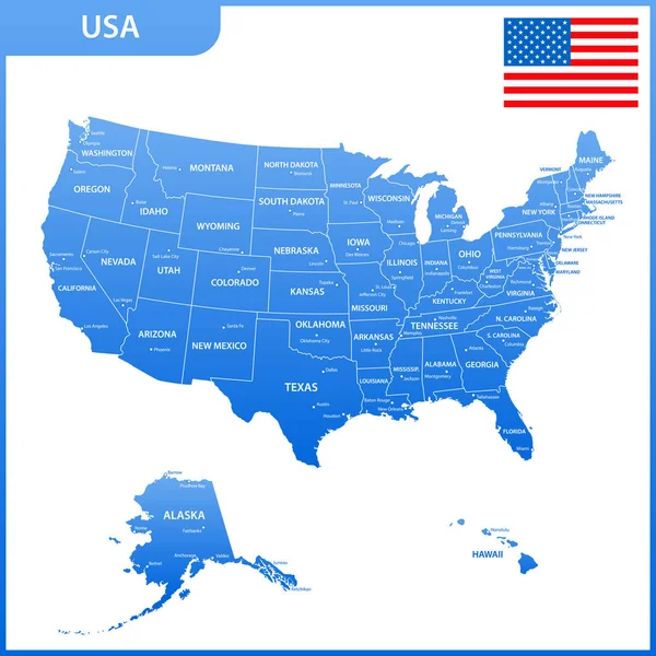
The Detailed Map Of The USA With Regions Or States And Cities, Capital. United States Of America
Vector, 1.69MB, 5500 × 5500 eps

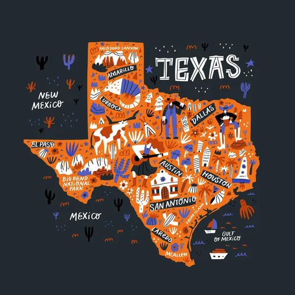
Texas Orange Map Flat Hand Drawn Vector Illustration. Western American State Infographic Doodle Drawing. Texas Landmarks, Attractions And Cities Guide. USA Travel Postcard, Poster Concept Design
Vector, 2.26MB, 6000 × 6000 eps

Vector Map Of United States Of America With Largest Cities' Skylines
Vector, 14.64MB, 7292 × 7292 eps

The Detailed Map Of The USA With Regions Or States And Cities, Capital. United States Of America With National Flag
Vector, 1.77MB, 5500 × 5500 eps
Texas Cartoon Map Vector Illustration. Western American State Cities, Landmarks, Tourist Attractions And Routes Names Doodle Drawings. USA Travel Infographic Poster, Banner Flat Hand Drawn Design
Vector, 2.01MB, 6000 × 6000 eps
Page 1 >> Next