
Stock image Orthorectified

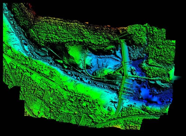
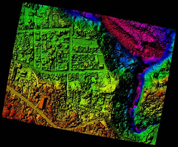
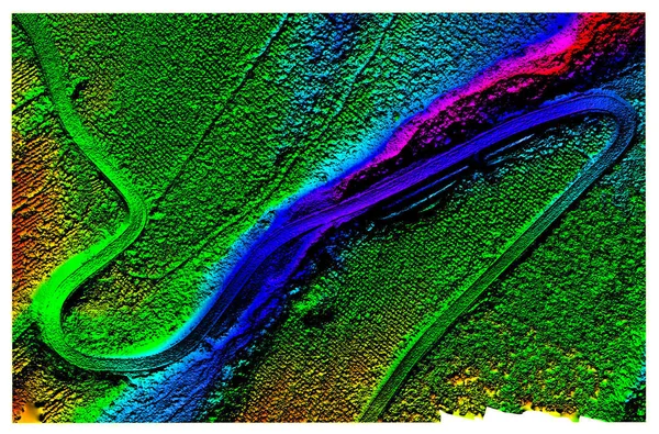
High Resolution Digital Elevation Model Of Agoyan Hydroelectric Dam In Banos De Agua Santa Blue Representing Low Altitude And Red High Altitude
Image, 22.07MB, 6000 × 4419 jpg
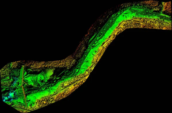
Aerial Orthorectified, Orthorectification Digital Elevation Model Of Banos De Agua Santa San Martin Canyon Altitude Represented From Blue To Red
Image, 10.24MB, 4000 × 3319 jpg
High Resolution Orthorectified, Orthorectification Aerial Map Used For Photogrammetry Panecillo Hill In Quito Ecuador
Image, 35.09MB, 6000 × 4173 jpg
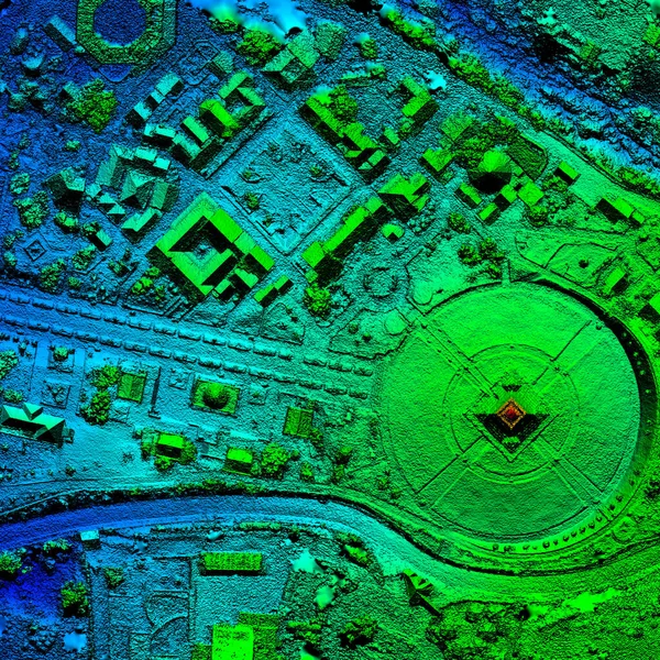
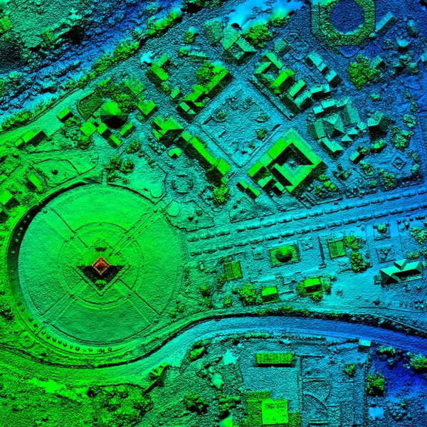
High Resolution Orthorectified Orthorectification Aerial Map Used For Photogrammetry At Centre Of The World Mitad Del Mundo In Quito Ecuador
Image, 26.49MB, 4000 × 4000 jpg
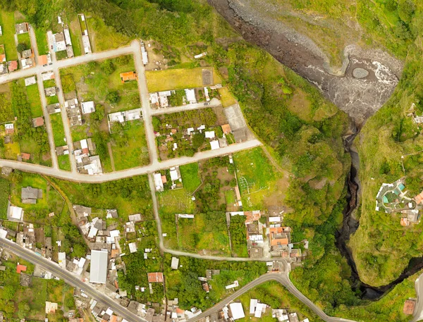
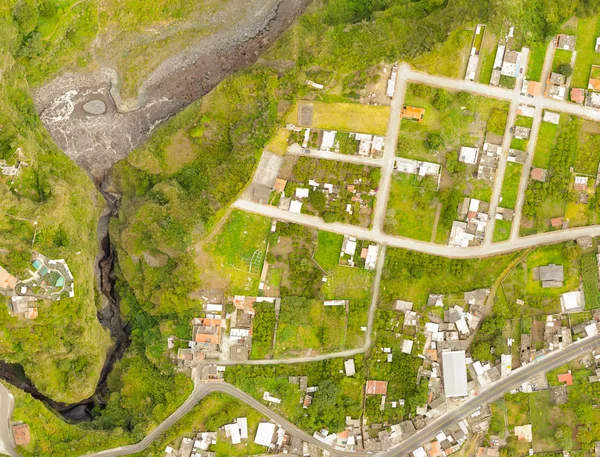
High Resolution Orthorectified, Orthorectification Aerial Map Used For Photogrammetry In Banos Ecuador
Image, 2.87MB, 5000 × 3350 jpg
High Resolution Orthorectified Orthorectification Aerial Map Used For Photogrammetry Panecillo Hill In Quito Ecuador
Image, 31.67MB, 6000 × 4173 jpg
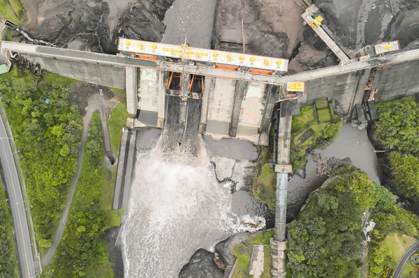
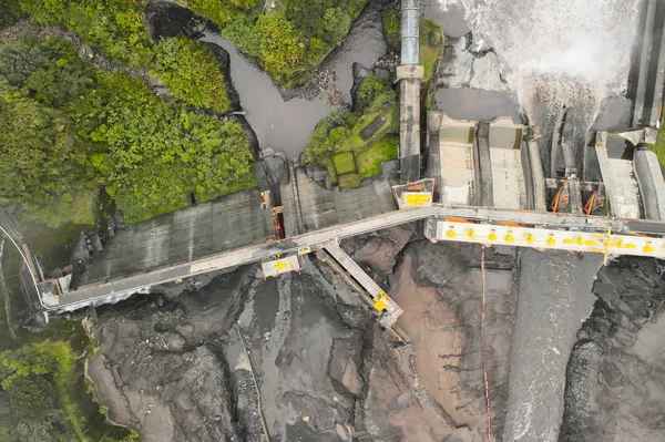
Digital Elevation Model Of Water Dam And Hydrologic Area High Tech Technology For Assessing Smart Engineering
Image, 9.83MB, 5000 × 3279 jpg
High Resolution Orthorectified, Orthorectification Aerial Map Used For Photogrammetry At Centre Of The World, Mitad Del Mundo In Quito Ecuador
Image, 28.76MB, 4000 × 4000 jpg

Virgen Del Panecillo Hill Statue And Monument In Quito Ecuador Very Popular Touristic Destination Aerial Image Of The Entire Park
Image, 28.7MB, 6000 × 4000 jpg
Digital Elevation Model Of Water Dam And Hydrologic Area High Tech Technology For Assessing Smart Engineering
Image, 8.54MB, 5000 × 3279 jpg
Aerial Orthorectified Orthorectification Digital Elevation Model Of Banos De Agua Santa San Martin Canyon Altitude Represented From Blue To Red
Image, 9.75MB, 4000 × 3319 jpg
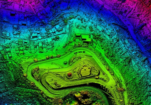
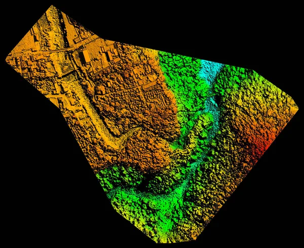
Digital Elevation Model Representing Geological Anomalies Orthorectified Drone Aerial
Image, 28.73MB, 6000 × 3954 jpg
High Resolution Orthorectified Orthorectification Aerial Map Used For Photogrammetry In Banos Ecuador
Image, 5.91MB, 5000 × 3350 jpg
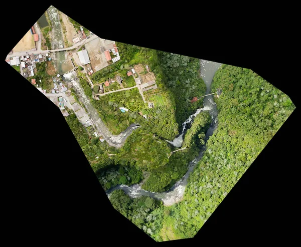
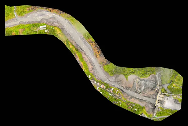
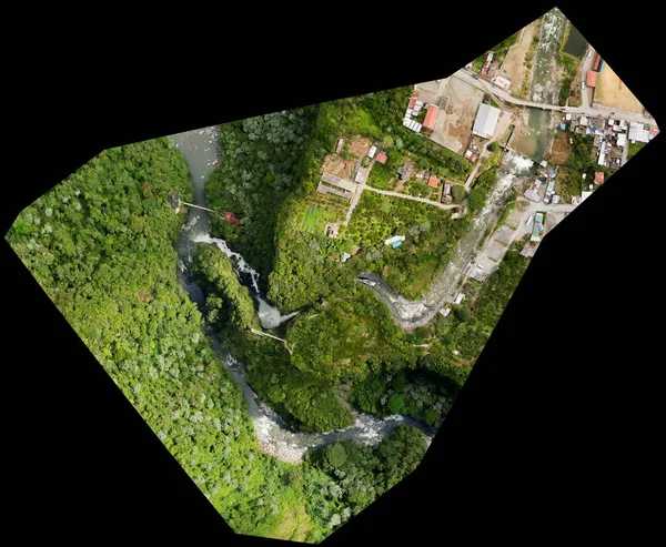
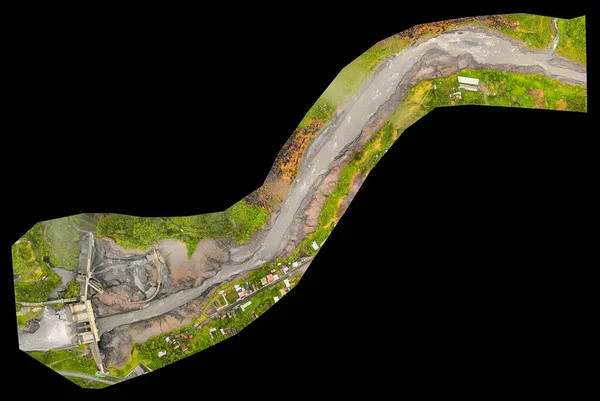
San Martin Canyon Banos De Agua Santa Orthorectified Drone Aerial Map Used For Photogrammetry
Image, 19.66MB, 5000 × 3812 jpg
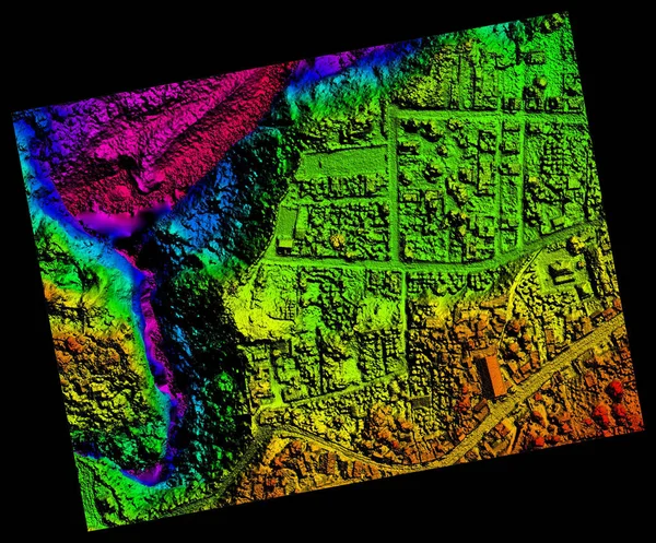
High Resolution Aerial Digital Elevation Model Used For Computer Assisted Geographical Information System
Image, 9.57MB, 6000 × 4900 jpg

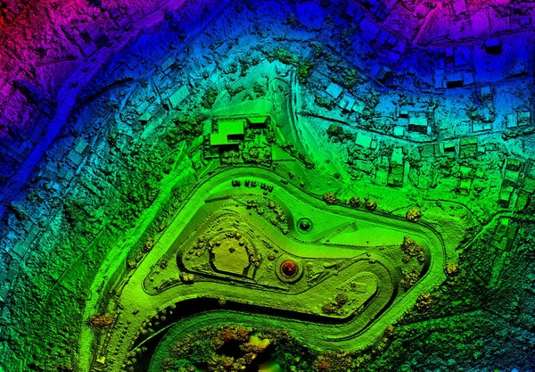
High Resolution Orthorectified, Orthorectification Aerial Map Used For Photogrammetry In Pelileo Ecuador
Image, 50.46MB, 6000 × 4985 jpg
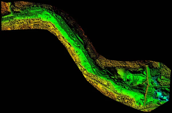
San Martin Canyon Banos De Agua Santa Orthorectified Drone Aerial Map Used For Photogrammetry
Image, 23.45MB, 5000 × 3812 jpg
Page 1 >> Next