
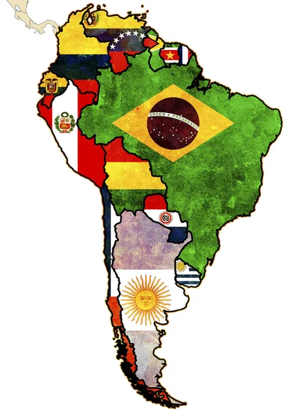
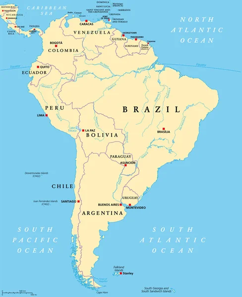
Stock image South America Political Map
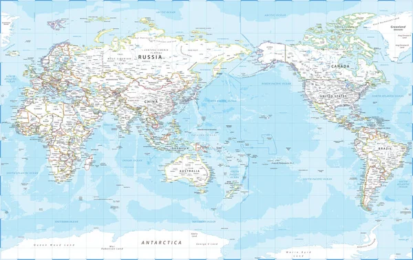
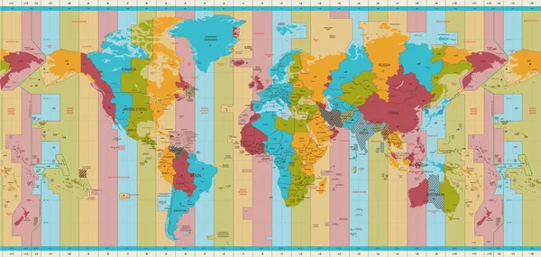
World Map - Pacific View - Asia China Center - Political Topographic - Vector Detailed
Vector, 64.01MB, 6205 × 3917 eps

South America Map - 4 Bright Color Scheme. High Detailed Political Map South American Continent With Country, Ocean And Sea Names Labeling
Vector, 1.43MB, 4500 × 6000 eps
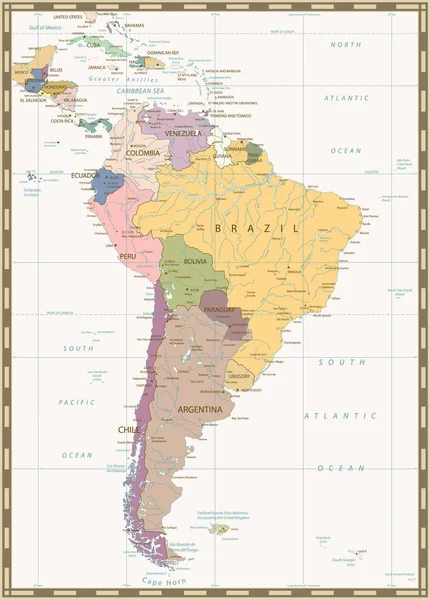
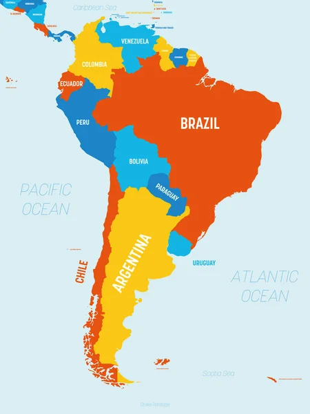
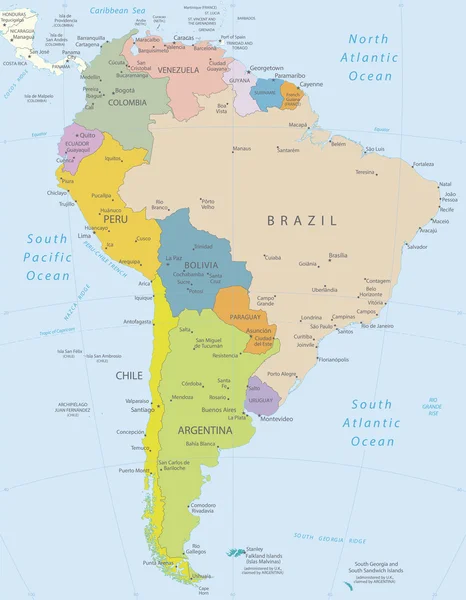
South America, Political Map With Borders, Capitals And The Largest Rivers. A Continent, Bordered By The Pacific And The Atlantic Ocean, By North America And The Caribbean Sea. Illustration. Vector.
Vector, 6.47MB, 6000 × 7368 eps

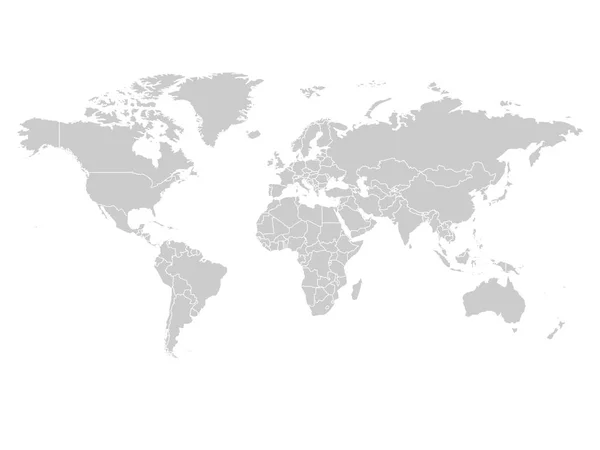
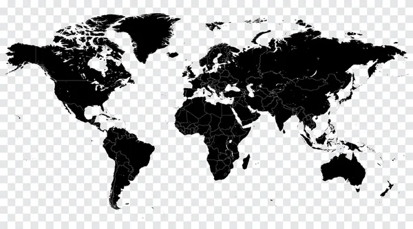
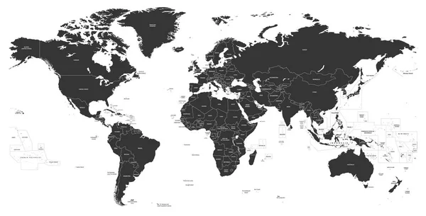
World Map In Grey Color On White Background. High Detail Blank Political Map. Vector Illustration With Labeled Compound Path Of Each Country
Vector, 3.96MB, 8000 × 6000 eps
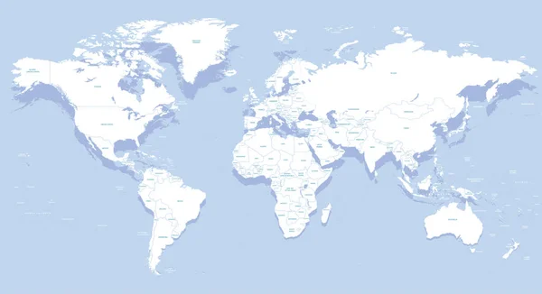


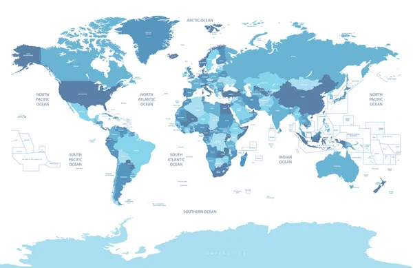
World Map In Blue Color On White Background. High Detail Blank Political Map. Vector Illustration With Labeled Compound Path Of Each Country
Vector, 3.97MB, 8000 × 6000 eps

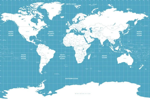

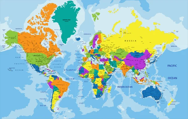
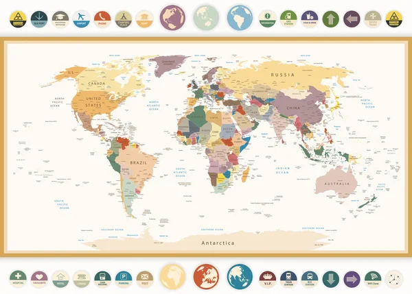
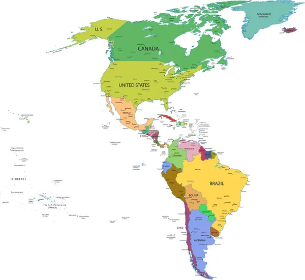
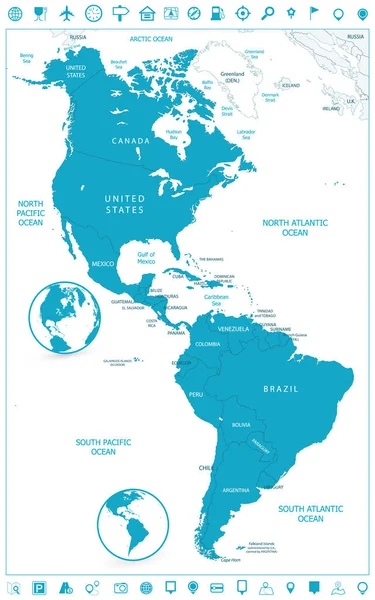
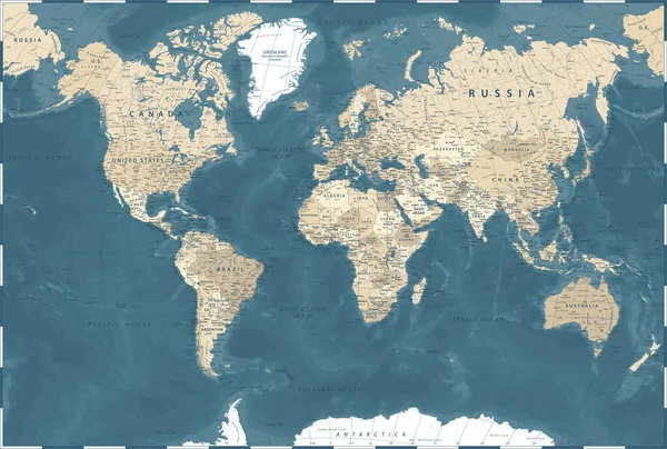
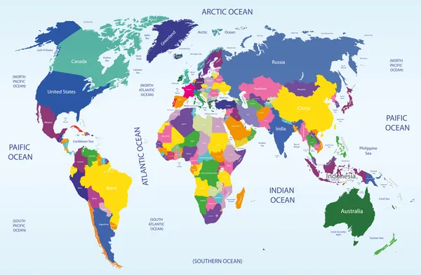
Vector High Detailed World Political Map With Countries And Oceans Names And Location\navigation Icons. All Layers Detached And Labeled. Vector
Vector, 12.12MB, 10417 × 7579 eps

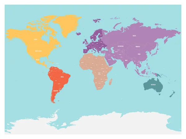
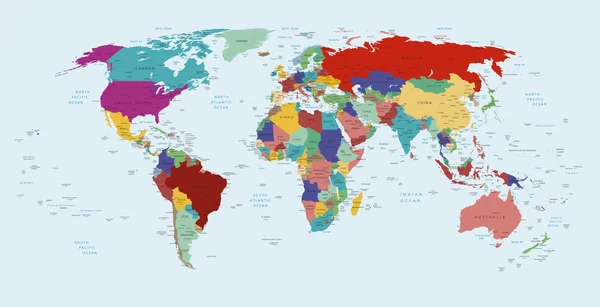
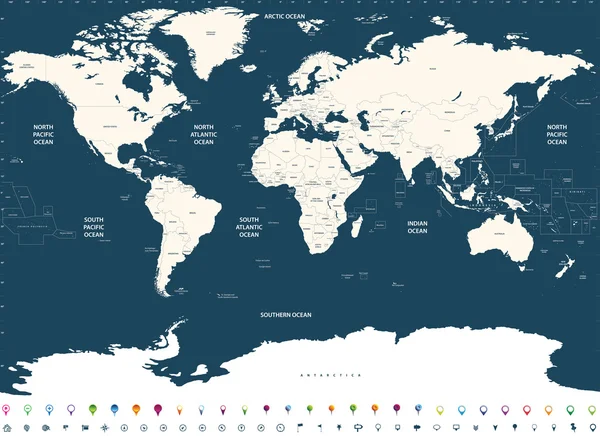
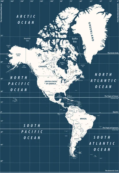
Political Map Of World With Antarctica. Continents In Different Colors On Blue Background. Black Labels With States And Significant Dependent Territories Names. High Detail Vector Illustration
Vector, 7.65MB, 6000 × 4500 eps
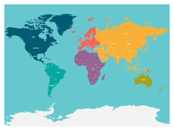
Political Map Of World With Antarctica. Continents In Different Colors On Blue Background. White Labels With States And Significant Dependent Territories Names. High Detail Vector Illustration
Vector, 7.64MB, 6000 × 4500 eps
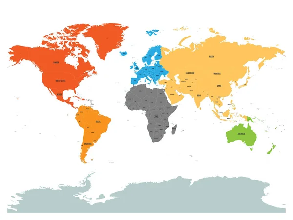
Political Map Of World With Antarctica. Continents In Different Colors On White Background. Black Labels With States And Significant Dependent Territories Names. High Detail Vector Illustration
Vector, 7.65MB, 6000 × 4500 eps

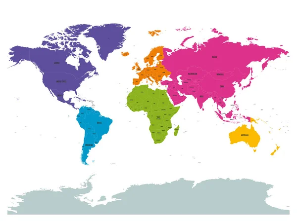
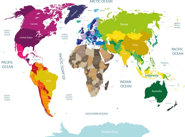
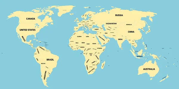
Political World Colored By Continents With Country Labels Om White Background. Simple Flat Vector Illustration
Vector, 6.21MB, 6000 × 4500 eps
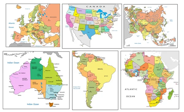


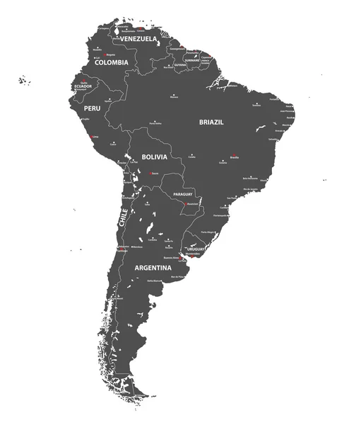
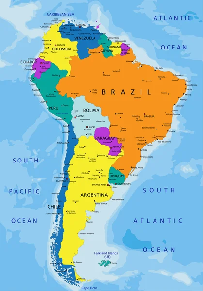
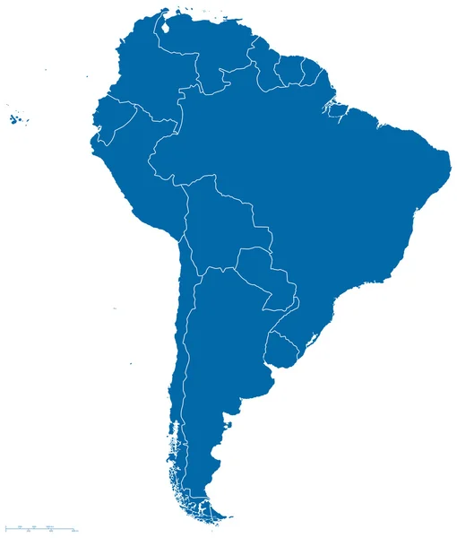
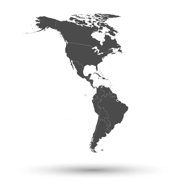
Vector High Detailed Map Of South America. All Layers Detached And Labeled.
Vector, 6.73MB, 5800 × 7292 eps
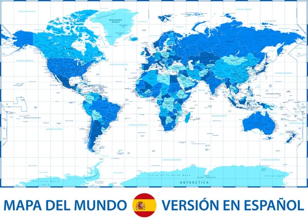
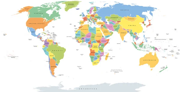
World Map Color Political - Spanish Language Version - Vector Illustration
Vector, 29.98MB, 5505 × 3999 eps
Page 1 >> Next