
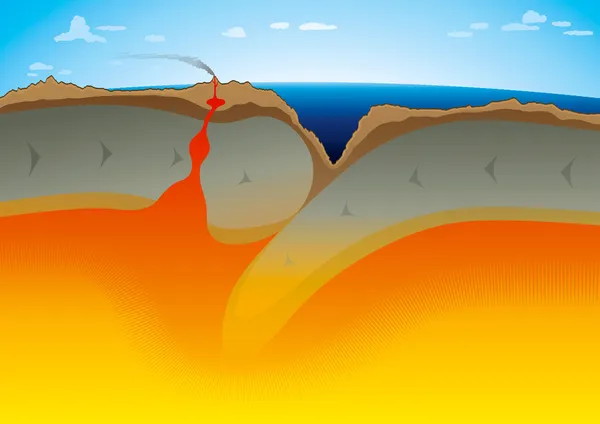
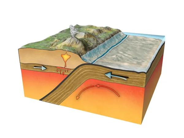
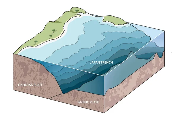
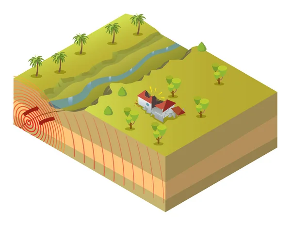
Stock image Subduction Zone

White Mask Of Lands Within Areas Adjacent To The Altiplano Tectonic Plate. Black Background. Van Der Grinten I Projection (oblique Transformation). Compositing Tool
Image, 0.09MB, 2880 × 1620 jpg

Relief Map Of The Area Around The Molucca Sea Tectonic Plate. 3D Rendering
Image, 4.05MB, 2880 × 1620 jpg
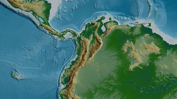
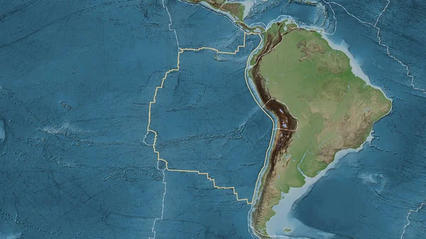
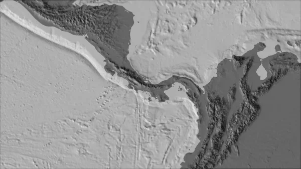
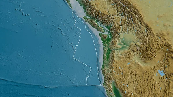
Outline Of The North Andes Tectonic Plate With The Borders Of Surrounding Plates Against The Background Of A Physical Map. 3D Rendering
Image, 4.76MB, 2880 × 1620 jpg
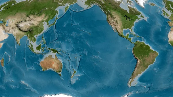
Pattern Map Of The Area Around The Pacific Tectonic Plate. 3D Rendering
Image, 5.52MB, 2880 × 1620 jpg
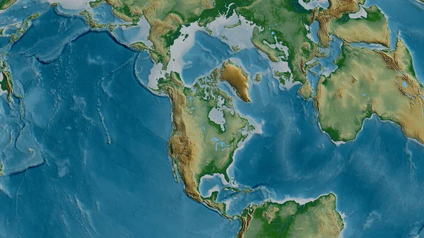
Physical Map Of The Area Around The North American Tectonic Plate. 3D Rendering
Image, 5.52MB, 2880 × 1620 jpg
Neighborhoods Of The Aegean Sea Tectonic Plate On The Relief Map In The Van Der Grinten I Projection (oblique Transformation). Raw Composite - No Outlines
Image, 5.12MB, 2880 × 1620 jpg

Neighborhoods Of The Caribbean Tectonic Plate On The Grayscale Map In The Van Der Grinten I Projection (oblique Transformation). Raw Composite - No Outlines
Image, 2.65MB, 2880 × 1620 jpg
Area Of The Nazca Tectonic Plate Marked With A Solid Line On A Pale Colored Elevation Map In The Patterson Cylindrical Projection
Image, 7.51MB, 3840 × 2160 jpg
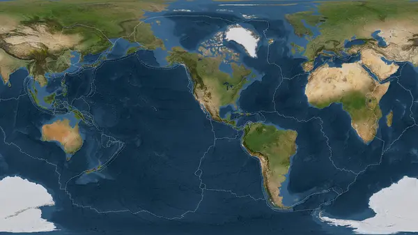
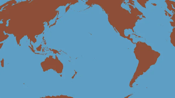
Satellite Imagery Map Of The World In The Patterson Cylindrical Projection Transformed To The Center Of The Rivera Tectonic Plate
Image, 6.56MB, 3840 × 2160 jpg

Relief Map Of The Area Around The Pacific Tectonic Plate. 3D Rendering
Image, 5.32MB, 2880 × 1620 jpg
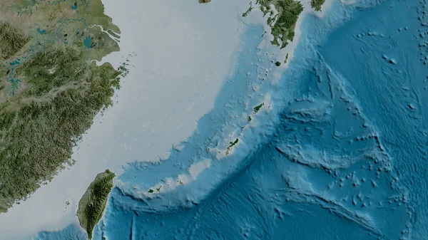
Satellite Map Of The Area Around The Okinawa Tectonic Plate. 3D Rendering
Image, 4.05MB, 2880 × 1620 jpg
Neighborhoods Of The Panama Tectonic Plate On The Bilevel Elevation Map In The Van Der Grinten I Projection (oblique Transformation). Raw Composite - No Outlines
Image, 2.12MB, 2880 × 1620 jpg
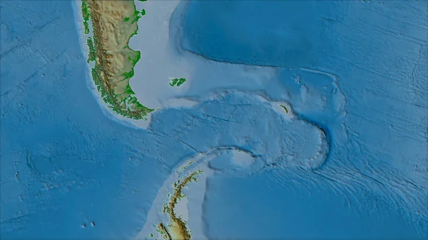
Neighborhoods Of The Scotia Tectonic Plate On The Physical Map In The Van Der Grinten I Projection (oblique Transformation). Raw Composite - No Outlines
Image, 3.92MB, 2880 × 1620 jpg
Tectonic Plates Borders On The Grayscale Map Of Areas Adjacent To The Caribbean Plate Area. Van Der Grinten I Projection (oblique Transformation)
Image, 2.7MB, 2880 × 1620 jpg
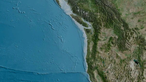
Satellite Map Of The Area Around The Juan De Fuca Tectonic Plate. 3D Rendering
Image, 5.02MB, 2880 × 1620 jpg

Outlined Pacific Tectonic Plate And Borders Of Adjacent Plates On The Physical Map In The Van Der Grinten I Projection (oblique Transformation)
Image, 7.06MB, 2880 × 1620 jpg

Juan De Fuca Tectonic Plate Outlined On The Globe. Topographic Map. 3D Rendering
Image, 4.54MB, 2880 × 1620 jpg
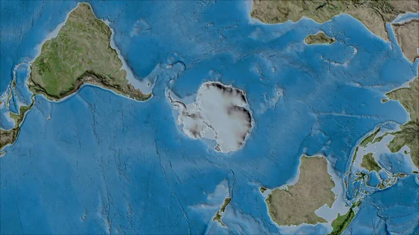
Neighborhoods Of The Antarctica Tectonic Plate On The Satellite B Map In The Van Der Grinten I Projection (oblique Transformation). Raw Composite - No Outlines
Image, 6.47MB, 2880 × 1620 jpg

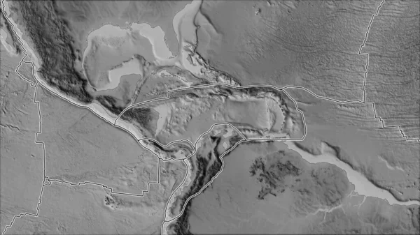
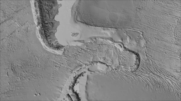
Neighborhoods Of The Altiplano Tectonic Plate On The Grayscale Map In The Van Der Grinten I Projection (oblique Transformation). Raw Composite - No Outlines
Image, 2.34MB, 2880 × 1620 jpg

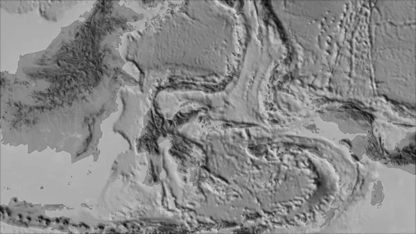
Neighborhoods Of The Molucca Sea Tectonic Plate On The Grayscale Map In The Van Der Grinten I Projection (oblique Transformation). Raw Composite - No Outlines
Image, 2.24MB, 2880 × 1620 jpg

Neighborhoods Of The North Bismarck Tectonic Plate On The Relief Map In The Van Der Grinten I Projection (oblique Transformation). Raw Composite - No Outlines
Image, 3.79MB, 2880 × 1620 jpg

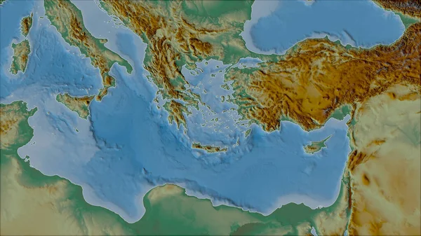
Neighborhoods Of The Anatolian Tectonic Plate On The Topographic Map In The Van Der Grinten I Projection (oblique Transformation). Raw Composite - No Outlines
Image, 5.95MB, 2880 × 1620 jpg
Neighborhoods Of The Scotia Tectonic Plate On The Grayscale Map In The Van Der Grinten I Projection (oblique Transformation). Raw Composite - No Outlines
Image, 2.06MB, 2880 × 1620 jpg
Outline Of The Juan De Fuca Tectonic Plate With The Borders Of Surrounding Plates Against The Background Of A Physical Map. 3D Rendering
Image, 4.92MB, 2880 × 1620 jpg

Neighborhoods Of The Juan De Fuca Tectonic Plate On The Physical Map In The Van Der Grinten I Projection (oblique Transformation). Raw Composite - No Outlines
Image, 4.81MB, 2880 × 1620 jpg

Satellite Map Of The Area Around The Pacific Tectonic Plate. 3D Rendering
Image, 5.12MB, 2880 × 1620 jpg

Outline Of The Burma Tectonic Plate With The Borders Of Surrounding Plates Against The Background Of A Satellite Map. 3D Rendering
Image, 3.58MB, 2880 × 1620 jpg

Outline Of The Pacific Tectonic Plate With The Borders Of Surrounding Plates Against The Background Of A Relief Map. 3D Rendering
Image, 5.55MB, 2880 × 1620 jpg
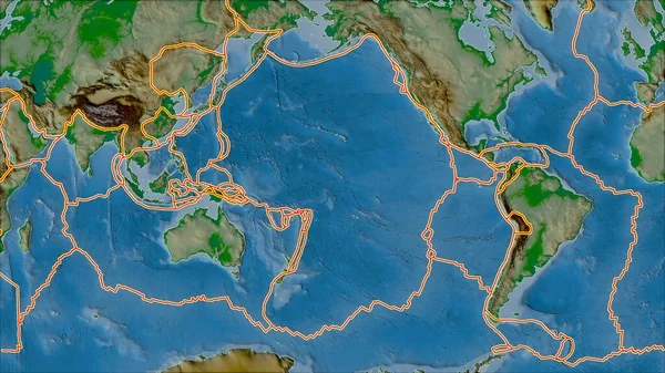
Tectonic Plates Borders On The Physical Map Of Areas Adjacent To The Pacific Plate Area. Van Der Grinten I Projection (oblique Transformation)
Image, 7.14MB, 2880 × 1620 jpg

Antarctic Plate Shape Outlined On A Darkened And Desaturated Background Of The Satellite Map With Informative Overlays. 3D Rendering
Image, 3.5MB, 2880 × 1620 jpg

Outline Of The Amur Tectonic Plate With The Borders Of Surrounding Plates Against The Background Of A Pattern Map. 3D Rendering
Image, 4.78MB, 2880 × 1620 jpg

Outline Of The Somalian Tectonic Plate With The Borders Of Surrounding Plates Against The Background Of A Relief Map. 3D Rendering
Image, 4.84MB, 2880 × 1620 jpg

Satellite Imagery Map Of The World In The Patterson Cylindrical Projection Transformed To The Center Of The Maoke Tectonic Plate
Image, 6.58MB, 3840 × 2160 jpg
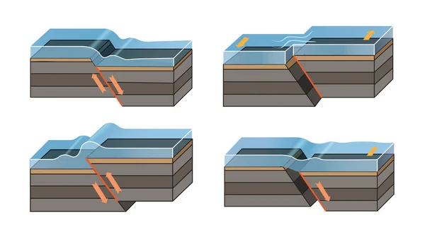
Earthquake Icons High-Quality Vector Icons Collection With Editable Stroke. Ideal For Professional And Creative Projects.
Vector, 5.79MB, 8026 × 4329 eps
Earthquake Icons High-Quality Vector Icons Collection With Editable Stroke. Ideal For Professional And Creative Projects.
Vector, 5.88MB, 8026 × 4329 eps
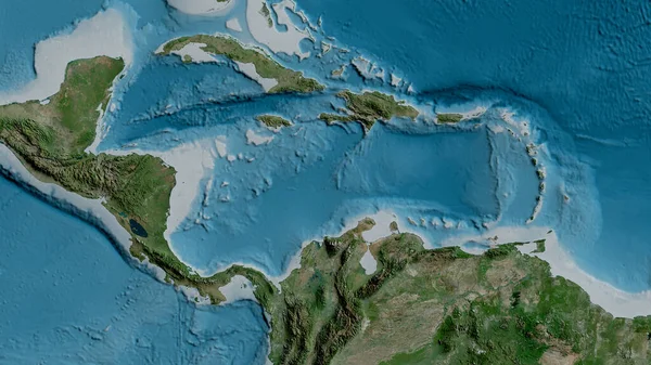
Satellite Map Of The Area Around The Caribbean Tectonic Plate. 3D Rendering
Image, 4.64MB, 2880 × 1620 jpg
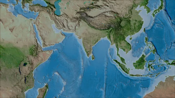
Neighborhoods Of The Indian Tectonic Plate On The Satellite A Map In The Van Der Grinten I Projection (oblique Transformation). Raw Composite - No Outlines
Image, 6.18MB, 2880 × 1620 jpg

Neighborhoods Of The Solomon Sea Tectonic Plate On The Grayscale Map In The Van Der Grinten I Projection (oblique Transformation). Raw Composite - No Outlines
Image, 1.96MB, 2880 × 1620 jpg
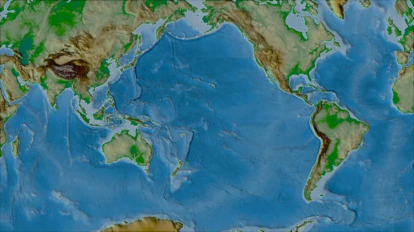
Neighborhoods Of The Pacific Tectonic Plate On The Physical Map In The Van Der Grinten I Projection (oblique Transformation). Raw Composite - No Outlines
Image, 6.81MB, 2880 × 1620 jpg

Solomon Sea Tectonic Plate Outlined On The Global Color Physical Map In The Kavrayskiy Projection. 3D Rendering
Image, 3.81MB, 2880 × 1620 jpg

South American Tectonic Plate Enlarged And Extruded The Global Grayscale Elevation Map In The Azimuthal Equidistant Projection With Dashed Plates Borders. 3D Rendering
Image, 2.87MB, 2880 × 1620 jpg

Okinawa Tectonic Plate Outlined On The Globe. Satellite Imagery. 3D Rendering
Image, 3.53MB, 2880 × 1620 jpg

Page 1 >> Next