
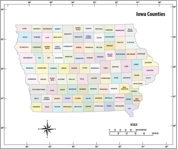
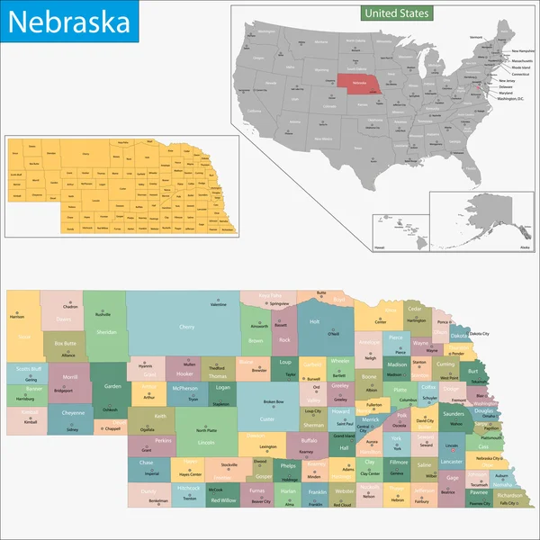
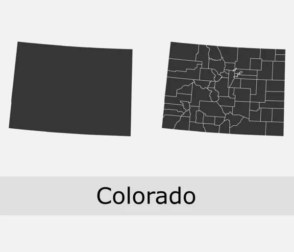
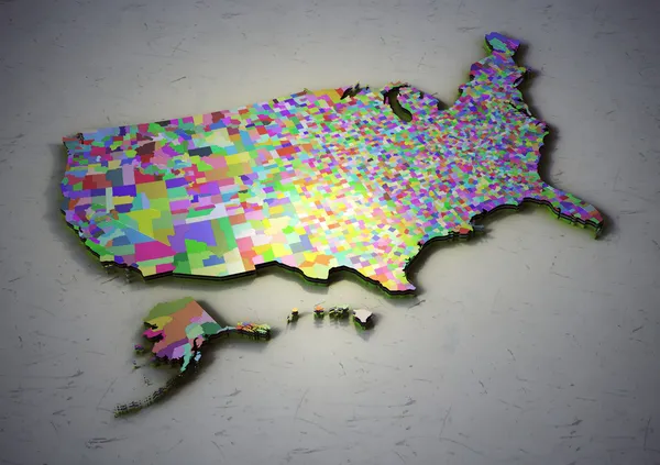
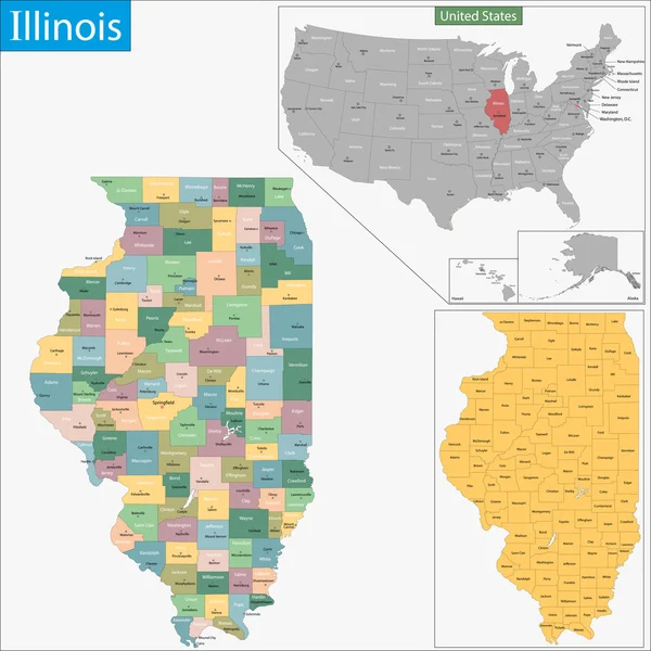
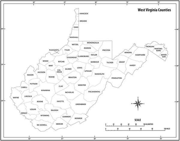
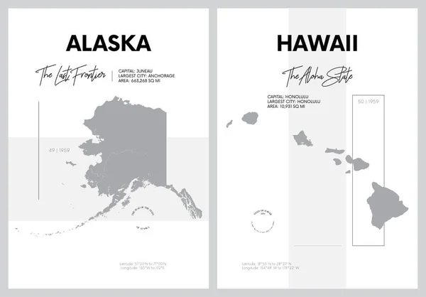
Stock image United States Counties page 2


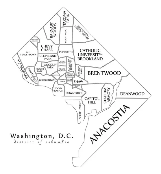
Modern City Map - Washington DC City Of The USA With Neighborhoods And Titles Outline Map
Vector, 8.67MB, 5000 × 5382 eps
New York State Outline Administrative And Political Vector Map In Black And White
Vector, 0.93MB, 3616 × 3100 eps
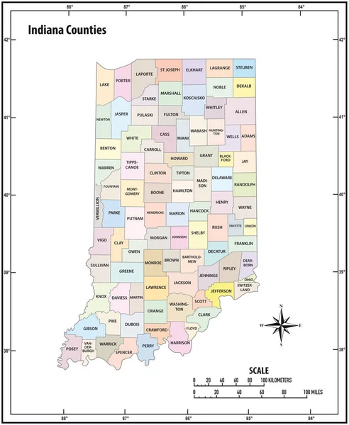
Indiana State Outline Administrative And Political Vector Map In Color
Vector, 1.13MB, 3100 × 3780 eps
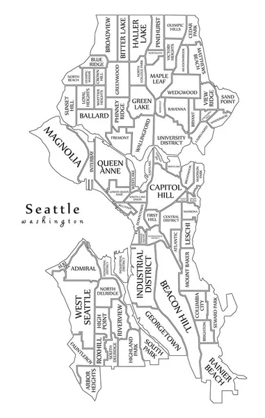
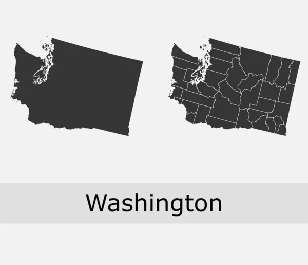
Modern City Map - Seattle Washington City Of The USA With Neighborhoods And Titles Outline Map
Vector, 9.94MB, 5000 × 7877 eps


Modern City Map - Louisville Kentucky City Of The USA With Neighborhoods And Titles Outline Map
Vector, 9.82MB, 6529 × 5000 eps

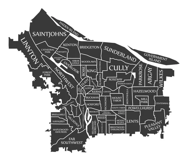
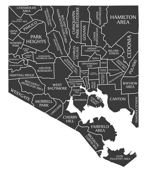
Modern City Map - Baltimore Maryland City Of The USA With Neighborhoods And Titles Outline Map
Vector, 9.7MB, 5000 × 5829 eps


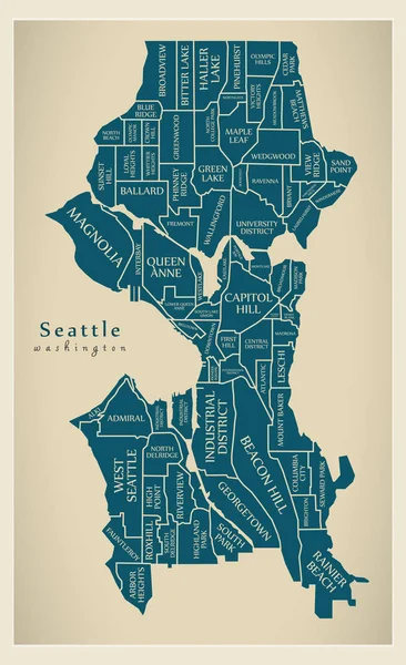
Modern City Map - Seattle Washington City Of The USA With Neighborhoods And Titles
Vector, 10.13MB, 5000 × 8185 eps
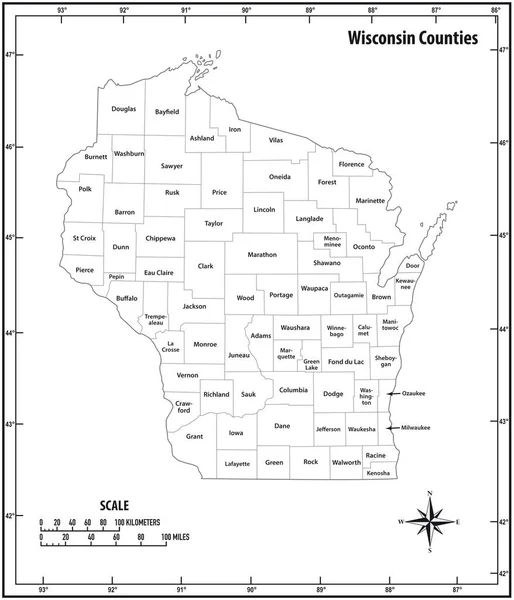
Wisconsin State Outline Administrative And Political Vector Map In Black And White
Vector, 0.99MB, 3100 × 3613 eps
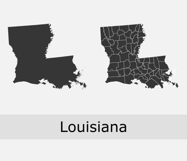
Louisiana Vector Maps Counties, Townships, Regions, Municipalities, Departments, Borders
Vector, 8.47MB, 4679 × 4023 eps


Modern City Map - Tampa Florida City Of The USA With Neighborhoods And Titles Outline Map
Vector, 10.26MB, 5000 × 5837 eps

Modern City Map - Long Beach California City Of The USA With Neighborhoods And Titles
Vector, 8.7MB, 5106 × 5000 eps


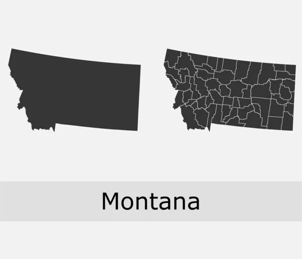
Highly Detailed Vector Silhouettes Of US State Maps, Division United States Into Counties, Political And Geographic Subdivisions Of A States, New England - Vermont, New Hampshire, Maine - Set 1 Of 17
Vector, 9.87MB, 9608 × 4501 eps

Kansas Vector Maps Counties, Townships, Regions, Municipalities, Departments, Borders
Vector, 5.12MB, 4705 × 4045 eps

Ohio State Outline Administrative And Political Vector Map In Black And White
Vector, 0.95MB, 3100 × 3651 eps
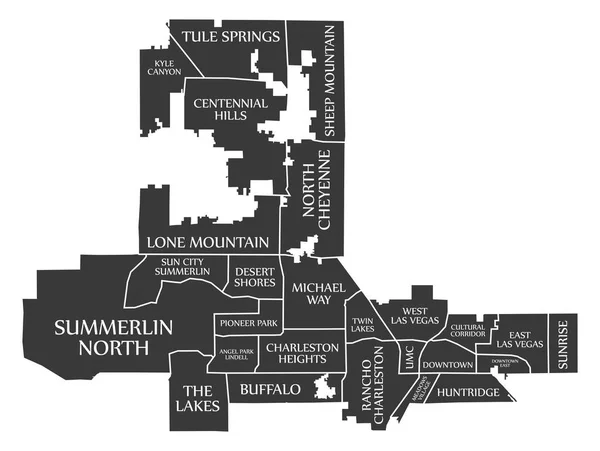
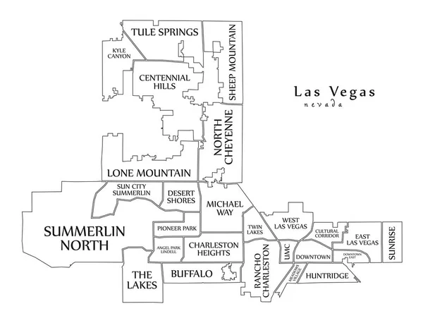
Modern City Map - Las Vegas Nevada City Of The USA With Neighborhoods And Titles Outline Map
Vector, 8.43MB, 6541 × 5000 eps

Highly Detailed Vector Silhouettes Of US State Maps, Division United States Into Counties, Political And Geographic Subdivisions Of A States, South Atlantic - South Carolina, North Carolina, Delaware - Set 9 Of 17
Vector, 9.36MB, 9608 × 4501 eps
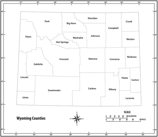
Wyoming State Outline Administrative And Political Map In Black And White
Vector, 0.69MB, 3565 × 3100 eps
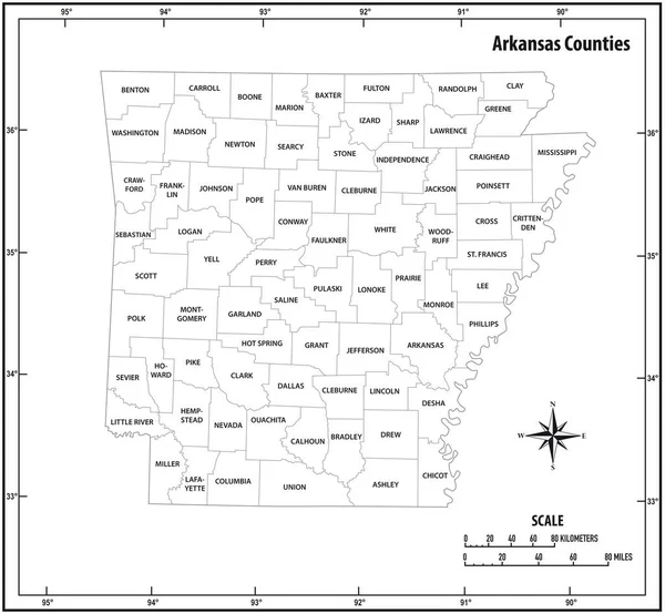
Arkansas State Outline Administrative And Political Map In Black And White
Vector, 0.93MB, 3352 × 3100 eps

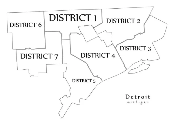
Modern City Map - Detroit Michigan City Of The USA With Districts And Titles Outline Map
Vector, 7.65MB, 6902 × 5000 eps
Previous << Page 2 >> Next