photo free
Home Images Vectors Videos

Stock image District Boundaries page 2

stock vector Paraguay provinces maps

Paraguay Provinces Maps

Vector, 4.72MB, 6000 × 4636 eps
stock vector italy  maps

Italy Maps

Vector, 1.23MB, 3540 × 5007 ai
stock vector Colombia provinces maps

Colombia Provinces Maps

Vector, 8.01MB, 6000 × 4636 eps
stock vector Detailed map of the State of North Rhine - Westphalia (Germany) with borders of municipalities, subdistricts, districts, and provinces. Vector illustration

Detailed Map Of The State Of North Rhine - Westphalia (Germany) With Borders Of Municipalities, Subdistricts, Districts, And Provinces. Vector Illustration

Vector, 9.18MB, 5000 × 5000 eps
stock vector Detailed map of the State of Brandenburg (Germany) with borders of municipalities, municipalities associations, districts, and state. Vector illustration

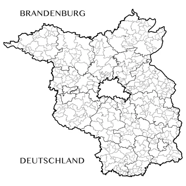
Detailed Map Of The State Of Brandenburg (Germany) With Borders Of Municipalities, Municipalities Associations, Districts, And State. Vector Illustration

Vector, 10.49MB, 5000 × 5000 eps
stock vector Switzerland provinces maps

Switzerland Provinces Maps

Vector, 6.96MB, 6000 × 4636 eps
stock vector map of germany with all cities over one hundred thousand inhabit

Map Of Germany With All Cities Over One Hundred Thousand Inhabit

Vector, 3.83MB, 5084 × 6505 eps
stock vector Slovakia provinces maps

Slovakia Provinces Maps

Vector, 1.46MB, 6000 × 4636 eps
stock vector Hungary provinces maps

Hungary Provinces Maps

Vector, 12.37MB, 6000 × 4636 eps
stock vector Georgia provinces maps

Georgia Provinces Maps

Vector, 6.31MB, 6000 × 4636 eps
stock image the Castle of St. George - a fortress within the boundaries of Lisbon, the historical core of the city.

The Castle Of St. George - A Fortress Within The Boundaries Of Lisbon, The Historical Core Of The City.

Image, 17.03MB, 5802 × 3868 jpg
stock vector administrative and political map of Germany newly revised 2019 in black and white

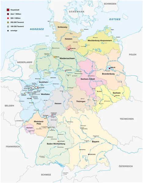
Administrative And Political Map Of Germany Newly Revised 2019 In Black And White

Vector, 7.28MB, 6258 × 8029 eps
stock vector Detailed map of the French region of Occitanie (France) with borders of municipalities, subdistricts (cantons), districts (arrondissements), departments (departements), and region

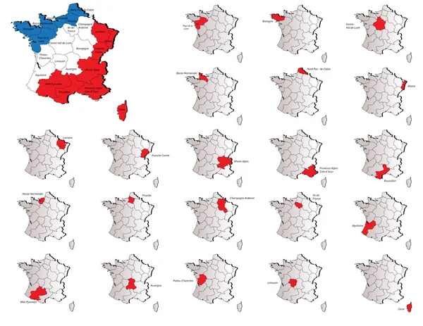
Detailed Map Of The French Region Of Occitanie (France) With Borders Of Municipalities, Subdistricts (cantons), Districts (arrondissements), Departments (departements), And Region

Vector, 9.27MB, 5000 × 5000 eps
stock vector Crete provinces maps

Crete Provinces Maps

Vector, 2.03MB, 6000 × 4636 eps
stock vector Turkey provinces maps

Turkey Provinces Maps

Vector, 1.5MB, 6000 × 4636 ai
stock image Gerrymandering mind map, concept for presentations and reports

Gerrymandering Mind Map, Concept For Presentations And Reports

Image, 3.89MB, 5760 × 3840 jpg
stock vector Belorrusia provinces maps

Belorrusia Provinces Maps

Vector, 1.38MB, 6000 × 4636 eps
stock vector italy region

Italy Region

Vector, 4.91MB, 5007 × 3540 ai
stock vector Spain maps

Spain Maps

Vector, 1.22MB, 3864 × 5000 eps
stock vector Detailed map of the Free State of Saxony (Germany) with borders of municipalities, municipalities associations, districts, and state. Vector illustration

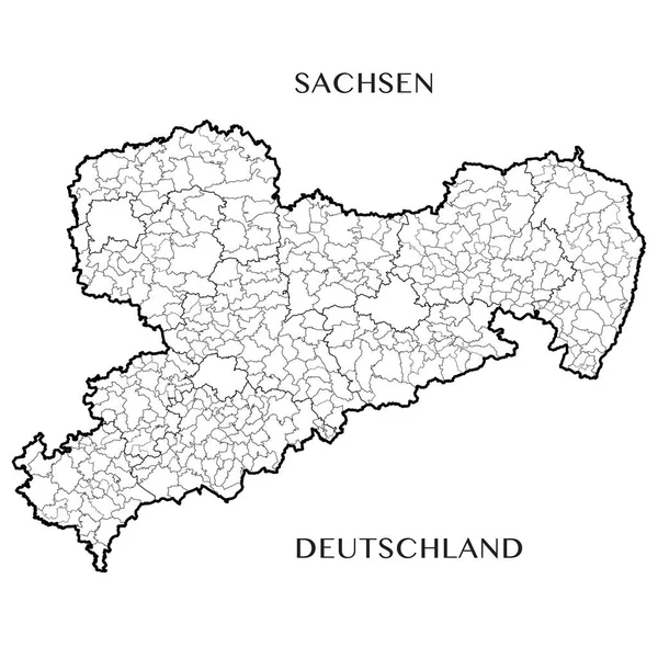
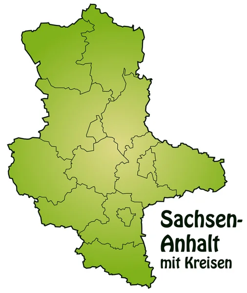
Detailed Map Of The Free State Of Saxony (Germany) With Borders Of Municipalities, Municipalities Associations, Districts, And State. Vector Illustration

Vector, 10.88MB, 5000 × 5000 eps
stock vector Malta maps

Malta Maps

Vector, 1.09MB, 6000 × 4636 eps
stock vector Guyana provinces maps

Guyana Provinces Maps

Vector, 4.73MB, 6000 × 4636 eps
stock vector France provinces maps

France Provinces Maps

Vector, 8.59MB, 6000 × 4636 eps
stock vector Uk provinces maps

Uk Provinces Maps

Vector, 3.57MB, 6000 × 4636 eps
stock vector Map of Saxony-Anhalt

Map Of Saxony-Anhalt

Vector, 0.12MB, 4000 × 4741 ai
stock vector Greece maps

Greece Maps

Vector, 6.24MB, 6000 × 4636 eps
stock vector France maps

France Maps

Vector, 2.66MB, 6000 × 4636 eps
stock vector Detailed map of the Region of Bourgogne Franche Comte (France) with borders of municipalities, subdistricts (cantons), districts (arrondissements), and departments (departements). Vector illustration

Detailed Map Of The Region Of Bourgogne Franche Comte (France) With Borders Of Municipalities, Subdistricts (cantons), Districts (arrondissements), And Departments (departements). Vector Illustration

Vector, 7.13MB, 5000 × 5000 eps
stock vector Detailed map of the French region Grand Est (France) with borders of municipalities, subdistricts (cantons), districts (arrondissements), departments (departements), and region

Detailed Map Of The French Region Grand Est (France) With Borders Of Municipalities, Subdistricts (cantons), Districts (arrondissements), Departments (departements), And Region

Vector, 8.61MB, 5000 × 5000 eps
stock image the Castle of St. George - a fortress within the boundaries of Lisbon, the historical core of the city.

The Castle Of St. George - A Fortress Within The Boundaries Of Lisbon, The Historical Core Of The City.

Image, 16.16MB, 3884 × 5879 jpg
stock vector Portugal maps

Portugal Maps

Vector, 3.35MB, 6000 × 4636 eps
stock vector Russia provinces maps

Russia Provinces Maps

Vector, 13.02MB, 6000 × 4642 eps
stock vector Colorful Map of Germany

Colorful Map Of Germany

Vector, 5.18MB, 4990 × 7058 eps
stock vector Italy blank map

Italy Blank Map

Vector, 0.69MB, 3679 × 5000 ai
stock vector Croydon, Greater London, United Kingdom high detail vector map

Croydon, Greater London, United Kingdom High Detail Vector Map

Vector, 9.4MB, 7108 × 8161 eps
stock vector Detailed map of the French region of Corsica (Corse, France) with borders of municipalities, subdistricts (cantons), districts (arrondissements), departments (departements), and region

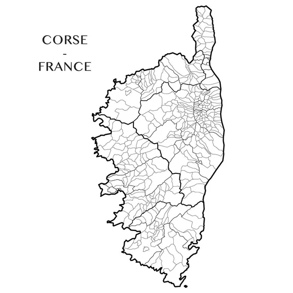
Detailed Map Of The French Region Of Corsica (Corse, France) With Borders Of Municipalities, Subdistricts (cantons), Districts (arrondissements), Departments (departements), And Region

Vector, 2.07MB, 5000 × 5000 eps
stock vector Detailed map of the Region of Normandy (France) with borders of municipalities, subdistricts (cantons), districts (arrondissements), and departments (departements). Vector illustration

Detailed Map Of The Region Of Normandy (France) With Borders Of Municipalities, Subdistricts (cantons), Districts (arrondissements), And Departments (departements). Vector Illustration

Vector, 5.56MB, 5000 × 5000 eps
stock vector Belgium provinces maps

Belgium Provinces Maps

Vector, 3.13MB, 6000 × 4636 eps
stock vector Detailed map of the Region of Auvergne Rhone Alpes (France) with borders of municipalities, subdistricts (cantons), districts (arrondissements), and departments (departements). Vector illustration

Detailed Map Of The Region Of Auvergne Rhone Alpes (France) With Borders Of Municipalities, Subdistricts (cantons), Districts (arrondissements), And Departments (departements). Vector Illustration

Vector, 13.55MB, 5000 × 5000 eps
stock vector Detailed map of the French region Hauts de France (France) with borders of municipalities, subdistricts (cantons), districts (arrondissements), departments (departements), and region

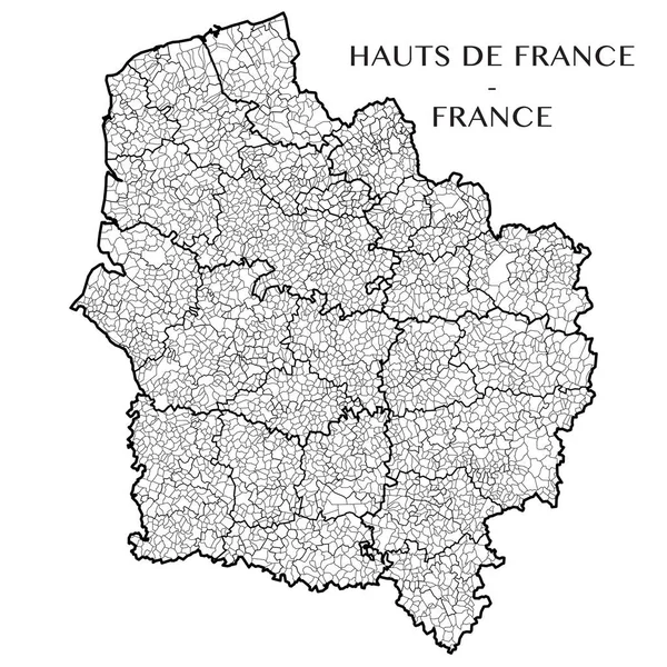
Detailed Map Of The French Region Hauts De France (France) With Borders Of Municipalities, Subdistricts (cantons), Districts (arrondissements), Departments (departements), And Region

Vector, 6.46MB, 5000 × 5000 eps
stock vector Detailed map of the French region of Brittany (Bretagne, France) with borders of municipalities, subdistricts (cantons), districts (arrondissements), departments (departements), and region

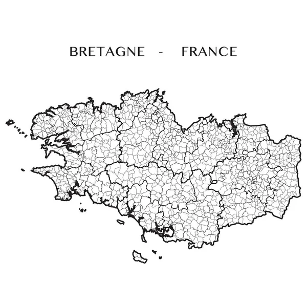
Detailed Map Of The French Region Of Brittany (Bretagne, France) With Borders Of Municipalities, Subdistricts (cantons), Districts (arrondissements), Departments (departements), And Region

Vector, 8.3MB, 5000 × 5000 eps
stock vector Detailed map of the French region of Pays de la Loire (France) with borders of municipalities, subdistricts (cantons), districts (arrondissements), departments (departements), and region

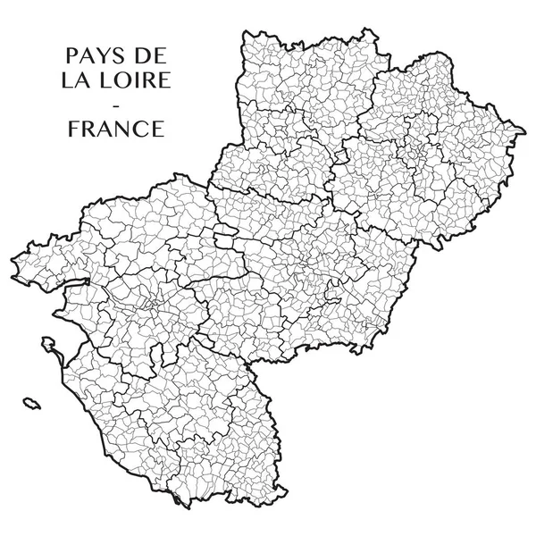
Detailed Map Of The French Region Of Pays De La Loire (France) With Borders Of Municipalities, Subdistricts (cantons), Districts (arrondissements), Departments (departements), And Region

Vector, 4.56MB, 5000 × 5000 eps
stock vector Map of Sao Paulo city

Map Of Sao Paulo City

Vector, 8.2MB, 3500 × 5000 eps
stock vector Detailed map of the State of Rhineland Palatinate (Rheinland Pfalz, Germany) with borders of municipalities, municipalities associations, subdistricts, districts, and state. Vector illustration

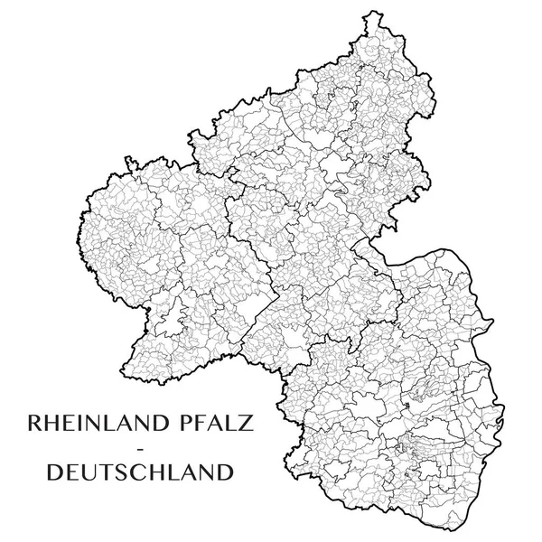
Detailed Map Of The State Of Rhineland Palatinate (Rheinland Pfalz, Germany) With Borders Of Municipalities, Municipalities Associations, Subdistricts, Districts, And State. Vector Illustration

Vector, 14.11MB, 5000 × 5000 eps
stock vector Detailed map of the French region of Nouvelle Aquitaine (France) with borders of municipalities, subdistricts (cantons), districts (arrondissements), departments (departements), and region

Detailed Map Of The French Region Of Nouvelle Aquitaine (France) With Borders Of Municipalities, Subdistricts (cantons), Districts (arrondissements), Departments (departements), And Region

Vector, 9.47MB, 5000 × 5000 eps
stock vector Detailed map of the Belgian Regions of Wallonia and Brussels-Capital (Belgium) with borders of municipalities, districts, provinces, and regions. Vector illustration

Detailed Map Of The Belgian Regions Of Wallonia And Brussels-Capital (Belgium) With Borders Of Municipalities, Districts, Provinces, And Regions. Vector Illustration

Vector, 5.63MB, 5000 × 5000 eps
stock vector Detailed map of the French region Centre Val de Loire (France) with borders of municipalities, subdistricts (cantons), districts (arrondissements), departments (departements), and region

Detailed Map Of The French Region Centre Val De Loire (France) With Borders Of Municipalities, Subdistricts (cantons), Districts (arrondissements), Departments (departements), And Region

Vector, 4.94MB, 5000 × 5000 eps
stock vector Italy blank map

Italy Blank Map

Vector, 0.55MB, 3679 × 5000 ai
stock vector administrative vector map of the Detmold region in German language, North Rhine-Westphalia, Germany

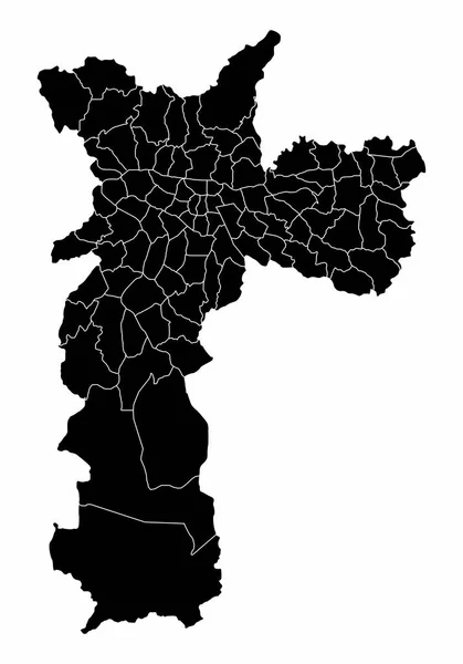
Administrative Vector Map Of The Detmold Region In German Language, North Rhine-Westphalia, Germany

Vector, 1.3MB, 3340 × 3700 eps
stock vector Chile provinces maps

Chile Provinces Maps

Vector, 4.37MB, 6000 × 4636 eps
Previous << Page 2 >> Next