photo free
Home Images Vectors Videos

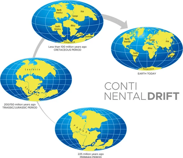
Stock image Continental Drift page 2

stock image Thingvellir rocks in Golden Circle of Iceland

Thingvellir Rocks In Golden Circle Of Iceland

Image, 13.22MB, 5184 × 3456 jpg
stock image Neighborhoods of the Aegean Sea tectonic plate on the relief map in the van der Grinten I projection (oblique transformation). Raw composite - no outlines

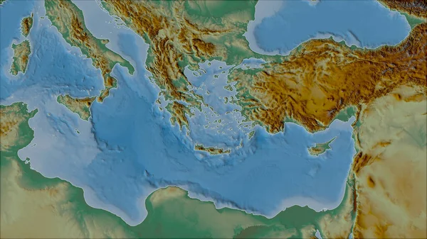
Neighborhoods Of The Aegean Sea Tectonic Plate On The Relief Map In The Van Der Grinten I Projection (oblique Transformation). Raw Composite - No Outlines

Image, 5.12MB, 2880 × 1620 jpg
stock image Tectonic plate interaction

Tectonic Plate Interaction

Image, 5.74MB, 6233 × 2986 jpg
stock image Relief map of the area around the Molucca Sea tectonic plate. 3D rendering

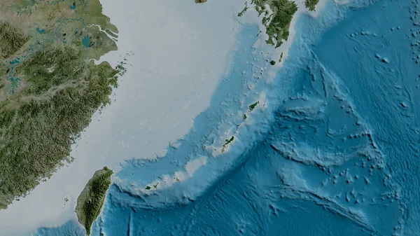
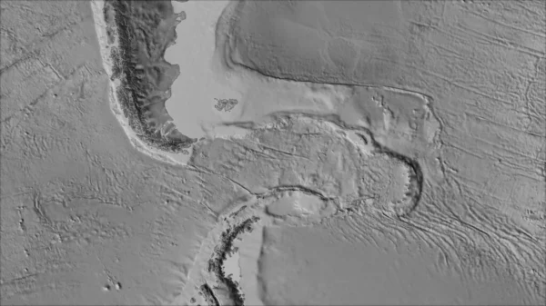
Relief Map Of The Area Around The Molucca Sea Tectonic Plate. 3D Rendering

Image, 4.05MB, 2880 × 1620 jpg
stock image Thingvellir rocks in Golden Circle of Iceland

Thingvellir Rocks In Golden Circle Of Iceland

Image, 7.58MB, 5184 × 3456 jpg
stock vector Silhouette of Map of the Earth 180MYA. Monochrome vector illustration of Earth map with black continents and white oceans isolated on white background. Projection. Prehistoric worldmap.

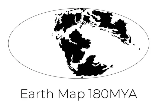
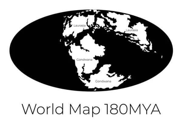
Silhouette Of Map Of The Earth 180MYA. Monochrome Vector Illustration Of Earth Map With Black Continents And White Oceans Isolated On White Background. Projection. Prehistoric Worldmap.

Vector, 1.07MB, 7143 × 5000 eps
stock vector Map of the World 180MYA. Monochrome vector illustration of Worldmap with white continents and black oceans isolated on white background. Prehistoric projection. Silhouette. Element for your design.

Map Of The World 180MYA. Monochrome Vector Illustration Of Worldmap With White Continents And Black Oceans Isolated On White Background. Prehistoric Projection. Silhouette. Element For Your Design.

Vector, 1MB, 7143 × 5000 eps
stock vector Continental drift and changes of Earth map. Colorful vector illustration of Worldmap at Permian, Jurassic, Paleogen and Quartenary periods isolated on background.

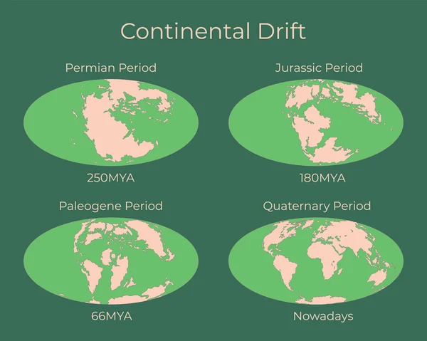
Continental Drift And Changes Of Earth Map. Colorful Vector Illustration Of Worldmap At Permian, Jurassic, Paleogen And Quartenary Periods Isolated On Background.

Vector, 3.62MB, 6250 × 5000 eps
stock vector Silhouette of Map of the Earth 230MYA. Monochrome vector illustration of Earth map with black continents and white oceans isolated on white background. Projection. Prehistoric worldmap.

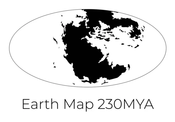
Silhouette Of Map Of The Earth 230MYA. Monochrome Vector Illustration Of Earth Map With Black Continents And White Oceans Isolated On White Background. Projection. Prehistoric Worldmap.

Vector, 0.93MB, 7143 × 5000 eps
stock image The Silfra fissure, ingvellir, where the European and American Plates meet. Thingvellir National Park near Reykjavik, Iceland .

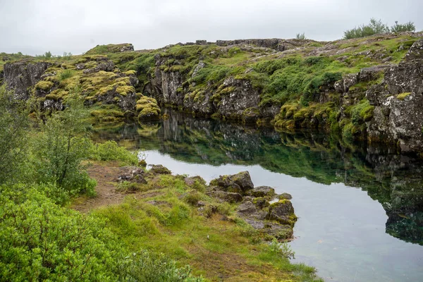
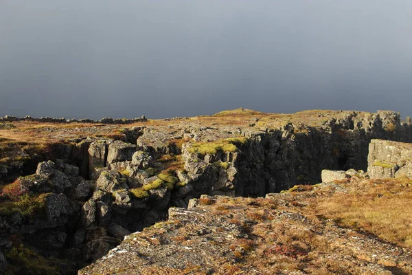
The Silfra Fissure, Ingvellir, Where The European And American Plates Meet. Thingvellir National Park Near Reykjavik, Iceland .

Image, 17.65MB, 6016 × 4016 jpg
stock image North American tectonic plate enlarged, extruded and rotated to the west side the global shapes only - land/ocean mask in the Azimuthal Equidistant projection with dashed plates borders. 3D rendering

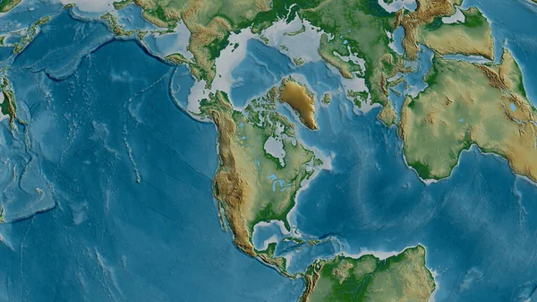
North American Tectonic Plate Enlarged, Extruded And Rotated To The West Side The Global Shapes Only - Land/ocean Mask In The Azimuthal Equidistant Projection With Dashed Plates Borders. 3D Rendering

Image, 1.74MB, 2880 × 1620 jpg
stock image Africann tectonic plate overview the global grayscale elevation map in the Azimuthal Equidistant projection with dashed plates borders. 3D rendering

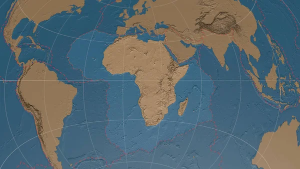
Africann Tectonic Plate Overview The Global Grayscale Elevation Map In The Azimuthal Equidistant Projection With Dashed Plates Borders. 3D Rendering

Image, 3.52MB, 2880 × 1620 jpg
stock vector Earths Inner Core

Earths Inner Core

Vector, 0.78MB, 6000 × 6000 eps
stock image Neighborhoods of the Caribbean tectonic plate on the grayscale map in the van der Grinten I projection (oblique transformation). Raw composite - no outlines

Neighborhoods Of The Caribbean Tectonic Plate On The Grayscale Map In The Van Der Grinten I Projection (oblique Transformation). Raw Composite - No Outlines

Image, 2.65MB, 2880 × 1620 jpg
stock image Area of the Nazca tectonic plate marked with a solid line on a pale colored elevation map in the Patterson Cylindrical projection

Area Of The Nazca Tectonic Plate Marked With A Solid Line On A Pale Colored Elevation Map In The Patterson Cylindrical Projection

Image, 7.51MB, 3840 × 2160 jpg
stock image Satellite imagery map of the world in the Patterson Cylindrical projection transformed to the center of the Rivera tectonic plate

Satellite Imagery Map Of The World In The Patterson Cylindrical Projection Transformed To The Center Of The Rivera Tectonic Plate

Image, 6.56MB, 3840 × 2160 jpg
stock image Relief map of the area around the Pacific tectonic plate. 3D rendering

Relief Map Of The Area Around The Pacific Tectonic Plate. 3D Rendering

Image, 5.32MB, 2880 × 1620 jpg
stock image Satellite map of the area around the Okinawa tectonic plate. 3D rendering

Satellite Map Of The Area Around The Okinawa Tectonic Plate. 3D Rendering

Image, 4.05MB, 2880 × 1620 jpg
stock image Physical map of the area around the North American tectonic plate. 3D rendering

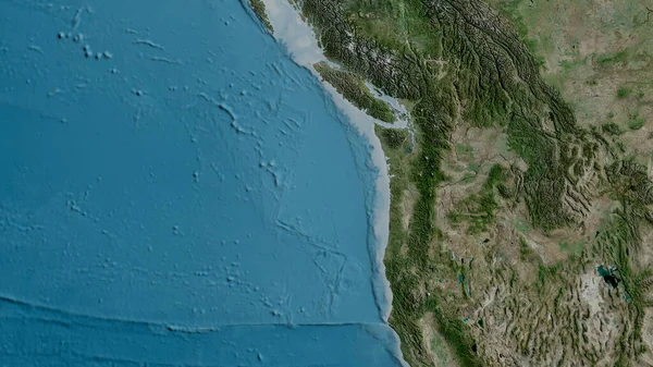
Physical Map Of The Area Around The North American Tectonic Plate. 3D Rendering

Image, 5.52MB, 2880 × 1620 jpg
stock image Antarctic tectonic plate overview the global shapes only - land/ocean mask in the Azimuthal Equidistant projection with dashed plates borders. 3D rendering

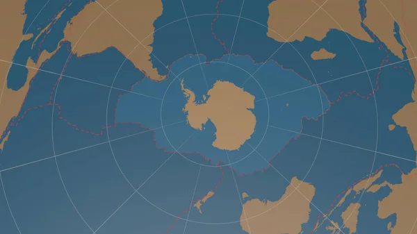
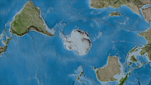
Antarctic Tectonic Plate Overview The Global Shapes Only - Land/ocean Mask In The Azimuthal Equidistant Projection With Dashed Plates Borders. 3D Rendering

Image, 1.56MB, 2880 × 1620 jpg
stock image Antarctica tectonic plate extruded on the globe. color physical map. 3D rendering

Antarctica Tectonic Plate Extruded On The Globe. Color Physical Map. 3D Rendering

Image, 3.72MB, 2880 × 1620 jpg
stock image Neighborhoods of the Panama tectonic plate on the bilevel elevation map in the van der Grinten I projection (oblique transformation). Raw composite - no outlines

Neighborhoods Of The Panama Tectonic Plate On The Bilevel Elevation Map In The Van Der Grinten I Projection (oblique Transformation). Raw Composite - No Outlines

Image, 2.12MB, 2880 × 1620 jpg
stock image Neighborhoods of the Scotia tectonic plate on the physical map in the van der Grinten I projection (oblique transformation). Raw composite - no outlines

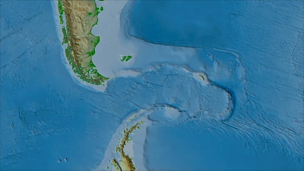
Neighborhoods Of The Scotia Tectonic Plate On The Physical Map In The Van Der Grinten I Projection (oblique Transformation). Raw Composite - No Outlines

Image, 3.92MB, 2880 × 1620 jpg
stock image Tectonic plates borders on the grayscale map of areas adjacent to the Caribbean plate area. Van der Grinten I projection (oblique transformation)

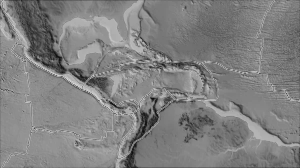
Tectonic Plates Borders On The Grayscale Map Of Areas Adjacent To The Caribbean Plate Area. Van Der Grinten I Projection (oblique Transformation)

Image, 2.7MB, 2880 × 1620 jpg
stock image Satellite map of the area around the Juan De Fuca tectonic plate. 3D rendering

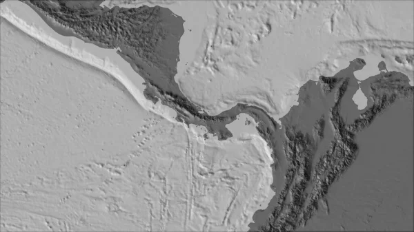
Satellite Map Of The Area Around The Juan De Fuca Tectonic Plate. 3D Rendering

Image, 5.02MB, 2880 × 1620 jpg
stock image Neighborhoods of the Antarctica tectonic plate on the satellite B map in the van der Grinten I projection (oblique transformation). Raw composite - no outlines

Neighborhoods Of The Antarctica Tectonic Plate On The Satellite B Map In The Van Der Grinten I Projection (oblique Transformation). Raw Composite - No Outlines

Image, 6.47MB, 2880 × 1620 jpg
stock image Niuafou tectonic plate outlined on the globe. topography and bathymetry colored elevation map. 3D rendering

Niuafou Tectonic Plate Outlined On The Globe. Topography And Bathymetry Colored Elevation Map. 3D Rendering

Image, 2.45MB, 2880 × 1620 jpg
stock image Indian tectonic plate outlined on the globe. topographic map. 3D rendering

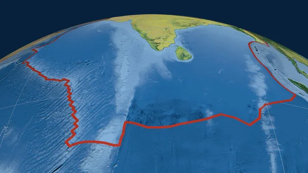
Indian Tectonic Plate Outlined On The Globe. Topographic Map. 3D Rendering

Image, 3.52MB, 2880 × 1620 jpg
stock image Neighborhoods of the Altiplano tectonic plate on the grayscale map in the van der Grinten I projection (oblique transformation). Raw composite - no outlines

Neighborhoods Of The Altiplano Tectonic Plate On The Grayscale Map In The Van Der Grinten I Projection (oblique Transformation). Raw Composite - No Outlines

Image, 2.34MB, 2880 × 1620 jpg
stock image Map of Earth's principal tectonic plates, Tectonic Plate World Map Concept Design, The sixteen major pieces of crust and uppermost mantle of the Earth, called the lithosphere, Earth's surface, geology

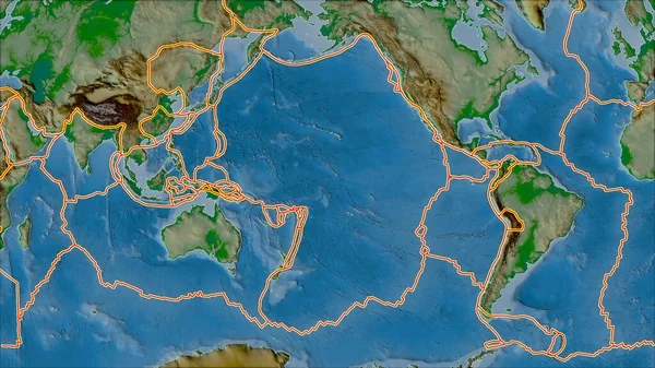
Map Of Earth's Principal Tectonic Plates, Tectonic Plate World Map Concept Design, The Sixteen Major Pieces Of Crust And Uppermost Mantle Of The Earth, Called The Lithosphere, Earth's Surface, Geology

Image, 1.06MB, 4800 × 2700 jpg
stock image Neighborhoods of the Molucca Sea tectonic plate on the grayscale map in the van der Grinten I projection (oblique transformation). Raw composite - no outlines

Neighborhoods Of The Molucca Sea Tectonic Plate On The Grayscale Map In The Van Der Grinten I Projection (oblique Transformation). Raw Composite - No Outlines

Image, 2.24MB, 2880 × 1620 jpg
stock image Neighborhoods of the North Bismarck tectonic plate on the relief map in the van der Grinten I projection (oblique transformation). Raw composite - no outlines

Neighborhoods Of The North Bismarck Tectonic Plate On The Relief Map In The Van Der Grinten I Projection (oblique Transformation). Raw Composite - No Outlines

Image, 3.79MB, 2880 × 1620 jpg
stock image Eurasian tectonic plate outlined on the globe. natural earth topographic map. 3D rendering

Eurasian Tectonic Plate Outlined On The Globe. Natural Earth Topographic Map. 3D Rendering

Image, 4.55MB, 2880 × 1620 jpg
stock image Neighborhoods of the Anatolian tectonic plate on the topographic map in the van der Grinten I projection (oblique transformation). Raw composite - no outlines

Neighborhoods Of The Anatolian Tectonic Plate On The Topographic Map In The Van Der Grinten I Projection (oblique Transformation). Raw Composite - No Outlines

Image, 5.95MB, 2880 × 1620 jpg
stock image New Hebrides tectonic plate outlined on the global topographic relief map in the Mollweide projection. 3D rendering

New Hebrides Tectonic Plate Outlined On The Global Topographic Relief Map In The Mollweide Projection. 3D Rendering

Image, 4.06MB, 2880 × 1620 jpg
stock vector The Process of Seafloor Spreading illustration

The Process Of Seafloor Spreading Illustration

Vector, 1.06MB, 6261 × 3550 eps
stock image Neighborhoods of the Scotia tectonic plate on the grayscale map in the van der Grinten I projection (oblique transformation). Raw composite - no outlines

Neighborhoods Of The Scotia Tectonic Plate On The Grayscale Map In The Van Der Grinten I Projection (oblique Transformation). Raw Composite - No Outlines

Image, 2.06MB, 2880 × 1620 jpg
stock image Outline of the Juan De Fuca tectonic plate with the borders of surrounding plates against the background of a physical map. 3D rendering

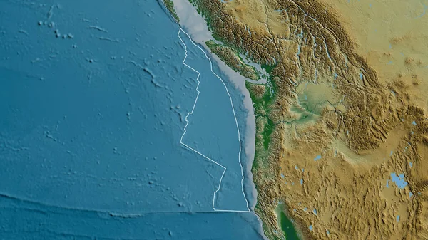
Outline Of The Juan De Fuca Tectonic Plate With The Borders Of Surrounding Plates Against The Background Of A Physical Map. 3D Rendering

Image, 4.92MB, 2880 × 1620 jpg
stock image Neighborhoods of the Juan De Fuca tectonic plate on the physical map in the van der Grinten I projection (oblique transformation). Raw composite - no outlines

Neighborhoods Of The Juan De Fuca Tectonic Plate On The Physical Map In The Van Der Grinten I Projection (oblique Transformation). Raw Composite - No Outlines

Image, 4.81MB, 2880 × 1620 jpg
stock vector Illustration of Earth's major tectonic plates

Illustration Of Earth's Major Tectonic Plates

Vector, 4.56MB, 6284 × 3535 eps
stock image South America tectonic plate extruded and presented against the global color physical map in the Kavrayskiy projection. 3D rendering

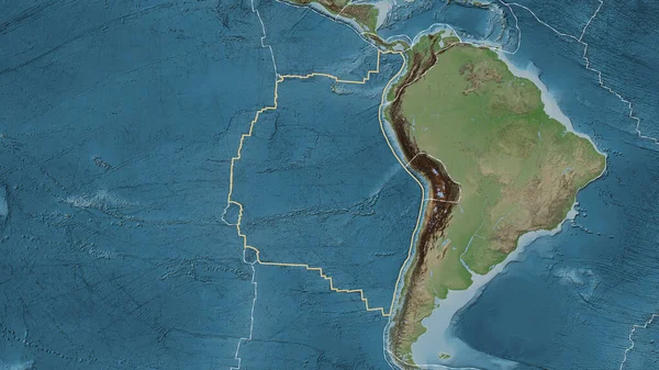
South America Tectonic Plate Extruded And Presented Against The Global Color Physical Map In The Kavrayskiy Projection. 3D Rendering

Image, 3.54MB, 2880 × 1620 jpg
stock vector The Process of Seafloor Spreading illustration

The Process Of Seafloor Spreading Illustration

Vector, 0.99MB, 6171 × 3742 eps
stock image Satellite map of the area around the Pacific tectonic plate. 3D rendering

Satellite Map Of The Area Around The Pacific Tectonic Plate. 3D Rendering

Image, 5.12MB, 2880 × 1620 jpg
stock vector Vector illustration of Continental Drift Theory.

Vector Illustration Of Continental Drift Theory.

Vector, 3.24MB, 3000 × 2581 eps
stock image Outline of the Burma tectonic plate with the borders of surrounding plates against the background of a satellite map. 3D rendering

Outline Of The Burma Tectonic Plate With The Borders Of Surrounding Plates Against The Background Of A Satellite Map. 3D Rendering

Image, 3.58MB, 2880 × 1620 jpg
stock image Outline of the Pacific tectonic plate with the borders of surrounding plates against the background of a relief map. 3D rendering

Outline Of The Pacific Tectonic Plate With The Borders Of Surrounding Plates Against The Background Of A Relief Map. 3D Rendering

Image, 5.55MB, 2880 × 1620 jpg
stock image Tectonic plates borders on the physical map of areas adjacent to the Pacific plate area. Van der Grinten I projection (oblique transformation)

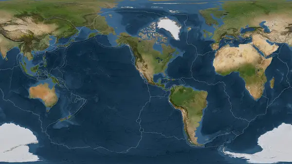
Tectonic Plates Borders On The Physical Map Of Areas Adjacent To The Pacific Plate Area. Van Der Grinten I Projection (oblique Transformation)

Image, 7.14MB, 2880 × 1620 jpg
stock image Kermadec tectonic plate described, extruded and presented against the globe. natural earth topographic map. 3D rendering

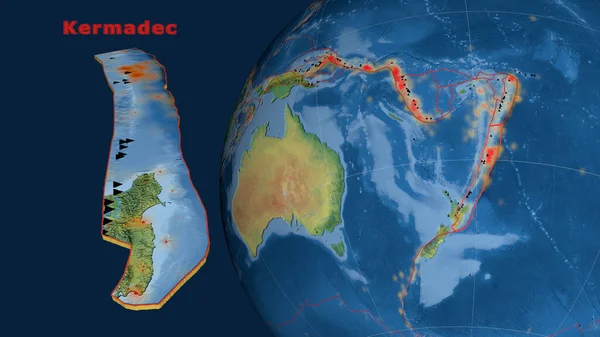
Kermadec Tectonic Plate Described, Extruded And Presented Against The Globe. Natural Earth Topographic Map. 3D Rendering

Image, 3.58MB, 2880 × 1620 jpg
stock image South America tectonic plate extruded and presented against the globe. grayscale elevation map. 3D rendering

South America Tectonic Plate Extruded And Presented Against The Globe. Grayscale Elevation Map. 3D Rendering

Image, 2.02MB, 2880 × 1620 jpg
stock image Arabiann tectonic plate overview the global grayscale elevation map in the Azimuthal Equidistant projection with dashed plates borders. 3D rendering

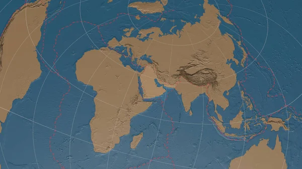
Arabiann Tectonic Plate Overview The Global Grayscale Elevation Map In The Azimuthal Equidistant Projection With Dashed Plates Borders. 3D Rendering

Image, 3.32MB, 2880 × 1620 jpg
Previous << Page 2 >> Next