
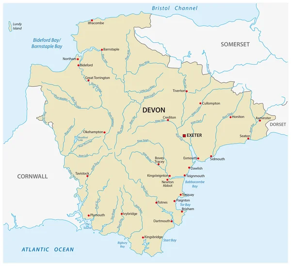
Stock image Devon Map


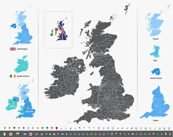
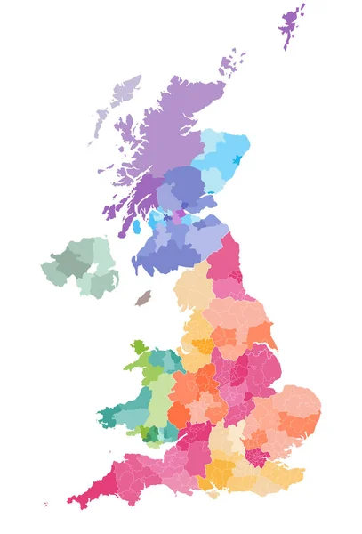
United Kingdom High Detailed Vector Map With Administrative Divisions Borders
Vector, 7.6MB, 5379 × 8333 eps
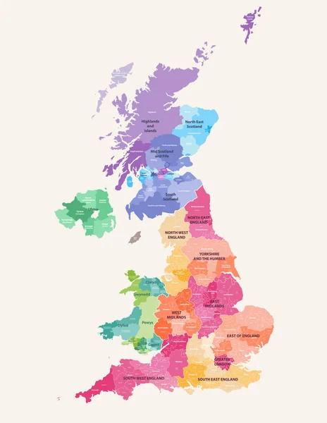
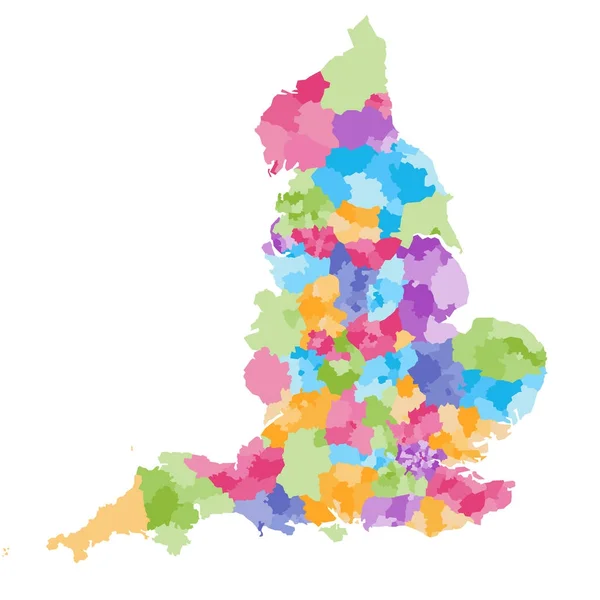
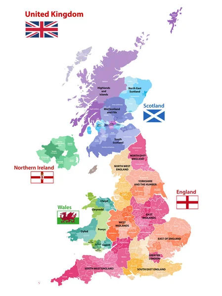
United Kingdom Administrative Districts High Detailed Vector Map Colored By Regions With Editable And Labelled Layers
Vector, 10.16MB, 6454 × 8333 eps

High-detailed Administrative Units Map Of United Kingdom. All Elements Entitled And Easy-to-use
Vector, 14.61MB, 7292 × 6127 eps


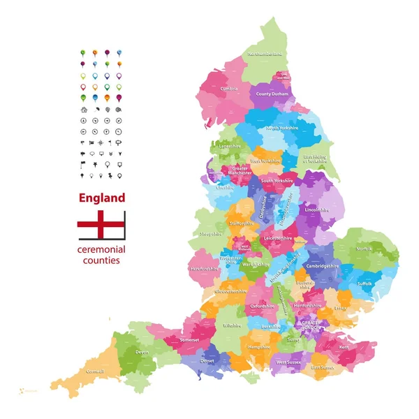
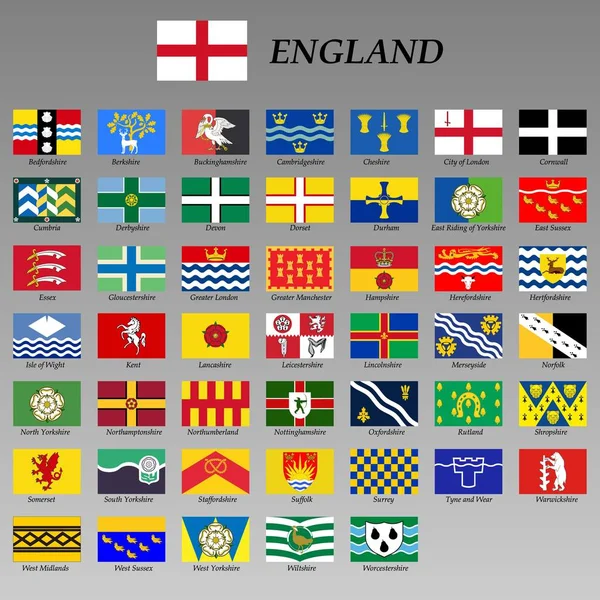
Vector Map Of England Ceremonial Counties. Flag Of England. Navigation And Location Icons
Vector, 9.37MB, 7292 × 7292 eps


United Kingdom Administrative Districts Vector High Detailed Map Colored By Regions And Counties
Vector, 10MB, 5144 × 8333 eps
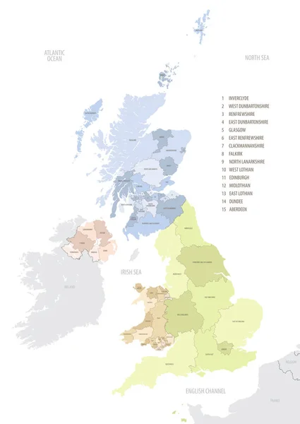
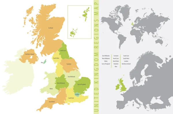
Location Map Of United Kingdom In Europe With Administrative Divisions, Detailed Vector Illustration
Vector, 4.61MB, 5453 × 7677 eps
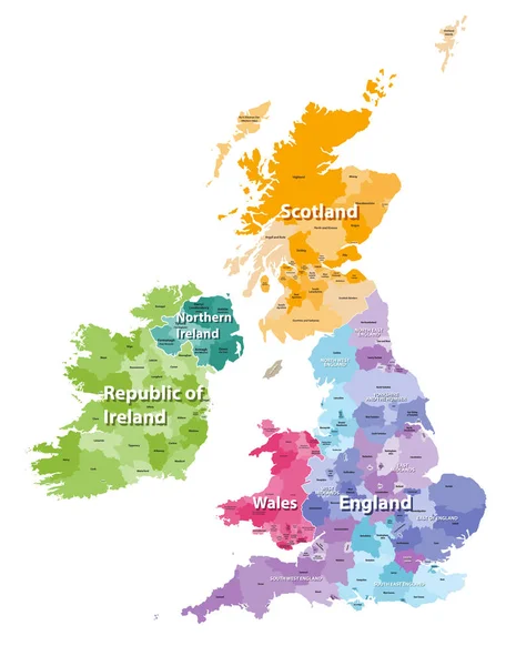
Vector Map Of United Kingdom Administrative Divisions Colored By Countries And Regions. Districts And Counties Map Of England, Wales, Scotland And Northern Ireland
Vector, 6.25MB, 5656 × 8333 eps
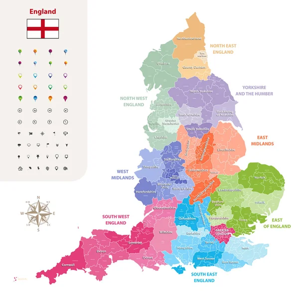
England Ceremonial Counties And Their Districts Vector Map. Each County Distinctions Between Each Other By Different Color Palette
Vector, 5.73MB, 7292 × 7292 eps
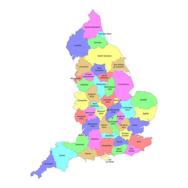
High Quality Colorful Labeled Map Of England With Borders Of The Counties
Vector, 3MB, 4000 × 4000 eps
Vector Map Of United Kingdom Colored By Countries, Counties And Regions
Vector, 10.75MB, 5458 × 7292 eps
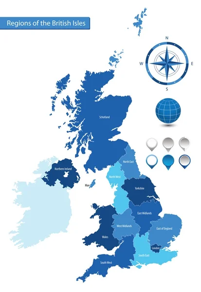
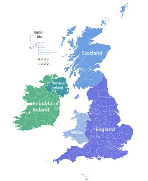
Color Detailed Map Of The Regions And Countries Of The British Isles For Your Design
Vector, 1.81MB, 5947 × 7951 eps
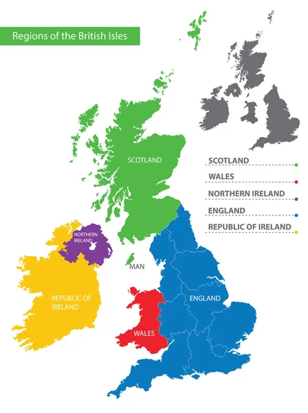
Detailed Vector Map Of The Regions Of The British Isles, In The Color Of The British Flag
Vector, 9.14MB, 5192 × 6496 eps


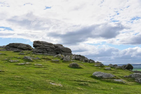
Haytor Rocks, Dartmoor's Most Famous Landmark, Is A Granite Tor On The Eastern Edge Of Dartmoor In Devon, UK. Sunny Day.
Image, 16.47MB, 6000 × 4000 jpg

Haytor Rocks, Dartmoor's Most Famous Landmark, Is A Granite Tor On The Eastern Edge Of Dartmoor In Devon, UK. Sunny Day.
Image, 14.03MB, 6000 × 4000 jpg
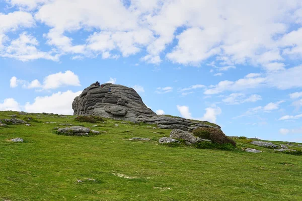
Haytor Rocks, Dartmoor's Most Famous Landmark, Is A Granite Tor On The Eastern Edge Of Dartmoor In Devon, UK. Sunny Day.
Image, 16.41MB, 6000 × 4000 jpg

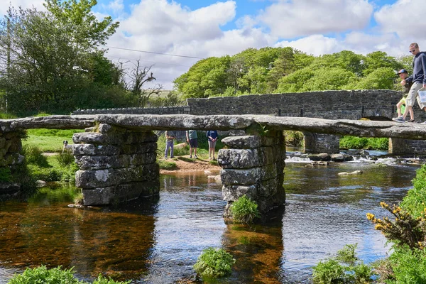
Medieval Clapper Bridge Over The East Dart River At Postbridge On Dartmoor In Devon, West Country, England, UK
Image, 29.91MB, 6000 × 4000 jpg

England Administrative Divisions Map. Metropolitan And Non-metropolitan Counties And Unitary Authorities. Blue Vector Map With Labels.
Vector, 0.94MB, 8000 × 8000 eps

English Riviera In Torbay, England, Gray Political Map. Geopark And Popular Tourist Destination Around Tor Bay On The English Channel, With The Towns Torquay, Paignton And Brixham In The County Devon.
Vector, 0.92MB, 6000 × 6000 eps


Top View Of Devon County, UK Flag. County Of United Kingdom Of Great Britain, England. No Flagpole. Plane Design, Layout. Flag Background
Image, 1.44MB, 6000 × 3488 jpg

Administrative Map Of Devon With Counties, Districts And Civil Parishes As Of 2022 - United Kingdom, England - Vector Map
Vector, 7.38MB, 3000 × 3000 eps
Flag Of County Devon, UK At Cloudy Sky Background On Sunset, Panoramic View. County Of United Kingdom Of Great Britain, England. Copy Space For Wide Banner, 3d Illustration
Image, 8.65MB, 5760 × 3654 jpg

A Tourist Information Sign In The High Street, Totnes, Devon, UK, Showing Your Location And A Map Marked With Local Attractions.
Image, 15.69MB, 6760 × 4417 jpg

English Riviera In Torbay, England, Political Map. Geopark And Popular Tourist Destination Around The Tor Bay On The English Channel, With The Towns Torquay, Paignton And Brixham, In The County Devon.
Vector, 1.1MB, 6000 × 6000 eps

Symbol Map Of The Administrative County Devon (United Kingdom) Showing The State/province With A Pattern Of Black Squares Like A Chessboard
Vector, 0.66MB, 6000 × 5507 eps
Page 1 >> Next